Home
Images
Vectors
Videos
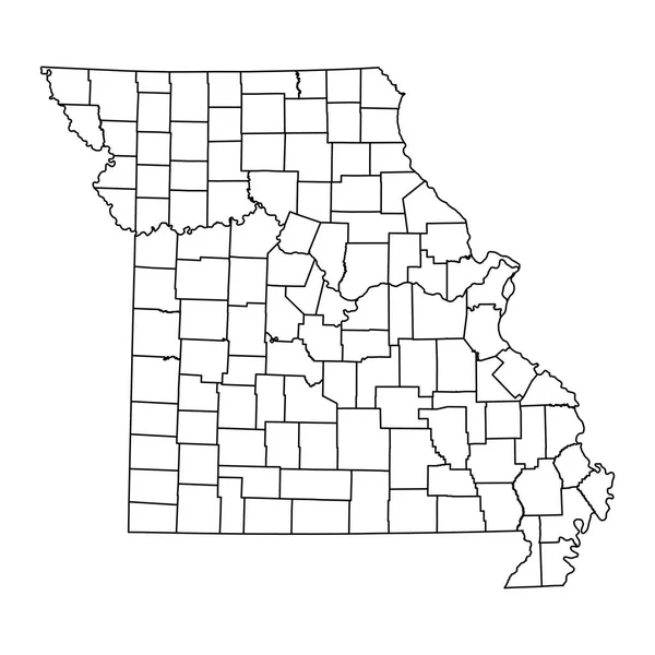
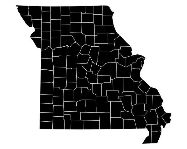
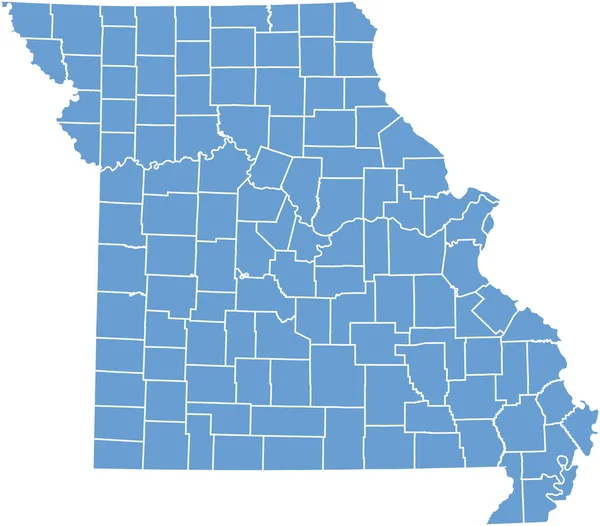
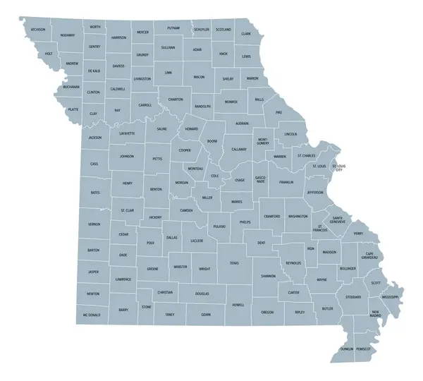
Stock vector Missouri, subdivided into 114 counties and the independent city St. Louis, gray political map. State in the Midwestern region of United States, Show Me State, Cave State, and Mother of the West.
Published:
Aug.03, 2024 11:04:35
Author:
Furian
Views:
0
Downloads:
0
File type:
vector
/
eps
File size:
3.09 MB
Orginal size:
6656
x
6000
px
Available sizes:
S
(500 x 451)
M
(1000 x 901)
L
(2000 x 1803)
XL
(6656 x 6000)
VECT
(6656 x 6000)
EL0
(6656 x 6000)
Level:
silver
Download Vector
Vector topics:
Vector
Illustration
Isolated
Travel
Silhouette
Border
Gray
Structure
Us
Usa
Country
Map
Cartography
Geography
Land
Overview
State
America
Boundary
Administrative
Destination
States
Region
Division
Federal
Jackson
Atlas
Americas
Nation
Subdivision
County
Mapping
Cole
Names
Mo
Missouri
Counties
Greene
Midwestern
Landlocked
Infographic
United States
St Louis
Subdivided
St Charles
Political Map
Show Me State
Cave State
Independent City
St Louis City
Similar stock vectors
Missouri State Map With Counties. Vector Illustration.
8334 × 8334
Iowa County Of Iowa Map
7000 × 4587
Accurate Map Of Missouri
5000 × 4000
High Quality Map Of Missouri Is A State Of United States Of America With Borders Of The Counties
4000 × 4000
A Part Of Usa Map With States On White Background
6103 × 5356
Missouri Road And Highway Map. Vector Illustration.
4805 × 4362
White Outline Counties Map With Counties Names Of US State Of Missouri
4800 × 3600