photo free
Home Images Vectors Videos

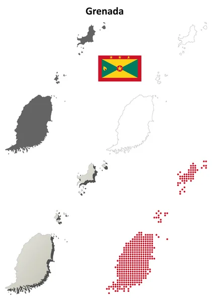
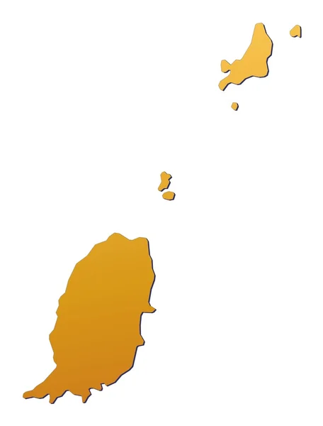
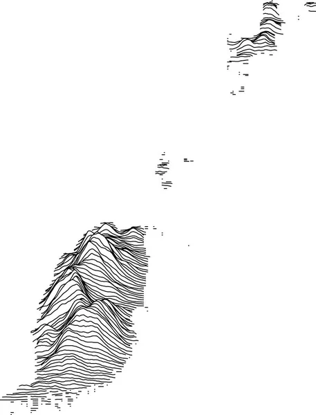
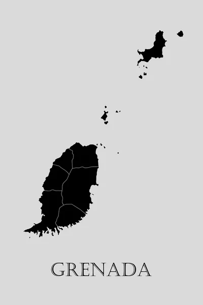
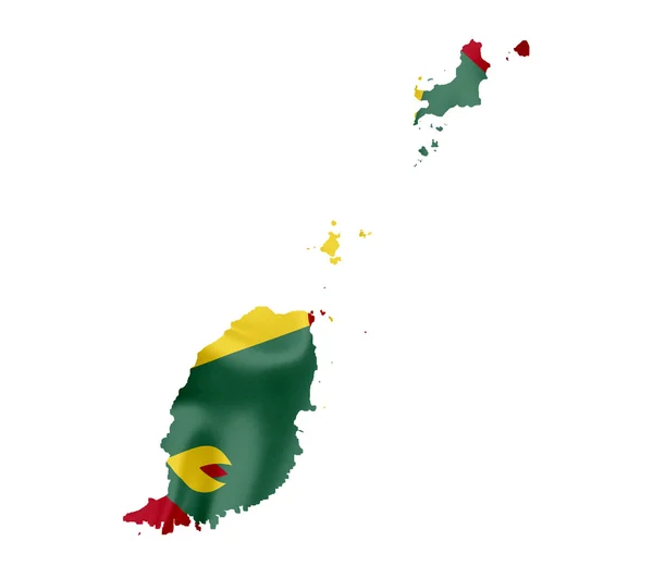
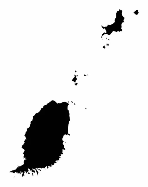
Stock image Grenada Contour Map

stock image St. George's, the capital city of the Grenada on a geographical map

St. George's, The Capital City Of The Grenada On A Geographical Map

Image, 8.48MB, 5184 × 3456 jpg
stock vector Grenada blank detailed outline map set

Grenada Blank Detailed Outline Map Set

Vector, 0.67MB, 4097 × 5824 eps
stock vector Grenada islands highly detailed physical map

Grenada Islands Highly Detailed Physical Map

Vector, 1.26MB, 6872 × 7500 eps
stock vector Official current vector coat of arms of unitary two-party parliamentary constitutional monarchy of Grenada

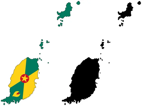
Official Current Vector Coat Of Arms Of Unitary Two-party Parliamentary Constitutional Monarchy Of Grenada

Vector, 1.43MB, 5008 × 4792 eps
stock vector Caribbean - highly detailed map.

Caribbean - Highly Detailed Map.

Vector, 10.27MB, 5001 × 3750 eps
stock vector Grenada vector map with infographic elements, pointer marks. Editable template with regions, cities and capital St. George's.

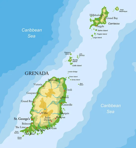
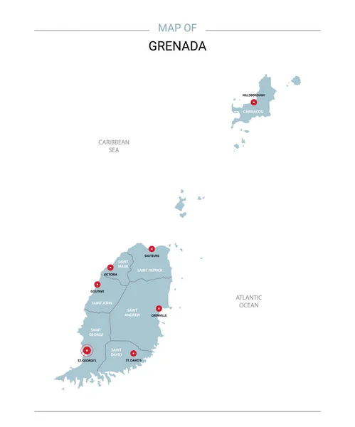
Grenada Vector Map With Infographic Elements, Pointer Marks. Editable Template With Regions, Cities And Capital St. George's.

Vector, 1.95MB, 4000 × 4000 eps
stock image map Grenada. Isolated Illustration. Black on White background.

Map Grenada. Isolated Illustration. Black On White Background.

Image, 1.04MB, 5000 × 5000 jpg
stock vector West Indies - vector maps of countries

West Indies - Vector Maps Of Countries

Vector, 0.53MB, 4665 × 4188 eps
stock vector Caribbean map

Caribbean Map

Vector, 5.28MB, 7000 × 7000 eps
stock vector Black location map of the Honduran Yoro department inside gray map of Honduras

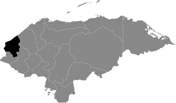
Black Location Map Of The Honduran Yoro Department Inside Gray Map Of Honduras

Vector, 0.6MB, 6004 × 3533 eps
stock vector Caribbean -highly detailed map.

Caribbean -highly Detailed Map.

Vector, 10.74MB, 5001 × 3803 eps
stock vector Caribbean -highly detailed map.

Caribbean -highly Detailed Map.

Vector, 10.74MB, 5001 × 3803 eps
stock vector Black location map of the Honduran Ocotepeque department inside gray map of Honduras

Black Location Map Of The Honduran Ocotepeque Department Inside Gray Map Of Honduras

Vector, 0.6MB, 6004 × 3533 eps
stock vector Black location map of the Honduran Corts department inside gray map of Honduras

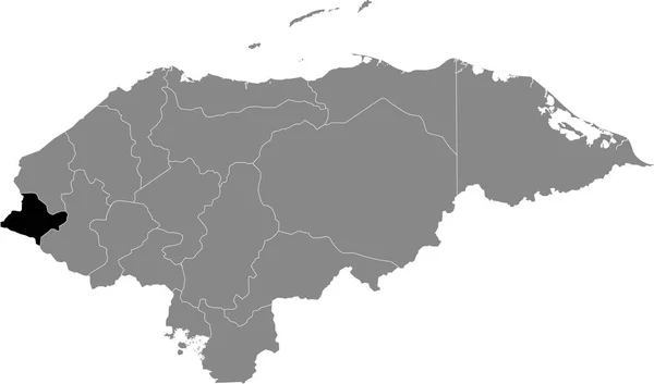
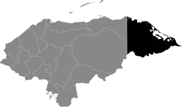
Black Location Map Of The Honduran Corts Department Inside Gray Map Of Honduras

Vector, 0.6MB, 6004 × 3533 eps
stock vector Colorful Caribbean map with countries and capital cities

Colorful Caribbean Map With Countries And Capital Cities

Vector, 0MB, 5000 × 3442 zip
stock vector Black location map of the Honduran Choluteca department inside gray map of Honduras

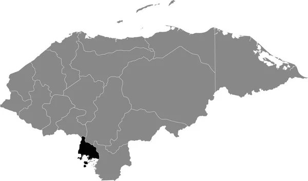
Black Location Map Of The Honduran Choluteca Department Inside Gray Map Of Honduras

Vector, 0.6MB, 6004 × 3533 eps
stock vector Black location map of the Honduran Lempira department inside gray map of Honduras

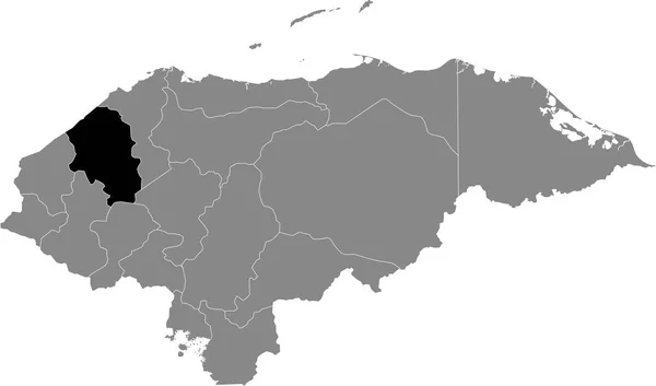
Black Location Map Of The Honduran Lempira Department Inside Gray Map Of Honduras

Vector, 0.6MB, 6004 × 3533 eps
stock vector Caribbean map

Caribbean Map

Vector, 3MB, 6000 × 4150 eps
stock vector Black location map of the Honduran Francisco Morazn department inside gray map of Honduras

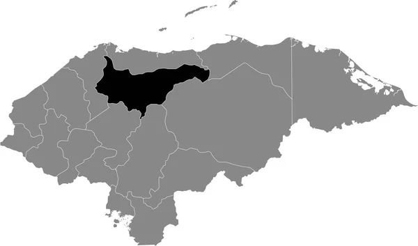
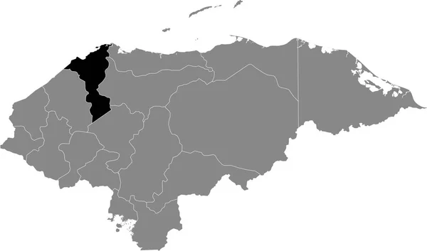
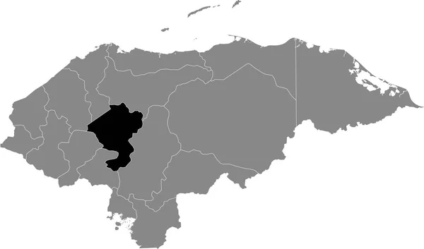
Black Location Map Of The Honduran Francisco Morazn Department Inside Gray Map Of Honduras

Vector, 0.6MB, 6004 × 3533 eps
stock vector Black location map of the Honduran Intibuc department inside gray map of Honduras

Black Location Map Of The Honduran Intibuc Department Inside Gray Map Of Honduras

Vector, 0.6MB, 6004 × 3533 eps
stock vector Black location map of the Honduran El Paraso department inside gray map of Honduras

Black Location Map Of The Honduran El Paraso Department Inside Gray Map Of Honduras

Vector, 0.6MB, 6004 × 3533 eps
stock vector Black location map of the Honduran La Paz department inside gray map of Honduras

Black Location Map Of The Honduran La Paz Department Inside Gray Map Of Honduras

Vector, 0.6MB, 6004 × 3533 eps
stock vector Black location map of the Honduran Comayagua department inside gray map of Honduras

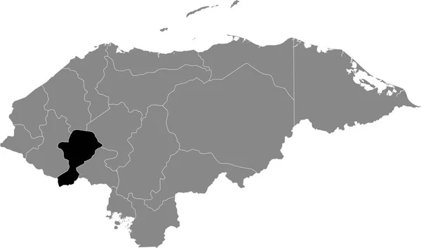
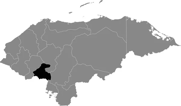
Black Location Map Of The Honduran Comayagua Department Inside Gray Map Of Honduras

Vector, 0.6MB, 6004 × 3533 eps
stock vector Caribbean map

Caribbean Map

Vector, 3.56MB, 6000 × 4131 eps
stock vector Political map of Carribean. Blue highlighted states and dependent territories. Simple flat vector illustration

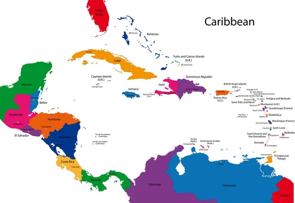
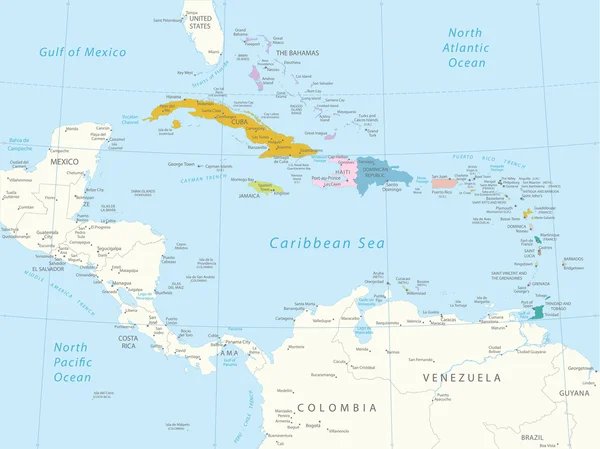
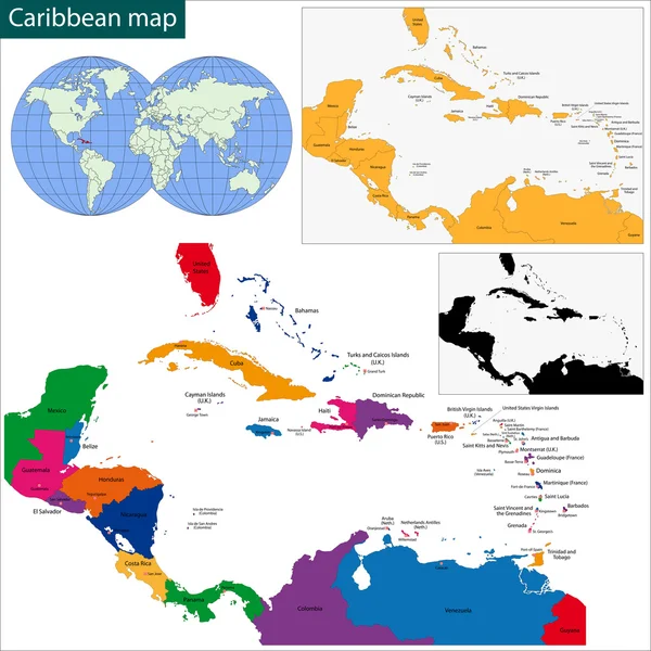
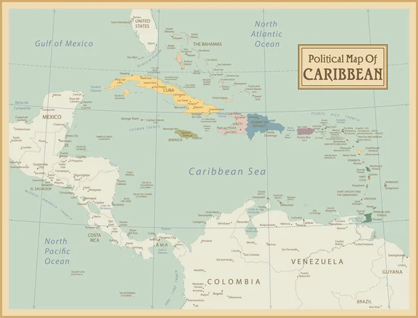
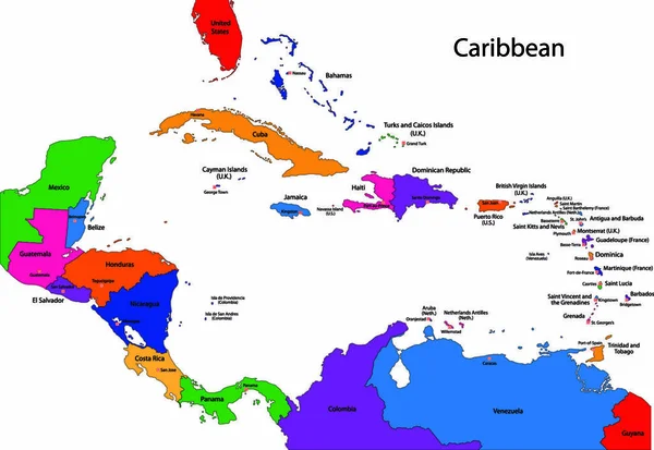
Political Map Of Carribean. Blue Highlighted States And Dependent Territories. Simple Flat Vector Illustration

Vector, 1.2MB, 6000 × 4500 eps
stock image Grenada map

Grenada Map

Image, 0.58MB, 2819 × 3706 jpg
stock vector Black location map of the Honduran Gracias a Dios department inside gray map of Honduras

Black Location Map Of The Honduran Gracias A Dios Department Inside Gray Map Of Honduras

Vector, 0.6MB, 6004 × 3533 eps
stock vector Lake Grenada Reservoir (United States of America, North America, us, usa, Mississippi) map vector illustration, scribble sketch Grenada Dam map

Lake Grenada Reservoir (United States Of America, North America, Us, Usa, Mississippi) Map Vector Illustration, Scribble Sketch Grenada Dam Map

Vector, 1.49MB, 7087 × 4726 eps
stock vector Black location map of the Honduran Santa Brbara department inside gray map of Honduras

Black Location Map Of The Honduran Santa Brbara Department Inside Gray Map Of Honduras

Vector, 0.6MB, 6004 × 3533 eps
stock vector Black location map of the Honduran Atlntida department inside gray map of Honduras

Black Location Map Of The Honduran Atlntida Department Inside Gray Map Of Honduras

Vector, 0.6MB, 6004 × 3533 eps
stock vector Black location map of the Honduran Valle department inside gray map of Honduras

Black Location Map Of The Honduran Valle Department Inside Gray Map Of Honduras

Vector, 0.6MB, 6004 × 3533 eps
stock vector Black location map of the Honduran Olancho department inside gray map of Honduras

Black Location Map Of The Honduran Olancho Department Inside Gray Map Of Honduras

Vector, 0.6MB, 6004 × 3533 eps
stock vector Black location map of the Honduran Islas de la Baha department inside gray map of Honduras

Black Location Map Of The Honduran Islas De La Baha Department Inside Gray Map Of Honduras

Vector, 0.6MB, 6004 × 3533 eps
stock vector Political map of Carribean. Pink highlighted states and dependent territories. Simple flat vector illustration

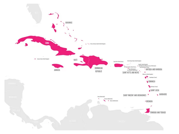
Political Map Of Carribean. Pink Highlighted States And Dependent Territories. Simple Flat Vector Illustration

Vector, 1.2MB, 6000 × 4500 eps
stock vector Grenada vector map. Editable template with regions, cities, red pins and blue surface on white background.

Grenada Vector Map. Editable Template With Regions, Cities, Red Pins And Blue Surface On White Background.

Vector, 0.96MB, 2500 × 3000 eps
stock vector Political map of Carribean. Gray lands on white background. Simple flat vector illustration

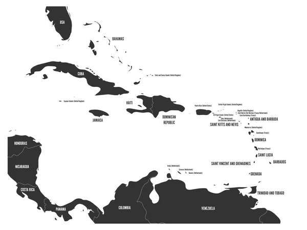
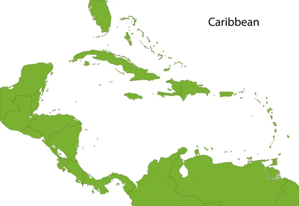
Political Map Of Carribean. Gray Lands On White Background. Simple Flat Vector Illustration

Vector, 1.2MB, 6000 × 4500 eps
stock vector Topographic map of Grenada with black contour lines

Topographic Map Of Grenada With Black Contour Lines

Vector, 0.59MB, 4196 × 5510 eps
stock vector Black location map of the Honduran Copn department inside gray map of Honduras

Black Location Map Of The Honduran Copn Department Inside Gray Map Of Honduras

Vector, 0.6MB, 6004 × 3533 eps
stock vector Black Grenada map - vector illustration

Black Grenada Map - Vector Illustration

Vector, 0.48MB, 6000 × 9000 eps
stock vector Black location map of the Honduran Coln department inside gray map of Honduras

Black Location Map Of The Honduran Coln Department Inside Gray Map Of Honduras

Vector, 0.6MB, 6004 × 3533 eps
stock vector Black map collection, black contour maps of World. Map collection Part 9.

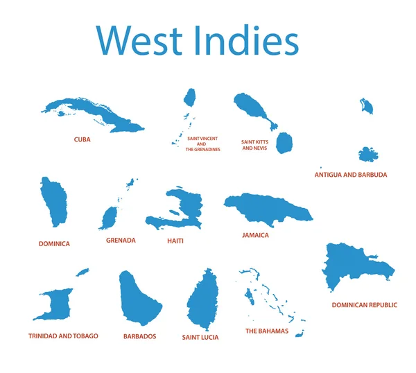
Black Map Collection, Black Contour Maps Of World. Map Collection Part 9.

Vector, 0.4MB, 5170 × 5000 eps
stock vector Grenada County, Mississippi (U.S. county, United States of America, USA, U.S., US) map vector illustration, scribble sketch Grenada map

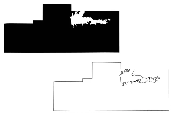
Grenada County, Mississippi (U.S. County, United States Of America, USA, U.S., US) Map Vector Illustration, Scribble Sketch Grenada Map

Vector, 0.76MB, 7087 × 4726 eps
stock vector Grenada

Grenada

Vector, 0.26MB, 4538 × 3408 eps
stock image Map of Grenada with waving flag isolated on white

Map Of Grenada With Waving Flag Isolated On White

Image, 0.89MB, 3216 × 2848 jpg
stock vector Political map of Carribean. Orange highlighted states and dependent territories. Simple flat vector illustration

Political Map Of Carribean. Orange Highlighted States And Dependent Territories. Simple Flat Vector Illustration

Vector, 1.2MB, 6000 × 4500 eps
stock vector Grenada silhouette map isolated on white background

Grenada Silhouette Map Isolated On White Background

Vector, 8.09MB, 3956 × 5000 eps
stock vector Political map of Carribean. Green highlighted sovereign states and orange dependent territories. Simple flat vector illustration

Political Map Of Carribean. Green Highlighted Sovereign States And Orange Dependent Territories. Simple Flat Vector Illustration

Vector, 1.2MB, 6000 × 4500 eps
stock vector Grenada country simplified map.Thin triple pencil sketch outline isolated on white background. Simple vector icon

Grenada Country Simplified Map.Thin Triple Pencil Sketch Outline Isolated On White Background. Simple Vector Icon

Vector, 0.25MB, 8000 × 8000 eps
stock vector Grenada blank outline map set

Grenada Blank Outline Map Set

Vector, 1.05MB, 6000 × 3000 eps
Page 1 >> Next