photo free
Home Images Vectors Videos

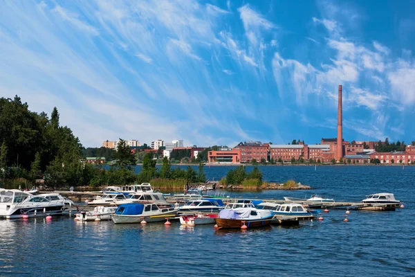
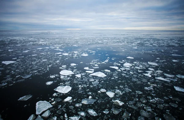
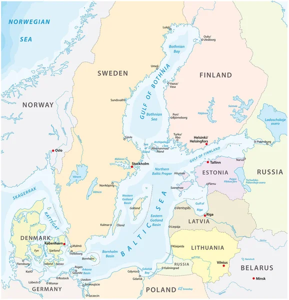
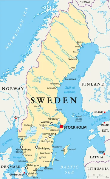
Stock image Gulf Of Bothnia page 2

stock image Waterfront in Vaasa. Finland

Waterfront In Vaasa. Finland

Image, 10.58MB, 4368 × 2912 jpg
stock image Beautiful sandy beach Yyteri at summer, in Pori, Finland

Beautiful Sandy Beach Yyteri At Summer, In Pori, Finland

Image, 10.08MB, 5892 × 3928 jpg
stock image Beautiful sandy beach Yyteri at summer, in Pori, Finland

Beautiful Sandy Beach Yyteri At Summer, In Pori, Finland

Image, 9.76MB, 5824 × 3883 jpg
stock vector Norway Political Map

Norway Political Map

Vector, 3.64MB, 6000 × 7269 eps
stock image Vaasa dock and University

Vaasa Dock And University

Image, 1.76MB, 3480 × 2320 jpg
stock image Drift ice

Drift Ice

Image, 9.94MB, 5490 × 3600 jpg
stock image Fasta Aland Island in the Gulf of Bothnia on a colored elevation map

Fasta Aland Island In The Gulf Of Bothnia On A Colored Elevation Map

Image, 3.12MB, 2880 × 1620 jpg
stock image Kimitoon Island in the Gulf of Bothnia on a satellite image taken in July 8, 2015

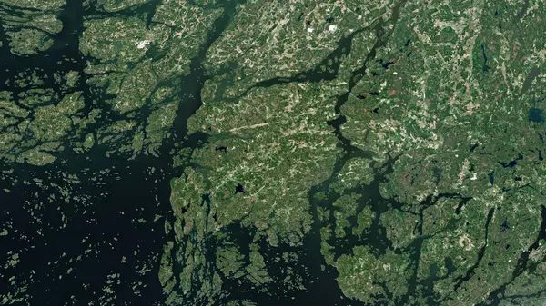
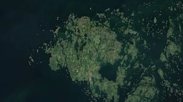
Kimitoon Island In The Gulf Of Bothnia On A Satellite Image Taken In July 8, 2015

Image, 7.28MB, 2880 × 1620 jpg
stock image Hailuoto Island in the Gulf of Bothnia on a topographic, OSM Humanitarian style map

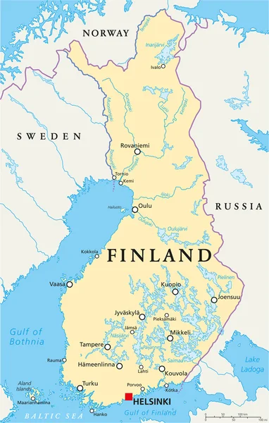
Hailuoto Island In The Gulf Of Bothnia On A Topographic, OSM Humanitarian Style Map

Image, 1.55MB, 2880 × 1620 jpg
stock image Hailuoto Island in the Gulf of Bothnia on a satellite image taken in May 29, 2024

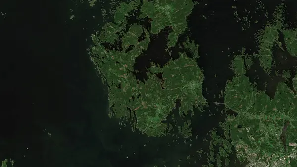
Hailuoto Island In The Gulf Of Bothnia On A Satellite Image Taken In May 29, 2024

Image, 4.68MB, 2880 × 1620 jpg
stock image Kimitoon Island in the Gulf of Bothnia, belonging to Finland, isolated on a topographic, OSM Humanitarian style map, with distance scale

Kimitoon Island In The Gulf Of Bothnia, Belonging To Finland, Isolated On A Topographic, OSM Humanitarian Style Map, With Distance Scale

Image, 1.38MB, 2160 × 2160 jpg
stock image Fasta Aland Island in the Gulf of Bothnia on a topographic, OSM Humanitarian style map

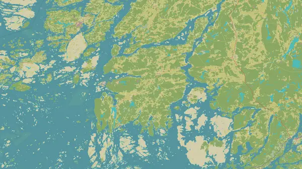
Fasta Aland Island In The Gulf Of Bothnia On A Topographic, OSM Humanitarian Style Map

Image, 3.1MB, 2880 × 1620 jpg
stock image Kimitoon Island in the Gulf of Bothnia on a topographic, OSM Humanitarian style map

Kimitoon Island In The Gulf Of Bothnia On A Topographic, OSM Humanitarian Style Map

Image, 5.12MB, 2880 × 1620 jpg
stock image Raippaluoto Island in the Gulf of Bothnia - belonging to Finland. Described location diagram with yellow shape of the island and sample maps of its surroundings

Raippaluoto Island In The Gulf Of Bothnia - Belonging To Finland. Described Location Diagram With Yellow Shape Of The Island And Sample Maps Of Its Surroundings

Image, 3.31MB, 3840 × 2160 jpg
stock vector map of the baltic sea the marginal sea of the atlantic ocean

Map Of The Baltic Sea The Marginal Sea Of The Atlantic Ocean

Vector, 1.84MB, 3899 × 4041 eps
stock image Fasta Aland Island in the Gulf of Bothnia, belonging to Finland, isolated on a satellite image taken in April 18, 2023, with distance scale

Fasta Aland Island In The Gulf Of Bothnia, Belonging To Finland, Isolated On A Satellite Image Taken In April 18, 2023, With Distance Scale

Image, 2.02MB, 2160 × 2160 jpg
stock image Hailuoto Island in the Gulf of Bothnia, belonging to Finland, isolated on a satellite image taken in July 21, 2024, with distance scale

Hailuoto Island In The Gulf Of Bothnia, Belonging To Finland, Isolated On A Satellite Image Taken In July 21, 2024, With Distance Scale

Image, 1.33MB, 2160 × 2160 jpg
stock image Hailuoto Island in the Gulf of Bothnia, belonging to Finland, isolated on a topographic, OSM Humanitarian style map, with distance scale

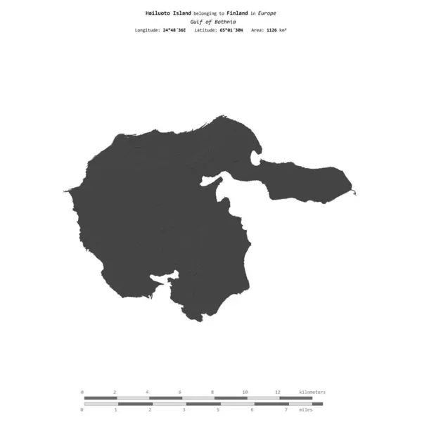
Hailuoto Island In The Gulf Of Bothnia, Belonging To Finland, Isolated On A Topographic, OSM Humanitarian Style Map, With Distance Scale

Image, 0.73MB, 2160 × 2160 jpg
stock image Hailuoto Island in the Gulf of Bothnia, belonging to Finland, isolated on a bilevel elevation map, with distance scale

Hailuoto Island In The Gulf Of Bothnia, Belonging To Finland, Isolated On A Bilevel Elevation Map, With Distance Scale

Image, 0.43MB, 2160 × 2160 jpg
stock vector Finland Political Map

Finland Political Map

Vector, 3.55MB, 5742 × 9000 eps
stock image Raippaluoto Island in the Gulf of Bothnia, belonging to Finland, isolated on a bilevel elevation map, with distance scale

Raippaluoto Island In The Gulf Of Bothnia, Belonging To Finland, Isolated On A Bilevel Elevation Map, With Distance Scale

Image, 0.62MB, 2160 × 2160 jpg
stock image Raippaluoto Island in the Gulf of Bothnia on a satellite image taken in June 15, 2021

Raippaluoto Island In The Gulf Of Bothnia On A Satellite Image Taken In June 15, 2021

Image, 5.1MB, 2880 × 1620 jpg
stock image Kimitoon Island in the Gulf of Bothnia, belonging to Finland, isolated on a satellite image taken in October 6, 2020, with distance scale

Kimitoon Island In The Gulf Of Bothnia, Belonging To Finland, Isolated On A Satellite Image Taken In October 6, 2020, With Distance Scale

Image, 1.96MB, 2160 × 2160 jpg
stock image Fasta Aland Island in the Gulf of Bothnia, belonging to Finland, isolated on a bilevel elevation map, with distance scale

Fasta Aland Island In The Gulf Of Bothnia, Belonging To Finland, Isolated On A Bilevel Elevation Map, With Distance Scale

Image, 0.76MB, 2160 × 2160 jpg
stock image Flag Of South Karelia region in Finland

Flag Of South Karelia Region In Finland

Image, 6.05MB, 4288 × 2848 jpg
stock image Rows with red huts in Gammelstad church town located near the Swedish town Lulea. UNESCO World Heritage site.

Rows With Red Huts In Gammelstad Church Town Located Near The Swedish Town Lulea. UNESCO World Heritage Site.

Image, 18.73MB, 6000 × 4000 jpg
stock image Raippaluoto Island in the Gulf of Bothnia on a colored elevation map

Raippaluoto Island In The Gulf Of Bothnia On A Colored Elevation Map

Image, 2.03MB, 2880 × 1620 jpg
stock image Hailuoto Island in the Gulf of Bothnia - belonging to Finland. Described location diagram with yellow shape of the island and sample maps of its surroundings

Hailuoto Island In The Gulf Of Bothnia - Belonging To Finland. Described Location Diagram With Yellow Shape Of The Island And Sample Maps Of Its Surroundings

Image, 2.45MB, 3840 × 2160 jpg
stock image Kimitoon Island in the Gulf of Bothnia, belonging to Finland, isolated on a bilevel elevation map, with distance scale

Kimitoon Island In The Gulf Of Bothnia, Belonging To Finland, Isolated On A Bilevel Elevation Map, With Distance Scale

Image, 0.71MB, 2160 × 2160 jpg
stock image Kimitoon Island in the Gulf of Bothnia on a colored elevation map

Kimitoon Island In The Gulf Of Bothnia On A Colored Elevation Map

Image, 4.76MB, 2880 × 1620 jpg
stock image Hailuoto Island in the Gulf of Bothnia on a colored elevation map

Hailuoto Island In The Gulf Of Bothnia On A Colored Elevation Map

Image, 1.08MB, 2880 × 1620 jpg
stock vector Sweden Political Map

Sweden Political Map

Vector, 3.5MB, 5545 × 9000 eps
stock image Fasta Aland Island in the Gulf of Bothnia - belonging to Finland. Described location diagram with yellow shape of the island and sample maps of its surroundings

Fasta Aland Island In The Gulf Of Bothnia - Belonging To Finland. Described Location Diagram With Yellow Shape Of The Island And Sample Maps Of Its Surroundings

Image, 3.61MB, 3840 × 2160 jpg
stock image Fasta Aland Island in the Gulf of Bothnia on a satellite image taken in July 14, 2021

Fasta Aland Island In The Gulf Of Bothnia On A Satellite Image Taken In July 14, 2021

Image, 4.99MB, 2880 × 1620 jpg
stock image Raippaluoto Island in the Gulf of Bothnia on a topographic, OSM Humanitarian style map

Raippaluoto Island In The Gulf Of Bothnia On A Topographic, OSM Humanitarian Style Map

Image, 2.83MB, 2880 × 1620 jpg
stock image Raippaluoto Island in the Gulf of Bothnia, belonging to Finland, isolated on a topographic, OSM Humanitarian style map, with distance scale

Raippaluoto Island In The Gulf Of Bothnia, Belonging To Finland, Isolated On A Topographic, OSM Humanitarian Style Map, With Distance Scale

Image, 1.38MB, 2160 × 2160 jpg
stock image Kimitoon Island in the Gulf of Bothnia - belonging to Finland. Described location diagram with yellow shape of the island and sample maps of its surroundings

Kimitoon Island In The Gulf Of Bothnia - Belonging To Finland. Described Location Diagram With Yellow Shape Of The Island And Sample Maps Of Its Surroundings

Image, 4.58MB, 3840 × 2160 jpg
stock image Fasta Aland Island in the Gulf of Bothnia, belonging to Finland, isolated on a topographic, OSM Humanitarian style map, with distance scale

Fasta Aland Island In The Gulf Of Bothnia, Belonging To Finland, Isolated On A Topographic, OSM Humanitarian Style Map, With Distance Scale

Image, 1.22MB, 2160 × 2160 jpg
stock image Raippaluoto Island in the Gulf of Bothnia, belonging to Finland, isolated on a satellite image taken in April 29, 2019, with distance scale

Raippaluoto Island In The Gulf Of Bothnia, Belonging To Finland, Isolated On A Satellite Image Taken In April 29, 2019, With Distance Scale

Image, 2.02MB, 2160 × 2160 jpg
Previous << Page 2 >> Next