photo free
Home Images Vectors Videos

Stock image Johnson Vector Map

stock vector Tennessee, TN, political map, with capital Nashville, largest cities, lakes and rivers. State of Tennessee. Landlocked state in Southeastern region of the United States, nicknamed The Volunteer State.

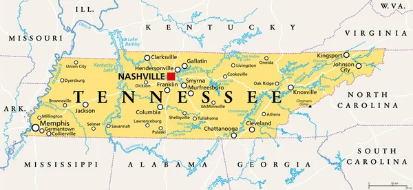
Tennessee, TN, Political Map, With Capital Nashville, Largest Cities, Lakes And Rivers. State Of Tennessee. Landlocked State In Southeastern Region Of The United States, Nicknamed The Volunteer State.

Vector, 4.02MB, 9000 × 4153 eps
stock vector Map of Tennessee

Map Of Tennessee

Vector, 0.9MB, 6000 × 3000 ai
stock vector Tennesy state detailed editable map

Tennesy State Detailed Editable Map

Vector, 1MB, 10000 × 3176 eps
stock vector The Missouri State county map with labels

The Missouri State County Map With Labels

Vector, 9.94MB, 5000 × 5000 eps
stock vector Tennessee County Map

Tennessee County Map

Vector, 1.11MB, 7496 × 3000 ai
stock vector Detailed map of Tennessee state,in vector format,with county borders,roads and major cities

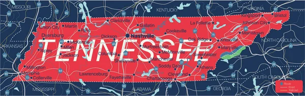
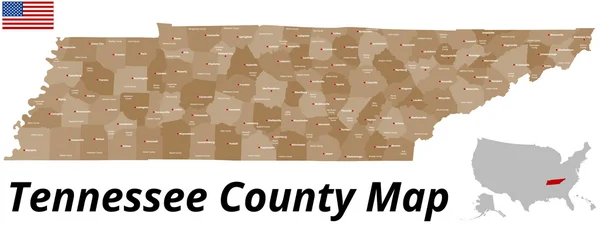
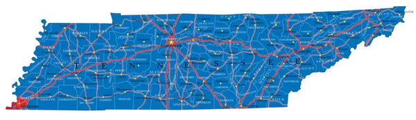
Detailed Map Of Tennessee State,in Vector Format,with County Borders,roads And Major Cities

Vector, 4.25MB, 10496 × 3037 eps
stock vector Tennessee, TN, gray political map, with capital Nashville, and with large, important cities. State of Tennessee, located in the Southeastern region of the United States. Nicknamed The Volunteer State.

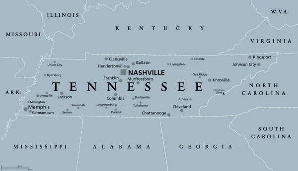
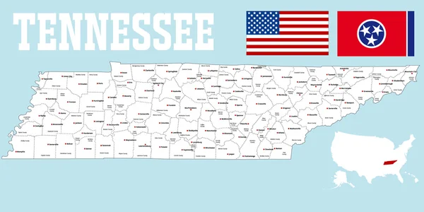
Tennessee, TN, Gray Political Map, With Capital Nashville, And With Large, Important Cities. State Of Tennessee, Located In The Southeastern Region Of The United States. Nicknamed The Volunteer State.

Vector, 2.41MB, 9000 × 5176 eps
stock vector Lubbock texas on blue background

Lubbock Texas On Blue Background

Vector, 0.07MB, 8400 × 5101 eps
stock vector Johnson County, Kansas (U.S. county, United States of America, USA, U.S., US) map vector illustration, scribble sketch Johnson map

Johnson County, Kansas (U.S. County, United States Of America, USA, U.S., US) Map Vector Illustration, Scribble Sketch Johnson Map

Vector, 0.55MB, 7087 × 4726 eps
stock vector Kansas, U.S. state subdivided into 105 counties, gray political map with borders and county names. State in the Midwestern region of United States, nicknamed The Sunflower State, and The Wheat State.

Kansas, U.S. State Subdivided Into 105 Counties, Gray Political Map With Borders And County Names. State In The Midwestern Region Of United States, Nicknamed The Sunflower State, And The Wheat State.

Vector, 1.8MB, 9000 × 5129 eps
stock vector Iowa counties, gray political map with borders and county names. Landlocked state in the Midwestern region of the United States, subdivided into 99 counties. Nicknamed The Hawkeye State. Illustration

Iowa Counties, Gray Political Map With Borders And County Names. Landlocked State In The Midwestern Region Of The United States, Subdivided Into 99 Counties. Nicknamed The Hawkeye State. Illustration

Vector, 1.96MB, 9000 × 5967 eps
stock vector Iowa counties, political map with borders and county names. Landlocked state in the Midwestern region of the United States, subdivided into 99 counties. Nicknamed The Hawkeye State. Illustration

Iowa Counties, Political Map With Borders And County Names. Landlocked State In The Midwestern Region Of The United States, Subdivided Into 99 Counties. Nicknamed The Hawkeye State. Illustration

Vector, 2.29MB, 9000 × 6000 eps
stock vector Kansas, U.S. state subdivided into 105 counties, political map with borders and county names. State in the Midwestern region of the United States, nicknamed The Sunflower State, and The Wheat State.

Kansas, U.S. State Subdivided Into 105 Counties, Political Map With Borders And County Names. State In The Midwestern Region Of The United States, Nicknamed The Sunflower State, And The Wheat State.

Vector, 2.09MB, 9000 × 5400 eps
Page 1 >> Next