photo free
Home Images Vectors Videos

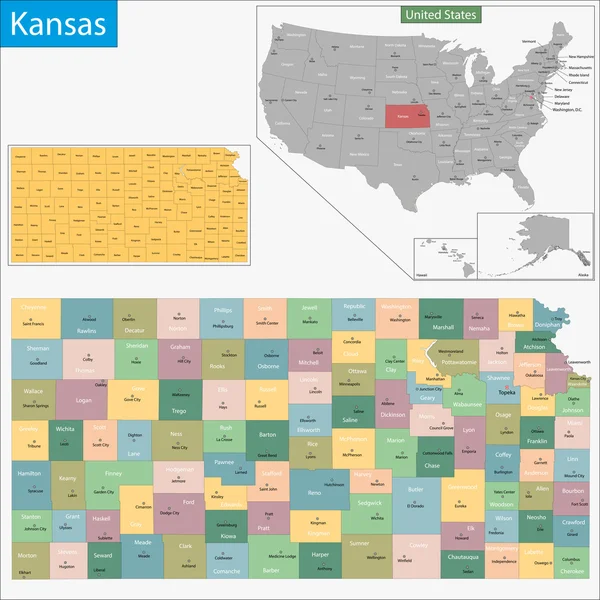
Stock image Kansas Administrative

stock vector Kansas vector maps counties, townships, regions, municipalities, departments, borders

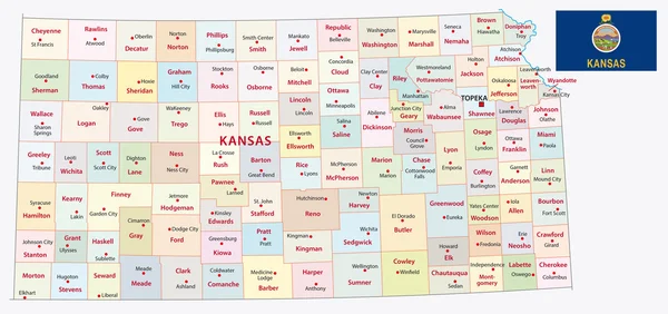
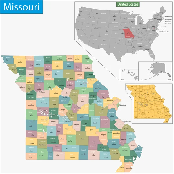
Kansas Vector Maps Counties, Townships, Regions, Municipalities, Departments, Borders

Vector, 5.12MB, 4705 × 4045 eps
stock vector Kansas map

Kansas Map

Vector, 7.58MB, 7002 × 7002 eps
stock vector Kansas state outline administrative and political vector map in black and white

Kansas State Outline Administrative And Political Vector Map In Black And White

Vector, 1.06MB, 4182 × 3100 eps
stock vector Kansas state outline administrative and political vector map in color

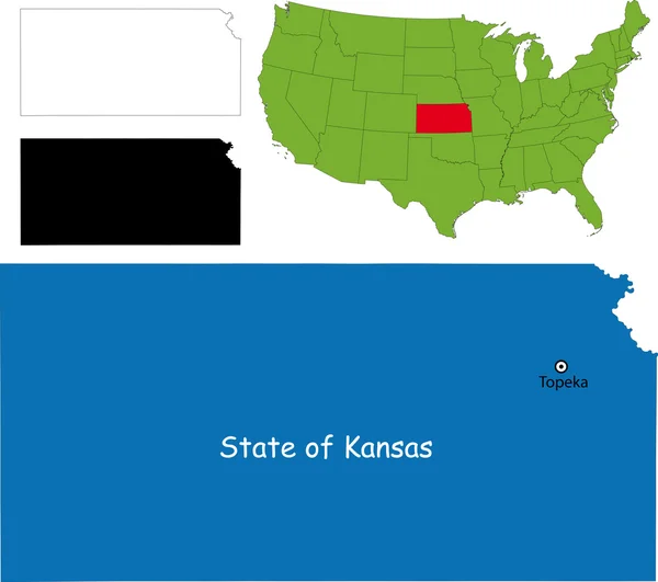
Kansas State Outline Administrative And Political Vector Map In Color

Vector, 1.11MB, 4182 × 3100 eps
stock vector USA blind map navigation set

USA Blind Map Navigation Set

Vector, 8.68MB, 8192 × 7638 eps
stock vector USA map with flag and navigation icons

USA Map With Flag And Navigation Icons

Vector, 3.03MB, 8192 × 6357 eps
stock vector kansas administrative map with flag

Kansas Administrative Map With Flag

Vector, 2.24MB, 6588 × 3100 eps
stock vector kansas administrative map with flag

Kansas Administrative Map With Flag

Vector, 2.14MB, 6592 × 3100 eps
stock vector Kanzas state detailed editable map

Kanzas State Detailed Editable Map

Vector, 1.15MB, 7500 × 4298 eps
stock vector Highly detailed vector silhouettes of US state maps, Division United States into counties, political and geographic subdivisions of a states, West North Central - Kansas, Iowa, Missouri - set 6 of 17

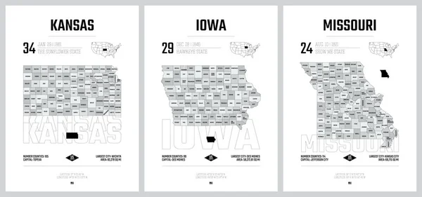
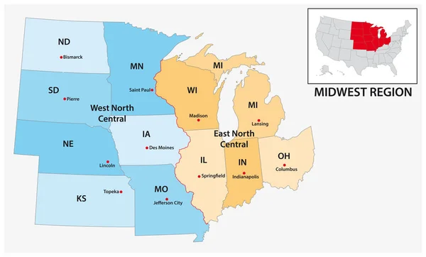
Highly Detailed Vector Silhouettes Of US State Maps, Division United States Into Counties, Political And Geographic Subdivisions Of A States, West North Central - Kansas, Iowa, Missouri - Set 6 Of 17

Vector, 7.31MB, 9608 × 4501 eps
stock vector USA maps collection large navigation set and World map

USA Maps Collection Large Navigation Set And World Map

Vector, 18.12MB, 5029 × 8192 eps
stock vector Set 4 of 5 Highly detailed vector silhouettes of USA state maps

Set 4 Of 5 Highly Detailed Vector Silhouettes Of USA State Maps

Vector, 5.44MB, 8858 × 3738 eps
stock vector Vector set 7 of 10 Highly detailed silhouettes of US state maps, divided into counties with names and territory nicknames

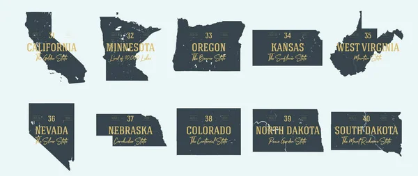
Vector Set 7 Of 10 Highly Detailed Silhouettes Of US State Maps, Divided Into Counties With Names And Territory Nicknames

Vector, 5.89MB, 9585 × 3348 eps
stock vector Vector set 5 of 10 Highly detailed silhouettes of US state maps, divided into counties with names and territory nicknames

Vector Set 5 Of 10 Highly Detailed Silhouettes Of US State Maps, Divided Into Counties With Names And Territory Nicknames

Vector, 6.48MB, 9585 × 3348 eps
stock vector Colorado - Kansas - Oklahoma - Missouri Map labelled black

Colorado - Kansas - Oklahoma - Missouri Map Labelled Black

Vector, 3.49MB, 10079 × 5000 eps
stock vector Map of the United States of America

Map Of The United States Of America

Vector, 2.33MB, 5000 × 3123 ai
stock vector Map of North America. Detailed map of North America with States of the USA and Provinces of Canada and all Mexican States. Template.  EPS10.

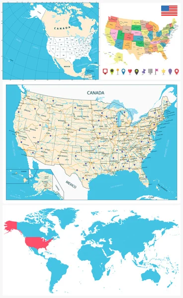
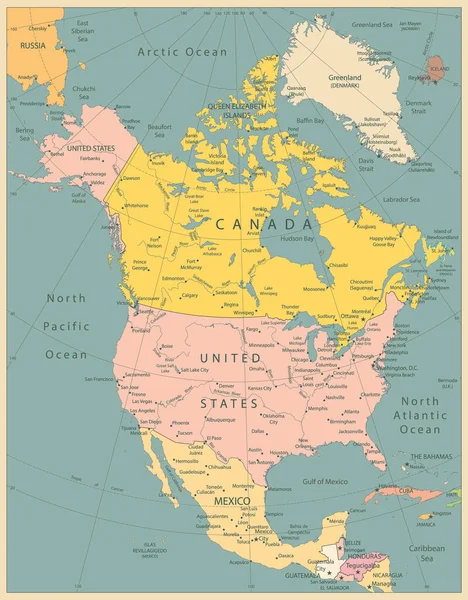
Map Of North America. Detailed Map Of North America With States Of The USA And Provinces Of Canada And All Mexican States. Template. EPS10.

Vector, 4.07MB, 5000 × 5000 eps
stock vector Kansas USA Map black inverted silhouette

Kansas USA Map Black Inverted Silhouette

Vector, 4.65MB, 8047 × 5000 eps
stock vector Map of the United States of America, with borders and state name

Map Of The United States Of America, With Borders And State Name

Vector, 25.9MB, 7296 × 4104 eps
stock image Symbol Map of the State Kansas (United States of America) showing the outline of the state as an asphalt surface

Symbol Map Of The State Kansas (United States Of America) Showing The Outline Of The State As An Asphalt Surface

Image, 19.31MB, 6000 × 3297 jpg
stock vector Administrative vector map of the US Census Region Midwest

Administrative Vector Map Of The US Census Region Midwest

Vector, 0.67MB, 5135 × 3100 eps
stock vector Detailed map of the United States of America. Big sities. Icons, location indicators

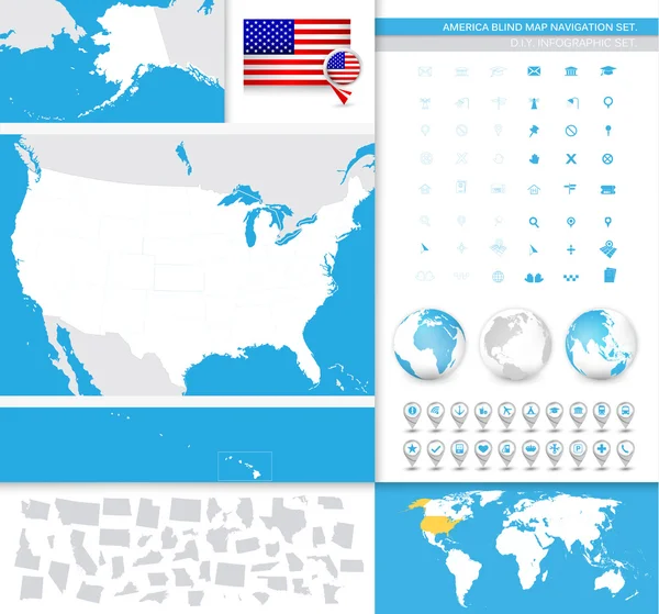
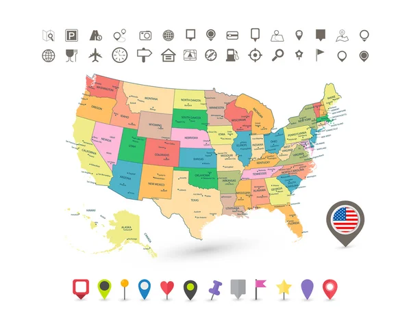
Detailed Map Of The United States Of America. Big Sities. Icons, Location Indicators

Vector, 7.55MB, 7087 × 7659 eps
stock image A Kansas State Flag Map Illustration with clipping path

A Kansas State Flag Map Illustration With Clipping Path

Image, 4.04MB, 7000 × 7000 jpg
stock vector Map of the United States of America, with borders and abbreviati

Map Of The United States Of America, With Borders And Abbreviati

Vector, 25.75MB, 7296 × 4104 eps
stock vector Missouri map

Missouri Map

Vector, 9.23MB, 7002 × 7002 eps
stock image Map of the State Kansas (United States of America) showing the isolated territory with relief representation, water bodies like seas, rivers, lakes and with borders. No labels at all.

Map Of The State Kansas (United States Of America) Showing The Isolated Territory With Relief Representation, Water Bodies Like Seas, Rivers, Lakes And With Borders. No Labels At All.

Image, 1.93MB, 6000 × 3251 jpg
stock image Symbol Map of the State Kansas (United States of America) showing the territory of the state as a lawn football field

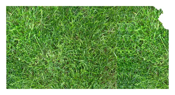
Symbol Map Of The State Kansas (United States Of America) Showing The Territory Of The State As A Lawn Football Field

Image, 18.04MB, 6000 × 3297 jpg
stock vector Colorado state detailed editable map

Colorado State Detailed Editable Map

Vector, 1.07MB, 7000 × 5291 eps
stock vector Kansas map

Kansas Map

Vector, 3.83MB, 5202 × 4609 eps
stock vector North America Political Map Vintage Colors. Highly detailed map. All elements are separated in editable layers clearly labeled.

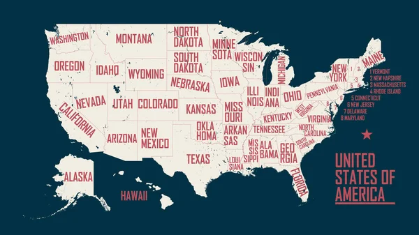
North America Political Map Vintage Colors. Highly Detailed Map. All Elements Are Separated In Editable Layers Clearly Labeled.

Vector, 12.9MB, 3767 × 4826 eps
Page 1 >> Next