
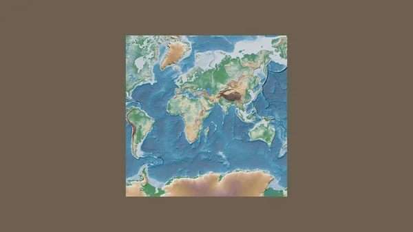
Stock image Orthographic Projection
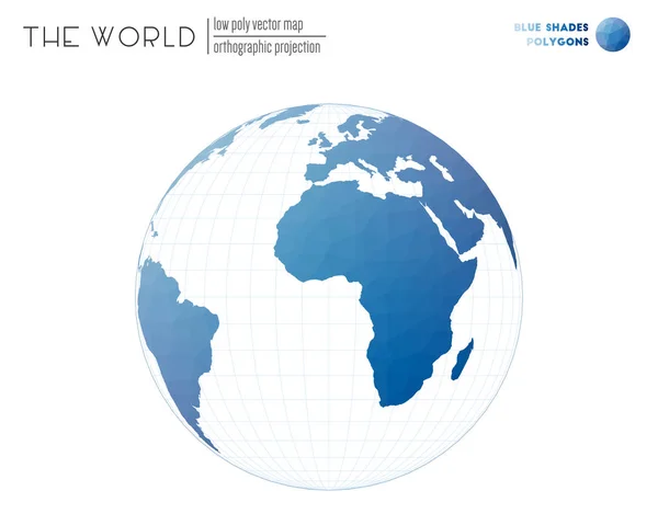
Triangular Mesh Of The World Orthographic Projection Of The World Blue Shades Colored Polygons
Vector, 0.98MB, 6145 × 4916 eps

Magic Wave Digital Illustration Of Neon Horizontal Stripes. Trendy Colorful Shiny Background. Modern Design. Futuristic Style. 3d Rendering
Image, 1.03MB, 3600 × 4800 jpg

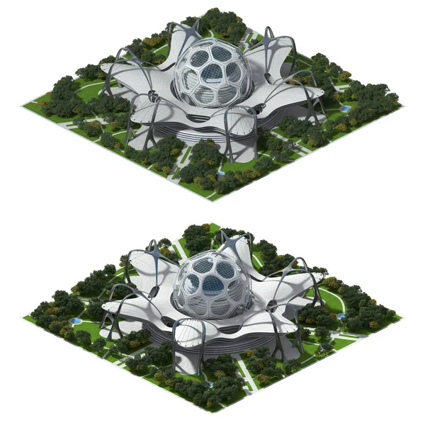
Futuristic Architecture For A Square Tiled Game Rendered In Dimetric Projection At 2 To1 Pixel Ratio, With A 30 Orthographic Corner Camera From 2 Angles. The Clipping Path Is Included In The 3D Illustration File.
Image, 6.93MB, 6300 × 6000 jpg
3D Futuristic Architecture Illustration For A Tiled Game Rendered In Dimetric Projection, With A 30 Degree Orthographic Camera From 2 Angles. The Clipping Path Is Included In The File.
Image, 17.99MB, 6600 × 6600 jpg
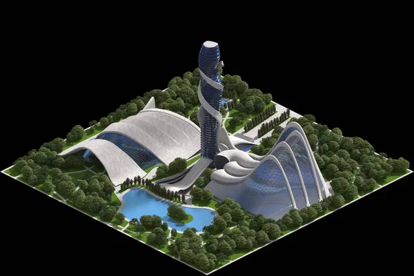
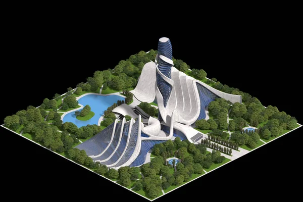
Landscaped Futuristic Architecture 3d Illustration For A Tiled Game Rendered In Dimetric Projection With A 30 Degree Orthographic Camera And Clipping Path Included In The File.
Image, 10.24MB, 6000 × 4000 jpg
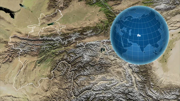
Tajikistan. Globe With The Shape Of The Country Against Zoomed Map With Its Outline. Satellite Imagery
Image, 6.43MB, 2880 × 1620 jpg

Close-up Of Norway And Its Location In The Region And In The Center Of A Large-scale World Map. Color Physical Map
Image, 1.83MB, 2880 × 1620 jpg
Futuristic Architecture For A Square Tiled Game Rendered In Dimetric Projection At 2-1 Pixel Ratio, With A 30 Orthographic Corner Camera From 2 Angles. The Clipping Path Is Included In The 3D Illustration
Image, 7.29MB, 6600 × 6600 jpg
Landscaped Futuristic Architecture 3d Illustration For A Tiled Game Rendered In Dimetric Projection With A 30 Degree Orthographic Camera And Clipping Path Included In The File.
Image, 11.31MB, 6000 × 4000 jpg

Enlarged Area Of South Korea Surrounded By A Circle On The Background Of Its Neighborhood. Color Physical Map
Image, 2.85MB, 2880 × 1620 jpg
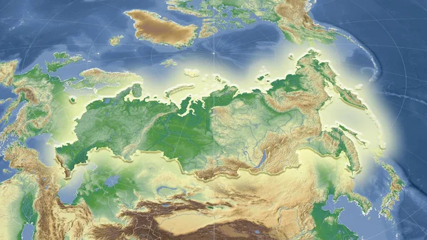
Russia And Its Neighborhood. Distant Oblique Perspective - Shape Glowed. Color Physical Map
Image, 4.99MB, 2880 × 1620 jpg

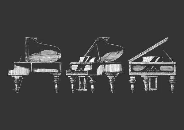
Seamless Pattern With Grand Piano. Vector Illustration In Ink Hand Drawn Style On White Background.
Vector, 6.2MB, 5208 × 5208 eps

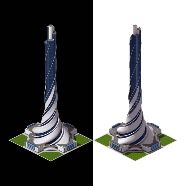
Futuristic Architecture For A Square Tiled Game Rendered In Dimetric Projection At 2 To 1 Pixel Ratio, With A 30 Orthographic Corner Camera From 2 Angles. The Clipping Path Is Included In The 3D Illustration.
Image, 15.03MB, 6300 × 6300 jpg
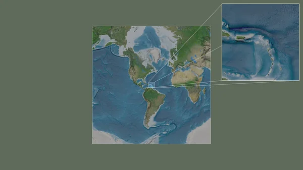
Expanded And Enlarged Area Of Caribbean Netherlands Sint Eustatius Extracted From The Large-scale Map Of The World With Leading Lines Connecting The Corners Of The Frames. Satellite Imagery
Image, 1.67MB, 2880 × 1620 jpg

Futuristic Architecture For A Square Grid Tiled Game, Rendered In Dimetric Projection From All 4 Corners. The Clipping Path Is Included In The 3D Illustration.
Image, 8.5MB, 6600 × 3672 jpg

The Highlighted Area Of Tajikistan With Capital Point And Label On The Desaturated Map Of Its Neighbourhood. Color Physical Map
Image, 4.08MB, 2880 × 1620 jpg

Close-up Of Cayman Islands Grand Cayman And Its Location In The Region And In The Center Of A Large-scale World Map. Satellite Imagery
Image, 1.96MB, 2880 × 1620 jpg
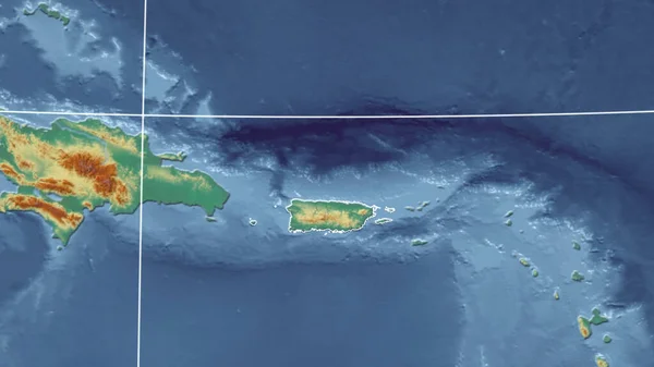
Puerto Rico. Neighborhood - Distant Perspective With Outline Of The Country. Topographic Relief Map
Image, 2.31MB, 2880 × 1620 jpg

Close-up Of Guernsey And Its Location In The Region And In The Center Of A Large-scale World Map. Satellite Imagery
Image, 1.92MB, 2880 × 1620 jpg
Expanded And Enlarged Area Of Caribbean Netherlands Bonaire Extracted From The Large-scale Map Of The World With Leading Lines Connecting The Corners Of The Frames. Satellite Imagery
Image, 1.83MB, 2880 × 1620 jpg

Futuristic Architecture 3d Illustration, For A Tiled Game Rendered In Dimetric Projection With A 30 Degree Orthographic Camera And Clipping Path Included In File.
Image, 10.91MB, 6000 × 4000 jpg

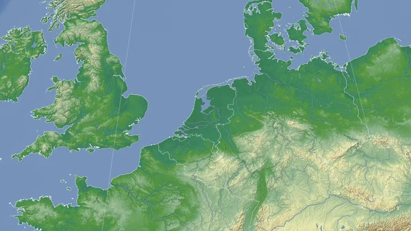
Netherlands And Its Neighborhood. Distant Oblique Perspective - No Outline. Color Physical Map
Image, 4.03MB, 2880 × 1620 jpg
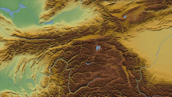
Tajikistan. Close-up Perspective Of The Country - No Outline. Color Physical Map
Image, 7.64MB, 2880 × 1620 jpg

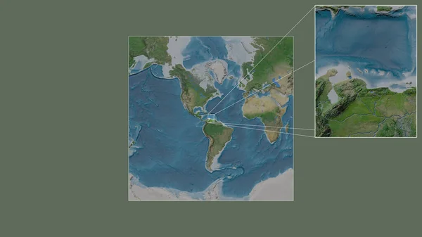
The Highlighted Area Of Colombia With Capital Point And Label On The Desaturated Map Of Its Neighbourhood. Satellite Imagery
Image, 3.36MB, 2880 × 1620 jpg
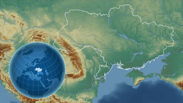
Ukraine. Globe With The Shape Of The Country Against Zoomed Map With Its Outline. Topographic Relief Map
Image, 4.5MB, 2880 × 1620 jpg

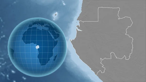
Gabon. Globe With The Shape Of The Country Against Zoomed Map With Its Outline. Grayscale Elevation Map
Image, 2.27MB, 2880 × 1620 jpg
Square Frame Of The Large-scale Map Of The World In An Oblique Van Der Grinten Projection Centered On The Territory Of Somalia. Color Physical Map
Image, 1.42MB, 2880 × 1620 jpg


Close-up Of Colombia And Its Location In The Region And In The Center Of A Large-scale World Map. Color Physical Map
Image, 2.15MB, 2880 × 1620 jpg

The Highlighted Area Of Costa Rica With Capital Point And Label On The Desaturated Map Of Its Neighbourhood. Color Physical Map
Image, 2.52MB, 2880 × 1620 jpg
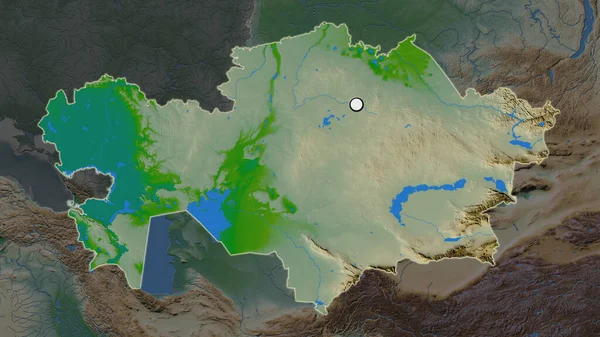
The Highlighted Area Of Kazakhstan With Capital Point On The Desaturated Map Of Its Neighbourhood. Color Physical Map
Image, 3.73MB, 2880 × 1620 jpg

3d Render. Minimalistic Abstract Background Design. A Heavy Barbell And A 3d Water Flask Stand On A Bright Colored Podium.
Image, 4.86MB, 3000 × 4500 jpg
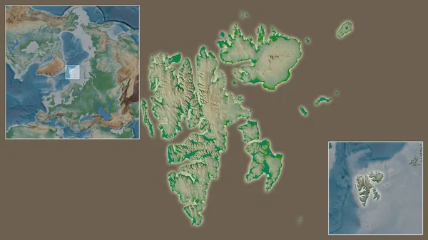
Close-up Of Svalbard And Its Location In The Region And In The Center Of A Large-scale World Map. Color Physical Map
Image, 2.07MB, 2880 × 1620 jpg

Area Of Caf Marked With A Circle On The Large-scale Map Of The Continent Isolated Against Desaturated Background. Capital Georeferences And Names Given. Color Physical Map
Image, 1.8MB, 2880 × 1620 jpg


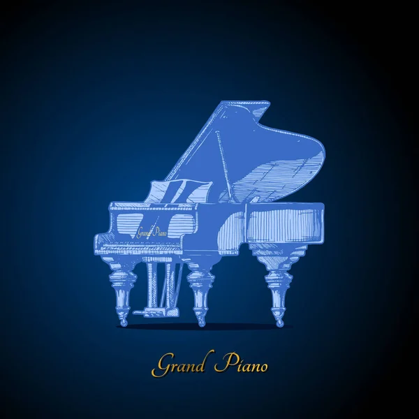
Vector Hand Drawn Illustration Of Grand Piano In Orthographic Projections. Isolated On Black Background.
Vector, 2.65MB, 7021 × 4965 eps

The Area Of Svalbard Centered In The Circle Surrounding Its Continent On The Desaturated Background. Capital Georeferences And Names Given. Satellite Imagery
Image, 1.95MB, 2880 × 1620 jpg

3d Render. Abstract Color Minimalistic Background Design. A Heavy Dumbbell Lies On The Podium. Orthographic Projection Isometry Style.
Image, 4.17MB, 3000 × 4500 jpg

North Korea And Its Neighborhood. Distant Oblique Perspective - No Outline. Color Physical Map
Image, 3.89MB, 2880 × 1620 jpg
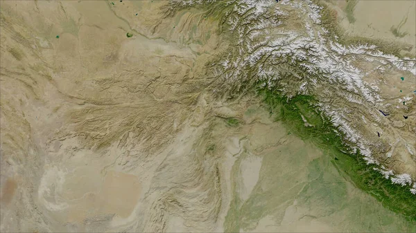
Afghanistan. Close-up Perspective Of The Country - No Outline. Satellite Imagery
Image, 5.39MB, 2880 × 1620 jpg


Colombia. Globe With The Shape Of The Country Against Zoomed Map With Its Outline Isolated On The Blue Background. Satellite Imagery
Image, 2.27MB, 2880 × 1620 jpg

Area Of Somalia Marked With A Circle On The Large-scale Map Of The Continent Isolated Against Desaturated Background. Capital Georeferences And Names Given. Color Physical Map
Image, 1.92MB, 2880 × 1620 jpg
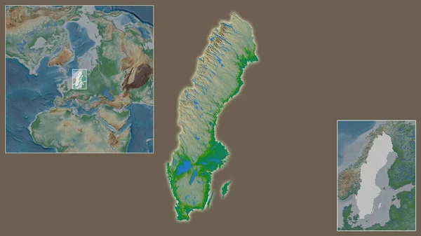
Close-up Of Sweden And Its Location In The Region And In The Center Of A Large-scale World Map. Color Physical Map
Image, 1.97MB, 2880 × 1620 jpg
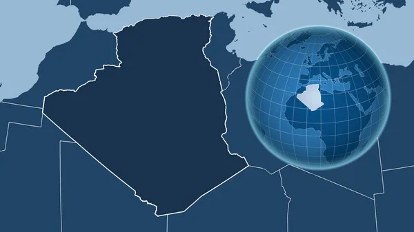
Algeria. Globe With The Shape Of The Country Against Zoomed Map With Its Outline. Shapes Only - Land/ocean Mask
Image, 1.13MB, 2880 × 1620 jpg
Page 1 >> Next