photo free
Home Images Vectors Videos

Stock image San Juan Map Outline

stock image Puerto Rico. Neighborhood - distant perspective with outline of the country. topographic relief map

Puerto Rico. Neighborhood - Distant Perspective With Outline Of The Country. Topographic Relief Map

Image, 2.31MB, 2880 × 1620 jpg
stock vector Puerto Rico-highly detailed physical map

Puerto Rico-highly Detailed Physical Map

Vector, 2.05MB, 7500 × 3839 eps
stock image Vintage map of Puerto Rico on grunge paper

Vintage Map Of Puerto Rico On Grunge Paper

Image, 8.94MB, 3216 × 2848 jpg
stock vector Map of Argentina

Map Of Argentina

Vector, 1.11MB, 3499 × 5000 ai
stock vector Argentina - map of provinces

Argentina - Map Of Provinces

Vector, 0.98MB, 6000 × 6000 eps
stock vector Abstract vector color map of Puerto Rico with transparent paint effect.

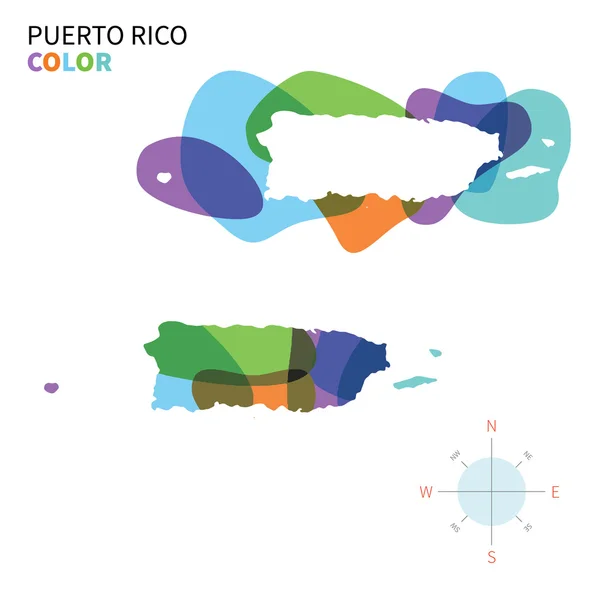
Abstract Vector Color Map Of Puerto Rico With Transparent Paint Effect.

Vector, 3.4MB, 5867 × 5867 eps
stock vector Puerto Rico map with shadow effect presentation

Puerto Rico Map With Shadow Effect Presentation

Vector, 2.23MB, 5418 × 4092 eps
stock vector Argentina - map of administrative provinces

Argentina - Map Of Administrative Provinces

Vector, 1MB, 6000 × 6000 eps
stock vector Puerto Rico map

Puerto Rico Map

Vector, 1.14MB, 10630 × 5315 eps
stock vector Puerto Rico blue Low Poly map with capital San Juan.

Puerto Rico Blue Low Poly Map With Capital San Juan.

Vector, 0.53MB, 5000 × 5000 eps
stock vector Puerto Rico map Blank vector map of the Country Borders of Puerto Rico for your infographic

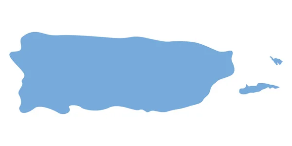
Puerto Rico Map Blank Vector Map Of The Country Borders Of Puerto Rico For Your Infographic

Vector, 0.26MB, 7773 × 3869 eps
stock image Countries winemakers - maps from wine corks. Map of Argentina on

Countries Winemakers - Maps From Wine Corks. Map Of Argentina On

Image, 3.66MB, 2825 × 4249 jpg
stock vector San Juan blank outline map set

San Juan Blank Outline Map Set

Vector, 0.35MB, 4583 × 5417 eps
stock image Countries winemakers - maps from wine corks. Map of Argentina on white background.

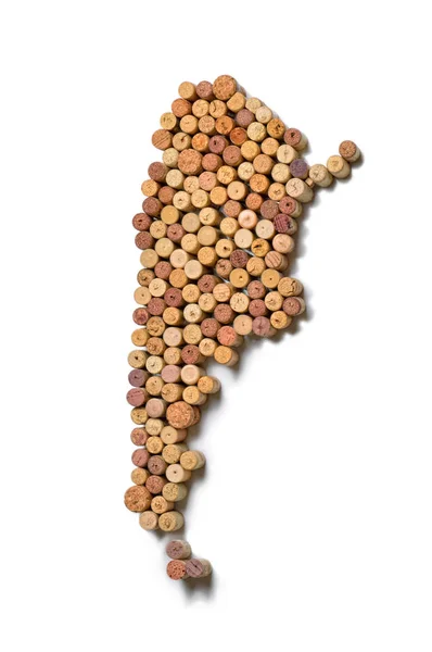
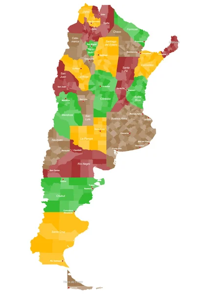
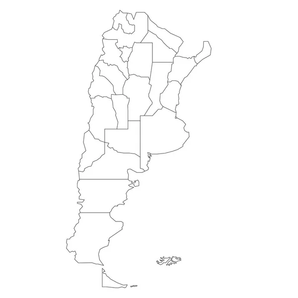
Countries Winemakers - Maps From Wine Corks. Map Of Argentina On White Background.

Image, 2.56MB, 2825 × 4249 jpg
stock vector Albardon department (San Juan) outline map set

Albardon Department (San Juan) Outline Map Set

Vector, 0.35MB, 6000 × 3000 eps
stock vector Ullum department (San Juan) outline map set

Ullum Department (San Juan) Outline Map Set

Vector, 0.4MB, 6000 × 3000 eps
stock vector Valle Fertil department (San Juan) outline map set

Valle Fertil Department (San Juan) Outline Map Set

Vector, 0.42MB, 6000 × 3000 eps
stock vector Symbol Map of the Province San Juan (Argentina) showing the territory with a series of black square lines on white background

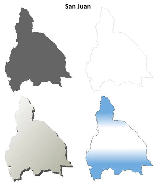
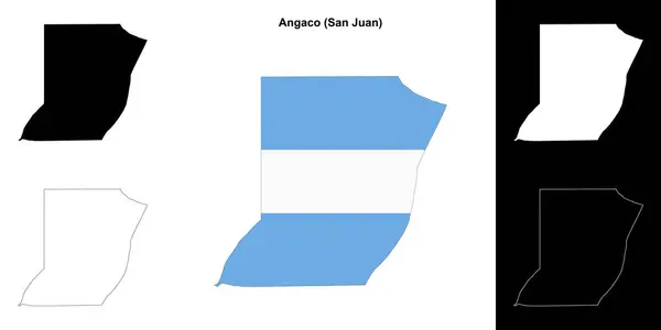
Symbol Map Of The Province San Juan (Argentina) Showing The Territory With A Series Of Black Square Lines On White Background

Vector, 0.58MB, 5221 × 6000 eps
stock image Shape of a Pale colored elevation map with lakes and rivers of the Puerto Rico - USA, with distance scale and map border coordinates, isolated on white

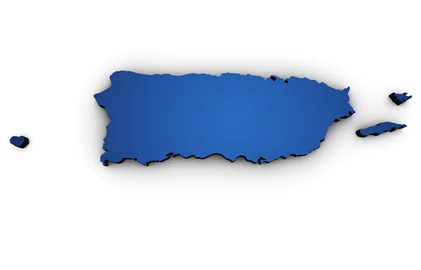
Shape Of A Pale Colored Elevation Map With Lakes And Rivers Of The Puerto Rico - USA, With Distance Scale And Map Border Coordinates, Isolated On White

Image, 2.33MB, 3883 × 1158 jpg
stock vector Puerto Rico map, black and white detailed outline regions of the country. Vector illustration

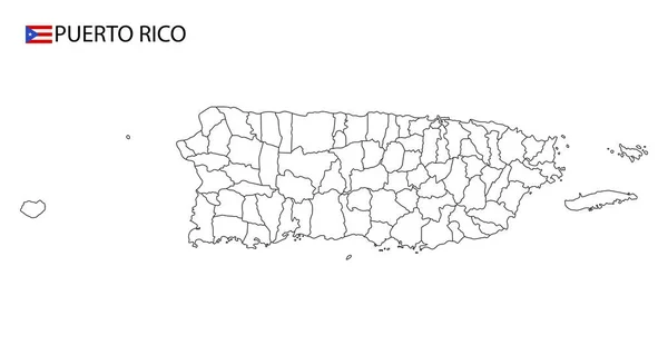
Puerto Rico Map, Black And White Detailed Outline Regions Of The Country. Vector Illustration

Vector, 1.9MB, 10140 × 5250 eps
stock vector Veinticinco de Mayo department (Buenos Aires) outline map set

Veinticinco De Mayo Department (Buenos Aires) Outline Map Set

Vector, 0.28MB, 6000 × 3000 eps
stock vector Calingasta department (San Juan) outline map set

Calingasta Department (San Juan) Outline Map Set

Vector, 0.38MB, 6000 × 3000 eps
stock image Zoomed-in view of Puerto Rico outline with perspective lines against a global map in the Mollweide projection. Shape on the left side. satellite imagery

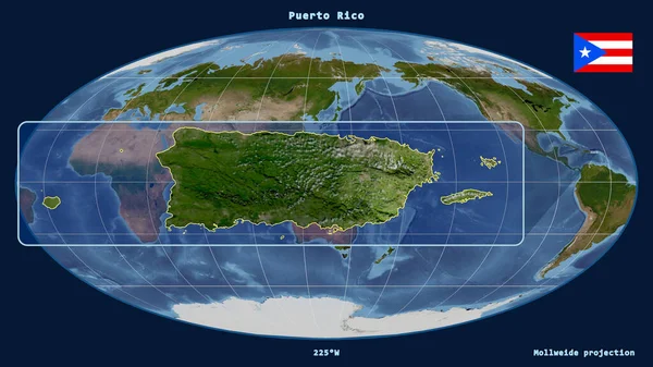
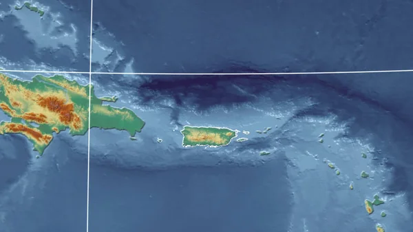
Zoomed-in View Of Puerto Rico Outline With Perspective Lines Against A Global Map In The Mollweide Projection. Shape On The Left Side. Satellite Imagery

Image, 3.14MB, 2880 × 1620 jpg
stock vector Symbol Map of the Province San Juan (Argentina) showing the territory with concentric circles in rainbow colors like a shooting target

Symbol Map Of The Province San Juan (Argentina) Showing The Territory With Concentric Circles In Rainbow Colors Like A Shooting Target

Vector, 0.65MB, 5155 × 6000 eps
stock vector San Juan outline map

San Juan Outline Map

Vector, 0.28MB, 4000 × 4800 eps
stock image Puerto Rico - USA outlined on a Colored elevation map with lakes and rivers

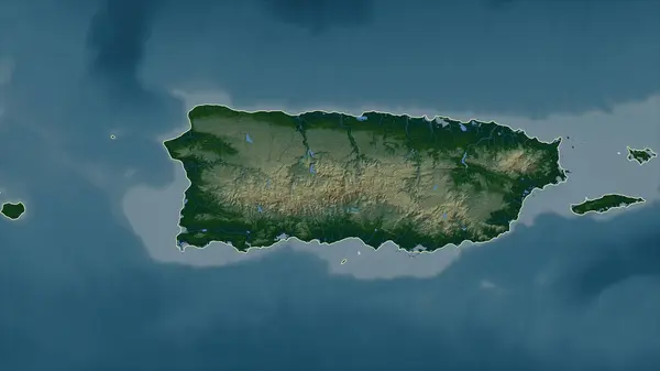
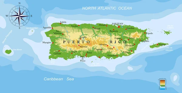
Puerto Rico - USA Outlined On A Colored Elevation Map With Lakes And Rivers

Image, 2.48MB, 2688 × 1512 jpg
stock vector Rawson department (San Juan) outline map set

Rawson Department (San Juan) Outline Map Set

Vector, 0.34MB, 6000 × 3000 eps
stock vector Pocito department (San Juan) outline map set

Pocito Department (San Juan) Outline Map Set

Vector, 0.27MB, 6000 × 3000 eps
stock vector Caucete department (San Juan) outline map set

Caucete Department (San Juan) Outline Map Set

Vector, 0.38MB, 6000 × 3000 eps
stock vector Zonda department (San Juan) outline map set

Zonda Department (San Juan) Outline Map Set

Vector, 0.31MB, 6000 × 3000 eps
stock vector Jachal department (San Juan) outline map set

Jachal Department (San Juan) Outline Map Set

Vector, 0.42MB, 6000 × 3000 eps
stock vector Angaco department (San Juan) outline map set

Angaco Department (San Juan) Outline Map Set

Vector, 0.28MB, 6000 × 3000 eps
stock image Puerto Rico - USA highlighted on a high resolution satellite map

Puerto Rico - USA Highlighted On A High Resolution Satellite Map

Image, 3.01MB, 2688 × 1512 jpg
stock vector Veinticinco de Mayo department (San Juan) outline map set

Veinticinco De Mayo Department (San Juan) Outline Map Set

Vector, 0.37MB, 6000 × 3000 eps
stock vector Veinticinco de Mayo department (Chaco) outline map set

Veinticinco De Mayo Department (Chaco) Outline Map Set

Vector, 0.23MB, 6000 × 3000 eps
stock vector Symbol Map of the Province San Juan (Argentina) showing the state/province with a pattern of black squares like a chessboard

Symbol Map Of The Province San Juan (Argentina) Showing The State/province With A Pattern Of Black Squares Like A Chessboard

Vector, 0.6MB, 5155 × 6000 eps
stock image Map of San Juan County in New Mexico state on white background. single County map highlighted by black color on New Mexico map. UNITED STATES, US

Map Of San Juan County In New Mexico State On White Background. Single County Map Highlighted By Black Color On New Mexico Map. UNITED STATES, US

Image, 3.29MB, 8000 × 5334 jpg
stock vector Iglesia department (San Juan) outline map set

Iglesia Department (San Juan) Outline Map Set

Vector, 0.4MB, 6000 × 3000 eps
stock vector Santa Lucia department (San Juan) outline map set

Santa Lucia Department (San Juan) Outline Map Set

Vector, 0.28MB, 6000 × 3000 eps
stock image Chiapas, state of Mexico. Elevation map colored in wiki style with lakes and rivers. Locations and names of major cities of the region. Corner auxiliary location maps

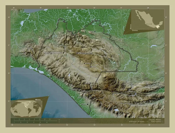
Chiapas, State Of Mexico. Elevation Map Colored In Wiki Style With Lakes And Rivers. Locations And Names Of Major Cities Of The Region. Corner Auxiliary Location Maps

Image, 10.96MB, 4930 × 3770 jpg
stock image Jalisco, state of Mexico. Elevation map colored in wiki style with lakes and rivers. Locations of major cities of the region. Corner auxiliary location maps

Jalisco, State Of Mexico. Elevation Map Colored In Wiki Style With Lakes And Rivers. Locations Of Major Cities Of The Region. Corner Auxiliary Location Maps

Image, 10.61MB, 4930 × 3770 jpg
stock image Tamaulipas, state of Mexico. Elevation map colored in wiki style with lakes and rivers. Locations and names of major cities of the region. Corner auxiliary location maps

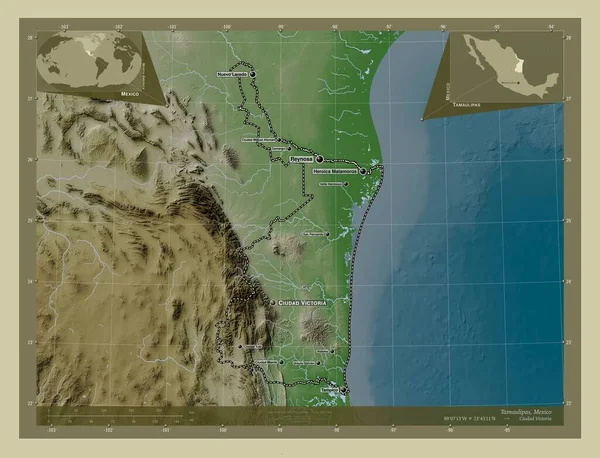
Tamaulipas, State Of Mexico. Elevation Map Colored In Wiki Style With Lakes And Rivers. Locations And Names Of Major Cities Of The Region. Corner Auxiliary Location Maps

Image, 7.5MB, 4930 × 3770 jpg
stock image Veracruz, state of Mexico. High resolution satellite map. Locations and names of major cities of the region. Corner auxiliary location maps

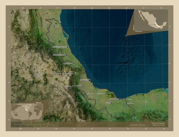
Veracruz, State Of Mexico. High Resolution Satellite Map. Locations And Names Of Major Cities Of The Region. Corner Auxiliary Location Maps

Image, 8.79MB, 4930 × 3770 jpg
stock image Guerrero, state of Mexico. Elevation map colored in wiki style with lakes and rivers. Locations of major cities of the region. Corner auxiliary location maps

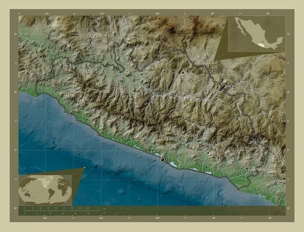
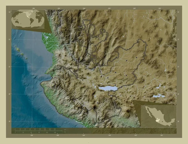
Guerrero, State Of Mexico. Elevation Map Colored In Wiki Style With Lakes And Rivers. Locations Of Major Cities Of The Region. Corner Auxiliary Location Maps

Image, 10.9MB, 4930 × 3770 jpg
stock vector Map Malawi Africa regions

Map Malawi Africa Regions

Vector, 3.83MB, 7500 × 3746 eps
stock image Veracruz, state of Mexico. Colored elevation map with lakes and rivers. Locations of major cities of the region. Corner auxiliary location maps

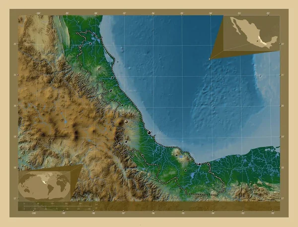
Veracruz, State Of Mexico. Colored Elevation Map With Lakes And Rivers. Locations Of Major Cities Of The Region. Corner Auxiliary Location Maps

Image, 9.01MB, 4930 × 3770 jpg
stock vector puerto rico

Puerto Rico

Vector, 2.78MB, 5000 × 4000 eps
stock vector Puerto Rico poster in retro style Map of the country with regions in autumn color palette Shape of

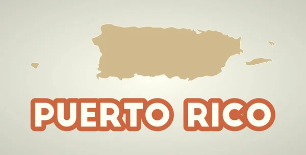
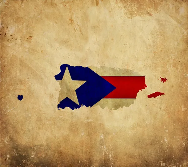
Puerto Rico Poster In Retro Style Map Of The Country With Regions In Autumn Color Palette Shape Of

Vector, 0.23MB, 7693 × 3905 eps
stock image Oaxaca, state of Mexico. Colored elevation map with lakes and rivers. Locations and names of major cities of the region. Corner auxiliary location maps

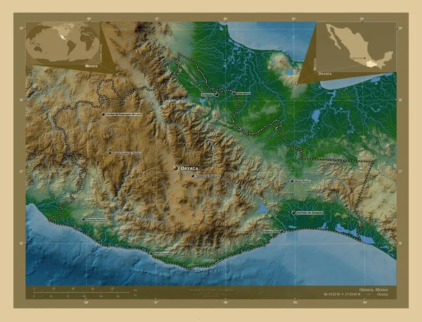
Oaxaca, State Of Mexico. Colored Elevation Map With Lakes And Rivers. Locations And Names Of Major Cities Of The Region. Corner Auxiliary Location Maps

Image, 10.66MB, 4930 × 3770 jpg
stock image Map Of Puerto Rico 3d Shape

Map Of Puerto Rico 3d Shape

Image, 1.6MB, 5600 × 3600 jpg
Page 1 >> Next