
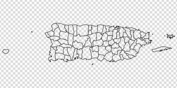
Stock image San Juan Map Outline page 2
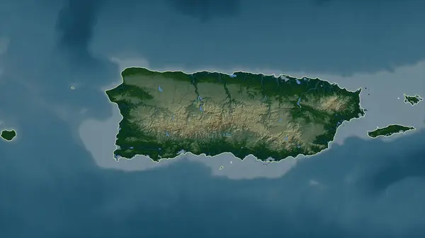
Puerto Rico - USA Outlined On A Colored Elevation Map With Lakes And Rivers
Image, 2.48MB, 2688 × 1512 jpg


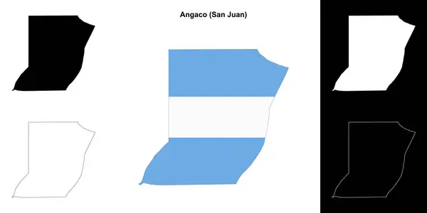


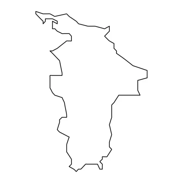
Symbol Map Of The Province San Juan (Argentina) Showing The State/province With A Pattern Of Black Squares Like A Chessboard
Vector, 0.6MB, 5155 × 6000 eps

Map Of San Juan County In New Mexico State On White Background. Single County Map Highlighted By Black Color On New Mexico Map. UNITED STATES, US
Image, 3.29MB, 8000 × 5334 jpg


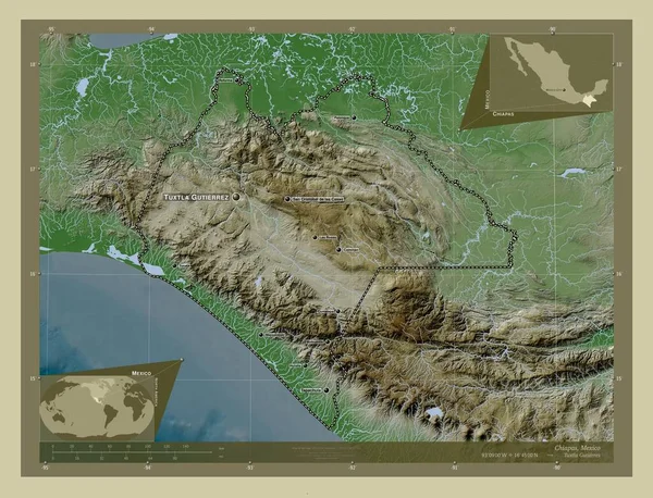
Chiapas, State Of Mexico. Elevation Map Colored In Wiki Style With Lakes And Rivers. Locations And Names Of Major Cities Of The Region. Corner Auxiliary Location Maps
Image, 10.96MB, 4930 × 3770 jpg
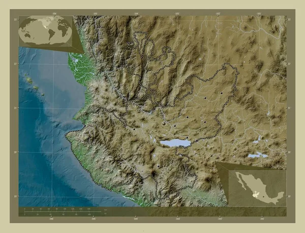
Jalisco, State Of Mexico. Elevation Map Colored In Wiki Style With Lakes And Rivers. Locations Of Major Cities Of The Region. Corner Auxiliary Location Maps
Image, 10.61MB, 4930 × 3770 jpg
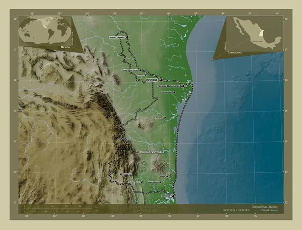
Tamaulipas, State Of Mexico. Elevation Map Colored In Wiki Style With Lakes And Rivers. Locations And Names Of Major Cities Of The Region. Corner Auxiliary Location Maps
Image, 7.5MB, 4930 × 3770 jpg
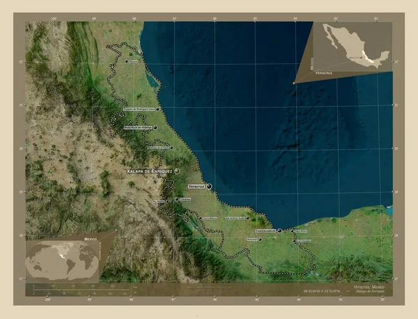
Veracruz, State Of Mexico. High Resolution Satellite Map. Locations And Names Of Major Cities Of The Region. Corner Auxiliary Location Maps
Image, 8.79MB, 4930 × 3770 jpg
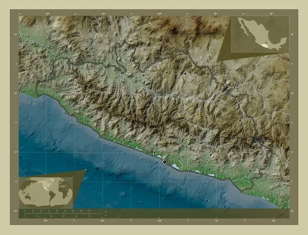
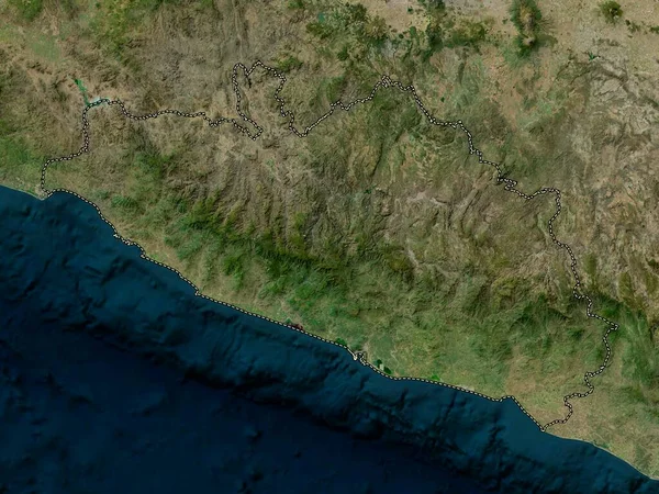
Guerrero, State Of Mexico. Elevation Map Colored In Wiki Style With Lakes And Rivers. Locations Of Major Cities Of The Region. Corner Auxiliary Location Maps
Image, 10.9MB, 4930 × 3770 jpg
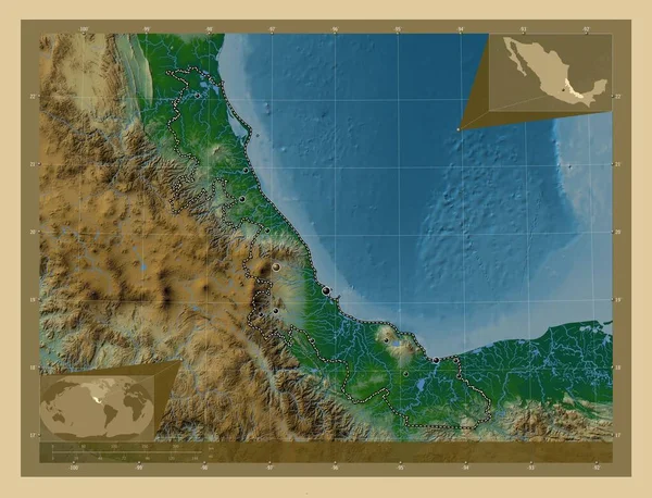
Veracruz, State Of Mexico. Colored Elevation Map With Lakes And Rivers. Locations Of Major Cities Of The Region. Corner Auxiliary Location Maps
Image, 9.01MB, 4930 × 3770 jpg

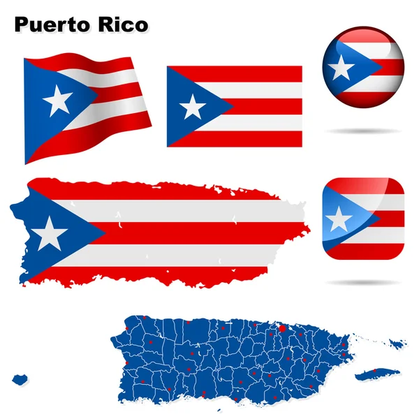
Puerto Rico Poster In Retro Style Map Of The Country With Regions In Autumn Color Palette Shape Of
Vector, 0.23MB, 7693 × 3905 eps
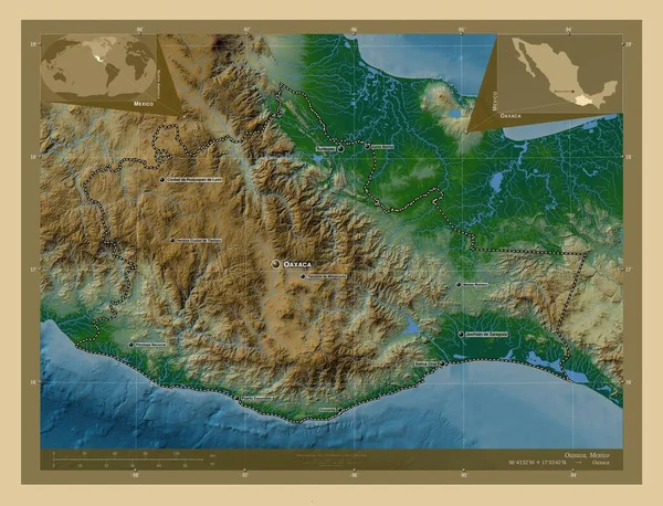
Oaxaca, State Of Mexico. Colored Elevation Map With Lakes And Rivers. Locations And Names Of Major Cities Of The Region. Corner Auxiliary Location Maps
Image, 10.66MB, 4930 × 3770 jpg
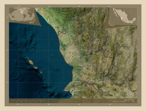
Nayarit, State Of Mexico. High Resolution Satellite Map. Locations And Names Of Major Cities Of The Region. Corner Auxiliary Location Maps
Image, 9.04MB, 4930 × 3770 jpg

Guarico , State Of Venezuela. Satellite Imagery. Shape Presented Against Its Country Area With Informative Overlays. 3D Rendering
Image, 7MB, 2880 × 1620 jpg
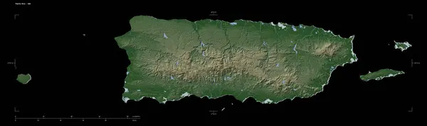
Shape Of A Pale Colored Elevation Map With Lakes And Rivers Of The Puerto Rico - USA, With Distance Scale And Map Border Coordinates, Isolated On Black
Image, 2.32MB, 3883 × 1158 jpg

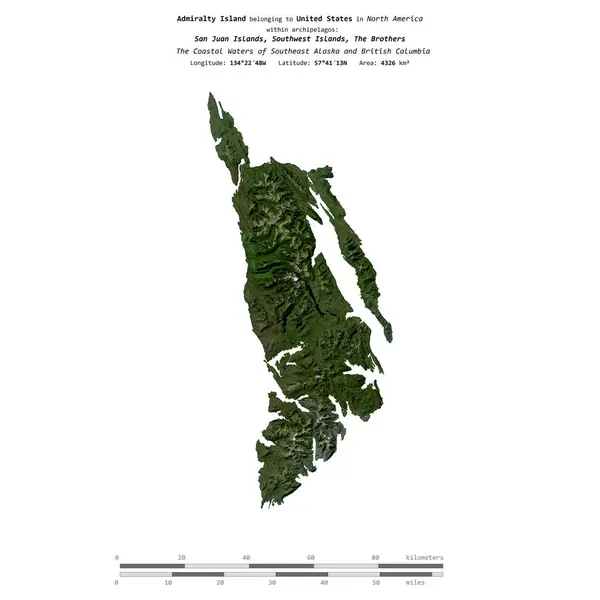
Admiralty Island In The The Coastal Waters Of Southeast Alaska And British Columbia - Belonging To United States. Described Location Diagram With Yellow Shape Of The Island And Sample Maps Of Its Surroundings
Image, 26.86MB, 11520 × 6480 jpg

San Juan Island In The The Coastal Waters Of Southeast Alaska And British Columbia, Belonging To United States, Isolated On A Bilevel Elevation Map, With Distance Scale
Image, 0.47MB, 2160 × 2160 jpg

Admiralty Island In The The Coastal Waters Of Southeast Alaska And British Columbia On A Colored Elevation Map
Image, 6.19MB, 2880 × 1620 jpg

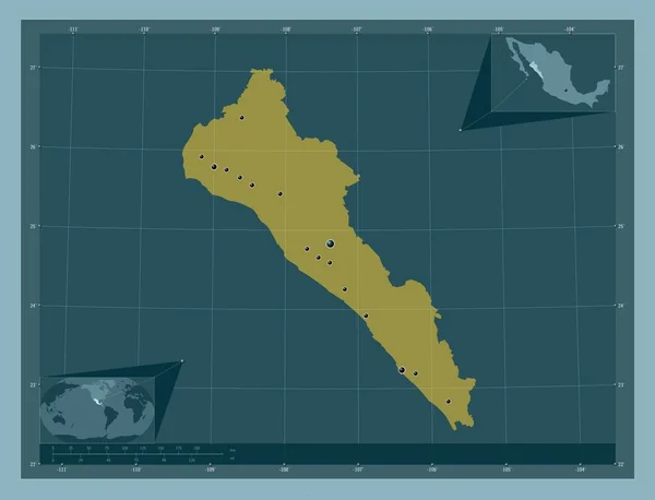
Sinaloa, State Of Mexico. Solid Color Shape. Locations Of Major Cities Of The Region. Corner Auxiliary Location Maps
Image, 1MB, 4930 × 3770 jpg

Map Of San Juan County In Colorado State On White Background. Single County Map Highlighted By Black Colour On Colorado Map. UNITED STATES, US
Image, 4.35MB, 8000 × 6266 jpg

San Juan Island In The The Coastal Waters Of Southeast Alaska And British Columbia On A Topographic, OSM Humanitarian Style Map
Image, 2.81MB, 2880 × 1620 jpg

San Juan Island In The The Coastal Waters Of Southeast Alaska And British Columbia, Belonging To United States, Isolated On A Topographic, OSM Humanitarian Style Map, With Distance Scale
Image, 1.17MB, 2160 × 2160 jpg

San Juan Island In The The Coastal Waters Of Southeast Alaska And British Columbia On A Colored Elevation Map
Image, 2.17MB, 2880 × 1620 jpg
San Juan Map, Administrative Division Of Puerto Rico. Vector Illustration.
Vector, 5.34MB, 8334 × 8334 eps

Admiralty Island In The The Coastal Waters Of Southeast Alaska And British Columbia, Belonging To United States, Isolated On A Bilevel Elevation Map, With Distance Scale
Image, 0.54MB, 2160 × 2160 jpg

San Juan Island In The The Coastal Waters Of Southeast Alaska And British Columbia - Belonging To United States. Described Location Diagram With Yellow Shape Of The Island And Sample Maps Of Its Surroundings
Image, 3.08MB, 3840 × 2160 jpg

Admiralty Island In The The Coastal Waters Of Southeast Alaska And British Columbia On A Topographic, OSM Humanitarian Style Map
Image, 2.41MB, 2880 × 1620 jpg

Gurico, State Of Venezuela. Satellite Imagery. Shape Outlined Against Its Country Area. 3D Rendering.
Image, 8.39MB, 2880 × 1620 jpg

Admiralty Island In The The Coastal Waters Of Southeast Alaska And British Columbia On A Satellite Image Taken In July 29, 2020
Image, 5.95MB, 2880 × 1620 jpg
Admiralty Island In The The Coastal Waters Of Southeast Alaska And British Columbia, Belonging To United States, Isolated On A Satellite Image Taken In September 14, 2020, With Distance Scale
Image, 1.01MB, 2160 × 2160 jpg
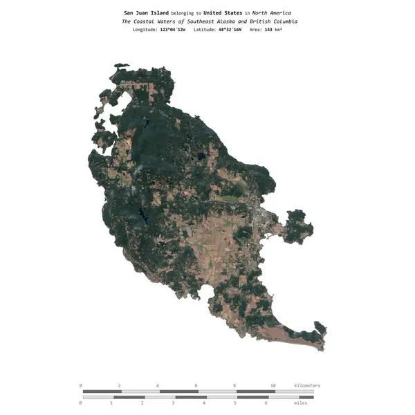
San Juan Island In The The Coastal Waters Of Southeast Alaska And British Columbia, Belonging To United States, Isolated On A Satellite Image Taken In October 2, 2022, With Distance Scale
Image, 1.62MB, 2160 × 2160 jpg

Admiralty Island In The The Coastal Waters Of Southeast Alaska And British Columbia, Belonging To United States, Isolated On A Topographic, OSM Humanitarian Style Map, With Distance Scale
Image, 0.5MB, 2160 × 2160 jpg

San Juan Island In The The Coastal Waters Of Southeast Alaska And British Columbia On A Satellite Image Taken In June 4, 2023
Image, 5.64MB, 2880 × 1620 jpg
Previous << Page 2 >> Next