photo free
Home Images Vectors Videos

Stock image Shiga Prefecture Map

stock vector Shiga prefecture Map frame icon

Shiga Prefecture Map Frame Icon

Vector, 1.71MB, 4520 × 4520 ai
stock image flag of shiga prefecture on map with administrative divisions and borders of japan

Flag Of Shiga Prefecture On Map With Administrative Divisions And Borders Of Japan

Image, 0.74MB, 4576 × 4531 jpg
stock vector Shiga prefecture outline map set

Shiga Prefecture Outline Map Set

Vector, 0.3MB, 6000 × 3000 eps
stock image SHIGA Japan travel map with landmarks and symbols. Hand drawn vector illustration.

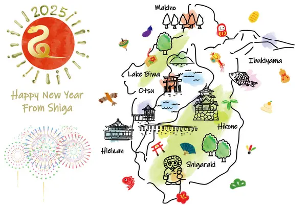
SHIGA Japan Travel Map With Landmarks And Symbols. Hand Drawn Vector Illustration.

Image, 3.45MB, 5000 × 3378 jpg
stock vector hand drawing cityscape prefecture SHIGA new year card 2023 template

Hand Drawing Cityscape Prefecture SHIGA New Year Card 2023 Template

Vector, 1.93MB, 5000 × 3378 eps
stock image Casual touch Stylish illustration of Lake Biwa

Casual Touch Stylish Illustration Of Lake Biwa

Image, 3.01MB, 4756 × 6137 jpg
stock vector Kansai region, or also Kinki region in Japan, multi colored political map. Southern-central region of main island Honshu, consisting of prefectures Hyogo, Mie, Nara, Osaka, Kyoto, Shiga, and Wakayama.

Kansai Region, Or Also Kinki Region In Japan, Multi Colored Political Map. Southern-central Region Of Main Island Honshu, Consisting Of Prefectures Hyogo, Mie, Nara, Osaka, Kyoto, Shiga, And Wakayama.

Vector, 3.65MB, 6000 × 6000 eps
stock vector Symbol Map of the Prefecture Shiga (Japan) showing the state/province with a pattern of randomly distributed colorful squares of different sizes

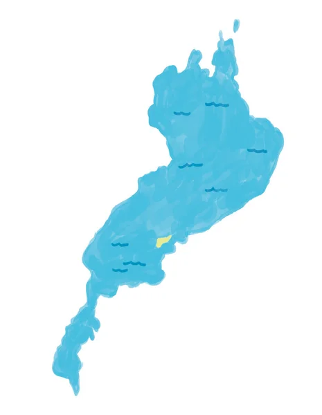
Symbol Map Of The Prefecture Shiga (Japan) Showing The State/province With A Pattern Of Randomly Distributed Colorful Squares Of Different Sizes

Vector, 0.92MB, 3974 × 6000 eps
stock vector Kansai region, or the Kinki region in Japan, political map. Southern-central region of the main island Honshu, consisting of the prefectures Hyogo, Mie, Nara, Osaka, Kyoto, Shiga, and Wakayama. Vector

Kansai Region, Or The Kinki Region In Japan, Political Map. Southern-central Region Of The Main Island Honshu, Consisting Of The Prefectures Hyogo, Mie, Nara, Osaka, Kyoto, Shiga, And Wakayama. Vector

Vector, 5.8MB, 6000 × 6000 eps
stock vector Symbol Map of the Prefecture Shiga (Japan) showing the contour of the state/province buffered inside in rainbow colors

Symbol Map Of The Prefecture Shiga (Japan) Showing The Contour Of The State/province Buffered Inside In Rainbow Colors

Vector, 0.74MB, 3974 × 6000 eps
stock vector Symbol Map of the Prefecture Shiga (Japan). Abstract map showing the state/province with a pattern of black and white squares like a chessboard

Symbol Map Of The Prefecture Shiga (Japan). Abstract Map Showing The State/province With A Pattern Of Black And White Squares Like A Chessboard

Vector, 0.6MB, 3974 × 6000 eps
stock vector Kansai region, or the Kinki region in Japan, gray political map. Southern-central region of the main island Honshu, consisting of the prefectures Hyogo, Mie, Nara, Osaka, Kyoto, Shiga, and Wakayama.

Kansai Region, Or The Kinki Region In Japan, Gray Political Map. Southern-central Region Of The Main Island Honshu, Consisting Of The Prefectures Hyogo, Mie, Nara, Osaka, Kyoto, Shiga, And Wakayama.

Vector, 3.78MB, 6000 × 6000 eps
stock vector Symbol Map of the Prefecture Shiga (Japan) showing the state/province with a pattern of black circles

Symbol Map Of The Prefecture Shiga (Japan) Showing The State/province With A Pattern Of Black Circles

Vector, 1.31MB, 3974 × 6000 eps
Page 1 >> Next