
Stock image Silk Route
One Belt, One Road, Chinese Strategic Investment In The 21st Century Map. Chinese Words On The Map Are The Name Such Like China, One Belt One Road, Europe, Africa, Asia
Vector, 1.6MB, 5501 × 3917 eps

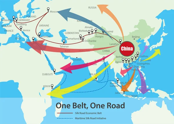
One Belt One Road. New Chinese Trade Silk Road. Vector Map Infographics Illustration
Vector, 2.34MB, 7160 × 3941 eps

One Belt One Road. New Chinese Trade Silk Road. Vector Map Infographics Illustration
Vector, 3.78MB, 7160 × 3941 eps
One Belt One Road New Silk Road Concept. 21st-century Connectivity And Cooperation Between Eurasian Countries. Vector Illustration.
Vector, 1.43MB, 8334 × 6250 eps
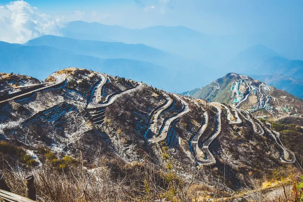
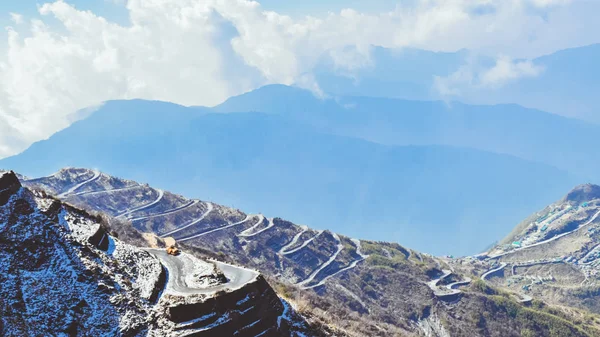
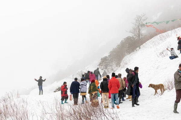
Zuluk Hilltop The Transit Point Of Silk Route From Thambi View Point. The Road Makes 32 Hairpin Turns. Located On Rugged Terrain Of Lower Himalaya In Sikkim. Historic Silk Route From Tibet To India.
Image, 13.95MB, 6000 × 4000 jpg

Zuluk Hilltop The Transit Point Of Silk Route. The Road Through Zuluk Makes Almost 32 Hairpin Turns To Reach Lungthung. Located At A Height Of 10,100 Feet On Rugged Terrain Of Lower Himalaya In Sikkim
Image, 9.49MB, 6000 × 4000 jpg

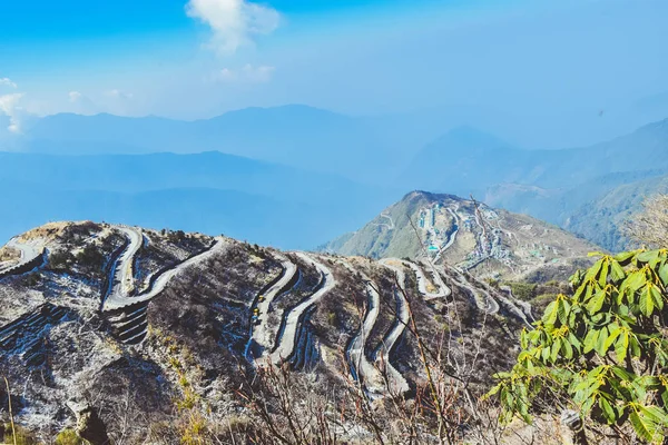
Rugged Terrain Of Lower Himalayas In East Sikkim, Zuluk Or Dzuluk, From Thambi View Point. Winding Road Of 32 Hairpin Turns. Historic Silk Route From Tibet To India. Offbeat Destination In East Sikkim
Image, 11.46MB, 6000 × 4000 jpg
Zuluk Is A Relatively New Tourist Destination Of East Sikkim. It Is A Small Village With A Large Military Settlement, Indo-Tibet Border Is Nearby Used By Traders Traveling To Tibet Through Jelep-la.
Image, 6.7MB, 6000 × 3375 jpg
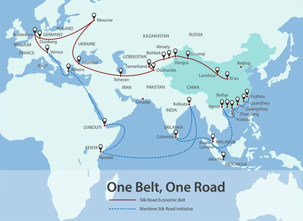
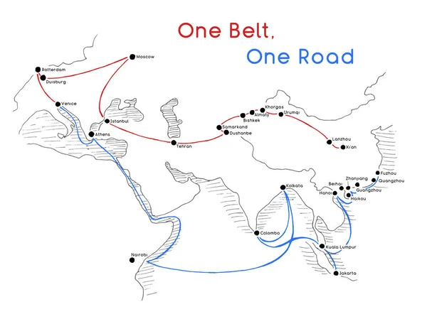
One Belt, One Road, Chinese Strategic Investment In The 21st Century Map.
Vector, 1.07MB, 5501 × 4009 eps


Sheep Herd Grazing Along A Mountain River, Naryn Gorge, Naryn Region, Kyrgyzstan, Asia
Image, 2.34MB, 5323 × 3543 jpg


Panoramic View Of Hilly Road Among Mountains Landscape With White Clouds And Blue Sky
Image, 25.5MB, 6352 × 3808 jpg
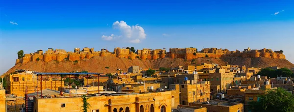
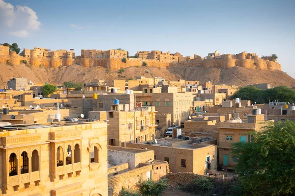
Jaisalmer,Rajasthan,India - October16,2019 : Panoramic Image Of Jaisalmer Fort Or Sonar Quila Or Golden Fort. A "living Fort" - Made Of Yellow Sandstone. UNESCO World Heritage Site At Thar Desert.
Image, 12.18MB, 5272 × 2007 jpg

March 2018 Tsomgo Or Changu ( Tashi Delek ) Lake, East Sikkim, India. March 2018
Image, 8.19MB, 6000 × 4000 jpg


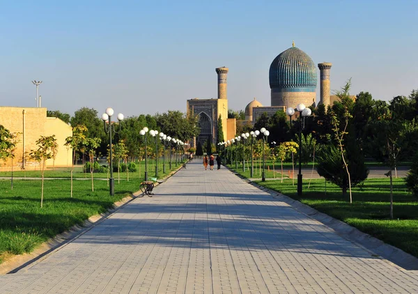
Khiva, Uzbekistan. People In The Street Of Old Town. 13 Of September 2017
Image, 9.88MB, 4256 × 2832 jpg
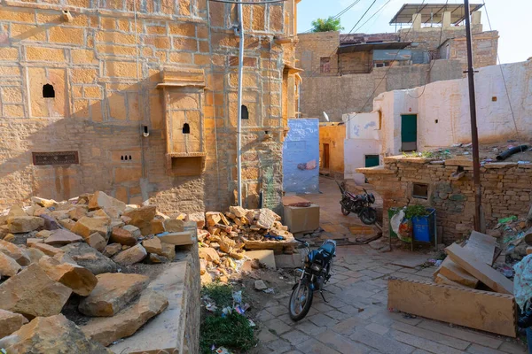
Jaisalmer, Rajasthan, India - October 13, 2019 : Inside View Of Jaisalmer Fort Or Sonar Quila Or Golden Fort, Made Of Yellow Sandstone, In The Morning Light. UNESCO World Heritage Site At Thar Desert.
Image, 5.68MB, 3000 × 2000 jpg


Jaisalmer,Rajasthan,India - October16,2019 : Jaisalmer Fort Or Sonar Quila Or Golden Fort. A "living Fort" - Made Of Sandstone. UNESCO World Heritage Site At Thar Desert Along Old Silk Trade Route.
Image, 12.52MB, 3900 × 2600 jpg


Russia, Derbent, Fortifications Of Derbent, Travel Landmark Line Vector Illustration
Vector, 1.82MB, 8000 × 4000 eps


Page 1 >> Next