
Stock image Southland Map
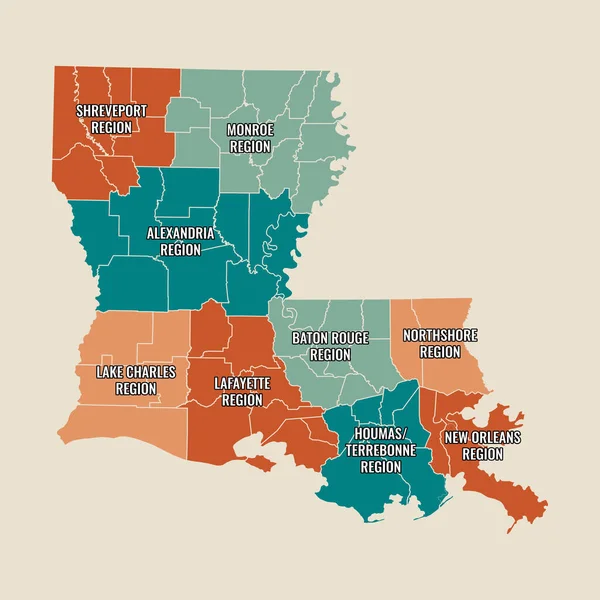
New Orleans Louisiana French Quarter Downtown Uptown Mississippi River Area Map
Image, 8.44MB, 9000 × 9000 jpg
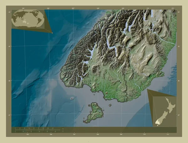
Southland, Regional Council Of New Zealand. Elevation Map Colored In Wiki Style With Lakes And Rivers. Locations Of Major Cities Of The Region. Corner Auxiliary Location Maps
Image, 7.75MB, 4930 × 3770 jpg
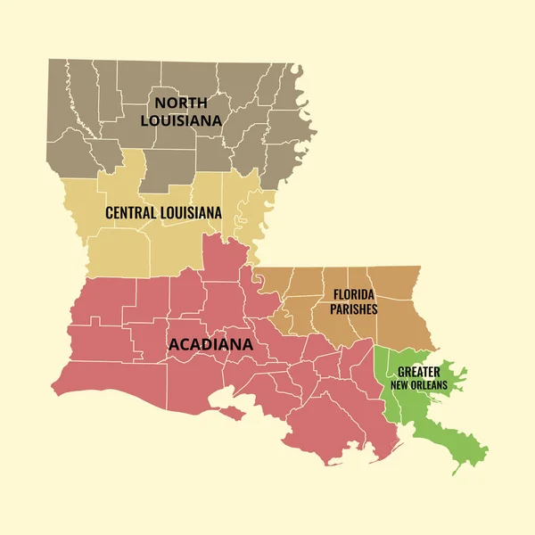
New Orleans Louisiana French Quarter Downtown Uptown Mississippi River Area Map
Image, 7.38MB, 9000 × 9000 jpg
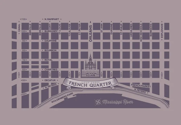
New Orleans Louisiana French Quarter Downtown Uptown Mississippi River Area Map
Image, 3.57MB, 6500 × 4500 jpg
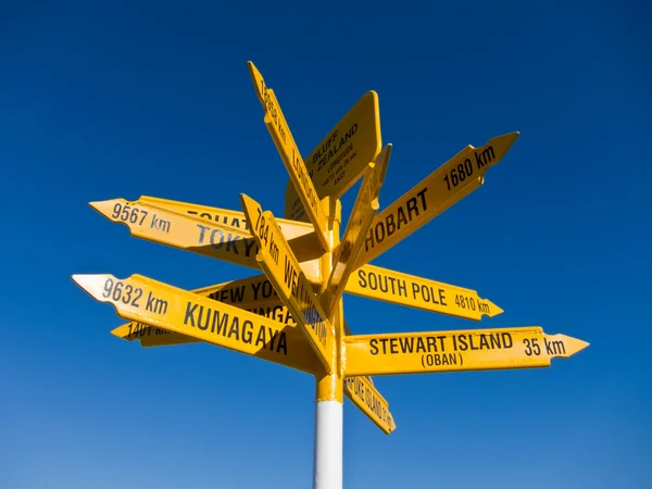


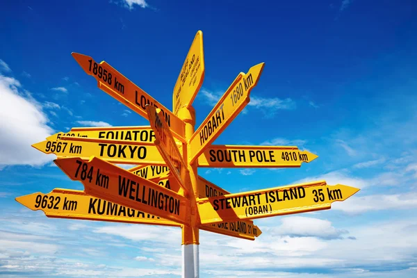
Bluff New Zealand Yellow Signpost, With Arrows Pointing To Different Directions, Major Destinations, Big Cities Such As Tokyo, Sydney, New York, Hobart, Kumagawa, Stewart Island, Cape Reinga, Equator
Image, 6.92MB, 5616 × 3744 jpg


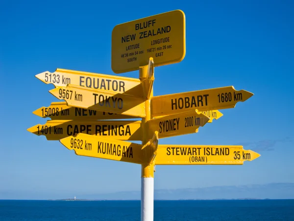

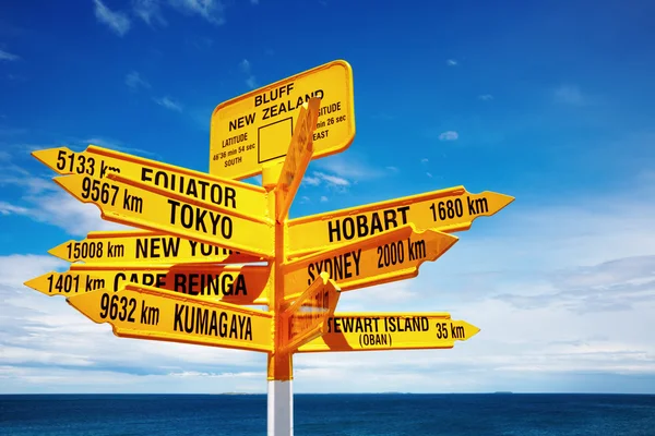
Global Signpost World Distances Measured From The World's Southernmost Signpost In Bluff, New Zealand.
Image, 6.08MB, 3872 × 2592 jpg


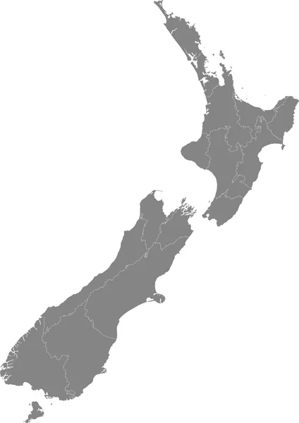
Symbol Map Of The Regional Council Southland (New Zealand). Abstract Map Showing The State/province With A Pattern Of Black And White Squares Like A Chessboard
Vector, 0.6MB, 3996 × 6000 eps

Symbol Map Of The Regional Council Southland (New Zealand) Showing The Territory With A Series Of Black Square Lines On White Background
Vector, 0.58MB, 4137 × 6000 eps

Symbol Map Of The Regional Council Southland (New Zealand) Showing The Territory With Concentric Circles In Rainbow Colors Like A Shooting Target
Vector, 0.64MB, 3996 × 6000 eps

Symbol Map Of The Regional Council Southland (New Zealand) Showing The State/province With A Pattern Of Randomly Distributed Colorful Squares Of Different Sizes
Vector, 0.8MB, 3996 × 6000 eps

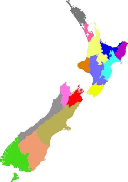
Southland Region Map, Administrative Division Of New Zealand. Vector Illustration.
Vector, 5.53MB, 8334 × 8334 eps

Symbol Map Of The Regional Council Southland (New Zealand) Showing The State/province With A Pattern Of Black Circles
Vector, 1.1MB, 3996 × 6000 eps
Page 1 >> Next