
Stock image Wabash Map Vector

U.S. States - Map Of Indiana With Paper Cut Effect. Hand Made. Rivers And Lakes Are Shown. Please Look At My Other Images Of Cartographic Series - They Are All Very Detailed And Carefully Drawn By Hand WITH RIVERS AND LAKES.
Vector, 2.19MB, 6891 × 6891 eps

U.S. States - Map Of Illinois State With Paper Cut Effect. Hand Made. Rivers And Lakes Are Shown. Please Look At My Other Images Of Cartographic Series - They Are All Very Detailed And Carefully Drawn By Hand WITH RIVERS AND LAKES.
Vector, 13.24MB, 7000 × 7000 eps
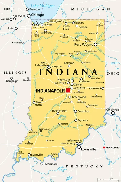
Indiana, IN, Political Map, With The Capital Indianapolis, And Most Important Cities, Rivers And Lakes. State In The Midwestern Region Of The United States Of America, Nicknamed The Hoosier State.
Vector, 3.4MB, 6000 × 9000 eps
Page 1 >> Next