photo free
Home Images Vectors Videos

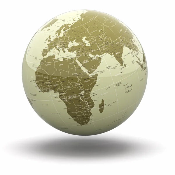
Stock image Antarctica On Political Globe

stock image Political world globe on white background. 3d

Political World Globe On White Background. 3d

Image, 4.19MB, 4500 × 4500 jpg
stock vector Hi Detail Black Vector Political World Map illustration

Hi Detail Black Vector Political World Map Illustration

Vector, 10.4MB, 9000 × 5000 eps
stock image Political world globe. 3d

Political World Globe. 3d

Image, 5.18MB, 4500 × 4500 jpg
stock image Political world globe on white background. 3d

Political World Globe On White Background. 3d

Image, 4.89MB, 4500 × 4500 jpg
stock image Political world globe on white background. 3d

Political World Globe On White Background. 3d

Image, 4.52MB, 4500 × 4500 jpg
stock vector Map of the World

Map Of The World

Vector, 6.89MB, 7001 × 4001 eps
stock vector World map

World Map

Vector, 14.26MB, 7001 × 4001 eps
stock vector World map

World Map

Vector, 8.64MB, 10000 × 7065 ai
stock vector Five continents world, political map. Africa, America, Antarctica, Australia and Eurasia, with shorelines and borders. Robinson projection. English labeling. Isolated on white background. Vector.

Five Continents World, Political Map. Africa, America, Antarctica, Australia And Eurasia, With Shorelines And Borders. Robinson Projection. English Labeling. Isolated On White Background. Vector.

Vector, 6.68MB, 9933 × 5099 eps
stock vector Political world map, grey, with white borders.

Political World Map, Grey, With White Borders.

Vector, 2.43MB, 6144 × 3744 eps
stock vector Political world map

Political World Map

Vector, 5.75MB, 2923 × 1900 eps
stock vector Six continents world, political map. America, Africa, Antarctica, Asia, Australia and Europe, with shorelines and borders. Robinson projection. English labeling. Isolated on white background. Vector.

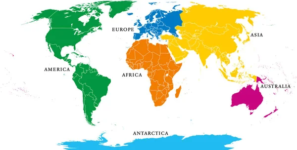
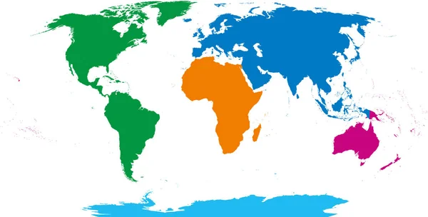
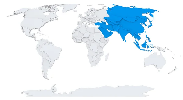
Six Continents World, Political Map. America, Africa, Antarctica, Asia, Australia And Europe, With Shorelines And Borders. Robinson Projection. English Labeling. Isolated On White Background. Vector.

Vector, 6.68MB, 10633 × 5458 eps
stock vector Map of World. Detailed thin black outline political map with country names. Vector map

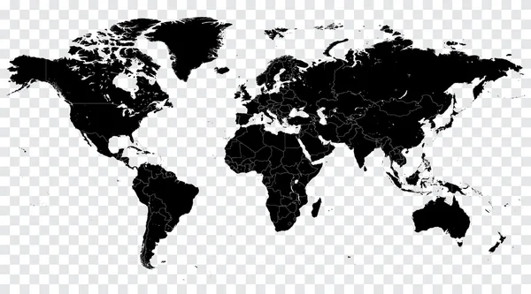
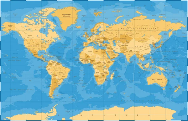
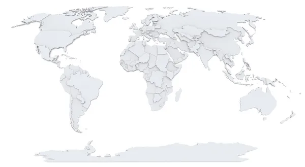
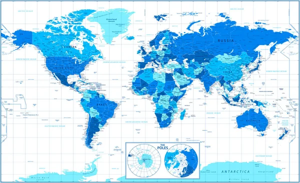
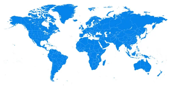
Map Of World. Detailed Thin Black Outline Political Map With Country Names. Vector Map

Vector, 13.16MB, 6000 × 4500 eps
stock vector Political world map on white background.

Political World Map On White Background.

Vector, 0.15MB, 8000 × 6000 eps
stock vector Political Golden Blue World Map Vector

Political Golden Blue World Map Vector

Vector, 13.05MB, 8035 × 5183 eps
stock image Africa on Bump map of world

Africa On Bump Map Of World

Image, 3.57MB, 9500 × 5200 jpg
stock vector World single states political map

World Single States Political Map

Vector, 6.72MB, 11000 × 5649 eps
stock vector Political map of the World.

Political Map Of The World.

Vector, 21.07MB, 5000 × 3067 eps
stock image North America on Bump map of world

North America On Bump Map Of World

Image, 2.92MB, 8000 × 4400 jpg
stock vector Political Colored World Map Vector

Political Colored World Map Vector

Vector, 12.36MB, 8035 × 5183 eps
stock vector Six continents, world map. Africa, America, Antarctica, Asia, Australia and Europe. Outline and colored shapes. Robinson projection. Isolated on white background. Vector.

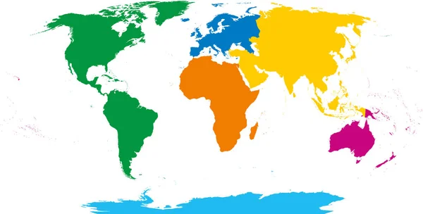
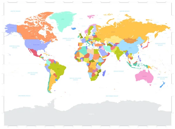
Six Continents, World Map. Africa, America, Antarctica, Asia, Australia And Europe. Outline And Colored Shapes. Robinson Projection. Isolated On White Background. Vector.

Vector, 5.05MB, 10633 × 5394 eps
stock vector Hi Detail Blue Vector Political World Map illustration

Hi Detail Blue Vector Political World Map Illustration

Vector, 10.97MB, 10039 × 5315 eps
stock image Bump map of world

Bump Map Of World

Image, 2.65MB, 8000 × 4400 jpg
stock vector Political world map on white background.

Political World Map On White Background.

Vector, 0.74MB, 8000 × 6000 eps
stock vector Four continents. World map with national borders. America, Africa-Eurasia, Australia and Antarctica. Political map under Robinson projection. English labeling. Isolated on white background. Vector.

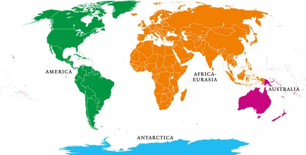
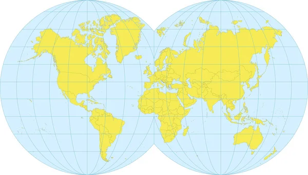
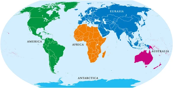
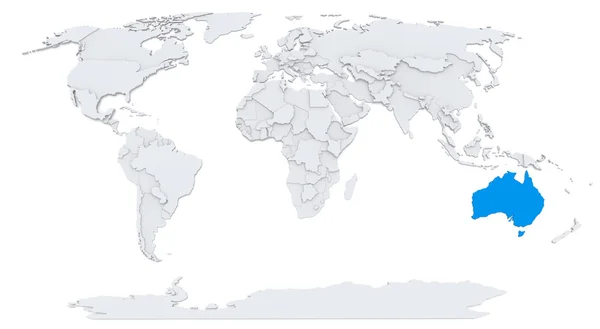
Four Continents. World Map With National Borders. America, Africa-Eurasia, Australia And Antarctica. Political Map Under Robinson Projection. English Labeling. Isolated On White Background. Vector.

Vector, 6.65MB, 10633 × 5394 eps
stock vector Six continents, political world map, with borders. Africa, America, Antarctica, Asia, Australia and Europe. Robinson projection. English labeling. Isolated illustration on white background. Vector.

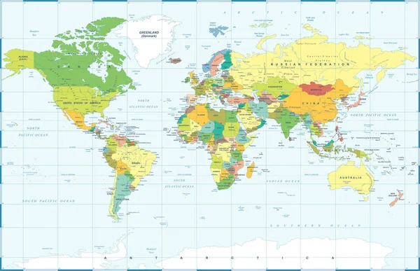
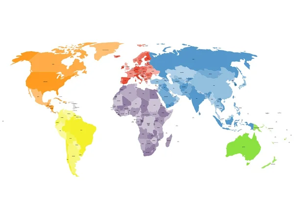
Six Continents, Political World Map, With Borders. Africa, America, Antarctica, Asia, Australia And Europe. Robinson Projection. English Labeling. Isolated Illustration On White Background. Vector.

Vector, 6.66MB, 10633 × 5394 eps
stock vector Hi Detail Blue Vector Political World Map illustration

Hi Detail Blue Vector Political World Map Illustration

Vector, 9.55MB, 8500 × 6232 eps
stock vector Political Colored World Map Vector

Political Colored World Map Vector

Vector, 13.16MB, 8035 × 5183 eps
stock vector World Political Map Outline

World Political Map Outline

Vector, 3.8MB, 9000 × 4603 eps
stock vector World Map and Poles Political - Vector Detailed Illustration

World Map And Poles Political - Vector Detailed Illustration

Vector, 24.5MB, 5730 × 3501 eps
stock image Australia on Bump map of world

Australia On Bump Map Of World

Image, 2.74MB, 8000 × 4400 jpg
stock vector Political world map on white background.

Political World Map On White Background.

Vector, 0.31MB, 12000 × 9000 eps
stock vector Five continents, world map. Africa, America, Antarctica, Australia and Eurasia. Outline and colored shapes under Robinson projection. Isolated on white background. Vector.

Five Continents, World Map. Africa, America, Antarctica, Australia And Eurasia. Outline And Colored Shapes Under Robinson Projection. Isolated On White Background. Vector.

Vector, 5.05MB, 9933 × 5039 eps
stock vector World Map Political - Vector Detailed Illustration

World Map Political - Vector Detailed Illustration

Vector, 11MB, 6674 × 3423 eps
stock vector Political map of world with Antarctica. Countries in four different colors without borders on white background. Black labels of states and significant dependent territories names. High detail vector

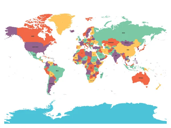
Political Map Of World With Antarctica. Countries In Four Different Colors Without Borders On White Background. Black Labels Of States And Significant Dependent Territories Names. High Detail Vector

Vector, 4.49MB, 6000 × 4500 eps
stock vector Countries of the World. Colorful vector map

Countries Of The World. Colorful Vector Map

Vector, 4.75MB, 6000 × 4500 eps
stock vector Four continents world map. America, Africa-Eurasia, Australia and Antarctica. Political map with shorelines and borders. Robinson projection. English labeling. Isolated on white background. Vector.

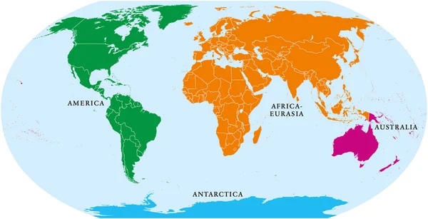
Four Continents World Map. America, Africa-Eurasia, Australia And Antarctica. Political Map With Shorelines And Borders. Robinson Projection. English Labeling. Isolated On White Background. Vector.

Vector, 6.68MB, 10633 × 5458 eps
stock image Asia on Bump map of world

Asia On Bump Map Of World

Image, 2.93MB, 8000 × 4400 jpg
stock vector World Map Political - Vector Detailed Illustration

World Map Political - Vector Detailed Illustration

Vector, 25.18MB, 6624 × 3423 eps
stock vector Political world map on white background.

Political World Map On White Background.

Vector, 1.12MB, 12000 × 9000 eps
stock vector Vector Colorful World Map with all continents in different colors and Earth globe with matching colors.

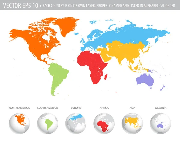
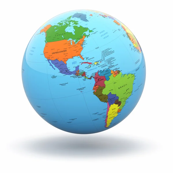
Vector Colorful World Map With All Continents In Different Colors And Earth Globe With Matching Colors.

Vector, 13.62MB, 4728 × 3723 eps
stock vector Political world map on white background, with every state labeled and selectable. Colored by continents. Versatile file, turn on an off visibility and color of each country in one click

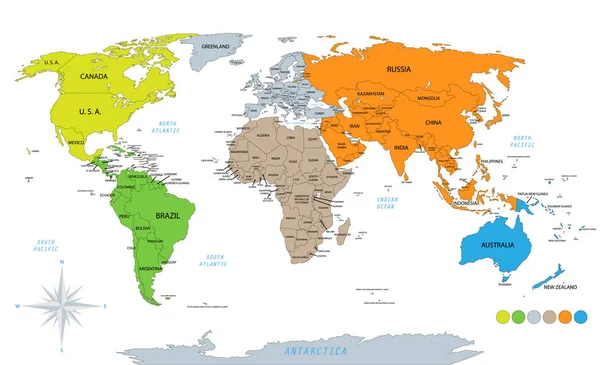
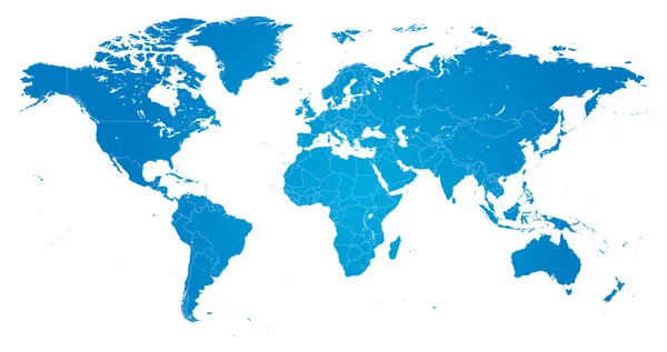
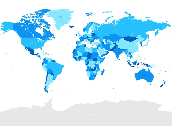
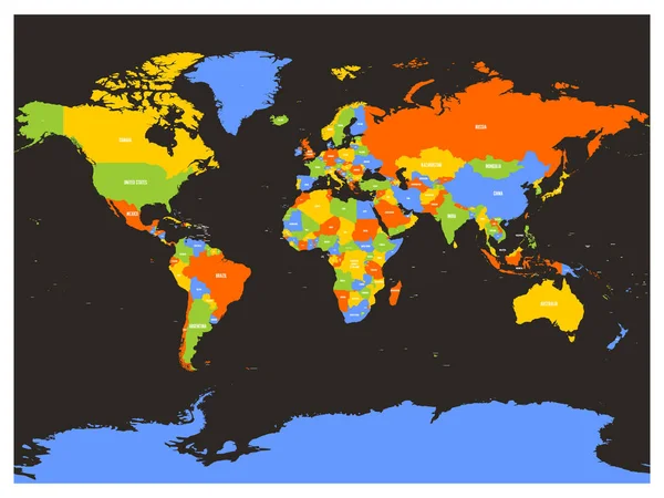
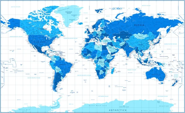
Political World Map On White Background, With Every State Labeled And Selectable. Colored By Continents. Versatile File, Turn On An Off Visibility And Color Of Each Country In One Click

Vector, 5.81MB, 6144 × 3744 eps
stock vector Political map of the world

Political Map Of The World

Vector, 8.65MB, 7335 × 3765 eps
stock vector Hi Detail colored Vector Political World Map illustration

Hi Detail Colored Vector Political World Map Illustration

Vector, 14.28MB, 8500 × 6257 eps
stock vector World political vector detailed map

World Political Vector Detailed Map

Vector, 10.08MB, 7500 × 3850 eps
stock image South America on Bump map of world

South America On Bump Map Of World

Image, 2.76MB, 8000 × 4400 jpg
stock image World map

World Map

Image, 1.76MB, 8919 × 4968 jpg
stock vector World Map Political - Vector Detailed Illustration

World Map Political - Vector Detailed Illustration

Vector, 28.18MB, 6430 × 3929 eps
stock vector Colored political world map with sovereign countries and larger dependent territories. Different colors for each countries

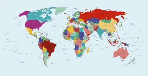
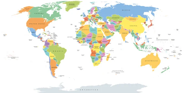
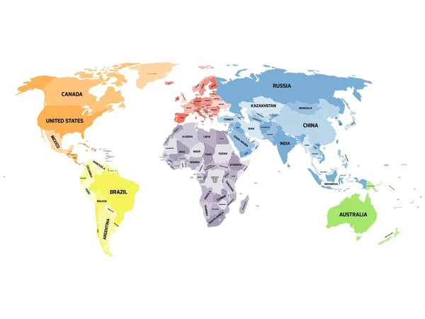
Colored Political World Map With Sovereign Countries And Larger Dependent Territories. Different Colors For Each Countries

Vector, 2.46MB, 6250 × 4167 eps
stock image Europe on Bump map of world

Europe On Bump Map Of World

Image, 2.85MB, 8000 × 4400 jpg
Page 1 >> Next