
Stock image Bathymetry
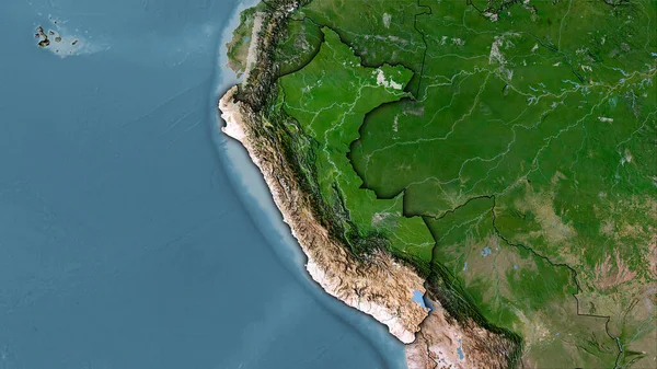
Peru Area On The Satellite C Map In The Stereographic Projection - Raw Composition Of Raster Layers With Dark Glowing Outline
Image, 5.94MB, 2880 × 1620 jpg
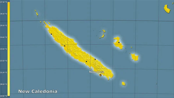
Mean Temperature Of Warmest Quarter Within The New Caledonia Area In The Stereographic Projection With Legend - Main Composition
Image, 1.15MB, 2880 × 1620 jpg

New Zealand. Globe With The Shape Of The Country Against Zoomed Map With Its Outline Isolated On The Blue Background. Shapes Only - Land/ocean Mask
Image, 1.4MB, 2880 × 1620 jpg

World Map In The Van Der Grinten Projection Centered On 11 East Longitude. Bilevel Topographic Map - Raw Composite Of Raster With Graticule. 3D Illustration
Image, 2.1MB, 4000 × 2000 jpg
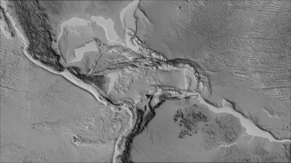
Neighborhoods Of The Caribbean Tectonic Plate On The Grayscale Map In The Van Der Grinten I Projection (oblique Transformation). Raw Composite - No Outlines
Image, 2.65MB, 2880 × 1620 jpg
World Map In The Winkel Tripel Projection Centered On 11 East Longitude. Satellite Imagery B - Raw Composite Of Raster With Graticule. 3D Illustration
Image, 9.18MB, 4000 × 2000 jpg
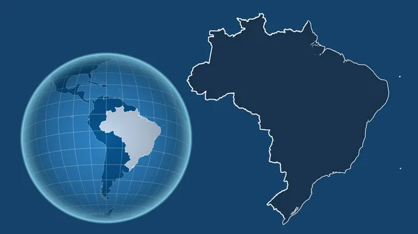
Brazil. Globe With The Shape Of The Country Against Zoomed Map With Its Outline Isolated On The Blue Background. Shapes Only - Land/ocean Mask
Image, 1.05MB, 2880 × 1620 jpg
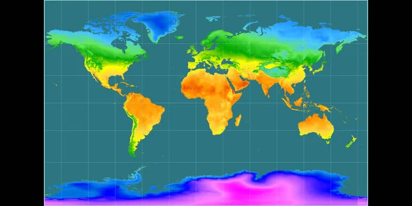
World Map In The Braun Stereographic Projection Centered On 11 East Longitude. Mean Annual Temperature Map - Raw Composite Of Raster With Graticule. 3D Illustration
Image, 3.4MB, 4000 × 2000 jpg

Taiwan Outlined On The Satellite Orthographic Map. Capital, Administrative Borders And Graticule
Image, 4.83MB, 3840 × 2160 jpg
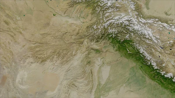
Afghanistan. Close-up Perspective Of The Country - No Outline. Satellite Imagery
Image, 5.39MB, 2880 × 1620 jpg

Tajikistan Area On The Satellite B Map In The Stereographic Projection - Raw Composition Of Raster Layers With Light Glowing Outline
Image, 6.35MB, 2880 × 1620 jpg

Mexico And Its Neighborhood. Distant Oblique Perspective - Shape Outlined. Color Physical Map
Image, 3.59MB, 2880 × 1620 jpg
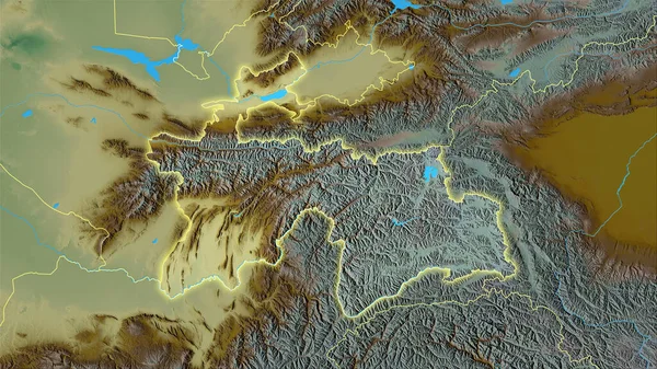
Tajikistan Area On The Topographic Relief Map In The Stereographic Projection - Raw Composition Of Raster Layers With Light Glowing Outline
Image, 7.08MB, 2880 × 1620 jpg

Enlarged Area Of South Korea Surrounded By A Circle On The Background Of Its Neighborhood. Color Physical Map
Image, 2.85MB, 2880 × 1620 jpg
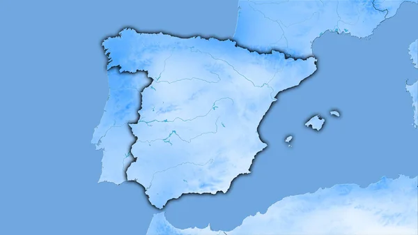
Spain Area On The Annual Precipitation Map In The Stereographic Projection - Raw Composition Of Raster Layers With Dark Glowing Outline
Image, 1.67MB, 2880 × 1620 jpg
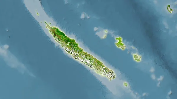
New Caledonia Area On The Satellite A Map In The Stereographic Projection - Raw Composition Of Raster Layers With Light Glowing Outline
Image, 2.19MB, 2880 × 1620 jpg
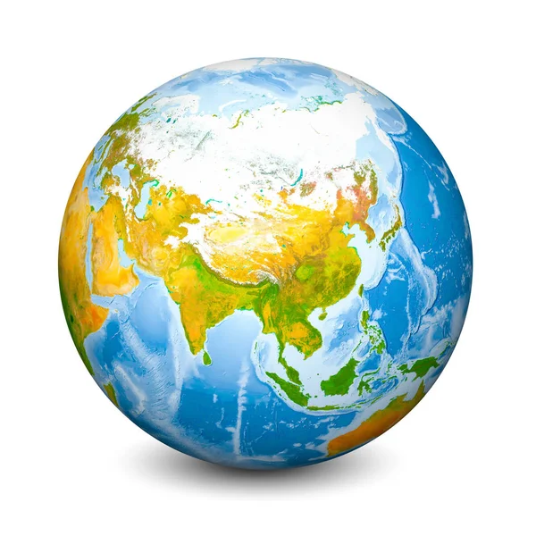
Earth Globe Focused On Asia. Realistic Topographical Lands And Oceans With Bathymetry. 3D Object Isolated On White Background. Elements Of This Image Furnished By NASA
Image, 21.59MB, 6000 × 6000 jpg
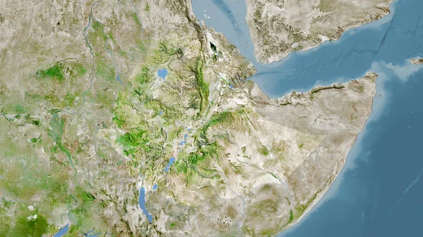
Ethiopia Area On The Satellite A Map In The Stereographic Projection - Raw Composition Of Raster Layers
Image, 6.57MB, 2880 × 1620 jpg

World Map In The Gall Stereographic Projection Centered On 11 East Longitude. Colored Shader, Elevation Map - Raw Composite Of Raster With Graticule. 3D Illustration
Image, 7.47MB, 4000 × 2000 jpg
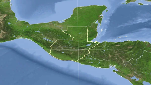
Guatemala And Its Neighborhood. Distant Oblique Perspective - Shape Outlined. Satellite Imagery
Image, 3.05MB, 2880 × 1620 jpg

Spain Area On The Satellite C Map In The Stereographic Projection - Raw Composition Of Raster Layers
Image, 5.47MB, 2880 × 1620 jpg
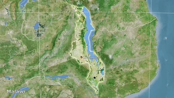
Malawi Area On The Satellite D Map In The Stereographic Projection - Main Composition
Image, 6.84MB, 2880 × 1620 jpg
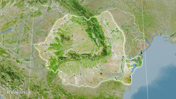
Romania Area On The Satellite A Map In The Stereographic Projection - Main Composition
Image, 7.64MB, 2880 × 1620 jpg

Costa Rica Outlined On The Relief Orthographic Map. Capital, Administrative Borders And Graticule
Image, 4.62MB, 3840 × 2160 jpg

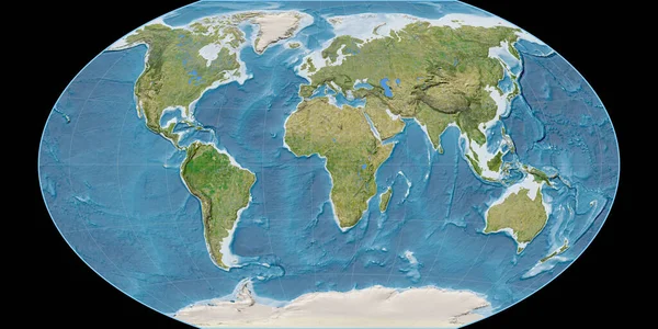
World Map In The Gall Stereographic Projection Centered On 11 East Longitude. Main Physiographic Landscape Features - Raw Composite Of Raster With Graticule. 3D Illustration
Image, 7.6MB, 4000 × 2000 jpg

Taiwan Area On The Satellite B Map In The Stereographic Projection - Raw Composition Of Raster Layers
Image, 3.08MB, 2880 × 1620 jpg
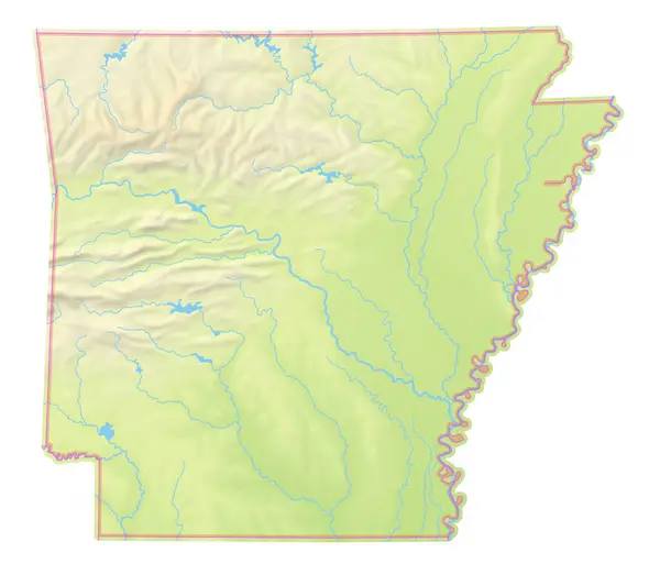
Map Of The State Arkansas (United States Of America) Showing The Isolated Territory With Relief Representation, Water Bodies Like Seas, Rivers, Lakes And With Borders. No Labels At All.
Image, 2.9MB, 6000 × 5130 jpg
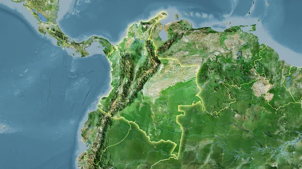
Colombia Area On The Satellite D Map In The Stereographic Projection - Raw Composition Of Raster Layers With Light Glowing Outline
Image, 6.11MB, 2880 × 1620 jpg
Sweden Area On The Topographic Relief Map In The Stereographic Projection - Raw Composition Of Raster Layers With Light Glowing Outline
Image, 5.03MB, 2880 × 1620 jpg

Autonomous Underwater Vehicle Exploring The Ocean Floor, Collecting Valuable Data For Scientific Research
Vector, 0.94MB, 5000 × 5000 eps

Map Of The State New Jersey (United States Of America) Showing The Isolated Territory With Relief Representation, Water Bodies Like Seas, Rivers, Lakes And With Borders. No Labels At All.
Image, 1.17MB, 3388 × 6000 jpg

Map Of The State Texas (United States Of America) Showing The Isolated Territory With Relief Representation, Water Bodies Like Seas, Rivers, Lakes And With Borders. No Labels At All.
Image, 2.48MB, 6000 × 5442 jpg

Map Of The State Idaho (United States Of America) Showing The Isolated Territory With Relief Representation, Water Bodies Like Seas, Rivers, Lakes And With Borders. No Labels At All.
Image, 2.33MB, 4054 × 6000 jpg
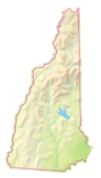
Map Of The State New Hampshire (United States Of America) Showing The Isolated Territory With Relief Representation, Water Bodies Like Seas, Rivers, Lakes And With Borders. No Labels At All.
Image, 1.49MB, 3418 × 6000 jpg

Colombia Extruded On The Relief Orthographic Map. Capital, Administrative Borders And Graticule
Image, 6.69MB, 3840 × 2160 jpg

Jordan Outlined On The Satellite Orthographic Map. Capital, Administrative Borders And Graticule
Image, 5.04MB, 3840 × 2160 jpg
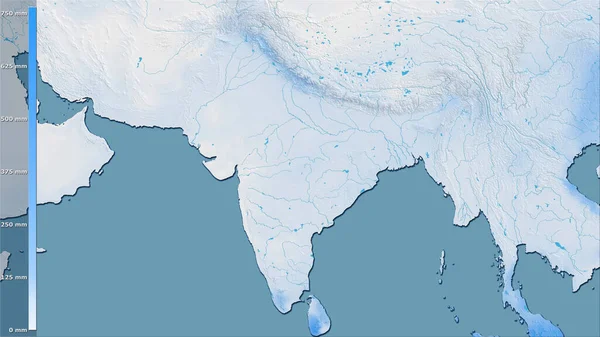
Precipitation Of Driest Quarter Within The India Area In The Stereographic Projection With Legend - Raw Composition Of Raster Layers
Image, 3.41MB, 2880 × 1620 jpg

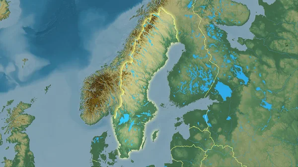
Norway. Globe With The Shape Of The Country Against Zoomed Map With Its Outline Isolated On The Blue Background. Color Physical Map
Image, 2.12MB, 2880 × 1620 jpg

Austria And Its Neighborhood. Distant Oblique Perspective - No Outline. Color Physical Map
Image, 5.53MB, 2880 × 1620 jpg
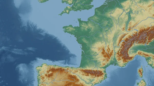
France. Close-up Perspective Of The Country - No Outline. Topographic Relief Map
Image, 3.83MB, 2880 × 1620 jpg

Mauritius. Globe With The Shape Of The Country Against Zoomed Map With Its Outline Isolated On The Blue Background. Satellite Imagery
Image, 2.58MB, 2880 × 1620 jpg

Maximum Temperature Of Warmest Month Within The Netherlands Area In The Stereographic Projection With Legend - Raw Composition Of Raster Layers With Light Glowing Outline
Image, 3.57MB, 2880 × 1620 jpg

World Map In The Miller Cylindrical Projection Centered On 11 East Longitude. Mean Annual Temperature Map - Raw Composite Of Raster With Graticule. 3D Illustration
Image, 3.05MB, 4000 × 2000 jpg
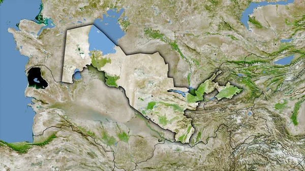
Uzbekistan Area On The Satellite A Map In The Stereographic Projection - Raw Composition Of Raster Layers With Dark Glowing Outline
Image, 6.89MB, 2880 × 1620 jpg
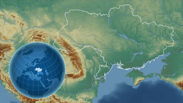
Ukraine. Globe With The Shape Of The Country Against Zoomed Map With Its Outline. Topographic Relief Map
Image, 4.5MB, 2880 × 1620 jpg

Tajikistan Area On The Satellite B Map In The Stereographic Projection - Raw Composition Of Raster Layers With Dark Glowing Outline
Image, 6.32MB, 2880 × 1620 jpg
Page 1 >> Next