photo free
Home Images Vectors Videos

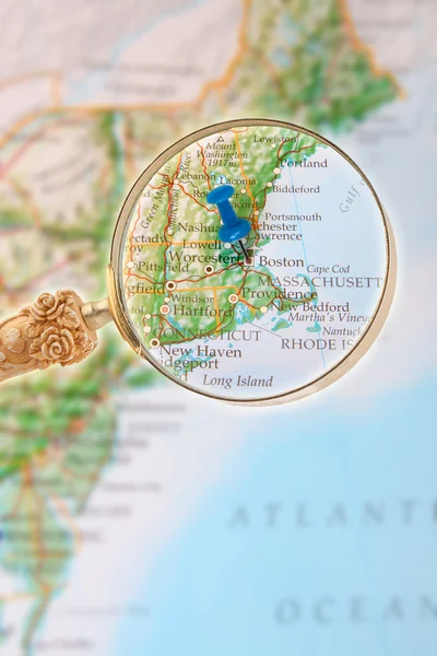
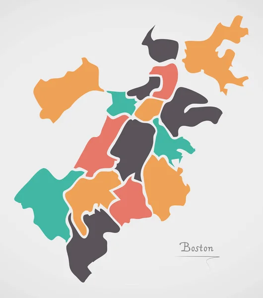
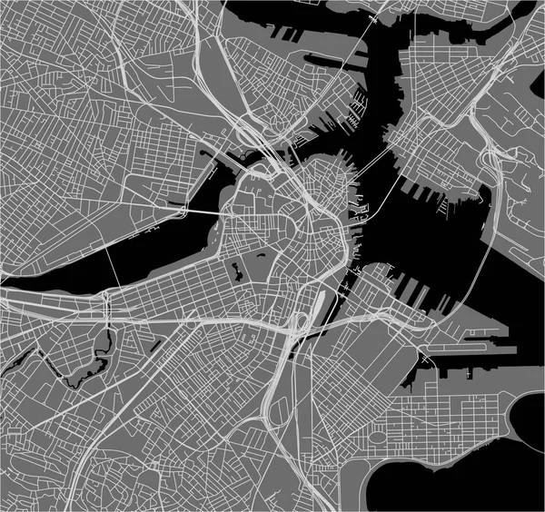
Stock image Boston Map page 2

stock vector USA map with flag and navigation icons

USA Map With Flag And Navigation Icons

Vector, 3.03MB, 8192 × 6357 eps
stock image United States of America Map. Illustration.

United States Of America Map. Illustration.

Image, 3.85MB, 5000 × 5000 jpg
stock vector Map of world

Map Of World

Vector, 3.12MB, 5671 × 2898 ai
stock vector USA map puzzle - One state-one puzzle piece - Massachusetts, Boston

USA Map Puzzle - One State-one Puzzle Piece - Massachusetts, Boston

Vector, 7.26MB, 2200 × 2200 eps
stock vector Boston Colorful Vector Map

Boston Colorful Vector Map

Vector, 2.1MB, 5334 × 5334 eps
stock vector Map of world

Map Of World

Vector, 1.29MB, 5629 × 2881 ai
stock vector United States of America Vector Map. Illustration.

United States Of America Vector Map. Illustration.

Vector, 0.81MB, 5000 × 5000 eps
stock vector United States of America Vector Map. Illustration.

United States Of America Vector Map. Illustration.

Vector, 0.69MB, 5000 × 5000 eps
stock vector map of the city of Boston, USA

Map Of The City Of Boston, USA

Vector, 6.51MB, 6931 × 4346 eps
stock vector Map of world

Map Of World

Vector, 10.28MB, 5759 × 2781 ai
stock vector USA - detailed map - illustration.

USA - Detailed Map - Illustration.

Vector, 7.84MB, 6400 × 3485 eps
stock vector USA - detailed topographic map - illustration.

USA - Detailed Topographic Map - Illustration.

Vector, 8.05MB, 6400 × 3375 eps
stock vector Map of world

Map Of World

Vector, 2.96MB, 5494 × 2912 ai
stock vector City map Boston, color detailed plan, vector illustration

City Map Boston, Color Detailed Plan, Vector Illustration

Vector, 3.95MB, 4219 × 5906 eps
stock vector Map of world

Map Of World

Vector, 22.35MB, 5757 × 2778 ai
stock vector Map of world with borders as scrible

Map Of World With Borders As Scrible

Vector, 2.08MB, 5047 × 3156 ai
stock image Looking in on Boston Massachusetts

Looking In On Boston Massachusetts

Image, 4.69MB, 3168 × 4752 jpg
stock vector Map of world

Map Of World

Vector, 2.41MB, 4990 × 3206 ai
stock vector Boston USA City Map in Retro Style. Outline Map. Vector Illustration.

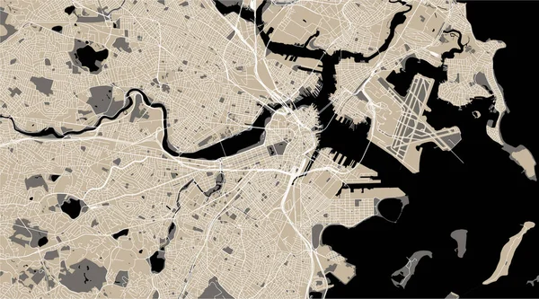
Boston USA City Map In Retro Style. Outline Map. Vector Illustration.

Vector, 2.4MB, 8150 × 4702 eps
stock vector United States of America Vector Map. Illustration.

United States Of America Vector Map. Illustration.

Vector, 1.14MB, 5000 × 5000 eps
stock image illustration map of the city of Boston, USA

Illustration Map Of The City Of Boston, USA

Image, 10.07MB, 6931 × 4346 jpg
stock vector Massachusetts state USA map silhouette made of stars lines dots triangles, low polygonal shapes.

Massachusetts State USA Map Silhouette Made Of Stars Lines Dots Triangles, Low Polygonal Shapes.

Vector, 2.19MB, 4167 × 4167 eps
stock vector Canada, United States and Mexico detailed map with states names and borders. Flags and largest cities skylines outline icons of United States, Canada and Mexico

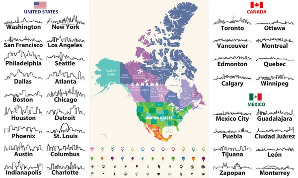
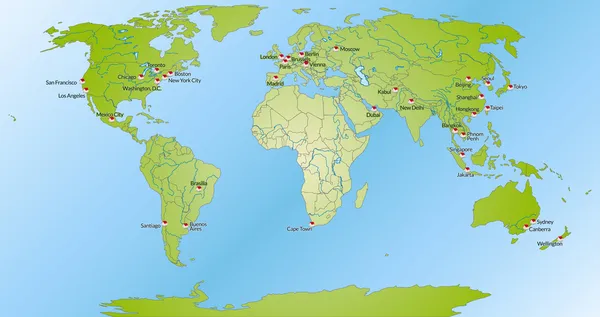
Canada, United States And Mexico Detailed Map With States Names And Borders. Flags And Largest Cities Skylines Outline Icons Of United States, Canada And Mexico

Vector, 13.55MB, 8333 × 4975 eps
stock vector vector map of the city of Boston, USA

Vector Map Of The City Of Boston, USA

Vector, 6.51MB, 6931 × 4346 eps
stock vector Unite States (USA) - 3D illustration

Unite States (USA) - 3D Illustration

Vector, 2.92MB, 5400 × 4674 eps
stock vector vector illustration of largest United States city skylines in black and white color palette. Navigation, location and travel icons; flag and map of United States of America

Vector Illustration Of Largest United States City Skylines In Black And White Color Palette. Navigation, Location And Travel Icons; Flag And Map Of United States Of America

Vector, 14.11MB, 7292 × 7292 eps
stock vector United States (USA) - map, flag, navigation labels, roads - illustration.

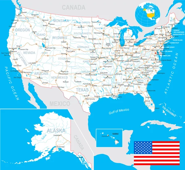
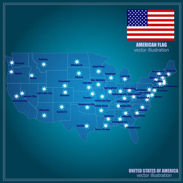
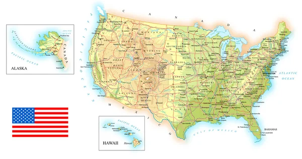
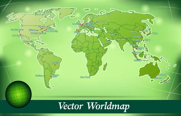
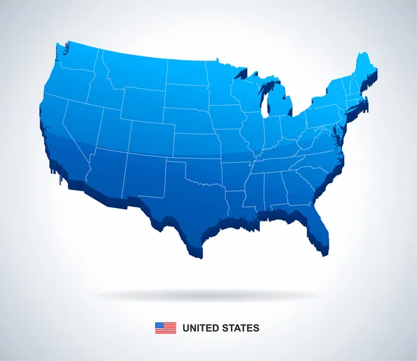
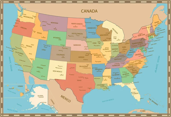
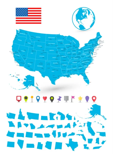
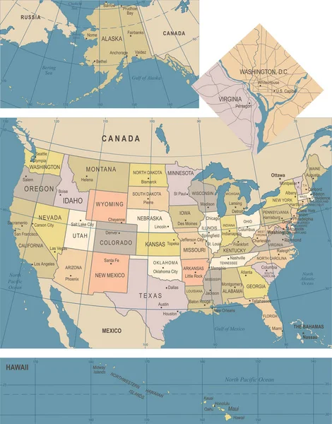
United States (USA) - Map, Flag, Navigation Labels, Roads - Illustration.

Vector, 7.27MB, 5400 × 4982 eps
stock vector United States largest cities skylines in tints of blue color palette. Vector illustration

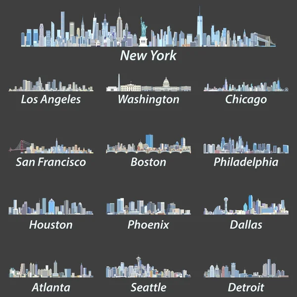
United States Largest Cities Skylines In Tints Of Blue Color Palette. Vector Illustration

Vector, 14.32MB, 7292 × 7292 eps
stock vector Map of world

Map Of World

Vector, 3.05MB, 5671 × 2898 ai
stock vector Boston Massachusetts Map with neighborhoods and modern round shapes

Boston Massachusetts Map With Neighborhoods And Modern Round Shapes

Vector, 6.56MB, 5000 × 5655 eps
stock vector Boston Compass Design Map Artprint

Boston Compass Design Map Artprint

Vector, 8.57MB, 8000 × 8000 eps
stock image Boston streets  and buildings map

Boston Streets And Buildings Map

Image, 10.51MB, 4724 × 3333 jpg
stock vector Map of world

Map Of World

Vector, 3.79MB, 5742 × 2939 ai
stock vector Highly detailed vintage color map of United States

Highly Detailed Vintage Color Map Of United States

Vector, 4.69MB, 8192 × 5633 eps
stock vector United States map - vector illustration

United States Map - Vector Illustration

Vector, 3.49MB, 8398 × 5378 eps
stock vector Map of USA with it's states and flat map pointers

Map Of USA With It's States And Flat Map Pointers

Vector, 3.97MB, 6034 × 8192 eps
stock vector Streets of Boston, city map, Massachusetts, United States. Street map

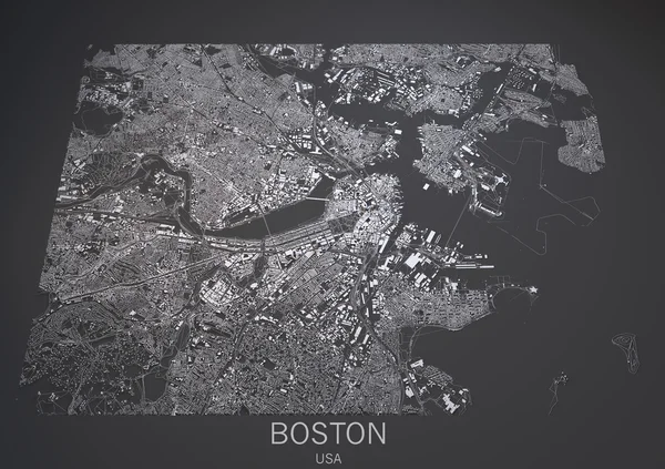
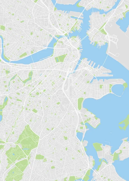
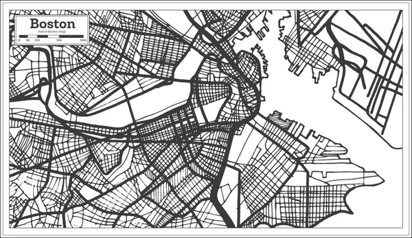
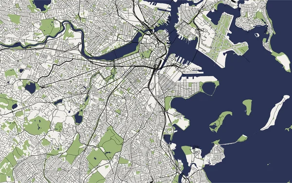
Streets Of Boston, City Map, Massachusetts, United States. Street Map

Vector, 1.98MB, 6659 × 4992 eps
stock vector Massachusetts County Map

Massachusetts County Map

Vector, 0.6MB, 5000 × 3000 ai
stock image Boston top view old illustration

Boston Top View Old Illustration

Image, 29.78MB, 5805 × 4000 jpg
stock vector United States of America isolated map and Massachusetts State territory. vector USA political map. geographic banner template

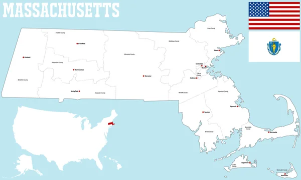
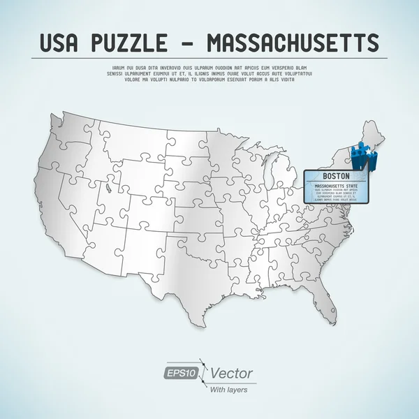
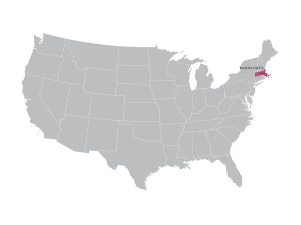
United States Of America Isolated Map And Massachusetts State Territory. Vector USA Political Map. Geographic Banner Template

Vector, 0.81MB, 6000 × 4000 eps
stock vector Highly detailed road map of United States and colorful map point

Highly Detailed Road Map Of United States And Colorful Map Point

Vector, 14.01MB, 8192 × 6615 eps
stock vector Map of world

Map Of World

Vector, 3.13MB, 5671 × 2898 ai
stock vector Cartoon vector map of USA. Travel illustration with american main cities.

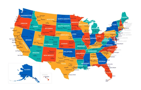
Cartoon Vector Map Of USA. Travel Illustration With American Main Cities.

Vector, 6.99MB, 5760 × 3218 eps
stock vector USA map

USA Map

Vector, 1.13MB, 7899 × 5677 eps
stock vector vector map of the city of Boston, USA

Vector Map Of The City Of Boston, USA

Vector, 3.16MB, 5170 × 4865 eps
stock vector map of the city of Boston, USA

Map Of The City Of Boston, USA

Vector, 6.44MB, 6898 × 3838 eps
stock vector vector illustration of largest United States city skylines. Navigation, location and travel icons; flag and map of United States of America

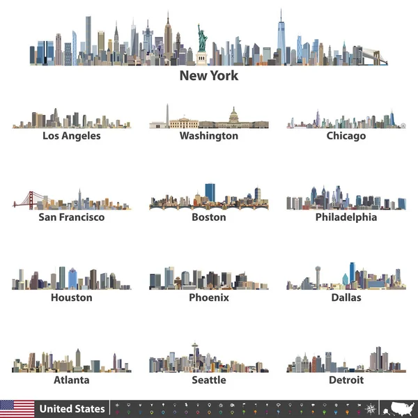
Vector Illustration Of Largest United States City Skylines. Navigation, Location And Travel Icons; Flag And Map Of United States Of America

Vector, 14.7MB, 7292 × 7292 eps
stock vector vector map of United States with indication of Massachusetts

Vector Map Of United States With Indication Of Massachusetts

Vector, 2.22MB, 4600 × 3450 eps
stock vector United States Map - Vintage Vector Illustration

United States Map - Vintage Vector Illustration

Vector, 3.58MB, 5500 × 7011 eps
stock vector Vector set 2 of 10 Highly detailed silhouettes of US state maps, divided into counties with names and territory nicknames

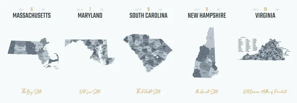
Vector Set 2 Of 10 Highly Detailed Silhouettes Of US State Maps, Divided Into Counties With Names And Territory Nicknames

Vector, 5.14MB, 9585 × 3348 eps
Previous << Page 2 >> Next