
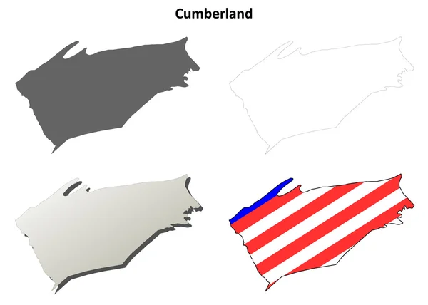
Stock image County Of Cumberland


Cumberland Falls On The Cumberland River In Cumberland Falls State Resort Park, Kentucky, USA.
Image, 45.54MB, 8256 × 5504 jpg

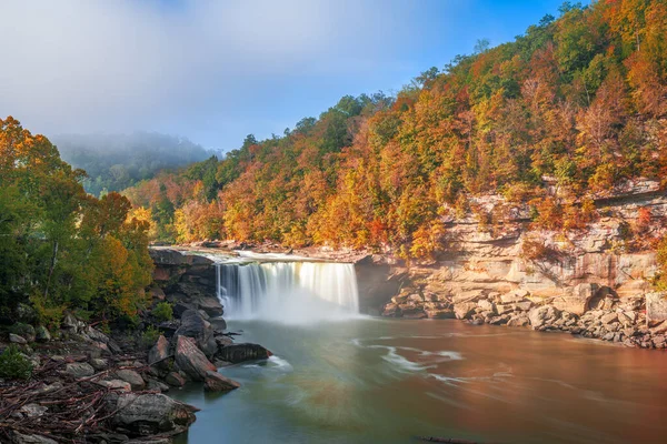
Cumberland Falls On The Cumberland River In Cumberland Falls State Resort Park, Kentucky, USA.
Image, 38.97MB, 8256 × 5504 jpg


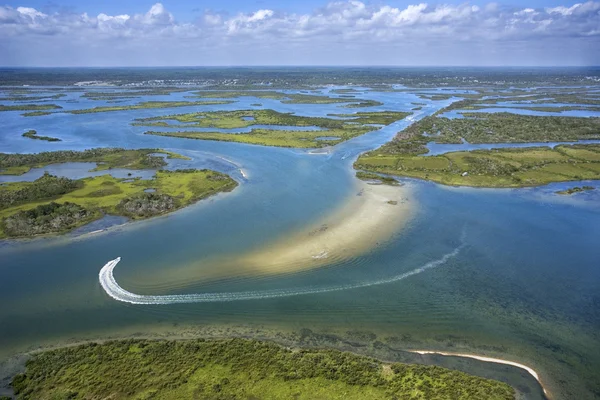
A Beautiful View Of A Coastal Beach Near Joggins In Cumberland County, Canada
Image, 12.35MB, 6000 × 4000 jpg
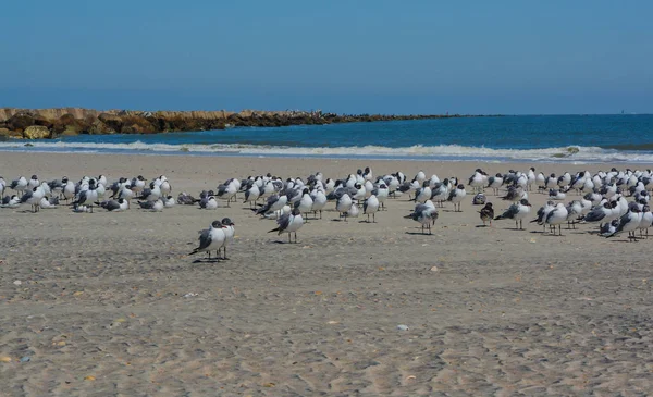
Laughing Gulls (Leucophaeus Atricilla) On Fernandina Beach, Fort Clinch State Park, Nassau County, Florida USA
Image, 12.85MB, 6272 × 3825 jpg

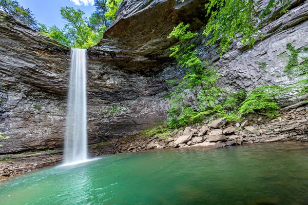
Beautiful Ozone Falls In Cumberland County Tennessee Is A Scenic Swimming Hole With A Cool, Cascading Waterfall Feeding The Pool.
Image, 34.88MB, 8231 × 5487 jpg

The Jetty Breakwater On Fernandina Beach, Fort Clinch State Park, Nassau County, Florida USA
Image, 13.65MB, 5999 × 3999 jpg

The Jetty Breakwater On Fernandina Beach, Fort Clinch State Park, Nassau County, Florida USA
Image, 15.62MB, 6009 × 3992 jpg


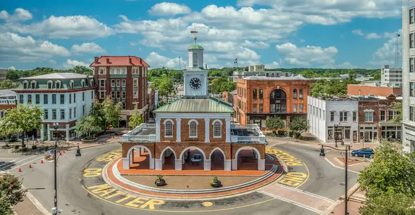
Aerial View Of Fayetteville Market House Historic Colonial Brick Building With Arches In Downtown Hay Street In The Middle Of A Traffic Circle Surrounded By Black Lives Matter Political Message
Image, 10.98MB, 5231 × 2719 jpg

Aerial View Of Fayetteville Market House Historic Colonial Brick Building With Arches In Downtown Hay Street In The Middle Of A Traffic Circle Surrounded By Black Lives Matter Political Message
Image, 13.64MB, 5272 × 3948 jpg

Aerial View Of Fayetteville North Carolina Downtown Business District, Main Street In Cumberland County First Baptist Church. Government Buildings
Image, 31.54MB, 10000 × 3384 jpg

Aerial View Of Fayetteville North Carolina Downtown Business District, Main Street In Cumberland County First Baptist Church. Government Buildings
Image, 32.31MB, 10000 × 3866 jpg

Cumberland City Council (Commonwealth Of Australia, New South Wales, NSW) Map Vector Illustration, Scribble Sketch Cumberland Map
Vector, 1.21MB, 7087 × 4726 eps

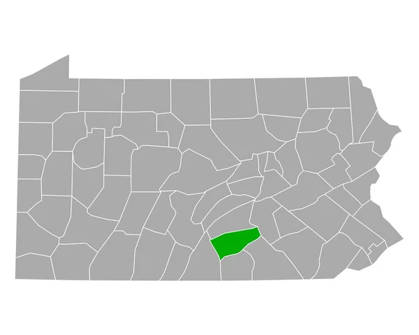
Map Of Cumberland County In Pennsylvania State On White Background. Single County Map Highlighted By Black Colour On Pennsylvania Map. UNITED STATES, US
Image, 4.22MB, 8000 × 5334 jpg

Map Of Cumberland County In Illinois State On White Background. Single County Map Highlighted By Black Colour On Illinois Map. UNITED STATES, US
Image, 5.19MB, 8000 × 8000 jpg

Aerial View Of Fayetteville Market House Historic Colonial Brick Building With Arches In Downtown Hay Street In The Middle Of A Traffic Circle Surrounded By Black Lives Matter Political Message
Image, 12.3MB, 5204 × 3767 jpg

Aerial View Of Fayetteville North Carolina Downtown Business District, Main Street In Cumberland County First Baptist Church. Government Buildings
Image, 19.7MB, 7209 × 3658 jpg

Aerial View Of Fayetteville North Carolina Downtown Business District, Main Street In Cumberland County First Baptist Church. Government Buildings
Image, 10.46MB, 5232 × 2719 jpg

Aerial View Of Fayetteville State University Public Historically Black University In Fayetteville, North Carolina With Dramatic Colorful Sunset Sky
Image, 14.55MB, 5272 × 3948 jpg

Aerial View Of Fayetteville State University Public Historically Black University In Fayetteville, North Carolina With Dramatic Colorful Sunset Sky
Image, 15.03MB, 5272 × 3948 jpg

Aerial View Of Fayetteville State University Public Historically Black University In Fayetteville, North Carolina With Dramatic Colorful Sunset Sky
Image, 14.46MB, 7000 × 2309 jpg

Maine Counties, Gray Political Map With Borders And County Names. State In The New England Region Of The United States, Subdivided Into 16 Counties. Nicknamed Pine Tree State, Or Also Vacationland.
Vector, 2.02MB, 6000 × 8634 eps

Map Of Cumberland County In North Carolina State On White Background. Single County Map Highlighted By Black Color On North Carolina Map. UNITED STATES, US
Image, 4.32MB, 8000 × 5334 jpg

Maine Map Shape, United States Of America. Flat Concept Icon Symbol Vector Illustration .
Vector, 0.22MB, 4096 × 4096 eps

Aerial View Of Fayetteville North Carolina Downtown Business District, Main Street In Cumberland County First Baptist Church. Government Buildings
Image, 11.34MB, 5232 × 2719 jpg


Map Of Cumberland County In Virginia State On White Background. Single County Map Highlighted By Black Colour On Virginia Map. UNITED STATES, US
Image, 4.45MB, 8000 × 5334 jpg

Aerial View Of Fayetteville State University Public Historically Black University In Fayetteville, North Carolina With Dramatic Colorful Sunset Sky
Image, 14.32MB, 5272 × 3948 jpg

Aerial View Of Fayetteville State University Public Historically Black University In Fayetteville, North Carolina With Dramatic Colorful Sunset Sky
Image, 14.01MB, 5272 × 3948 jpg

Maine Counties, Political Map With Borders And County Names. State In The New England Region Of The United States, Subdivided Into 16 Counties. Nicknamed The Pine Tree State, Or Also Vacationland.
Vector, 3.18MB, 6000 × 8211 eps
Page 1 >> Next