photo free
Home Images Vectors Videos

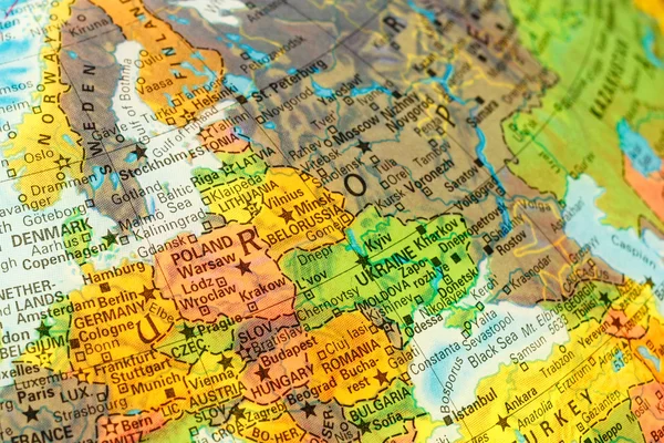
Stock image Eastern Europe Map page 2

stock vector Map of Czech Republic

Map Of Czech Republic

Vector, 0.88MB, 5000 × 3334 ai
stock vector Map of the Russian Federation with federal subjects

Map Of The Russian Federation With Federal Subjects

Vector, 9.37MB, 7001 × 4001 eps
stock vector Abstract vector color map of Ukraine with transparent paint effect.

Abstract Vector Color Map Of Ukraine With Transparent Paint Effect.

Vector, 3.51MB, 5867 × 5867 eps
stock image Satellite view of Eastern Europe on Earth with city lights. Extremely detailed plastic planet surface with real mountains. 3D illustration. Elements of this image furnished by NASA.

Satellite View Of Eastern Europe On Earth With City Lights. Extremely Detailed Plastic Planet Surface With Real Mountains. 3D Illustration. Elements Of This Image Furnished By NASA.

Image, 15.33MB, 5000 × 3750 jpg
stock vector Detailed vector map of Russia and capital city Moscow

Detailed Vector Map Of Russia And Capital City Moscow

Vector, 3.53MB, 5867 × 5867 eps
stock vector Political map of Europe and Caucasian region in shades of gray on white background. Simple flat vector illustration

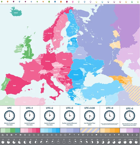
Political Map Of Europe And Caucasian Region In Shades Of Gray On White Background. Simple Flat Vector Illustration

Vector, 1.53MB, 6000 × 3375 eps
stock vector Political map of Europe and Caucasian region in shades of green on white background. Simple flat vector illustration

Political Map Of Europe And Caucasian Region In Shades Of Green On White Background. Simple Flat Vector Illustration

Vector, 1.54MB, 6000 × 3375 eps
stock vector Hungary region map

Hungary Region Map

Vector, 0.9MB, 5000 × 5000 ai
stock vector Poland network map.

Poland Network Map.

Vector, 11.66MB, 8333 × 8333 eps
stock vector Russian Federation network map.

Russian Federation Network Map.

Vector, 7.01MB, 8333 × 8333 eps
stock vector Czech Republic network map.

Czech Republic Network Map.

Vector, 7.67MB, 8333 × 8333 eps
stock vector Bulgaria administrative devisions

Bulgaria Administrative Devisions

Vector, 0.81MB, 5000 × 4167 ai
stock image Eastern Europe with national flags on simple political globe. 3D illustration.

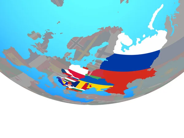
Eastern Europe With National Flags On Simple Political Globe. 3D Illustration.

Image, 1.95MB, 5000 × 3750 jpg
stock image Ukraine highlighted on a white simplified 3D world map. Digital 3D render.

Ukraine Highlighted On A White Simplified 3D World Map. Digital 3D Render.

Image, 4.23MB, 5760 × 3240 jpg
stock vector Europe time zones high detailed map with location and clock icons.

Europe Time Zones High Detailed Map With Location And Clock Icons.

Vector, 12.71MB, 7293 × 6944 eps
stock vector Two versions of the map of Ukraine, with the flag of Ukraine and highlighted in dark grey. Vector map.

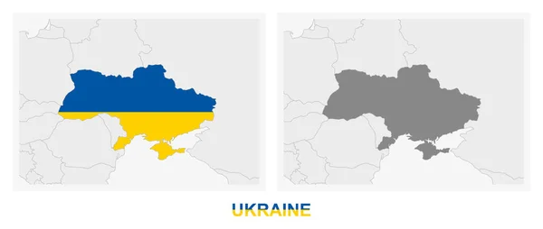
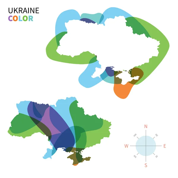
Two Versions Of The Map Of Ukraine, With The Flag Of Ukraine And Highlighted In Dark Grey. Vector Map.

Vector, 0.77MB, 8000 × 3388 eps
stock vector Poland map outline with stars and lines abstract framework.

Poland Map Outline With Stars And Lines Abstract Framework.

Vector, 9.28MB, 4167 × 4167 eps
stock vector Moldova, Republic of network map.

Moldova, Republic Of Network Map.

Vector, 6.37MB, 8333 × 8333 eps
stock image Eurasia - High resolution map of Europe and Asia

Eurasia - High Resolution Map Of Europe And Asia

Image, 22.2MB, 11000 × 4492 jpg
stock vector Ukraine - administrative map of oblasts

Ukraine - Administrative Map Of Oblasts

Vector, 0.39MB, 8000 × 6000 eps
stock image Eastern Europe from space in the evening

Eastern Europe From Space In The Evening

Image, 8.5MB, 5000 × 3750 jpg
stock image Hungary highlighted on a white simplified 3D world map. Digital 3D render.

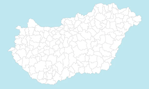
Hungary Highlighted On A White Simplified 3D World Map. Digital 3D Render.

Image, 4.61MB, 5760 × 3240 jpg
stock image Russian Federation map

Russian Federation Map

Image, 0.41MB, 4300 × 2800 jpg
stock vector ������������

������������

Vector, 1.28MB, 5000 × 5000 eps
stock vector Poland Map - Vintage Vector Illustration

Poland Map - Vintage Vector Illustration

Vector, 3.2MB, 5500 × 6023 eps
stock vector Map of Serbia

Map Of Serbia

Vector, 0.12MB, 3859 × 5000 ai
stock vector Administrative divisions of Ukraine

Administrative Divisions Of Ukraine

Vector, 3.43MB, 6000 × 4024 eps
stock vector Europe time zones high detailed map with location and clock icons.

Europe Time Zones High Detailed Map With Location And Clock Icons.

Vector, 11.63MB, 7009 × 7292 eps
stock image Eastern Europe with national flags on 3D globe. 3D illustration.

Eastern Europe With National Flags On 3D Globe. 3D Illustration.

Image, 2.49MB, 5000 × 3750 jpg
stock vector eps vector illustration with country ukraine and administrative divisions, oblasts, autonomous republics and special cities

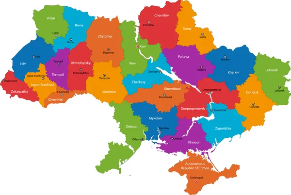
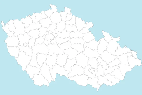
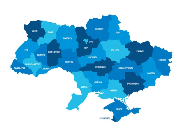
Eps Vector Illustration With Country Ukraine And Administrative Divisions, Oblasts, Autonomous Republics And Special Cities

Vector, 1.85MB, 9096 × 7678 eps
stock image CEI countries from space on planet Earth at night with bright city lights. Detailed plastic planet surface with real mountains. 3D illustration. Elements of this image furnished by NASA.

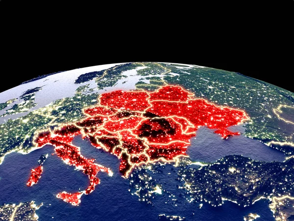
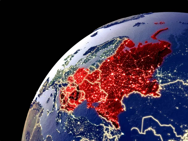
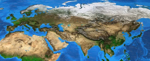
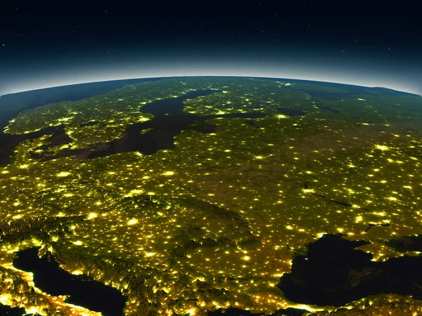
CEI Countries From Space On Planet Earth At Night With Bright City Lights. Detailed Plastic Planet Surface With Real Mountains. 3D Illustration. Elements Of This Image Furnished By NASA.

Image, 15.38MB, 5000 × 3750 jpg
stock image Central Europe Map Czech Republic Targeted in Red

Central Europe Map Czech Republic Targeted In Red

Image, 2.05MB, 4200 × 3200 jpg
stock image Poland Map Abstract 3D Europe Continent

Poland Map Abstract 3D Europe Continent

Image, 2.38MB, 4086 × 3200 jpg
stock image map eastern Europe

Map Eastern Europe

Image, 11.79MB, 4421 × 2947 jpg
stock vector Map of Hungary

Map Of Hungary

Vector, 0.8MB, 5000 × 3000 ai
stock image Evening above Eastern Europe from space

Evening Above Eastern Europe From Space

Image, 10.14MB, 5000 × 3750 jpg
stock image Eastern Europe from space in the evening

Eastern Europe From Space In The Evening

Image, 8.5MB, 5000 × 3750 jpg
stock vector Czech Republik district maps

Czech Republik District Maps

Vector, 0.95MB, 3577 × 5000 ai
stock vector Poland Political Map

Poland Political Map

Vector, 3.1MB, 6376 × 6000 eps
stock vector ������������

������������

Vector, 0.87MB, 5000 × 5000 eps
stock vector Poland Map - Info Graphic Vector Illustration

Poland Map - Info Graphic Vector Illustration

Vector, 12.01MB, 8758 × 5500 eps
stock vector Poland Map - Vintage Vector Illustration

Poland Map - Vintage Vector Illustration

Vector, 3.16MB, 5500 × 5892 eps
stock vector Map of venues of the Football World Cup in Russia, 2018. Political map of western part of Russian Federation with capital Moscow, borders and neighbor countries. English labeling. Illustration. Vector

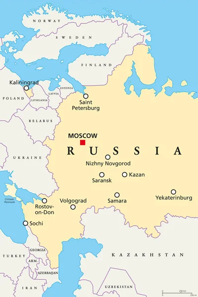
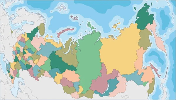
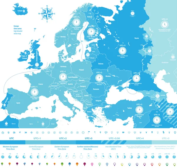
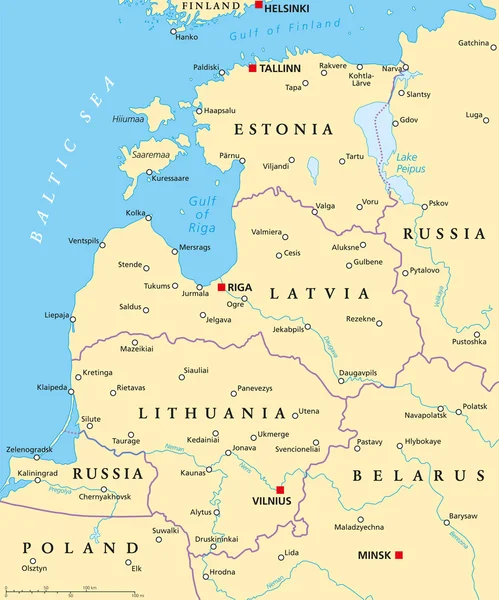
Map Of Venues Of The Football World Cup In Russia, 2018. Political Map Of Western Part Of Russian Federation With Capital Moscow, Borders And Neighbor Countries. English Labeling. Illustration. Vector

Vector, 3.39MB, 6421 × 9633 eps
stock vector Map of the Czech Republic

Map Of The Czech Republic

Vector, 1.34MB, 5000 × 3333 ai
stock vector Belarus Political Map

Belarus Political Map

Vector, 1.23MB, 6818 × 6000 eps
stock vector Energy industry and ecology of Belarus

Energy Industry And Ecology Of Belarus

Vector, 3.59MB, 6400 × 6400 eps
stock vector Baltic Countries Political Map

Baltic Countries Political Map

Vector, 1.34MB, 6000 × 7205 eps
stock vector Map of Romania

Map Of Romania

Vector, 0.6MB, 5000 × 3332 ai
stock vector Isometric 3d design of Ukraina wildlife. Animals, birds and plants constructor elements isolated on white set. Build your own geography infographics collection. Vector illustration

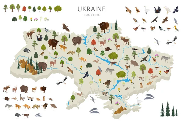
Isometric 3d Design Of Ukraina Wildlife. Animals, Birds And Plants Constructor Elements Isolated On White Set. Build Your Own Geography Infographics Collection. Vector Illustration

Vector, 4.7MB, 6746 × 4500 eps
stock image the tank model and map on Europe, Russia-Ukrainian boundary

The Tank Model And Map On Europe, Russia-Ukrainian Boundary

Image, 7.31MB, 5760 × 3840 jpg
Previous << Page 2 >> Next