
Stock image Electoral Map

US Election Map. American Presidential Election Results Infographics Template. All The States Are Separated And Named In The Layer Panel.
Vector, 1.5MB, 8192 × 4975 eps
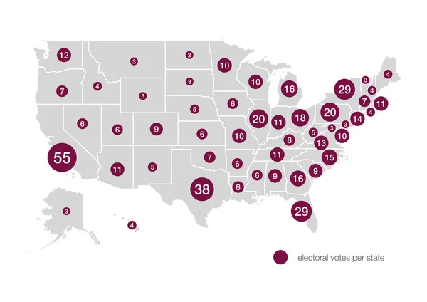
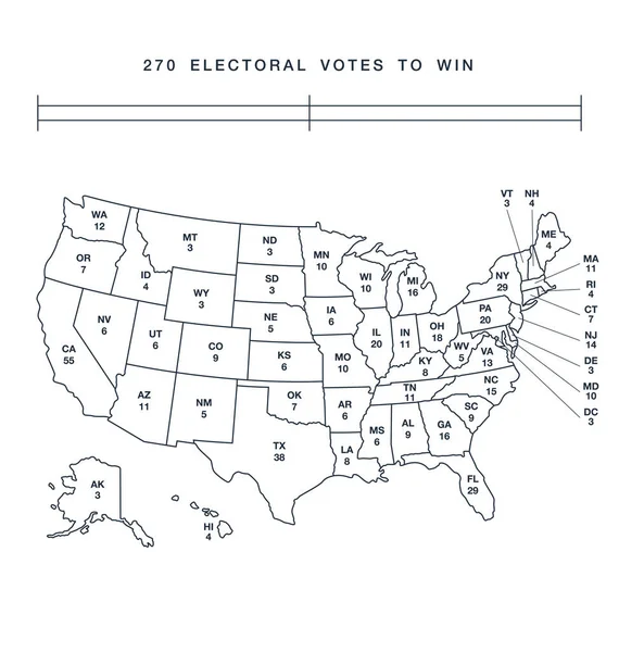
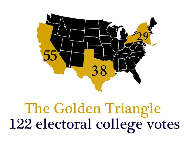
Electoral Votes Allocated To Each State For United States Presidential Elections
Image, 0.78MB, 2970 × 2100 jpg

Electoral Votes Allocated To Each State For United States Presidential Elections
Image, 0.83MB, 2970 × 2100 jpg

Election Theft Text Message On Textured Grunge Copper And Vintage Gold Background
Image, 25.38MB, 6812 × 4541 jpg

Wallers, France - 06 27 2024 : Playing Cards And Poker Chips On French Election Ballots.
Image, 20.77MB, 6240 × 4160 jpg

Wallers, France - 06 27 2024 : Game Dice On Top Of French Election Ballots
Image, 22.08MB, 6240 × 4160 jpg

Wallers, France - 06 27 2024 : Playing Cards And Poker Chips On French Election Ballots.
Image, 23.34MB, 6240 × 4160 jpg

Wallers, France - 06 27 2024 : French Electoral Map In Front Of Nomination Form For Elections
Image, 20.42MB, 4160 × 6240 jpg

Wallers, France - 06 27 2024 : Electoral Map On Envelope Containing Candidatures For The French Elections.
Image, 8.5MB, 4128 × 2918 jpg

Wallers, France - 06 27 2024 : Game Dice On Top Of French Election Ballots
Image, 19.27MB, 6240 × 4160 jpg

Wallers, France - 06 27 2024 : Playing Cards And Poker Chips On French Election Ballots.
Image, 22.44MB, 6240 × 4160 jpg
Wallers, France - 06 27 2024 : Electoral Map On Envelope Containing Candidatures For The French Elections.
Image, 23.17MB, 6240 × 4160 jpg

Wallers, France - 06 27 2024 : French Electoral Map Hold By A Man Hand, On A White Background
Image, 18.26MB, 4160 × 6240 jpg

Wallers, France - 06 27 2024 : French Electoral Map In Front Of Nomination Form For Elections
Image, 21.92MB, 6240 × 4160 jpg

Wallers, France - 06 27 2024 : French Electoral Map Hold By A Man Hand, On A White Background
Image, 17.69MB, 6240 × 4160 jpg

Wallers, France - 06 27 2024 : Playing Cards And Poker Chips On French Election Ballots.
Image, 20.26MB, 6240 × 4160 jpg

Wallers, France - 06 27 2024 : French Electoral Map In Front Of Nomination Form For Elections
Image, 16.58MB, 6240 × 4160 jpg
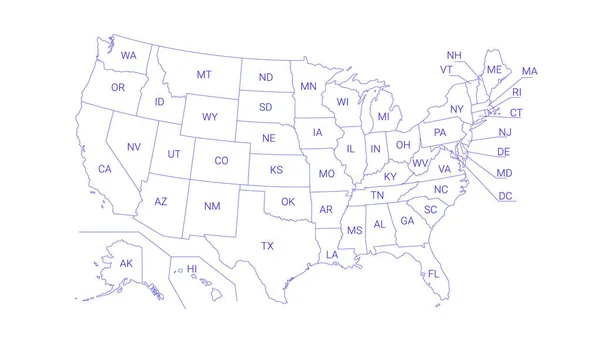
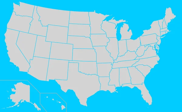
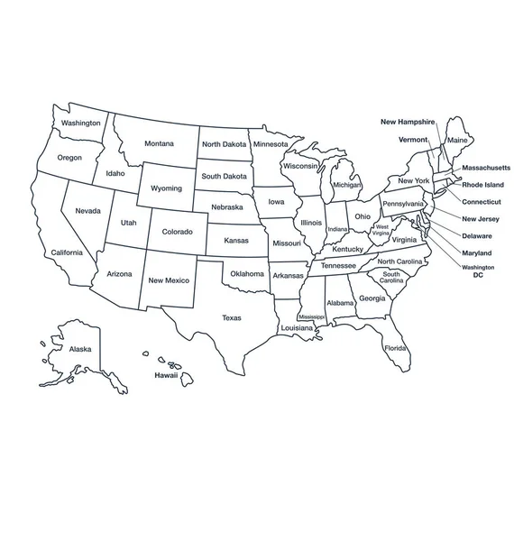
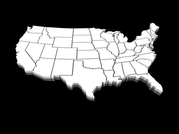
Outline Political US Map With Titles Of The States. All USA Regions Are Separated And Named In A Layer Panel
Vector, 0.61MB, 8192 × 4686 eps

Map Of America. United States Political Map. US Blueprint With The Titles Of States And Regions. All Countries Are Named In The Layer Panel.
Vector, 0.63MB, 8192 × 3657 eps

US Election Map. American Presidential Election Results Infographics Template. All The States Are Separated And Named In The Layer Panel.
Vector, 1.51MB, 8192 × 4975 eps
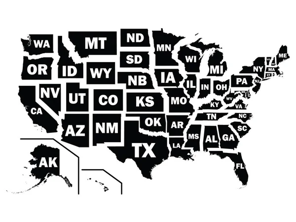
Silhouette Map Of The United States Of America Federal States With Their Postal Code Abbreviations
Vector, 1.96MB, 4800 × 3600 eps


Grey Flat Election Counties Map Of The USA Federal State Of Michigan
Vector, 0.52MB, 3600 × 4800 eps
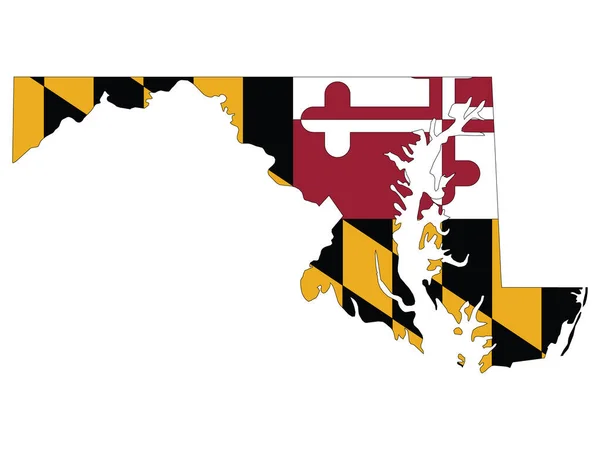
Vector Illustration Of The Flag Map Of USA Federal State Of Maryland
Vector, 0.48MB, 4800 × 3600 eps

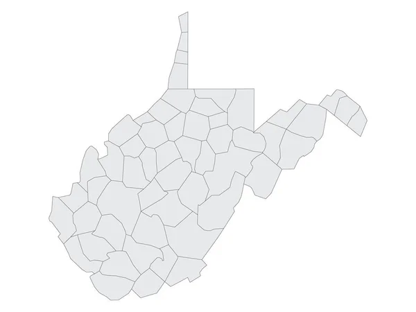
Grey Flat Election Counties Map Of The USA Federal State Of West Virginia
Vector, 0.49MB, 4800 × 3600 eps


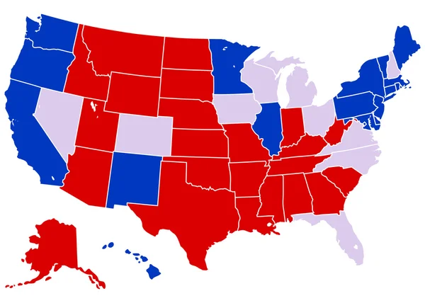
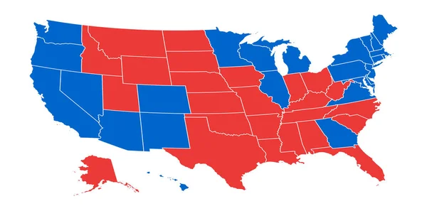
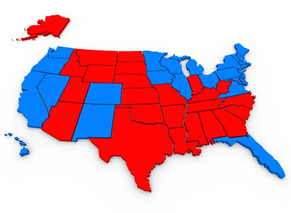
This Is How USA Voted In The 2020 Presidential Election Showing The Electoral Votes For Each State Going To The Republicans (red) Or "nto The Democrats (blue)
Vector, 4.91MB, 5417 × 3794 eps

Silhouette Map Of The US Federal State Of Michigan With It's Postal Code Abbreviation
Vector, 0.45MB, 3600 × 4800 eps


Vector Illustration Of The Flag Map Of USA Federal State Of South Carolina
Vector, 0.81MB, 4800 × 3600 eps

Silhouette Map Of The US Federal State Of Illinois With It's Postal Code Abbreviation
Vector, 0.41MB, 3600 × 4800 eps
Page 1 >> Next