
Stock image Elevation Map


Seamless Vector Topographic Map Pattern. Contour Topographic Seamless Vector Map
Vector, 1.45MB, 4500 × 4500 eps
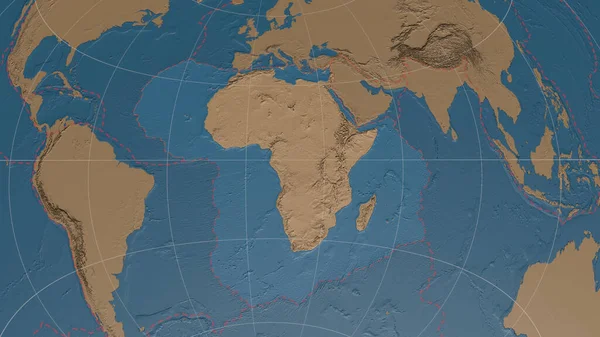
Africann Tectonic Plate Overview The Global Grayscale Elevation Map In The Azimuthal Equidistant Projection With Dashed Plates Borders. 3D Rendering
Image, 3.52MB, 2880 × 1620 jpg

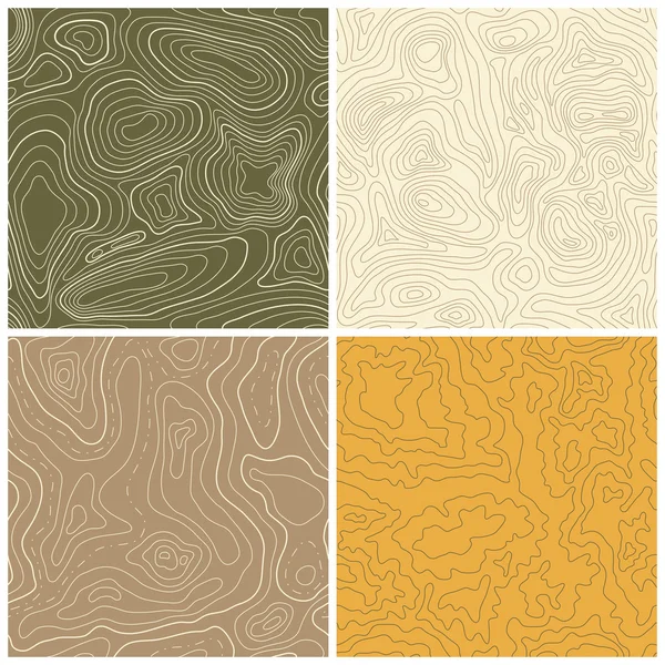
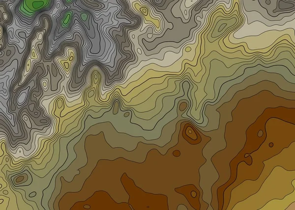
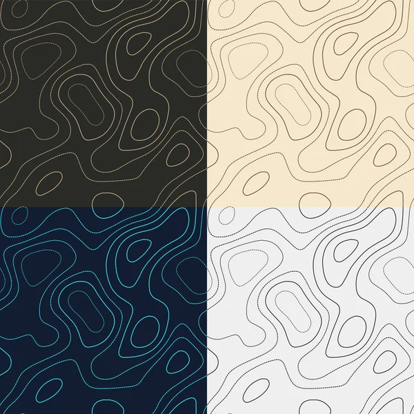
Topography Patterns Seamless Elevation Map Tiles Awesome Isoline Background Modern Tileable
Vector, 0.44MB, 5488 × 5488 eps

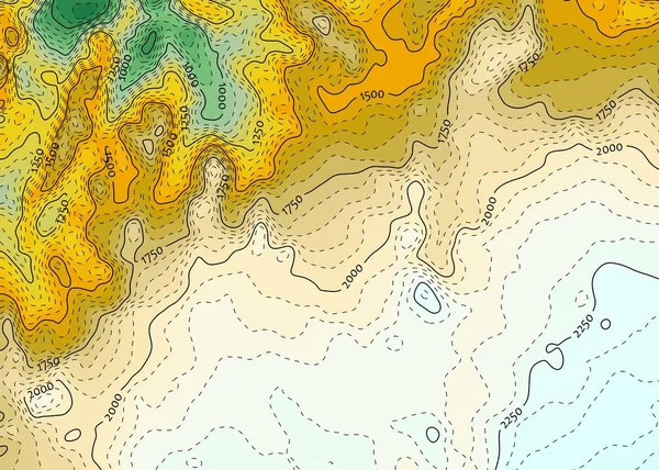
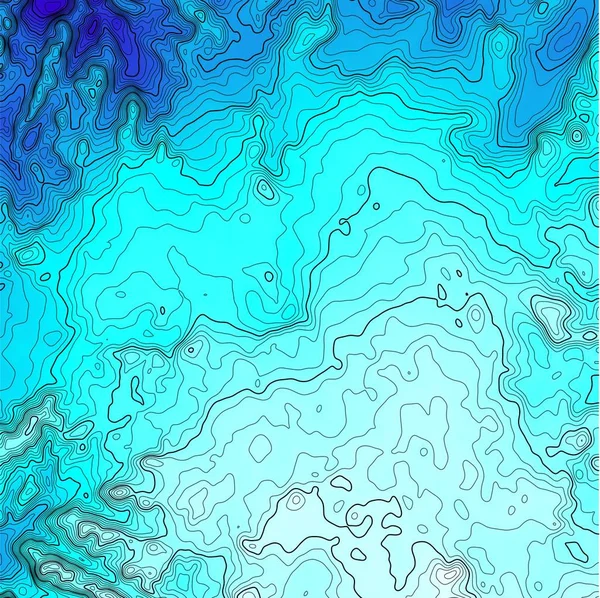
Vector Abstract Blue Earth Relief Map. Generated Conceptual Elevation Map. Isolines Of Landscape Surface Elevation. Geographic Map Conceptual Design. Elegant Background For Presentations.
Vector, 4.94MB, 5000 × 5000 eps
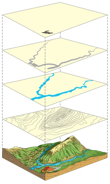
Illustration Of Terrain Model And Its Representation On Topographic Map In Layers.
Vector, 1.91MB, 6000 × 10017 eps

Tocantins, State Of Brazil. Elevation Map Colored In Wiki Style With Lakes And Rivers. Locations Of Major Cities Of The Region. Corner Auxiliary Location Maps
Image, 10.37MB, 4930 × 3770 jpg

Desaturated Shape Of Mainland United States With Its Capital, Main Regional Division And The Separated Ohio Area. Labels. Colored Elevation Map. 3D Rendering
Image, 1MB, 2880 × 1620 jpg
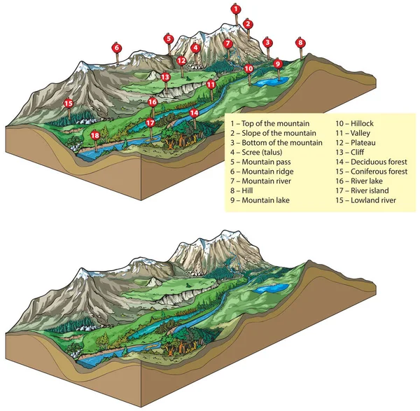
Vector Illustration Of Inland Relief Types - Landforms: Mountains And Valley Relief.
Vector, 17.27MB, 7000 × 6858 eps

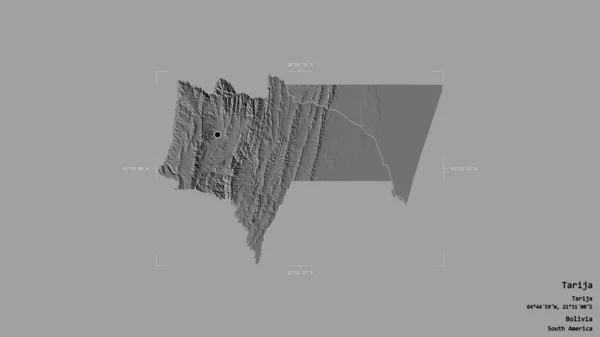
Area Of Tarija, Department Of Bolivia, Isolated On A Solid Background In A Georeferenced Bounding Box. Labels. Bilevel Elevation Map. 3D Rendering
Image, 0.6MB, 2880 × 1620 jpg

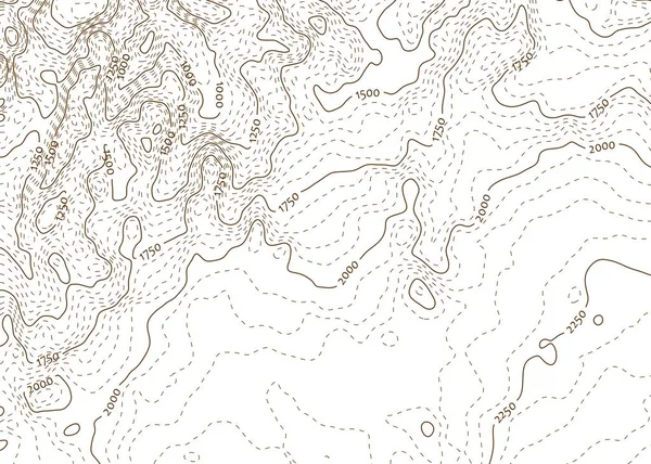
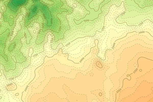
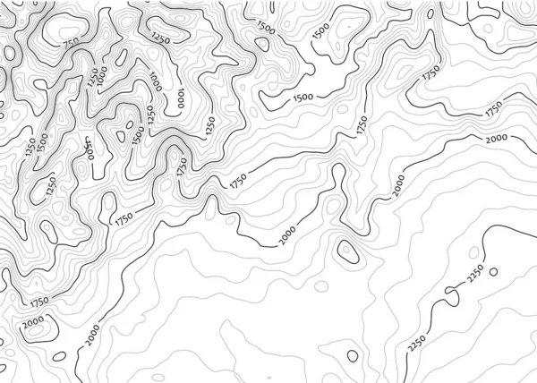
Topographic Map Background Concept. Elevation . Topo Contour . Isolated On White
Vector, 0.95MB, 5000 × 5000 eps
Tocantins, State Of Brazil. Elevation Map Colored In Wiki Style With Lakes And Rivers. Corner Auxiliary Location Maps
Image, 10.37MB, 4930 × 3770 jpg
Topography Patterns Seamless Elevation Map Tiles Beautiful Isoline Background Cool Tileable
Vector, 2.36MB, 5488 × 5488 eps

Topography Patterns Seamless Elevation Map Tiles Appealing Isoline Background Modern Tileable
Vector, 3.04MB, 5488 × 5488 eps
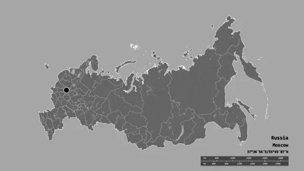
Desaturated Shape Of Russia With Its Capital, Main Regional Division And The Separated Saratov Area. Labels. Bilevel Elevation Map. 3D Rendering
Image, 0.81MB, 2880 × 1620 jpg

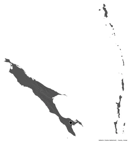
Shape Of Sakhalin, Region Of Russia, With Its Capital Isolated On White Background. Bilevel Elevation Map. 3D Rendering
Image, 0.53MB, 3468 × 3836 jpg
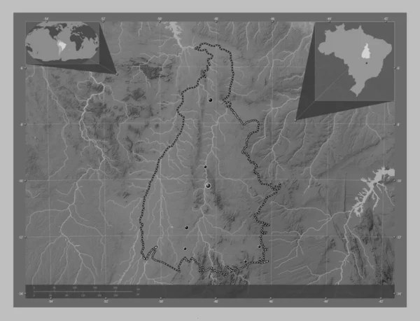
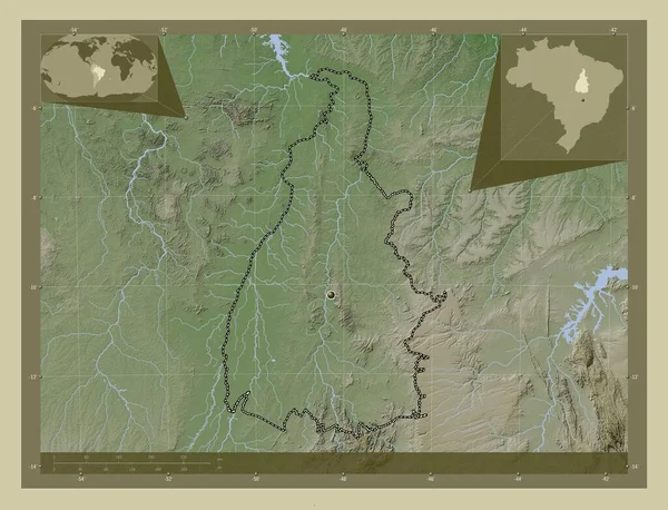
Tocantins, State Of Brazil. Grayscale Elevation Map With Lakes And Rivers. Locations Of Major Cities Of The Region. Corner Auxiliary Location Maps
Image, 7.74MB, 4930 × 3770 jpg

Desaturated Shape Of Turkey With Its Capital, Main Regional Division And The Separated Konya Area. Labels. Colored Elevation Map. 3D Rendering
Image, 1.49MB, 2880 × 1620 jpg
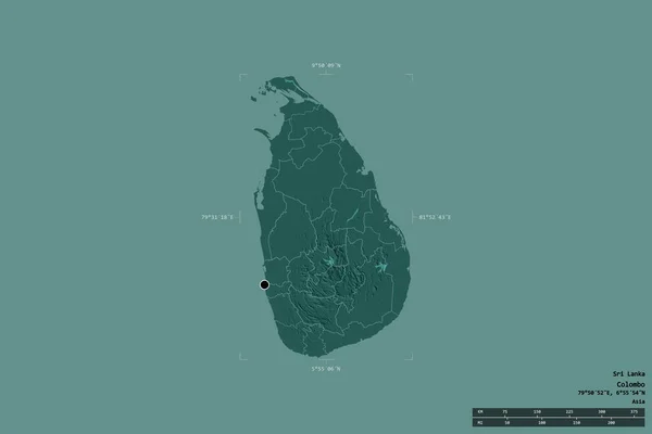
Area Of Sri Lanka Isolated On A Solid Background In A Georeferenced Bounding Box. Main Regional Division, Distance Scale, Labels. Colored Elevation Map. 3D Rendering
Image, 0.77MB, 3000 × 2000 jpg

Topographic Map Background Concept. Elevation . Topo Contour . Isolated On White
Vector, 0.83MB, 5000 × 5000 eps
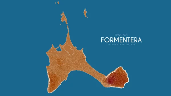
Topographic Map Of Formentera, Balearic Islands, Spain. Vector Detailed Elevation Map Of Island. Geographic Elegant Landscape Outline Poster.
Vector, 8.45MB, 6000 × 3375 eps
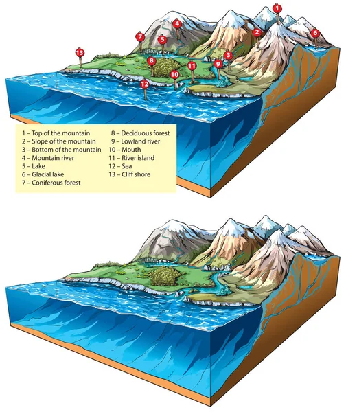
Vector Illustration Of Inland Relief Types - Landforms: Mountains, Rivers And Sea.
Vector, 9.2MB, 8000 × 9512 eps
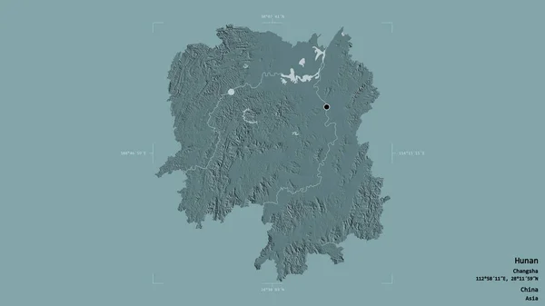
Area Of Hunan, Province Of China, Isolated On A Solid Background In A Georeferenced Bounding Box. Labels. Colored Elevation Map. 3D Rendering
Image, 1.61MB, 2880 × 1620 jpg
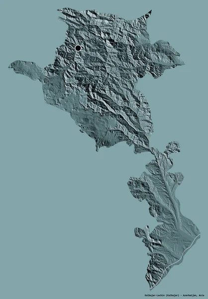
Shape Of Kalbajar-Lachin, Region Of Azerbaijan, With Its Capital Isolated On A Solid Color Background. Colored Elevation Map. 3D Rendering
Image, 4.18MB, 2678 × 3836 jpg


Shape Of Jilin, Province Of China, With Its Capital Isolated On Solid Background. Distance Scale, Region Preview And Labels. Colored Elevation Map. 3D Rendering
Image, 1.21MB, 2880 × 1620 jpg
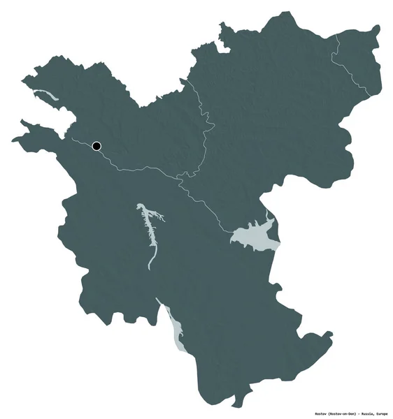
Shape Of Rostov, Region Of Russia, With Its Capital Isolated On White Background. Colored Elevation Map. 3D Rendering
Image, 2.16MB, 3595 × 3836 jpg

Shape Of Nusa Tenggara Timur, Province Of Indonesia, With Its Capital Isolated On White Background. Bilevel Elevation Map. 3D Rendering
Image, 0.73MB, 3836 × 2085 jpg


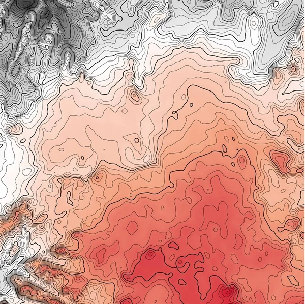
Vector Abstract Earth Relief Map. Generated Conceptual Elevation Map. Isolines Of Landscape Surface Elevation. Geographic Map Conceptual Design. Elegant Background For Presentations.
Vector, 6.06MB, 6000 × 3375 eps

Russia Area On The Grayscale Elevation Map In The Stereographic Projection - Raw Composition Of Raster Layers
Image, 2.14MB, 2880 × 1620 jpg

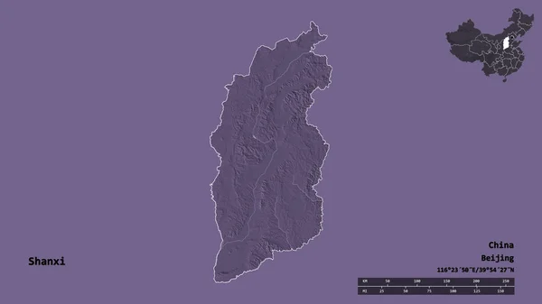
Shape Of Shanxi, Province Of China, With Its Capital Isolated On Solid Background. Distance Scale, Region Preview And Labels. Colored Elevation Map. 3D Rendering
Image, 1.02MB, 2880 × 1620 jpg

Page 1 >> Next