photo free
Home Images Vectors Videos

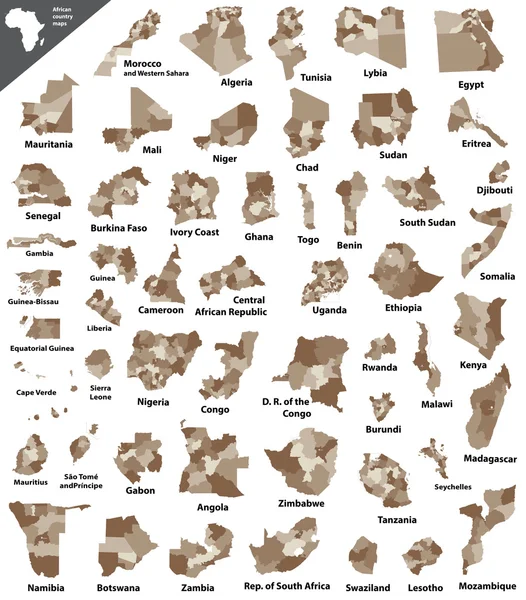
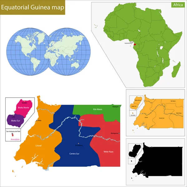
Stock image Equatorial Guinea Map

stock vector Equatorial Guinea map in geometric polygonal style. Abstract gems triangle.

Equatorial Guinea Map In Geometric Polygonal Style. Abstract Gems Triangle.

Vector, 5.24MB, 4525 × 6399 eps
stock vector equatorial Guinea map - High detailed Black map with counties/re

Equatorial Guinea Map - High Detailed Black Map With Counties/re

Vector, 1.82MB, 7000 × 4890 eps
stock vector Equatorial Guinea map vector, Equatorial Guinea flag vector, isolated Equatorial Guinea

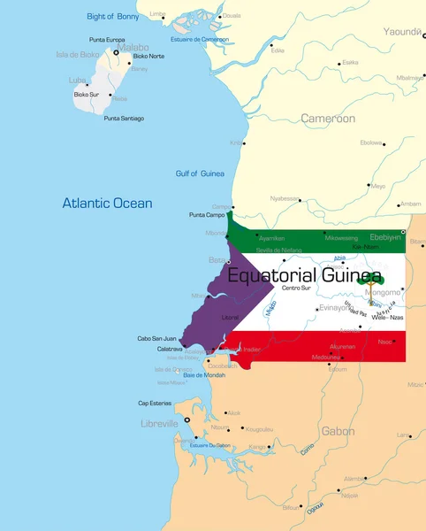
Equatorial Guinea Map Vector, Equatorial Guinea Flag Vector, Isolated Equatorial Guinea

Vector, 2.85MB, 5662 × 4299 eps
stock vector Republic of Equatorial Guinea - vector map

Republic Of Equatorial Guinea - Vector Map

Vector, 0.18MB, 3564 × 3784 eps
stock vector Equatorial Guinea country big text with flag inside map suitable for a logo icon design

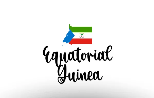
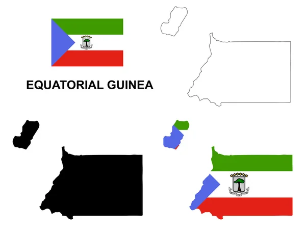
Equatorial Guinea Country Big Text With Flag Inside Map Suitable For A Logo Icon Design

Vector, 3.7MB, 5793 × 3720 eps
stock vector African countries set, hearts and flags, part 2

African Countries Set, Hearts And Flags, Part 2

Vector, 1.09MB, 5000 × 4966 eps
stock vector Equatorial Guinea vector map with infographic elements, pointer

Equatorial Guinea Vector Map With Infographic Elements, Pointer

Vector, 2.1MB, 4000 × 4000 eps
stock vector Vector maps set.  High detailed 46 maps of African countries wit

Vector Maps Set. High Detailed 46 Maps Of African Countries Wit

Vector, 12.15MB, 6000 × 3600 eps
stock vector Vector isometric maps set - Africa continent.  Maps of African countries with administrative division and cities. Part 2.

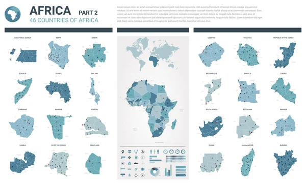
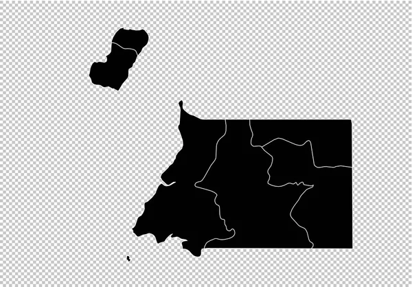
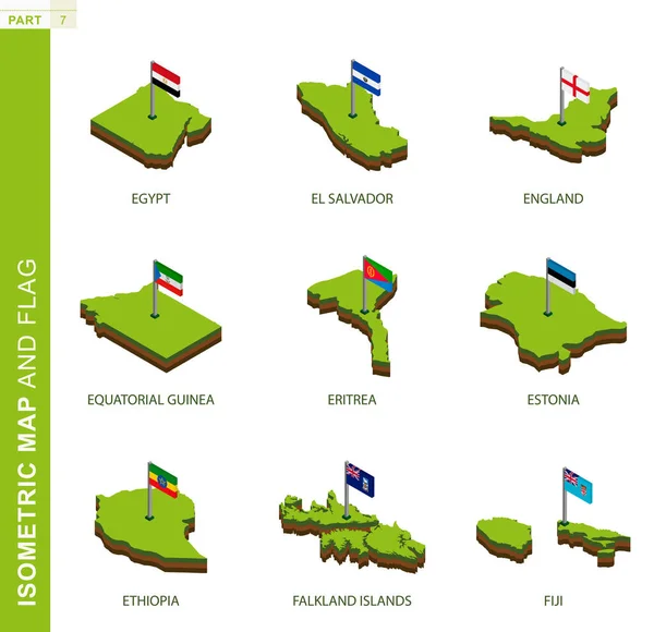
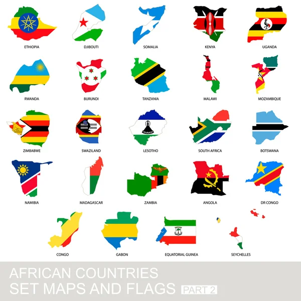
Vector Isometric Maps Set - Africa Continent. Maps Of African Countries With Administrative Division And Cities. Part 2.

Vector, 10.57MB, 5600 × 3500 eps
stock vector Location of Equatorial Guinea on the world map, marked with Equatorial Guinea flag pin.

Location Of Equatorial Guinea On The World Map, Marked With Equatorial Guinea Flag Pin.

Vector, 7.01MB, 8000 × 4000 eps
stock image Equatorial Guinea from space on planet Earth with blue digital network representing international communication, technology and travel. 3D illustration. Elements of this image furnished by NASA.

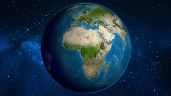
Equatorial Guinea From Space On Planet Earth With Blue Digital Network Representing International Communication, Technology And Travel. 3D Illustration. Elements Of This Image Furnished By NASA.

Image, 12.52MB, 5000 × 3750 jpg
stock vector Central Africa region, political map

Central Africa Region, Political Map

Vector, 3.84MB, 6489 × 9733 eps
stock vector African vector isolated country maps

African Vector Isolated Country Maps

Vector, 9.92MB, 6250 × 7119 eps
stock vector AFRICA Countries - Part FOUR

AFRICA Countries - Part FOUR

Vector, 0.5MB, 6201 × 6201 eps
stock vector Colors of Equatorial Guinea

Colors Of Equatorial Guinea

Vector, 0.33MB, 5000 × 5000 eps
stock vector Equatorial Guinea map

Equatorial Guinea Map

Vector, 9.59MB, 7004 × 7004 eps
stock vector Africa contoured map with highlighted Equatorial Guinea.

Africa Contoured Map With Highlighted Equatorial Guinea.

Vector, 1.31MB, 5000 × 5000 eps
stock image map of equatorial guinea on vintage paper with old pen on the wooden texture desk

Map Of Equatorial Guinea On Vintage Paper With Old Pen On The Wooden Texture Desk

Image, 17.74MB, 7360 × 4912 jpg
stock vector Gabon Political Map

Gabon Political Map

Vector, 0.83MB, 6000 × 5997 eps
stock vector Set of 9 isometric map and flag, 3D vector isometric shape.

Set Of 9 Isometric Map And Flag, 3D Vector Isometric Shape.

Vector, 8.84MB, 5170 × 5000 eps
stock vector Nigeria and West Africa countries on the Gulf of Guinea, political map. Ghana, Togo, Benin, Nigeria, Cameroon, Equatorial Guinea, and Sao Tome And Principe, with borders, capitals and largest cities.

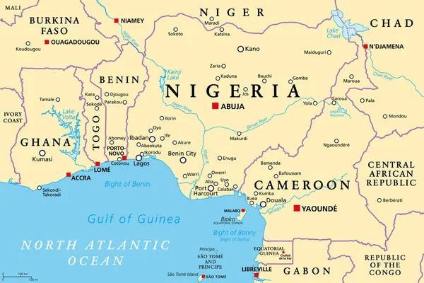
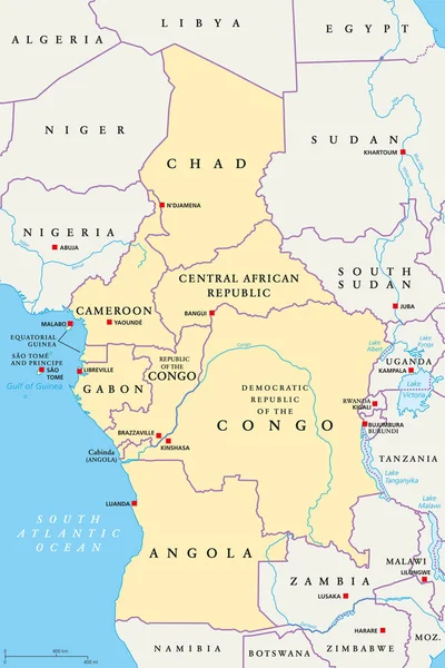
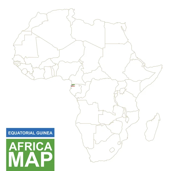
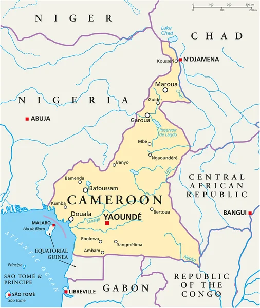
Nigeria And West Africa Countries On The Gulf Of Guinea, Political Map. Ghana, Togo, Benin, Nigeria, Cameroon, Equatorial Guinea, And Sao Tome And Principe, With Borders, Capitals And Largest Cities.

Vector, 3.62MB, 9000 × 6000 eps
stock vector South africa. The Capital Is Cape Town. Flag of South Africa. Map of the continent of Africa with country borders. Vector graphics.

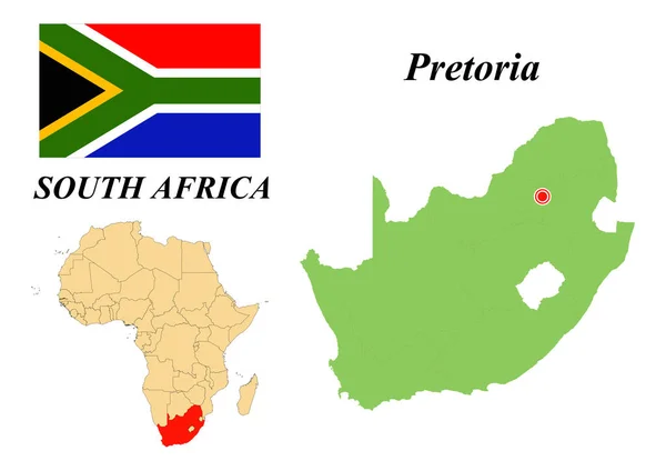
South Africa. The Capital Is Cape Town. Flag Of South Africa. Map Of The Continent Of Africa With Country Borders. Vector Graphics.

Vector, 6.25MB, 6931 × 4901 eps
stock vector Equatorial Guinea

Equatorial Guinea

Vector, 1.25MB, 2911 × 3617 eps
stock vector Blue-green detailed map of Equatorial Guinea administrative divisions with country flag and location on the globe. Vector illustration

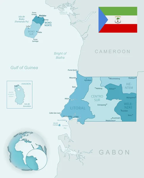
Blue-green Detailed Map Of Equatorial Guinea Administrative Divisions With Country Flag And Location On The Globe. Vector Illustration

Vector, 11.77MB, 5222 × 6442 eps
stock vector Equatorial Guinea

Equatorial Guinea

Vector, 0.19MB, 5206 × 2447 eps
stock vector Federal Republic of Nigeria. Capital of Abuja. Flag of Nigeria. Map of the continent of Africa with country borders. Vector graphics.

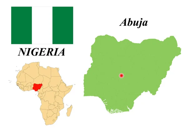
Federal Republic Of Nigeria. Capital Of Abuja. Flag Of Nigeria. Map Of The Continent Of Africa With Country Borders. Vector Graphics.

Vector, 1.48MB, 6931 × 4901 eps
stock vector Cameroon Political Map

Cameroon Political Map

Vector, 1.87MB, 6000 × 7115 eps
stock vector Map of the Economic Community of Central African States (ECCAS).

Map Of The Economic Community Of Central African States (ECCAS).

Vector, 6.58MB, 5000 × 5014 eps
stock image Equatorial Guinea on a map of Africa

Equatorial Guinea On A Map Of Africa

Image, 5.44MB, 7000 × 6000 jpg
stock vector FRANKFURT, GERMANY-MAY 31, 2021: Houses of the former workers settlement Colonie, Frankfurt-Zeilsheim, Germany

FRANKFURT, GERMANY-MAY 31, 2021: Houses Of The Former Workers Settlement Colonie, Frankfurt-Zeilsheim, Germany

Vector, 1.76MB, 3100 × 4871 eps
stock vector African countries set, maps and flags

African Countries Set, Maps And Flags

Vector, 1.01MB, 5000 × 5000 eps
stock image Waving textile flag of Equatorial Guinea fills country map. White isolated background, 3d illustration

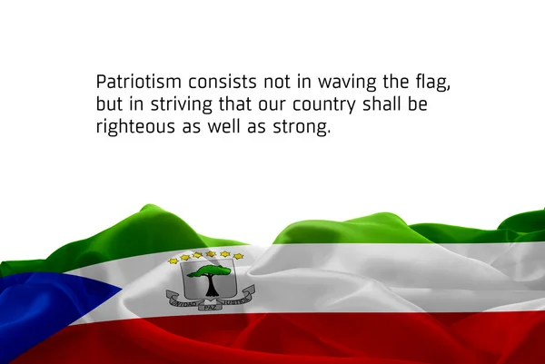
Waving Textile Flag Of Equatorial Guinea Fills Country Map. White Isolated Background, 3d Illustration

Image, 3.54MB, 3411 × 5116 jpg
stock vector High detailed national flags of African countries, clipped in round shape glossy metal buttons, vector, part 2

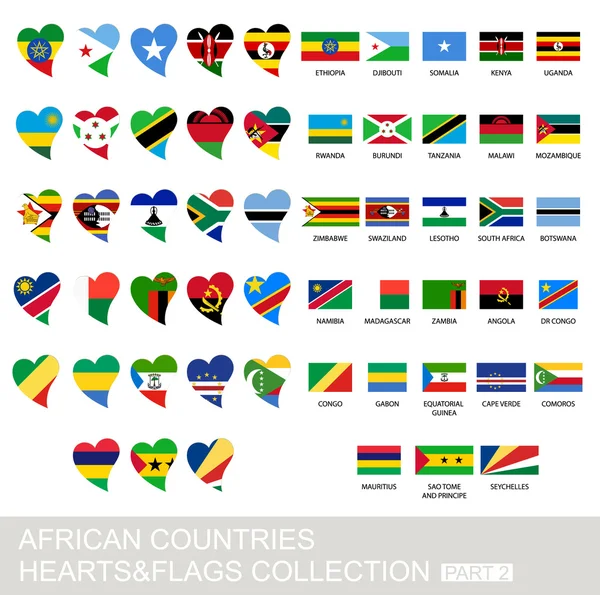
High Detailed National Flags Of African Countries, Clipped In Round Shape Glossy Metal Buttons, Vector, Part 2

Vector, 5.93MB, 5760 × 3600 eps
stock vector Equatorial Guinea Political Map

Equatorial Guinea Political Map

Vector, 0.87MB, 6378 × 6000 eps
stock image Equatorial Guinea on model of planet Earth

Equatorial Guinea On Model Of Planet Earth

Image, 9.34MB, 5000 × 3750 jpg
stock image vintage equatorial guinea map

Vintage Equatorial Guinea Map

Image, 15.9MB, 6300 × 4205 jpg
stock vector Set of round glossy flags of sovereign countries of Africa

Set Of Round Glossy Flags Of Sovereign Countries Of Africa

Vector, 2.93MB, 2434 × 2800 eps
stock vector Equatorial Guinea flag set of 8 items vector

Equatorial Guinea Flag Set Of 8 Items Vector

Vector, 4.08MB, 7325 × 6368 eps
stock image Map outline of Equatorial Guinea with flag grunge paper effect

Map Outline Of Equatorial Guinea With Flag Grunge Paper Effect

Image, 1.76MB, 3397 × 2823 jpg
stock vector Vintage label cards of  Equatorial Guinea flag.

Vintage Label Cards Of Equatorial Guinea Flag.

Vector, 0.39MB, 3100 × 3092 eps
stock vector Vector of Equatorial Guinea map flag with flag set isolated on white background. Collection of flag icons with square, circle, love, heart, and rectangle shapes.

Vector Of Equatorial Guinea Map Flag With Flag Set Isolated On White Background. Collection Of Flag Icons With Square, Circle, Love, Heart, And Rectangle Shapes.

Vector, 0.99MB, 5692 × 5692 eps
stock vector Flag of Equatorial Guinea on white background. Dotted map of Equatorial Guinea with Capital name - Malabo.

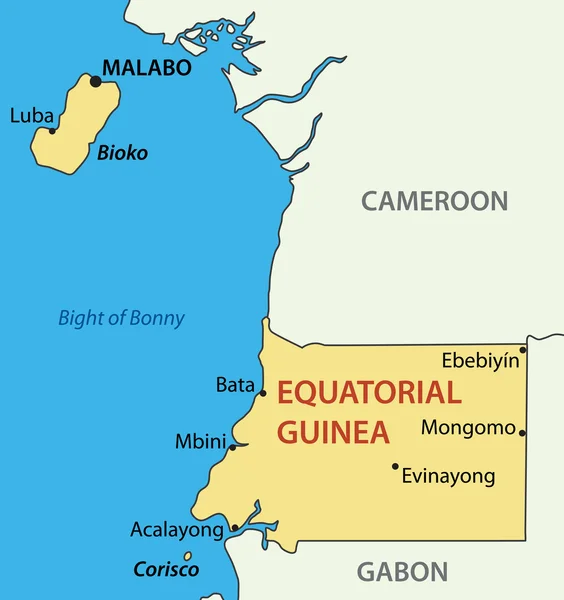
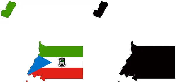
Flag Of Equatorial Guinea On White Background. Dotted Map Of Equatorial Guinea With Capital Name - Malabo.

Vector, 11.57MB, 10000 × 7071 eps
stock image Satellite globe map centered on Cameroun

Satellite Globe Map Centered On Cameroun

Image, 5.96MB, 3840 × 2160 jpg
stock image Equatorial Guinea and its neighborhood. Distant oblique perspective - shape glowed. satellite imagery

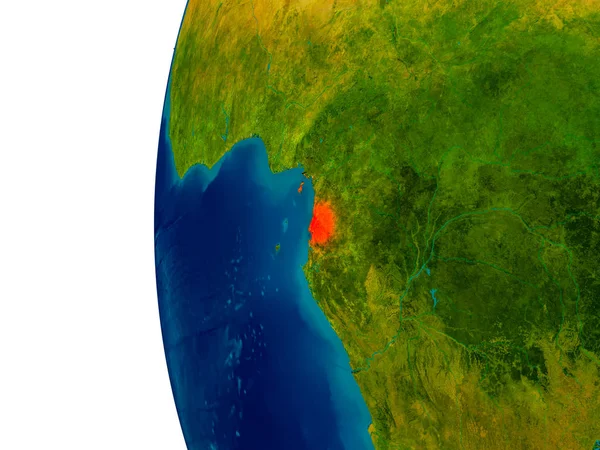
Equatorial Guinea And Its Neighborhood. Distant Oblique Perspective - Shape Glowed. Satellite Imagery

Image, 3.3MB, 2880 × 1620 jpg
stock vector Equatorial Guinea Rectangle flag icon with shadow.

Equatorial Guinea Rectangle Flag Icon With Shadow.

Vector, 5.74MB, 5000 × 4000 eps
stock image 3D Flag of Brazil and Equatorial Guinea on Blue Sky with Sun Shine

3D Flag Of Brazil And Equatorial Guinea On Blue Sky With Sun Shine

Image, 0.7MB, 3500 × 2000 jpg
stock vector Equatorial Guinea blank outline map

Equatorial Guinea Blank Outline Map

Vector, 0.55MB, 4000 × 4800 eps
stock image Equatorial Guinea area on the satellite B map in the stereographic projection - raw composition of raster layers

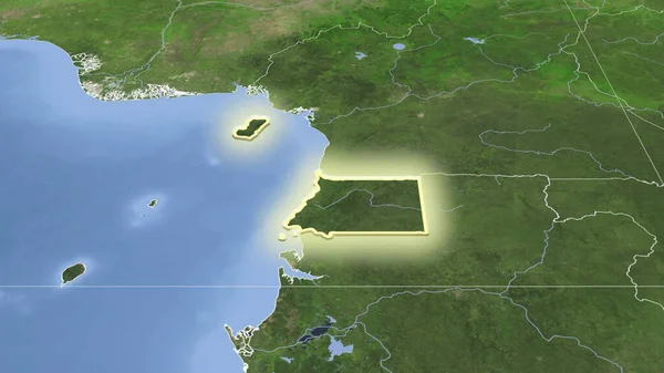
Equatorial Guinea Area On The Satellite B Map In The Stereographic Projection - Raw Composition Of Raster Layers

Image, 3.99MB, 2880 × 1620 jpg
stock image High detailed flag of Equatorial Guinea. National Equatorial Guinea flag. Africa.

High Detailed Flag Of Equatorial Guinea. National Equatorial Guinea Flag. Africa.

Image, 7.37MB, 3840 × 2160 jpg
stock image waving flag of Equatorial Guinea

Waving Flag Of Equatorial Guinea

Image, 7.9MB, 8431 × 5637 jpg
Page 1 >> Next