photo free
Home Images Vectors Videos

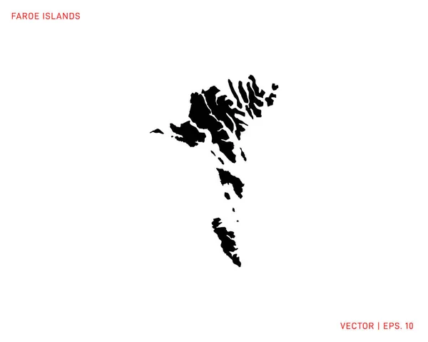
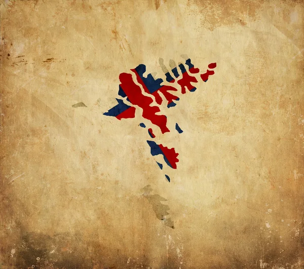
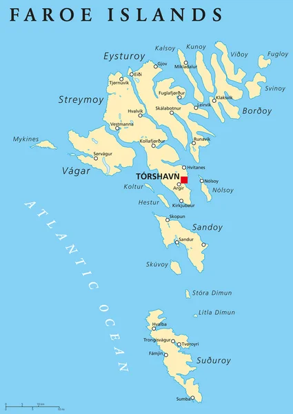
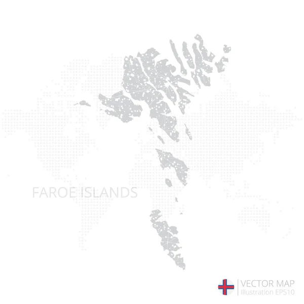
Stock image Faroe Islands Map

stock vector Map of Faroe Islands. High Detailed Silhouette Map - Vector

Map Of Faroe Islands. High Detailed Silhouette Map - Vector

Vector, 2.04MB, 5000 × 4000 eps
stock vector Road map of the Faroe Islands North Atlantic Archipelago with flag, Denmark

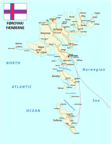
Road Map Of The Faroe Islands North Atlantic Archipelago With Flag, Denmark

Vector, 0MB, 3853 × 4000 zip
stock vector Europe with selected Faroe Islands map and Faroe Islands flag icon.

Europe With Selected Faroe Islands Map And Faroe Islands Flag Icon.

Vector, 0.45MB, 6000 × 4184 eps
stock vector Map of Faroe Islands on political world map with magnifying glass

Map Of Faroe Islands On Political World Map With Magnifying Glass

Vector, 25.02MB, 6000 × 4000 eps
stock image Atlantic Puffins on cliffs

Atlantic Puffins On Cliffs

Image, 3.33MB, 5472 × 3648 jpg
stock vector Map markers with flags - Europe. Original colors.

Map Markers With Flags - Europe. Original Colors.

Vector, 7.62MB, 4000 × 4133 eps
stock vector Abstract mash line and point scales on dark background with Map of faroe Islands. Wire frame 3D mesh polygonal network line, design sphere, dot and structure. communications map of faroe Islands. Vector.

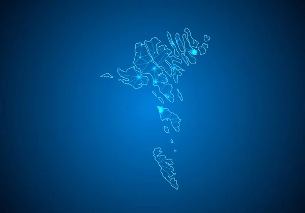
Abstract Mash Line And Point Scales On Dark Background With Map Of Faroe Islands. Wire Frame 3D Mesh Polygonal Network Line, Design Sphere, Dot And Structure. Communications Map Of Faroe Islands. Vector.

Vector, 0.81MB, 5002 × 3501 eps
stock vector Map of Faroe Islands

Map Of Faroe Islands

Vector, 5.35MB, 5983 × 5983 eps
stock vector vector maps and flags of Europe countries with administrative divisions (regions borders)

Vector Maps And Flags Of Europe Countries With Administrative Divisions (regions Borders)

Vector, 11.38MB, 6036 × 8334 eps
stock image Vintage map of Faroe Islands on grunge paper

Vintage Map Of Faroe Islands On Grunge Paper

Image, 8.97MB, 3216 × 2848 jpg
stock vector Faroe Islands political map

Faroe Islands Political Map

Vector, 2.63MB, 6986 × 9033 eps
stock vector Map of Faroe Islands with flag

Map Of Faroe Islands With Flag

Vector, 6.15MB, 5984 × 5984 eps
stock vector Faroe Islands Map Flag. Map of Faroes with flag isolated on white background. Autonomous territory within the Kingdom of Denmark. Vector illustration.

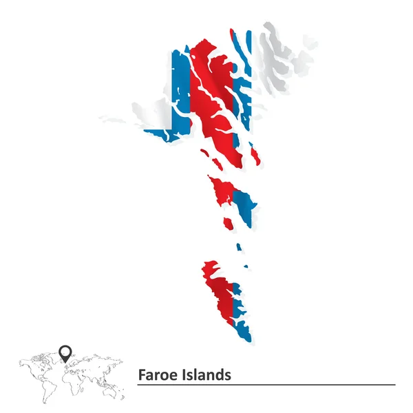
Faroe Islands Map Flag. Map Of Faroes With Flag Isolated On White Background. Autonomous Territory Within The Kingdom Of Denmark. Vector Illustration.

Vector, 5.36MB, 5000 × 4000 eps
stock vector Faroe Islands Political Map

Faroe Islands Political Map

Vector, 1.07MB, 6000 × 8460 eps
stock vector World map with magnified Faroe Islands

World Map With Magnified Faroe Islands

Vector, 5.51MB, 5000 × 3125 eps
stock vector Nordic Council members, political map. Cooperation among the Nordic states Denmark, Finland, Iceland, Norway and Sweden, the autonomous territories Faroe Islands and Greenland, and the region Aland.

Nordic Council Members, Political Map. Cooperation Among The Nordic States Denmark, Finland, Iceland, Norway And Sweden, The Autonomous Territories Faroe Islands And Greenland, And The Region Aland.

Vector, 3.06MB, 7972 × 6000 eps
stock vector Map of faroe Islands. High detailed vector map - faroe Islands.

Map Of Faroe Islands. High Detailed Vector Map - Faroe Islands.

Vector, 5.47MB, 6000 × 4200 eps
stock image Mikladalur, Faroe Islands - 06.12.2017: Statue of Seal Woman on the rocky shore of Mikladalur, Kalsoy, with ocean anc dramatic clouds in the background. Late morning in the wild Faroe Islands.

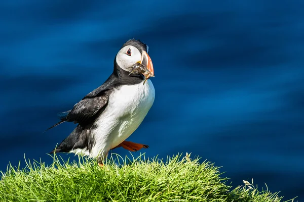
Mikladalur, Faroe Islands - 06.12.2017: Statue Of Seal Woman On The Rocky Shore Of Mikladalur, Kalsoy, With Ocean Anc Dramatic Clouds In The Background. Late Morning In The Wild Faroe Islands.

Image, 4.54MB, 4000 × 2668 jpg
stock image Atlantic Puffins on cliffs

Atlantic Puffins On Cliffs

Image, 1.96MB, 5472 × 3648 jpg
stock vector Faroe Islands map vector

Faroe Islands Map Vector

Vector, 0.58MB, 8858 × 5906 eps
stock image Atlantic Puffins on cliffs

Atlantic Puffins On Cliffs

Image, 1.16MB, 3997 × 2665 jpg
stock vector Set of Faroe Islands pin, icon and map pointer flags. Vector

Set Of Faroe Islands Pin, Icon And Map Pointer Flags. Vector

Vector, 0.33MB, 5001 × 3860 eps
stock image A Faroe Islands flag button 3d illustration with clipping path

A Faroe Islands Flag Button 3d Illustration With Clipping Path

Image, 5.54MB, 8000 × 8000 jpg
stock image A Faroe Islands flagpole 3d illustration on white with clipping path

A Faroe Islands Flagpole 3d Illustration On White With Clipping Path

Image, 5.39MB, 7000 × 7000 jpg
stock vector Locator map showing the location of the country Faroe Islands in Europe. The country is highlighted with a red polygon. No labels at all. Made with Natural Earth.

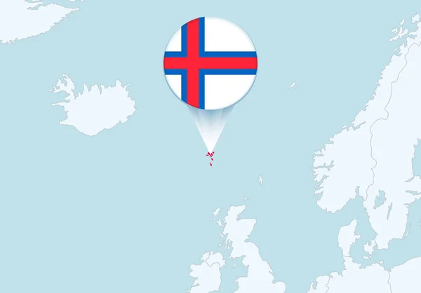
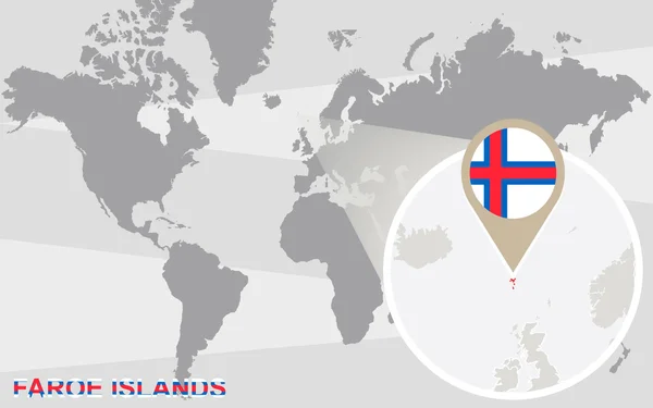
Locator Map Showing The Location Of The Country Faroe Islands In Europe. The Country Is Highlighted With A Red Polygon. No Labels At All. Made With Natural Earth.

Vector, 1.1MB, 4477 × 4530 eps
stock vector Pin map with Faroe Islands flag on world map. Vector illustration.

Pin Map With Faroe Islands Flag On World Map. Vector Illustration.

Vector, 18.89MB, 6000 × 3150 eps
stock image Boroy Island in the North Atlantic Ocean, belonging to Faroe Islands, isolated on a topographic, OSM Humanitarian style map, with distance scale

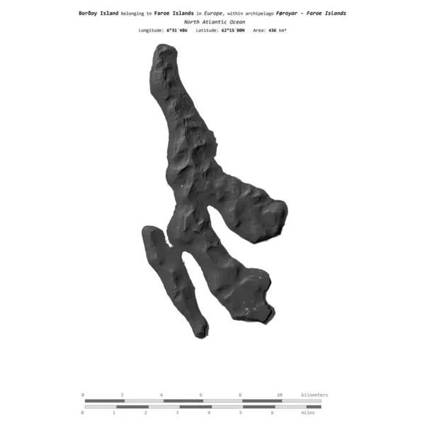
Boroy Island In The North Atlantic Ocean, Belonging To Faroe Islands, Isolated On A Topographic, OSM Humanitarian Style Map, With Distance Scale

Image, 0.52MB, 2160 × 2160 jpg
stock image Suuroy Island in the North Atlantic Ocean - belonging to Faroe Islands. Described location diagram with yellow shape of the island and sample maps of its surroundings

Suuroy Island In The North Atlantic Ocean - Belonging To Faroe Islands. Described Location Diagram With Yellow Shape Of The Island And Sample Maps Of Its Surroundings

Image, 1.97MB, 3840 × 2160 jpg
stock image Sandoy Island in the North Atlantic Ocean on a colored elevation map

Sandoy Island In The North Atlantic Ocean On A Colored Elevation Map

Image, 0.75MB, 2880 × 1620 jpg
stock image Suuroy Island in the North Atlantic Ocean, belonging to Faroe Islands, isolated on a topographic, OSM Humanitarian style map, with distance scale

Suuroy Island In The North Atlantic Ocean, Belonging To Faroe Islands, Isolated On A Topographic, OSM Humanitarian Style Map, With Distance Scale

Image, 0.51MB, 2160 × 2160 jpg
stock image Boroy Island in the North Atlantic Ocean, belonging to Faroe Islands, isolated on a satellite image taken in July 8, 2014, with distance scale

Boroy Island In The North Atlantic Ocean, Belonging To Faroe Islands, Isolated On A Satellite Image Taken In July 8, 2014, With Distance Scale

Image, 0.95MB, 2160 × 2160 jpg
stock image Vagar Island in the North Atlantic Ocean on a topographic, OSM Humanitarian style map

Vagar Island In The North Atlantic Ocean On A Topographic, OSM Humanitarian Style Map

Image, 2MB, 2880 × 1620 jpg
stock image Suuroy Island in the North Atlantic Ocean, belonging to Faroe Islands, isolated on a satellite image taken in October 20, 2019, with distance scale

Suuroy Island In The North Atlantic Ocean, Belonging To Faroe Islands, Isolated On A Satellite Image Taken In October 20, 2019, With Distance Scale

Image, 0.91MB, 2160 × 2160 jpg
stock image Eysturoy Island in the North Atlantic Ocean on a satellite image taken in September 10, 2022

Eysturoy Island In The North Atlantic Ocean On A Satellite Image Taken In September 10, 2022

Image, 6.13MB, 2880 × 1620 jpg
stock image Boroy Island in the North Atlantic Ocean - belonging to Faroe Islands. Described location diagram with yellow shape of the island and sample maps of its surroundings

Boroy Island In The North Atlantic Ocean - Belonging To Faroe Islands. Described Location Diagram With Yellow Shape Of The Island And Sample Maps Of Its Surroundings

Image, 2.85MB, 3840 × 2160 jpg
stock image Sandoy Island in the North Atlantic Ocean, belonging to Faroe Islands, isolated on a satellite image taken in June 17, 2020, with distance scale

Sandoy Island In The North Atlantic Ocean, Belonging To Faroe Islands, Isolated On A Satellite Image Taken In June 17, 2020, With Distance Scale

Image, 1.26MB, 2160 × 2160 jpg
stock image Suuroy Island in the North Atlantic Ocean on a topographic, OSM Humanitarian style map

Suuroy Island In The North Atlantic Ocean On A Topographic, OSM Humanitarian Style Map

Image, 0.41MB, 2880 × 1620 jpg
stock image Vagar Island in the North Atlantic Ocean, belonging to Faroe Islands, isolated on a bilevel elevation map, with distance scale

Vagar Island In The North Atlantic Ocean, Belonging To Faroe Islands, Isolated On A Bilevel Elevation Map, With Distance Scale

Image, 0.5MB, 2160 × 2160 jpg
stock image Vagar Island in the North Atlantic Ocean - belonging to Faroe Islands. Described location diagram with yellow shape of the island and sample maps of its surroundings

Vagar Island In The North Atlantic Ocean - Belonging To Faroe Islands. Described Location Diagram With Yellow Shape Of The Island And Sample Maps Of Its Surroundings

Image, 2.75MB, 3840 × 2160 jpg
stock image Boroy Island in the North Atlantic Ocean, belonging to Faroe Islands, isolated on a bilevel elevation map, with distance scale

Boroy Island In The North Atlantic Ocean, Belonging To Faroe Islands, Isolated On A Bilevel Elevation Map, With Distance Scale

Image, 0.38MB, 2160 × 2160 jpg
stock image Streymoy Island in the North Atlantic Ocean, belonging to Faroe Islands, isolated on a satellite image taken in June 23, 2018, with distance scale

Streymoy Island In The North Atlantic Ocean, Belonging To Faroe Islands, Isolated On A Satellite Image Taken In June 23, 2018, With Distance Scale

Image, 1.01MB, 2160 × 2160 jpg
stock image Boroy Island in the North Atlantic Ocean on a bilevel elevation map

Boroy Island In The North Atlantic Ocean On A Bilevel Elevation Map

Image, 0.84MB, 2880 × 1620 jpg
stock image Boroy Island in the North Atlantic Ocean on a topographic, OSM Humanitarian style map

Boroy Island In The North Atlantic Ocean On A Topographic, OSM Humanitarian Style Map

Image, 1.78MB, 2880 × 1620 jpg
stock image Vagar Island in the North Atlantic Ocean, belonging to Faroe Islands, isolated on a topographic, OSM Humanitarian style map, with distance scale

Vagar Island In The North Atlantic Ocean, Belonging To Faroe Islands, Isolated On A Topographic, OSM Humanitarian Style Map, With Distance Scale

Image, 0.8MB, 2160 × 2160 jpg
stock image Streymoy Island in the North Atlantic Ocean on a colored elevation map

Streymoy Island In The North Atlantic Ocean On A Colored Elevation Map

Image, 1.6MB, 2880 × 1620 jpg
stock image Sandoy Island in the North Atlantic Ocean, belonging to Faroe Islands, isolated on a topographic, OSM Humanitarian style map, with distance scale

Sandoy Island In The North Atlantic Ocean, Belonging To Faroe Islands, Isolated On A Topographic, OSM Humanitarian Style Map, With Distance Scale

Image, 0.8MB, 2160 × 2160 jpg
stock image Vagar Island in the North Atlantic Ocean on a satellite image taken in September 10, 2022

Vagar Island In The North Atlantic Ocean On A Satellite Image Taken In September 10, 2022

Image, 6.24MB, 2880 × 1620 jpg
stock image Eysturoy Island in the North Atlantic Ocean on a topographic, OSM Humanitarian style map

Eysturoy Island In The North Atlantic Ocean On A Topographic, OSM Humanitarian Style Map

Image, 1.43MB, 2880 × 1620 jpg
stock image Vagar Island in the North Atlantic Ocean on a colored elevation map

Vagar Island In The North Atlantic Ocean On A Colored Elevation Map

Image, 1.9MB, 2880 × 1620 jpg
stock vector Faroe Islands grey map isolated on white background with abstract mesh line and point scales. Vector illustration eps 10

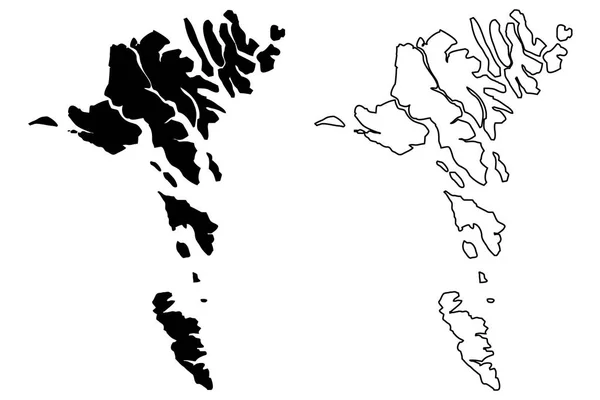
Faroe Islands Grey Map Isolated On White Background With Abstract Mesh Line And Point Scales. Vector Illustration Eps 10

Vector, 5.78MB, 5556 × 5556 eps
Page 1 >> Next