photo free
Home Images Vectors Videos

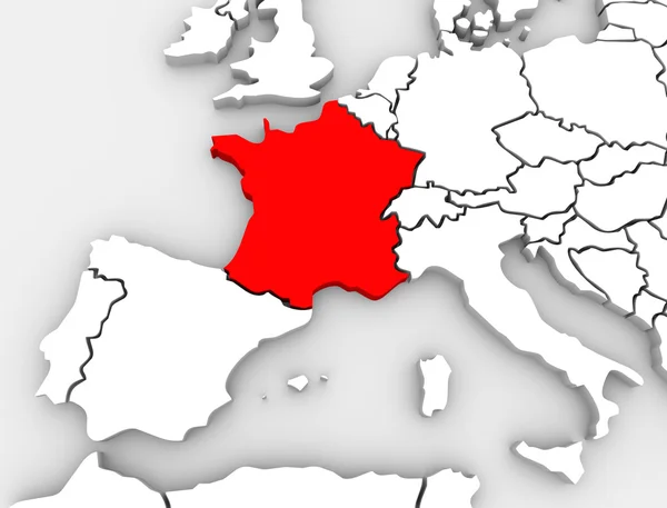
Stock image France Map 3d

stock vector France Map

France Map

Vector, 2.01MB, 5000 × 5000 ai
stock vector France map card paper 3D natural vector

France Map Card Paper 3D Natural Vector

Vector, 1.12MB, 3980 × 4002 eps
stock vector Stylized map of France. Isometric 3D green map with cities, borders, capital Paris, regions. Vector illustration. Editable layers clearly labeled. English language

Stylized Map Of France. Isometric 3D Green Map With Cities, Borders, Capital Paris, Regions. Vector Illustration. Editable Layers Clearly Labeled. English Language

Vector, 3.14MB, 4800 × 4000 eps
stock vector Blank contour maps of France

Blank Contour Maps Of France

Vector, 3.54MB, 6695 × 6686 eps
stock image France Map 3d Shape

France Map 3d Shape

Image, 2.43MB, 5600 × 4200 jpg
stock image Map of europe

Map Of Europe

Image, 1.2MB, 3600 × 2700 jpg
stock image Map of europe

Map Of Europe

Image, 2.14MB, 3600 × 2700 jpg
stock vector Blue-gray detailed map of France and administrative divisions and location on the globe.

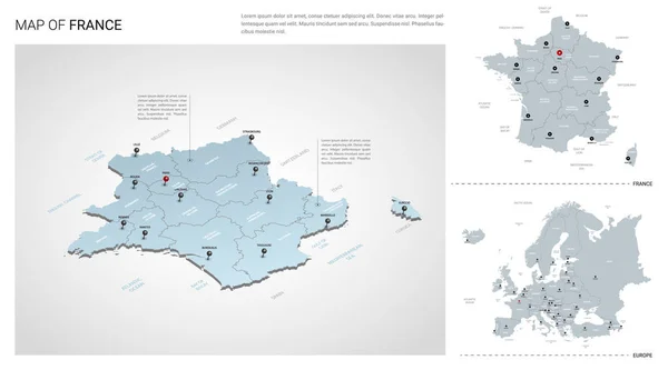
Blue-gray Detailed Map Of France And Administrative Divisions And Location On The Globe.

Vector, 15.31MB, 5248 × 5480 eps
stock vector French map with flag of France. Vector illustration.

French Map With Flag Of France. Vector Illustration.

Vector, 0.83MB, 5000 × 5000 eps
stock vector France map blue white card paper 3D vector

France Map Blue White Card Paper 3D Vector

Vector, 8.87MB, 4110 × 4022 eps
stock vector France Map country

France Map Country

Vector, 1.94MB, 4520 × 4520 ai
stock image 3d map of France

3d Map Of France

Image, 0.57MB, 2480 × 1754 jpg
stock image France Flag Map Shape

France Flag Map Shape

Image, 3.32MB, 5600 × 4200 jpg
stock image 3D World Map

3D World Map

Image, 4.26MB, 6000 × 3000 jpg
stock image France Abstract 3D Map Europe Continent

France Abstract 3D Map Europe Continent

Image, 2.98MB, 4200 × 3200 jpg
stock vector Vector set of France country.

Vector Set Of France Country.

Vector, 7.83MB, 5400 × 3000 eps
stock vector Alsace blank detailed outline map set

Alsace Blank Detailed Outline Map Set

Vector, 0.19MB, 3721 × 5871 eps
stock vector France map outline with stars and lines abstract framework. Communication, connection concept

France Map Outline With Stars And Lines Abstract Framework. Communication, Connection Concept

Vector, 13.76MB, 4167 × 4167 eps
stock image Detailed Earth. Italy, Greece and the Mediterranean Sea

Detailed Earth. Italy, Greece And The Mediterranean Sea

Image, 11.79MB, 5000 × 5000 jpg
stock image Map of Europe. 3d

Map Of Europe. 3d

Image, 0.88MB, 3600 × 2700 jpg
stock vector Centre region blank detailed outline map set

Centre Region Blank Detailed Outline Map Set

Vector, 0.22MB, 4538 × 4956 eps
stock image Shape of France with its capital isolated on white background. Topographic relief map. 3D rendering

Shape Of France With Its Capital Isolated On White Background. Topographic Relief Map. 3D Rendering

Image, 3.84MB, 2567 × 2370 jpg
stock vector Yvelines, Ile-de-France outline map set

Yvelines, Ile-de-France Outline Map Set

Vector, 0.15MB, 4583 × 5417 eps
stock image France map blue white card paper 3D raster

France Map Blue White Card Paper 3D Raster

Image, 0.91MB, 4110 × 4022 jpg
stock image High detailed white silhouette of France map and national flag

High Detailed White Silhouette Of France Map And National Flag

Image, 3MB, 10000 × 3600 jpg
stock vector Provence-Alpes-Cote d'Azur blank detailed outline map set

Provence-Alpes-Cote D'Azur Blank Detailed Outline Map Set

Vector, 2.56MB, 4946 × 4760 eps
stock vector Europe with parts of Asia, detailed map, individual states and islands and sea with names, blue white card paper 3D vector

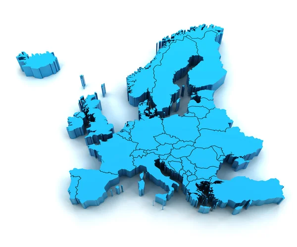
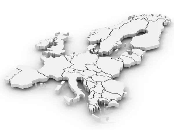
Europe With Parts Of Asia, Detailed Map, Individual States And Islands And Sea With Names, Blue White Card Paper 3D Vector

Vector, 11.09MB, 4815 × 3500 eps
stock vector France Map flag Vector 3D illustration eps 10

France Map Flag Vector 3D Illustration Eps 10

Vector, 5.51MB, 6250 × 6250 eps
stock vector Martinique outline map set

Martinique Outline Map Set

Vector, 1.03MB, 4479 × 5010 eps
stock vector France map - three-dimensional vector illustration.

France Map - Three-dimensional Vector Illustration.

Vector, 1.4MB, 5400 × 5186 eps
stock vector Limousin blank detailed outline map set

Limousin Blank Detailed Outline Map Set

Vector, 0.19MB, 4650 × 5009 eps
stock image Isolated Blue 3D map of France on a white background. Isolated 3D illustration of a map of France.

Isolated Blue 3D Map Of France On A White Background. Isolated 3D Illustration Of A Map Of France.

Image, 1.87MB, 5069 × 2766 jpg
stock image Silhouette of France map with flag

Silhouette Of France Map With Flag

Image, 3.45MB, 4500 × 3000 jpg
stock image European continent marked with flags

European Continent Marked With Flags

Image, 4.73MB, 5000 × 3600 jpg
stock vector France country silhouette. High detailed map. White country silhouette with dropped long shadow on beige background.

France Country Silhouette. High Detailed Map. White Country Silhouette With Dropped Long Shadow On Beige Background.

Vector, 9.93MB, 8000 × 8000 eps
stock image France map glass card paper 3D raster

France Map Glass Card Paper 3D Raster

Image, 1.13MB, 4000 × 3978 jpg
stock vector Stylized vector France map.  Infographic 3d gold map illustration with cities, borders, capital, administrative divisions and pointer marks, shadow; gradient background.

Stylized Vector France Map. Infographic 3d Gold Map Illustration With Cities, Borders, Capital, Administrative Divisions And Pointer Marks, Shadow; Gradient Background.

Vector, 1.84MB, 3000 × 3000 eps
stock image Blue 3D map of France on a dark blue background. 3D illustration of a map of France.

Blue 3D Map Of France On A Dark Blue Background. 3D Illustration Of A Map Of France.

Image, 3.04MB, 5069 × 2766 jpg
stock vector Guadeloupe detailed outline map set

Guadeloupe Detailed Outline Map Set

Vector, 1.28MB, 5305 × 4493 eps
stock vector Super powers flags

Super Powers Flags

Vector, 4.52MB, 5607 × 3738 eps
stock image Europe sunrise

Europe Sunrise

Image, 9.25MB, 4200 × 4200 jpg
stock vector Blue-green detailed map of France and administrative divisions with country flag and location on the globe.

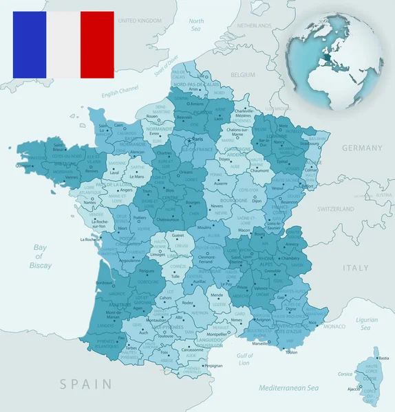
Blue-green Detailed Map Of France And Administrative Divisions With Country Flag And Location On The Globe.

Vector, 15.05MB, 5248 × 5480 eps
stock image Detail Europe map with national borders

Detail Europe Map With National Borders

Image, 13.61MB, 9000 × 7500 jpg
stock image French flag map

French Flag Map

Image, 6.37MB, 4960 × 5039 jpg
stock vector Location of Normandy on map France. 3d location sign similar to the flag of Normandy. Quality map  with regions of  French Republic for your design. EPS10.

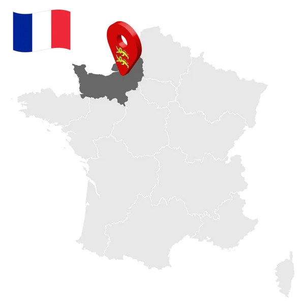
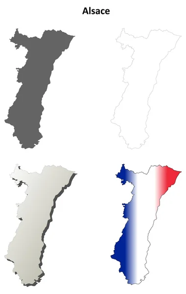
Location Of Normandy On Map France. 3d Location Sign Similar To The Flag Of Normandy. Quality Map With Regions Of French Republic For Your Design. EPS10.

Vector, 4.28MB, 5000 × 5000 eps
stock image France map with tricolor scarf - political election - 3D rendering

France Map With Tricolor Scarf - Political Election - 3D Rendering

Image, 3.85MB, 5500 × 5500 jpg
stock image Map of europe

Map Of Europe

Image, 1.13MB, 3600 × 2700 jpg
stock image Map of Europe and Estonia.

Map Of Europe And Estonia.

Image, 2.4MB, 5600 × 4200 jpg
stock vector France map 3D, flag and navigation icons - illustration.

France Map 3D, Flag And Navigation Icons - Illustration.

Vector, 2.6MB, 5400 × 5783 eps
stock vector European union flags and membership . 3D realistic pennant hanging design . White isolated background and europe map . Vector .

European Union Flags And Membership . 3D Realistic Pennant Hanging Design . White Isolated Background And Europe Map . Vector .

Vector, 7.7MB, 6740 × 4000 eps
Page 1 >> Next