
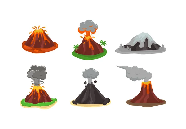
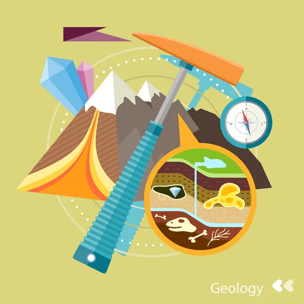
Stock image Geology Diagram


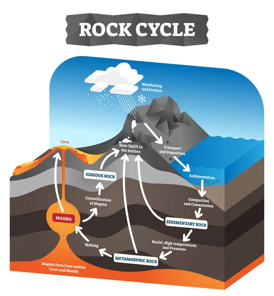
Rock Cycle Vector Illustration. Educational Labeled Geology Process Scheme.
Vector, 5.98MB, 4000 × 4320 eps
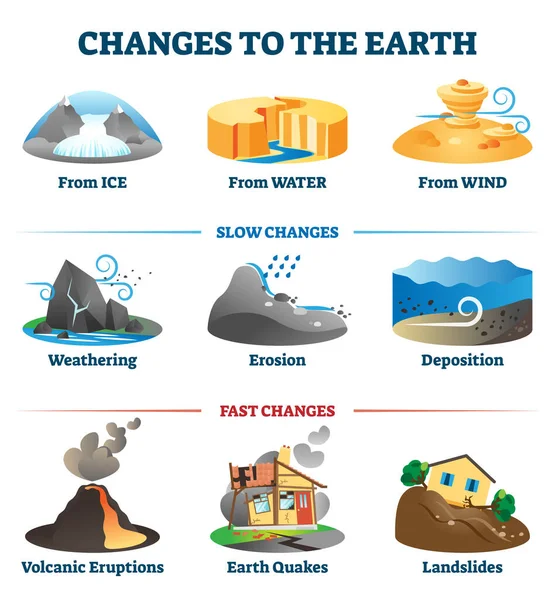
Changes To The Earth Environment Labeled Collection Vector Illustration.
Vector, 6.2MB, 4167 × 4500 eps
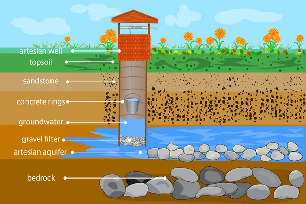
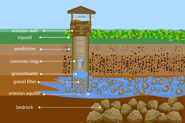
Artesian Water Well In Cross Section. Water Resource. Artesian Water And Groundwater Infographic. Well Schematic Diagram. Typical Aquifer Cross-section. Schematic Of An Artesian Well. Water Supply System. Stock Vector Illustration
Vector, 3.92MB, 5000 × 3333 eps
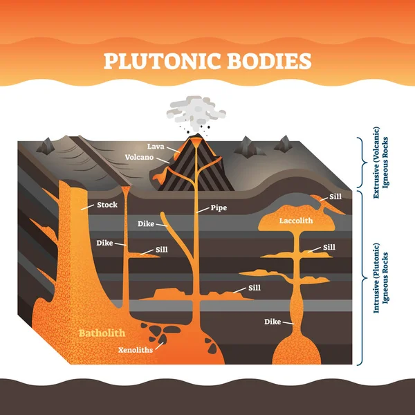
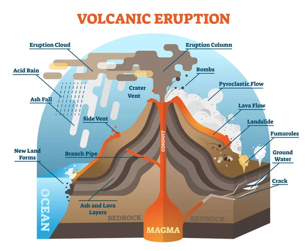
Plutonic Bodies Vector Illustration. Labeled Volcano Igneous Rock Masses.
Vector, 10.1MB, 4000 × 4000 eps
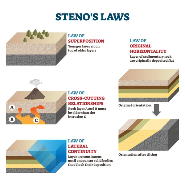
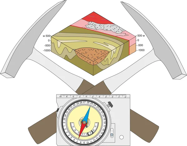
Stenos Laws Vector Illustration. Labeled Rocks Classification Infographics
Vector, 9.84MB, 4000 × 4000 eps

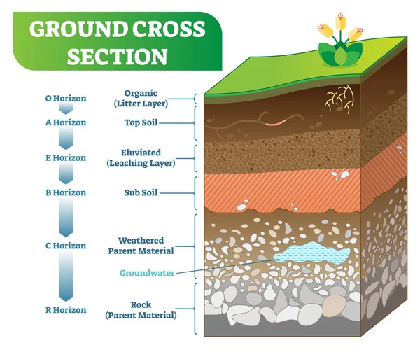
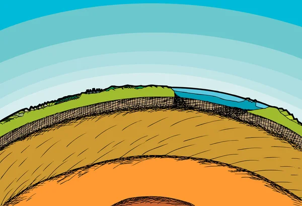
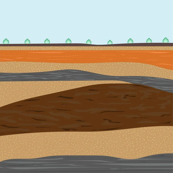
Ground Cross Section Vector Illustration With Organic, Topsoil, Subsoil And Other Horizon Levels.
Vector, 6.64MB, 4834 × 4056 eps
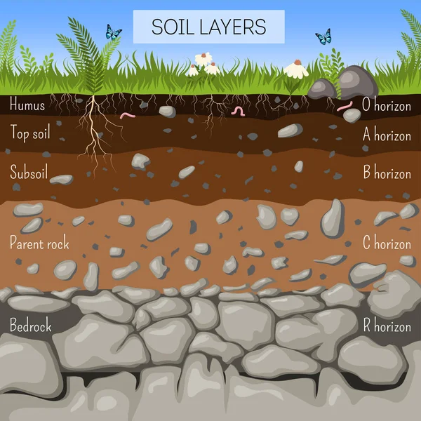
Soil Layers Diagram With Grass, Earth Texture, Stones, Plant Roots, Underground Species.
Vector, 2.79MB, 4167 × 4167 eps

Fault Type Vector Illustration Set (3 Dimensions) / Normal, Reverse, Strike-slip Etc.
Vector, 1.49MB, 7322 × 9025 eps

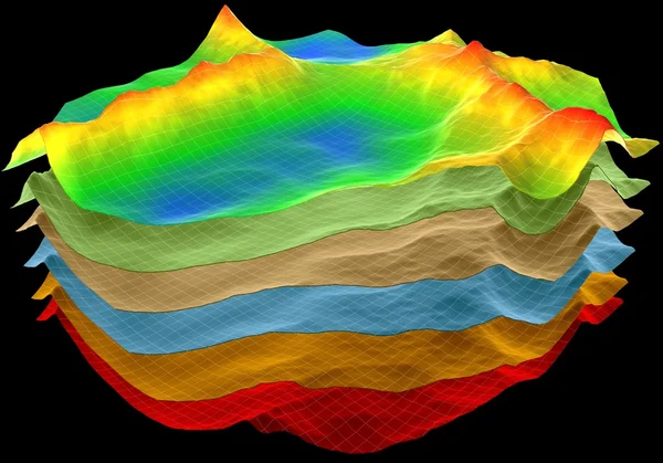
Abstract Background With Wireframe Technology Color Grid On Dark Blue. Big Data. Visual 3d Presentation Of Analysis Research. Computing Concept. Banner For Business, Science And Technology.
Vector, 4.23MB, 5800 × 2900 eps

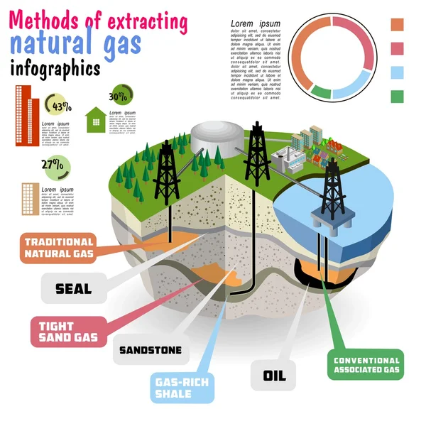
Extraction Of Oil, Soil Layers And Well For The Drilling Petroleum Resources. The Diagram In A Cut, A Template For Page, Banners, Posters. Vector Illustration.
Vector, 3.4MB, 5000 × 4000 eps
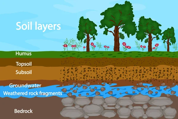
Soil Layers. Diagram For Layer Of Soil. Soil Layer Scheme With Grass, Earth Texture, Groundwater And Stones. Cross Section Of Humus Or Organic And Underground Soil Layers Beneath. Stock Vector Illustration
Vector, 1.79MB, 5000 × 3333 eps
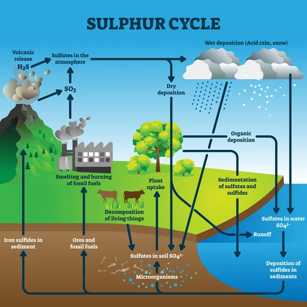
Sulphur Cycle Vector Illustration. Labeled Geological Earth Elements Scheme
Vector, 8.57MB, 4000 × 4000 eps

Measuring Biodiversity In Ecosystem Or Species At One Region Outline Diagram
Vector, 6.22MB, 4000 × 4000 eps
Artesian Water Well In Cross Section. Water Resource. Artesian Water And Groundwater Infographic. Well Schematic Diagram. Typical Aquifer Cross-section. Schematic Of An Artesian Well. Water Supply System. Stock Vector Illustration
Vector, 8.71MB, 5000 × 3333 eps

Soil Seamless Layers Ground Layer. Stones And Grass On Dirts. Vector
Vector, 2.27MB, 4167 × 4167 eps
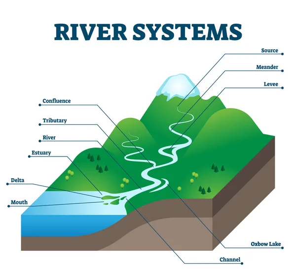
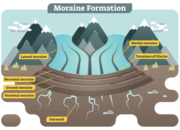
River Systems And Drainage Basin Educational Structure Vector Illustration
Vector, 5.62MB, 4200 × 3864 eps
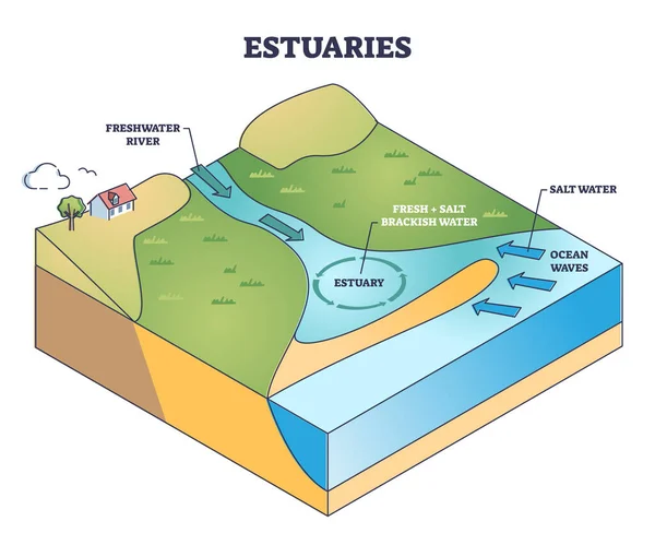
Estuaries Water Body Structure With Salt And Freshwater Outline Diagram. Labeled Educational Scheme With River Stream Flow To Ocean And Mixing Water Formation Vector Illustration. Geological Process.
Vector, 5.65MB, 4500 × 3663 eps
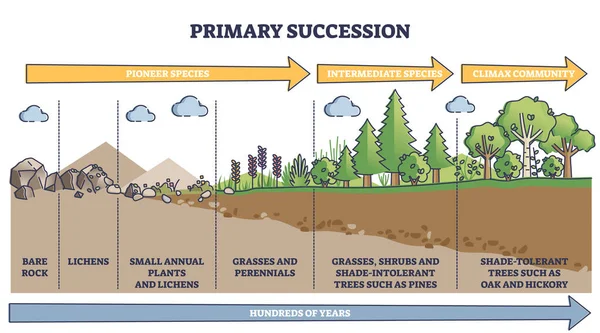
Primary Succession And Ecological Growth Process Stages Outline Diagram
Vector, 5.77MB, 5500 × 3056 eps
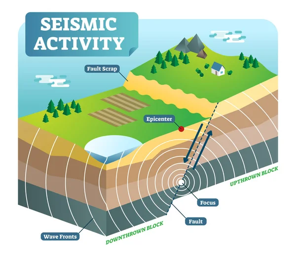
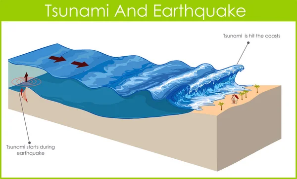
Seismic Activity Isometric Vector Illustration With Two Moving Plates And Focus Epicenter.
Vector, 4.13MB, 4498 × 3880 eps

Depositional Landforms And Sediment Created Relief Area Types Outline Diagram. Labeled Educational Scheme With Gulf, Peninsula, Delta, Bay And Island Water Geological Formation Vector Illustration.
Vector, 5.59MB, 4500 × 3938 eps
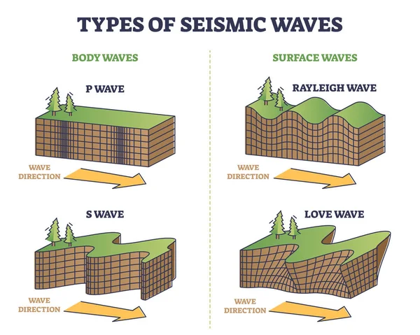
Types Of Seismic Waves As Earth Movement In Earthquake Outline Collection Set. Educational Labeled Rayleigh, Love And Body, Surface Wave Comparison With Direction Explanation Vector Illustration.
Vector, 5.42MB, 4500 × 3600 eps
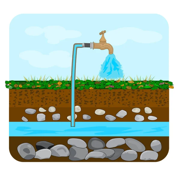
Groundwater Or Artesian Water. Water Extraction. Artesian Water Well In Cross Section. Water Well Drilling Diagram With Derrick. Schematic Of An Artesian Well. Earth Layers. Stock Vector Illustration
Vector, 2.55MB, 4500 × 4500 eps
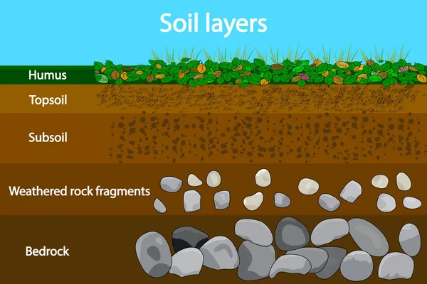
Soil Layers. Diagram Showing Soil Layers. Soil Layer Scheme With Grass And Earth Texture And Stones. Cross Section Of Humus Or Organic And Underground Soil Layers Beneath. Geology Infographics. Vector Illustration
Vector, 5.52MB, 5000 × 3333 eps

Cryosphere Elements Educational Scheme With Ice And Water Outline Diagram
Vector, 5.48MB, 6000 × 2936 eps
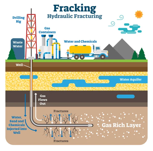
Hydraulic Fracturing Flat Schematic Vector Illustration With Fracking Gas Rich Ground Layers.
Vector, 6.23MB, 5962 × 5903 eps
Page 1 >> Next