
Stock image Gnss
Global Navigation Satellite System (GNSS), A General Word For Satellite Navigation Systems, Is A Technology Communication Image,3d Rendering
Image, 11.46MB, 8000 × 4500 jpg
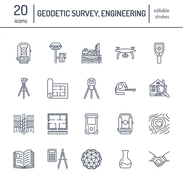
Geodetic Survey Engineering Vector Flat Line Icons. Geodesy Equipment, Tacheometer, Theodolite, Tripod. Geological Research, Building Measurement Inspection Illustration. Construction Service Signs.
Vector, 0.49MB, 4167 × 4167 eps


Technology Communication Image Global Navigation Satellite System,standard Generic Term For Satellite Navigation Systems,GNSS,3d Rendering
Image, 10.68MB, 8000 × 4500 jpg

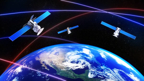
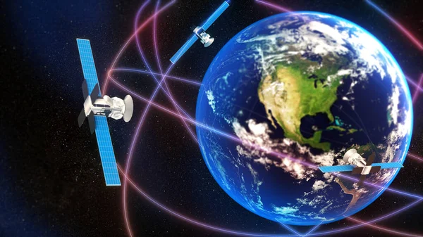
3d Rendering. Global Positioning System GPS Of Navigation Satellites Or Satnav Transmit Data Coverage Around Planet Earth
Image, 6.54MB, 6000 × 3375 jpg

Theodolite, Vertical Projection Device Line Icon Vector Illustration
Vector, 0.35MB, 5000 × 5000 eps


Isolated GNSS Remote Control For Military Drone. Mockup Blank Screen Of Drone Remote Controller.
Image, 5.29MB, 6111 × 4713 jpg
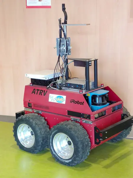
Rangueil, France - March 14, 2024 - Red ATRV, A Wheeled Mobile Robot By Real World Interface Inc., Instrumented And Tested By LAAS, The French National Research Center's (CNRS) Automation Laboratory
Image, 2.59MB, 1836 × 2448 jpg

UBONRATCHATHANI, THAILAND-SEPTEMBER 26, 2017 : Asian Smart Engineer Or Surveyor Is Working On Controller Screen For Surveying Land In Rice Field. GPS Surveying Instrument.
Image, 14.61MB, 6000 × 4000 jpg


Male Engineer Surveyor In Blue Helmet And Winter Jacket Stands In Front Of Building Under Construction In Protective Medical Mask From Coronavirus With A Tablet From GPS. Cold Clear Day. Mixed Media
Image, 14.46MB, 6720 × 4480 jpg
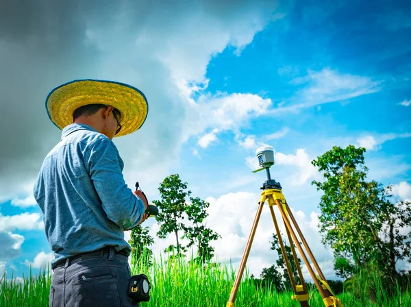
Asian Smart Engineer Or Surveyor In Black Jeans And Long Sleeve Shirt And Woven Bamboo Hat. He Is Working On Controller Screen For Surveying Land In Rice Field, Thailand. GPS Surveying Instrument.
Image, 11.27MB, 5348 × 4000 jpg

Geodetic Engineer Surveyor In White Hard Hat Doing Measurements With GNSS Satellite Receiver During Road Construction Works.
Image, 5.86MB, 3000 × 2250 jpg

Rangueil, France - March 14, 2024 - Red ATRV, A Wheeled Mobile Robot By Real World Interface Inc., Instrumented And Tested By LAAS, The French National Research Center's (CNRS) Automation Laboratory
Image, 3.57MB, 2250 × 3000 jpg
Surveyors Line Vector Icons And Signs. Mapping, Geologists, Survey, Measurement, Surveying, Geomatics, Civil, Cartography Vector Outline Illustration Set
Vector, 0.66MB, 4160 × 6000 eps
Global Navigation Satellite System (GNSS), A General Word For Satellite Navigation Systems, Is A Technology Communication Image,3d Rendering
Image, 11.86MB, 8000 × 4500 jpg

3d Rendering. Global Positioning System GPS Of Navigation Satellites Or Satnav Transmit Data Coverage Around Planet Earth
Image, 4.84MB, 6000 × 3375 jpg

Asian Smart Engineer Or Surveyor In Black Jeans And Long Sleeve Shirt And Woven Bamboo Hat. He Is Working On Controller Screen For Surveying Land In Rice Field, Thailand. GPS Surveying Instrument.
Image, 16.98MB, 5805 × 4000 jpg
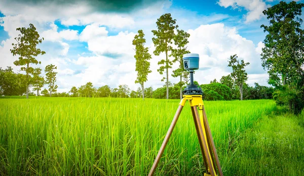
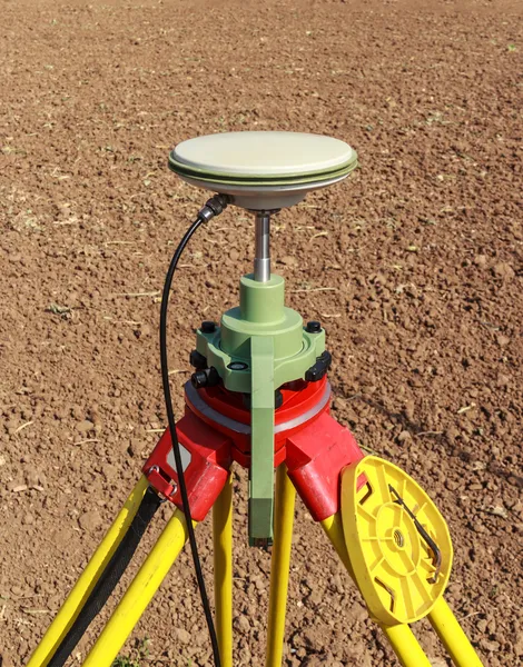
GPS Surveying Instrument Install On Tripod In Green Rice Field, Thailand
Image, 15.52MB, 6000 × 3490 jpg

Geodetic Tower Standing On The Ground And Used For Triangulation By Surveyors
Vector, 0.79MB, 5000 × 5000 eps

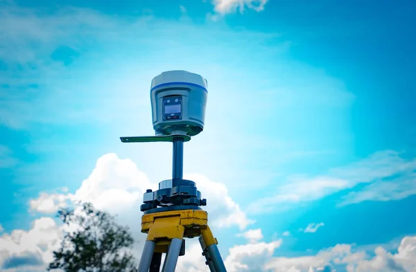
Open Sky Is A Dream Of Surveyor To Get Maximum Number Of Sattelites To Have Highly Precision Coordinates
Image, 7.54MB, 4940 × 3272 jpg
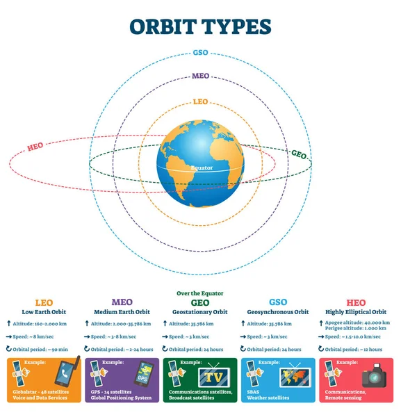
Orbit Types Vector Illustration. Labeled Satellites Altitude, Speed Scheme.
Vector, 7.47MB, 4000 × 4160 eps

3d Rendering. Global Positioning System GPS Of Navigation Satellites Or Satnav Transmit Data Coverage Around Planet Earth
Image, 3.73MB, 6000 × 3375 jpg
Page 1 >> Next