
Stock image Hydrological Engineering
Storm Water Drainage Concrete Ditch Tray Was Made As Drainage Canal Before Construction Of Road
Image, 20.94MB, 5432 × 3623 jpg

Before Construction Road, Storm Water Drainage Concrete Tray Rainwater Were Made Drainage Gutter
Image, 20.46MB, 5432 × 3623 jpg

Woven Straw Matt Used For Stormwater Erosion Control With Grass Growing Through . High Quality Photo
Image, 15.18MB, 8216 × 5477 jpg

Drainage Canals Were Constructed From Concrete Ditch Trays Used For Storm Water Drainage Before Construction Of Roads
Image, 19.69MB, 5555 × 3705 jpg

It Was Concrete Ditch Trays That Were Used For Storm Water Drainage That Were Used As Drainage Canals Before Roads Were Constructed
Image, 21.4MB, 5555 × 3705 jpg

Concrete Ditch Trays Used For Storm Water Drainage Were Made As Drainage Canal Before Construction Of Road
Image, 23.21MB, 5432 × 3623 jpg

Storm Water Drainage Trays Were Constructed As Drainage Canals Before Roads Were Constructed.
Image, 19.19MB, 5555 × 3705 jpg

Woven Straw Matt Used For Stormwater Erosion Control With Grass Growing Through . High Quality Photo
Image, 21.09MB, 10000 × 4500 jpg
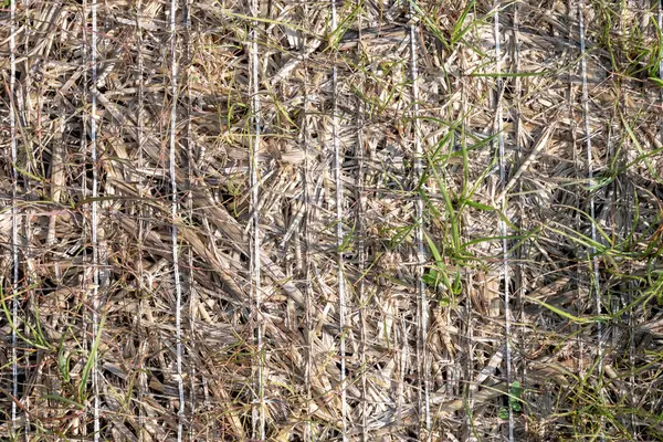
Woven Straw Matt Used For Stormwater Erosion Control With Grass Growing Through . High Quality Photo
Image, 25.86MB, 8216 × 5477 jpg

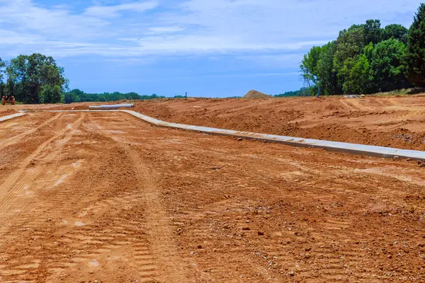
Concrete Ditch Trays Were Used To Drain Storm Water Before Construction Of Road
Image, 22.25MB, 5432 × 3623 jpg

Drainage Canal Was Constructed Before Construction Of Road For Storm Water Drainage
Image, 21.33MB, 5432 × 3623 jpg

Concrete Ditch Trays Were Used To Drain Storm Water As Drainage Canals Prior To Construction Of Roads
Image, 22.25MB, 5555 × 3705 jpg

Prior To Construction Of Roads, Concrete Ditch Trays Were Used As Drainage Canals For Storm Water
Image, 19.72MB, 5555 × 3705 jpg

View Of Kurobe Dam. The Kurobe Dam Or Kuroyon Dam Is A Variable-radius Arch Dam On The Kurobe River In Toyama Prefecture, Japan.
Image, 15.09MB, 4710 × 3144 jpg
High Resolution Orthorectified, Orthorectification Aerial Map Used For Photogrammetry In Banos Ecuador
Image, 2.87MB, 5000 × 3350 jpg
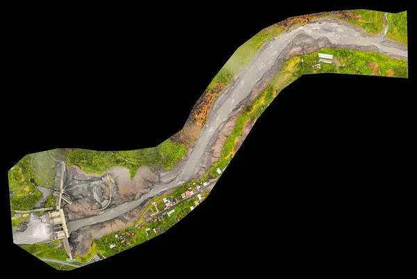
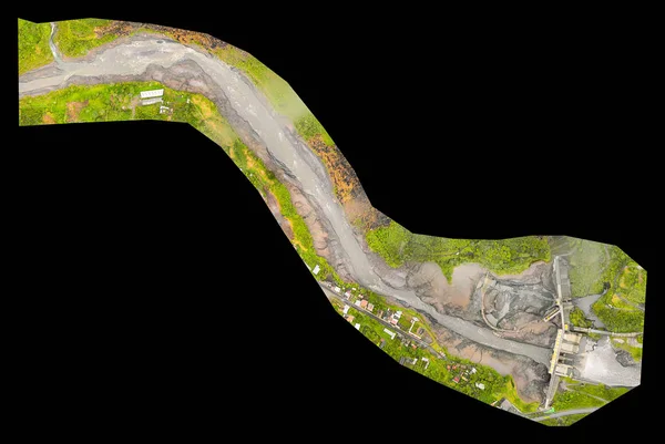
High Resolution Orthorectified Orthorectification Aerial Map Used For Photogrammetry In Banos Ecuador
Image, 5.91MB, 5000 × 3350 jpg

View Of Kurobe Dam. The Kurobe Dam Or Kuroyon Dam Is A Variable-radius Arch Dam On The Kurobe River In Toyama Prefecture, Japan.
Image, 11.92MB, 4710 × 3144 jpg

View Of Kurobe Dam. The Kurobe Dam Or Kuroyon Dam Is A Variable-radius Arch Dam On The Kurobe River In Toyama Prefecture, Japan.
Image, 22.6MB, 4912 × 7360 jpg
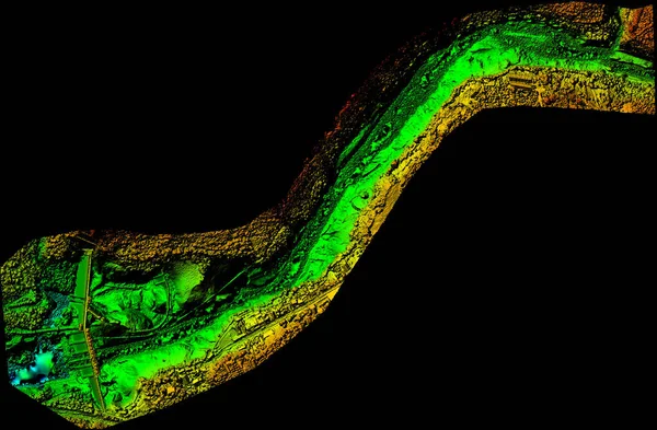
Digital Elevation Model Of Water Dam And Hydrologic Area High Tech Technology For Assessing Smart Engineering
Image, 8.54MB, 5000 × 3279 jpg
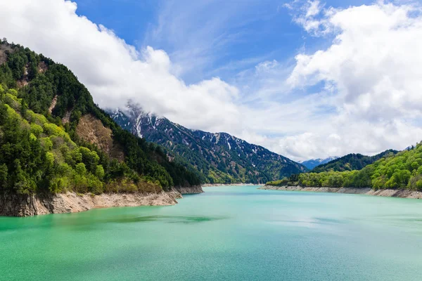
View Of Kurobe Dam. The Kurobe Dam Or Kuroyon Dam Is A Variable-radius Arch Dam On The Kurobe River In Toyama Prefecture, Japan.
Image, 9.17MB, 4461 × 2977 jpg
Page 1 >> Next