
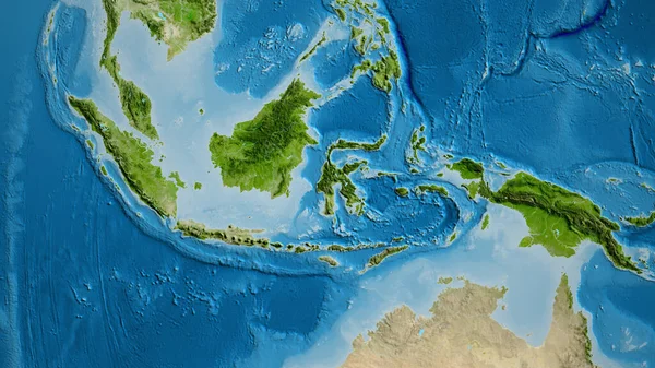
Stock image Idn

Pulau Kofiau In The Ceram Sea On A Topographic, OSM Humanitarian Style Map
Image, 0.42MB, 2880 × 1620 jpg

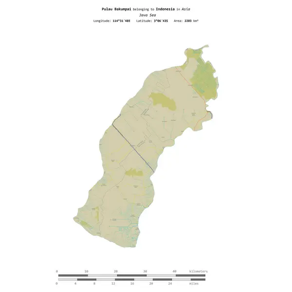
Pulau Bakumpai In The Java Sea, Belonging To Indonesia, Isolated On A Topographic, OSM Humanitarian Style Map, With Distance Scale
Image, 0.74MB, 2160 × 2160 jpg

Pulau Seram In The Ceram Sea, Belonging To Indonesia, Isolated On A Bilevel Elevation Map, With Distance Scale
Image, 0.45MB, 2160 × 2160 jpg


Pulau Alor In The Savu Sea - Belonging To Indonesia. Described Location Diagram With Yellow Shape Of The Island And Sample Maps Of Its Surroundings
Image, 2.38MB, 3840 × 2160 jpg

Pulau Tahulandang In The Molukka Sea - Belonging To Indonesia. Described Location Diagram With Yellow Shape Of The Island And Sample Maps Of Its Surroundings
Image, 2.18MB, 3840 × 2160 jpg

Pulau Tanahjampea In The Banda Sea - Belonging To Indonesia. Described Location Diagram With Yellow Shape Of The Island And Sample Maps Of Its Surroundings
Image, 2.06MB, 3840 × 2160 jpg

Pulau Tanah Masa In The Indian Ocean - Belonging To Indonesia. Described Location Diagram With Yellow Shape Of The Island And Sample Maps Of Its Surroundings
Image, 2.11MB, 3840 × 2160 jpg

Pulau Talatakoh In The Gulf Of Tomini - Belonging To Indonesia. Described Location Diagram With Yellow Shape Of The Island And Sample Maps Of Its Surroundings
Image, 2.65MB, 3840 × 2160 jpg

Pulau Wamar In The Arafura Sea - Belonging To Indonesia. Described Location Diagram With Yellow Shape Of The Island And Sample Maps Of Its Surroundings
Image, 2.13MB, 3840 × 2160 jpg

Pulau Workai In The Arafura Sea - Belonging To Indonesia. Described Location Diagram With Yellow Shape Of The Island And Sample Maps Of Its Surroundings
Image, 2.24MB, 3840 × 2160 jpg

Kobroor Island In The Arafura Sea On A Satellite Image Taken In September 9, 2019
Image, 5.08MB, 2880 × 1620 jpg

Pulau Batanta In The Halmahera Sea - Belonging To Indonesia. Described Location Diagram With Yellow Shape Of The Island And Sample Maps Of Its Surroundings
Image, 2.49MB, 3840 × 2160 jpg

Pulau Sangeang In The Flores Sea On A Topographic, OSM Humanitarian Style Map
Image, 0.3MB, 2880 × 1620 jpg
Pulau Sagin In The Arafura Sea On A Topographic, OSM Humanitarian Style Map
Image, 0.44MB, 2880 × 1620 jpg

Pulau Siantan In The South China Sea On A Topographic, OSM Humanitarian Style Map
Image, 0.71MB, 2880 × 1620 jpg

Pulau Siau In The Molukka Sea On A Topographic, OSM Humanitarian Style Map
Image, 0.48MB, 2880 × 1620 jpg

Pulau Mendanau In The Java Sea, Belonging To Indonesia, Isolated On A Satellite Image Taken In October 11, 2023, With Distance Scale
Image, 1.78MB, 2160 × 2160 jpg

Pulau Roon In The South Pacific Ocean, Belonging To Indonesia, Isolated On A Satellite Image Taken In April 26, 2021, With Distance Scale
Image, 0.8MB, 2160 × 2160 jpg

Pulau Salebabu In The Molukka Sea, Belonging To Indonesia, Isolated On A Satellite Image Taken In May 28, 2021, With Distance Scale
Image, 0.64MB, 2160 × 2160 jpg
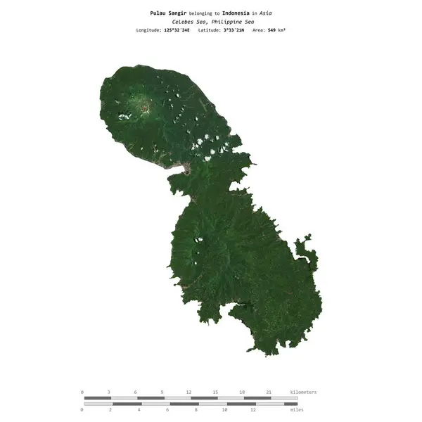
Pulau Sangir In The Celebes Sea, Belonging To Indonesia, Isolated On A Satellite Image Taken In April 13, 2020, With Distance Scale
Image, 1.33MB, 2160 × 2160 jpg

Pulau Sera In The Banda Sea, Belonging To Indonesia, Isolated On A Satellite Image Taken In August 17, 2021, With Distance Scale
Image, 1.26MB, 2160 × 2160 jpg

Pulau Selu In The Banda Sea, Belonging To Indonesia, Isolated On A Satellite Image Taken In September 1, 2023, With Distance Scale
Image, 1.22MB, 2160 × 2160 jpg

Pulau Liat In The Java Sea, Belonging To Indonesia, Isolated On A Satellite Image Taken In March 29, 2024, With Distance Scale
Image, 1.55MB, 2160 × 2160 jpg

Madura Island In The Java Sea, Belonging To Indonesia, Isolated On A Satellite Image Taken In October 11, 2018, With Distance Scale
Image, 0.97MB, 2160 × 2160 jpg

Pulau Maikoor In The Arafura Sea, Belonging To Indonesia, Isolated On A Satellite Image Taken In September 9, 2019, With Distance Scale
Image, 1.15MB, 2160 × 2160 jpg

Pulau Haruku In The Banda Sea On A Topographic, OSM Humanitarian Style Map
Image, 0.87MB, 2880 × 1620 jpg

Pulau Kapaladjernih In The South China Sea On A Topographic, OSM Humanitarian Style Map
Image, 0.68MB, 2880 × 1620 jpg

Pulau Kai Kecil In The Banda Sea On A Topographic, OSM Humanitarian Style Map
Image, 0.88MB, 2880 × 1620 jpg

Pulau Laut In The Java Sea On A Topographic, OSM Humanitarian Style Map
Image, 1.31MB, 2880 × 1620 jpg

Pulau Kurkam In The Ceram Sea On A Topographic, OSM Humanitarian Style Map
Image, 0.29MB, 2880 × 1620 jpg

Pulau Labengke In The Banda Sea On A Topographic, OSM Humanitarian Style Map
Image, 0.4MB, 2880 × 1620 jpg

Pulau Labobo In The Banda Sea On A Topographic, OSM Humanitarian Style Map
Image, 0.36MB, 2880 × 1620 jpg

Pulau Rantau In The Malacca Strait On A Topographic, OSM Humanitarian Style Map
Image, 3.17MB, 2880 × 1620 jpg

Pulau Obit In The Molukka Sea On A Topographic, OSM Humanitarian Style Map
Image, 0.78MB, 2880 × 1620 jpg

Pulau Moty In The Molukka Sea On A Topographic, OSM Humanitarian Style Map
Image, 0.31MB, 2880 × 1620 jpg

Pulau Dullah In The Banda Sea On A Topographic, OSM Humanitarian Style Map
Image, 0.95MB, 2880 × 1620 jpg

Pulau Meos Waar In The South Pacific Ocean - Belonging To Indonesia. Described Location Diagram With Yellow Shape Of The Island And Sample Maps Of Its Surroundings
Image, 1.83MB, 3840 × 2160 jpg

Pulau Mubur In The South China Sea - Belonging To Indonesia. Described Location Diagram With Yellow Shape Of The Island And Sample Maps Of Its Surroundings
Image, 2.35MB, 3840 × 2160 jpg

Pulau Babar In The Banda Sea, Belonging To Indonesia, Isolated On A Topographic, OSM Humanitarian Style Map, With Distance Scale
Image, 0.4MB, 2160 × 2160 jpg

Pulau Amutu Besar In The Ceram Sea, Belonging To Indonesia, Isolated On A Topographic, OSM Humanitarian Style Map, With Distance Scale
Image, 0.25MB, 2160 × 2160 jpg

Pulau Selaru In The Banda Sea - Belonging To Indonesia. Described Location Diagram With Yellow Shape Of The Island And Sample Maps Of Its Surroundings
Image, 1.87MB, 3840 × 2160 jpg

Pulau Singkep In The South China Sea - Belonging To Indonesia. Described Location Diagram With Yellow Shape Of The Island And Sample Maps Of Its Surroundings
Image, 2.09MB, 3840 × 2160 jpg

Sumatra Island In The Java Sea - Belonging To Indonesia. Described Location Diagram With Yellow Shape Of The Island And Sample Maps Of Its Surroundings
Image, 2.87MB, 3840 × 2160 jpg

Pulau Roon In The South Pacific Ocean - Belonging To Indonesia. Described Location Diagram With Yellow Shape Of The Island And Sample Maps Of Its Surroundings
Image, 1.8MB, 3840 × 2160 jpg

Pulau Samosir In The Lake Toba - Belonging To Indonesia. Described Location Diagram With Yellow Shape Of The Island And Sample Maps Of Its Surroundings
Image, 3.29MB, 3840 × 2160 jpg

Page 1 >> Next