photo free
Home Images Vectors Videos

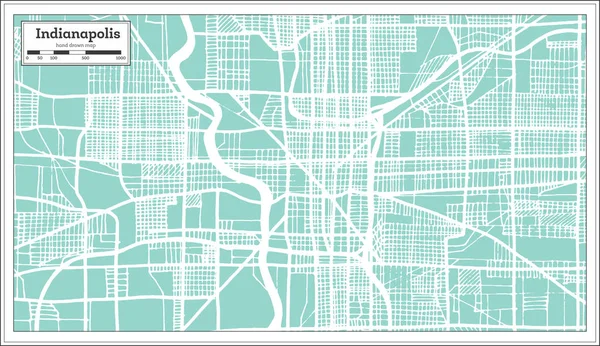
Stock image Indianapolis Map

stock image Indianapolis on USA map travel background

Indianapolis On USA Map Travel Background

Image, 14.94MB, 6000 × 4000 jpg
stock vector map of the city of Indianapolis, Indiana, USA

Map Of The City Of Indianapolis, Indiana, USA

Vector, 29.36MB, 4937 × 6276 eps
stock vector Indiana cities map

Indiana Cities Map

Vector, 8.34MB, 3504 × 5004 eps
stock vector Indianapolis, Indiana. Downtown vector map.

Indianapolis, Indiana. Downtown Vector Map.

Vector, 2.95MB, 8000 × 8000 eps
stock vector Grunge rubber stamp with name of Indianapolis, Indiana

Grunge Rubber Stamp With Name Of Indianapolis, Indiana

Vector, 2.15MB, 5669 × 5669 eps
stock image Indianapolis, indiana in the USA on the map

Indianapolis, Indiana In The USA On The Map

Image, 5.02MB, 4928 × 3264 jpg
stock vector Indianapolis map. Detailed map of Indianapolis city administrative area. Cityscape panorama. Royalty free vector illustration. Outline map with highways, streets, rivers. Tourist decorative street map.

Indianapolis Map. Detailed Map Of Indianapolis City Administrative Area. Cityscape Panorama. Royalty Free Vector Illustration. Outline Map With Highways, Streets, Rivers. Tourist Decorative Street Map.

Vector, 31.84MB, 4053 × 4053 eps
stock image Knoxville on USA map background

Knoxville On USA Map Background

Image, 8.98MB, 5563 × 3709 jpg
stock image Knoxville on USA map background

Knoxville On USA Map Background

Image, 14.79MB, 5743 × 3829 jpg
stock image Knoxville on USA map background

Knoxville On USA Map Background

Image, 12.07MB, 5691 × 3794 jpg
stock vector Indianapolis map infographic vector illustration

Indianapolis Map Infographic Vector Illustration

Vector, 1.79MB, 2469 × 2000 eps
stock vector Indiana State Interstate Map

Indiana State Interstate Map

Vector, 2.63MB, 3636 × 5199 eps
stock vector Road map of Indianapolis in Indiana. Contains layered vector with roads water, parks, etc.

Road Map Of Indianapolis In Indiana. Contains Layered Vector With Roads Water, Parks, Etc.

Vector, 10.91MB, 2400 × 2400 eps
stock vector Map of Indianapolis in Indiana in grayscale. Contains layered vector with roads water, parks, etc.

Map Of Indianapolis In Indiana In Grayscale. Contains Layered Vector With Roads Water, Parks, Etc.

Vector, 10.89MB, 2400 × 2400 eps
stock vector Map of Indianapolis in Indiana in blue. Contains layered vector with roads water, parks, etc.

Map Of Indianapolis In Indiana In Blue. Contains Layered Vector With Roads Water, Parks, Etc.

Vector, 9.33MB, 2400 × 2400 eps
stock vector Label set with names of Indiana cities

Label Set With Names Of Indiana Cities

Vector, 0.88MB, 4252 × 4252 eps
stock vector vector map of United States with indication of Indiana

Vector Map Of United States With Indication Of Indiana

Vector, 1.73MB, 4600 × 3450 eps
stock vector United States of America isolated map and Indiana State territory. vector USA political map. geographic banner template

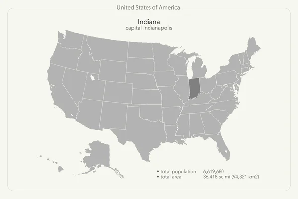
United States Of America Isolated Map And Indiana State Territory. Vector USA Political Map. Geographic Banner Template

Vector, 0.72MB, 6000 × 4000 eps
stock vector Streets of Indianapolis, city map, capital city, Indiana. Streets and urban area. Usa. The city is the capital and most populous city of the U.S. state of Indiana and the seat of Marion County

Streets Of Indianapolis, City Map, Capital City, Indiana. Streets And Urban Area. Usa. The City Is The Capital And Most Populous City Of The U.S. State Of Indiana And The Seat Of Marion County

Vector, 4.7MB, 6659 × 4992 eps
stock vector USA map puzzle - One state-one puzzle piece - Indiana, Indianapolis

USA Map Puzzle - One State-one Puzzle Piece - Indiana, Indianapolis

Vector, 7.75MB, 2200 × 2200 eps
stock vector Canada, United States and Mexico detailed map with states names and borders. Flags and largest cities skylines outline icons of United States, Canada and Mexico

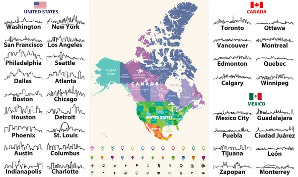
Canada, United States And Mexico Detailed Map With States Names And Borders. Flags And Largest Cities Skylines Outline Icons Of United States, Canada And Mexico

Vector, 13.55MB, 8333 × 4975 eps
stock vector Highly detailed vector silhouettes of US state maps, Division United States into counties, political and geographic subdivisions of a states, East North Central - Illinois, Indiana, Ohio - set 4 of 17

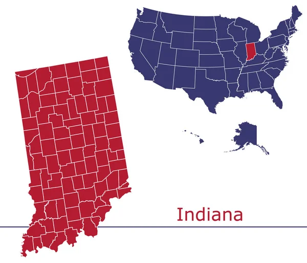
Highly Detailed Vector Silhouettes Of US State Maps, Division United States Into Counties, Political And Geographic Subdivisions Of A States, East North Central - Illinois, Indiana, Ohio - Set 4 Of 17

Vector, 6.95MB, 9608 × 4501 eps
stock vector Indiana counties vector map with USA map colors national flag

Indiana Counties Vector Map With USA Map Colors National Flag

Vector, 22.48MB, 4680 × 4024 eps
stock vector Indianapolis USA City Map in Retro Style. Outline Map.

Indianapolis USA City Map In Retro Style. Outline Map.

Vector, 3.46MB, 8150 × 4702 eps
stock vector Urban vector city map of Indianapolis,Indiana, United States of America

Urban Vector City Map Of Indianapolis,Indiana, United States Of America

Vector, 3.55MB, 6000 × 3110 eps
stock vector road map of the US American State of indiana

Road Map Of The US American State Of Indiana

Vector, 1.5MB, 3100 × 4581 eps
stock vector Indianapolis, Indiana, two logo artworks

Indianapolis, Indiana, Two Logo Artworks

Vector, 2.28MB, 10667 × 5334 eps
stock vector Satellite map of Indianapolis, Indiana, Usa, city streets. Street map and map of the city center

Satellite Map Of Indianapolis, Indiana, Usa, City Streets. Street Map And Map Of The City Center

Vector, 8.09MB, 10067 × 5984 eps
stock vector Indiana map

Indiana Map

Vector, 8.29MB, 7002 × 7002 eps
stock vector Vector hand drawn stylized map of The United States of America. Travel illustration of USA cities. Hand drawn lettering illustration. North America map element

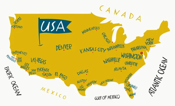
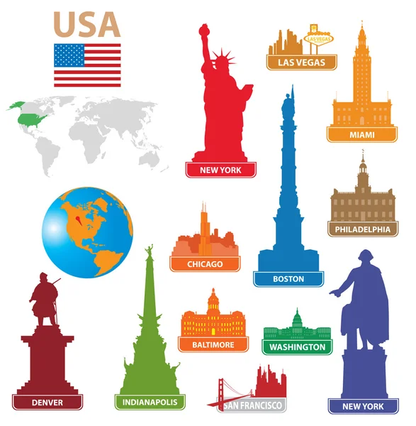
Vector Hand Drawn Stylized Map Of The United States Of America. Travel Illustration Of USA Cities. Hand Drawn Lettering Illustration. North America Map Element

Vector, 0.5MB, 6600 × 4000 eps
stock vector Indiana USA State Map

Indiana USA State Map

Vector, 0.43MB, 5200 × 5200 eps
stock vector Two versions of the map of US State Indiana, with the flag of Indiana and highlighted in dark grey. Vector map.

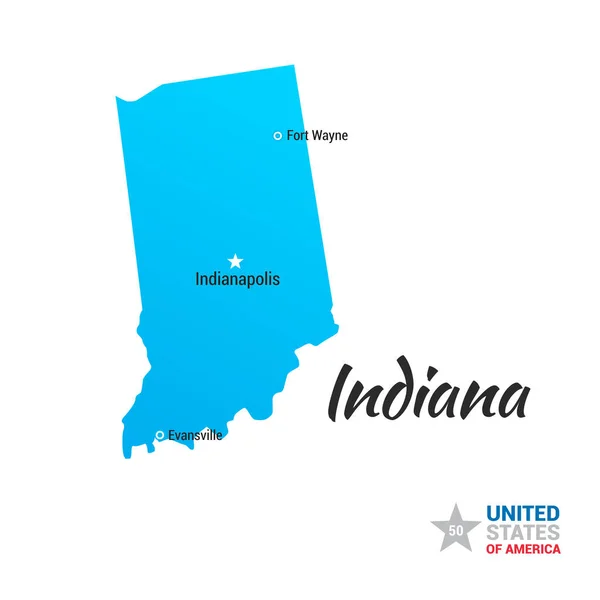
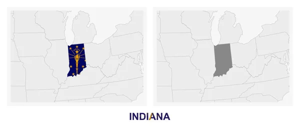
Two Versions Of The Map Of US State Indiana, With The Flag Of Indiana And Highlighted In Dark Grey. Vector Map.

Vector, 0.66MB, 8000 × 3388 eps
stock vector Indiana, IN, political map, with the capital Indianapolis, and most important cities, rivers and lakes. State in the Midwestern region of the United States of America, nicknamed The Hoosier State.

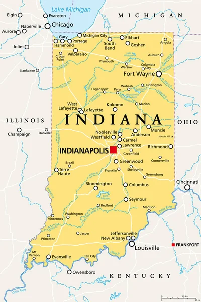
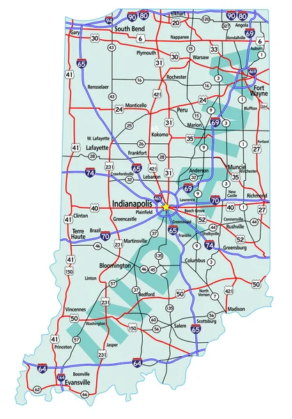
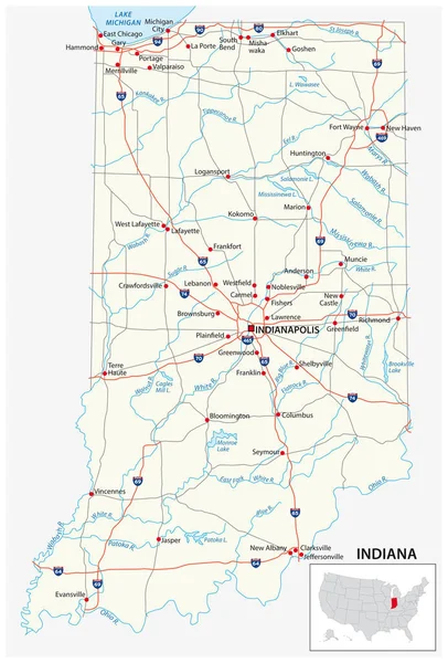
Indiana, IN, Political Map, With The Capital Indianapolis, And Most Important Cities, Rivers And Lakes. State In The Midwestern Region Of The United States Of America, Nicknamed The Hoosier State.

Vector, 3.4MB, 6000 × 9000 eps
stock vector Symbols city USA

Symbols City USA

Vector, 2.52MB, 2600 × 2658 eps
stock vector Indiana State silhouette map

Indiana State Silhouette Map

Vector, 8.07MB, 3504 × 5004 eps
stock vector Simple black vector map of the Federal State of Indiana, USA

Simple Black Vector Map Of The Federal State Of Indiana, USA

Vector, 0.41MB, 4001 × 6200 eps
stock vector circuit for motorsport and autosport

Circuit For Motorsport And Autosport

Vector, 8.86MB, 4000 × 4000 eps
stock vector Indiana vector maps counties, townships, regions, municipalities, departments, borders

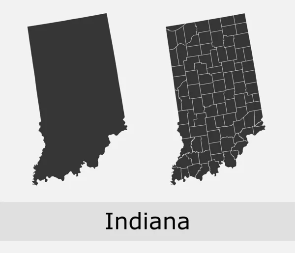
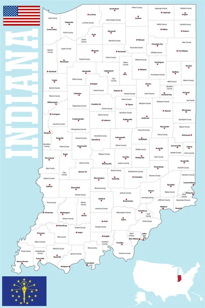
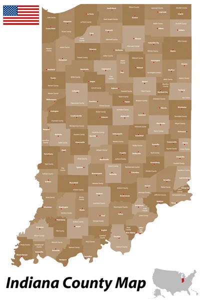
Indiana Vector Maps Counties, Townships, Regions, Municipalities, Departments, Borders

Vector, 5.3MB, 4690 × 4032 eps
stock vector Indiana County Map

Indiana County Map

Vector, 0.84MB, 3336 × 5000 ai
stock vector Indiana state map polygonal with spot lights places

Indiana State Map Polygonal With Spot Lights Places

Vector, 4.47MB, 6621 × 5000 eps
stock vector Vector set 4 of 10 Highly detailed silhouettes of US state maps, divided into counties with names and territory nicknames

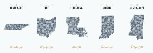
Vector Set 4 Of 10 Highly Detailed Silhouettes Of US State Maps, Divided Into Counties With Names And Territory Nicknames

Vector, 6.15MB, 9585 × 3348 eps
stock image Map of Indiana - USA

Map Of Indiana - USA

Image, 9.21MB, 8000 × 9000 jpg
stock image State of Indiana map

State Of Indiana Map

Image, 0.84MB, 4300 × 2800 jpg
stock vector Indiana County Map

Indiana County Map

Vector, 0.89MB, 3337 × 5000 ai
stock vector Indiana State on USA Map. Indiana flag and map.

Indiana State On USA Map. Indiana Flag And Map.

Vector, 1.13MB, 5000 × 3663 eps
stock image New York NY Skyline City Metropolitan Area Nightlife 3d Illustration

New York NY Skyline City Metropolitan Area Nightlife 3d Illustration

Image, 2.04MB, 5000 × 4000 jpg
stock vector set of grand prix race track.

Set Of Grand Prix Race Track.

Vector, 6.75MB, 5600 × 4000 eps
stock vector Indiana map

Indiana Map

Vector, 4.17MB, 5202 × 3954 eps
stock vector USA map with magnified Indiana State. Indiana flag and map.

USA Map With Magnified Indiana State. Indiana Flag And Map.

Vector, 1.9MB, 5000 × 3125 eps
stock image Indiana  State Map

Indiana State Map

Image, 10.17MB, 5000 × 3000 jpg
Page 1 >> Next