
Stock image Island Saint Croix Map

Saint Croix Map Island Silhouette Icon Isolated Saint Croix Black Map Outline Vector
Vector, 0.2MB, 8333 × 8333 eps

Saint Croix Map On Road Sign Wide Poster With Saint Croix Island Map On Yellow Rhomb Road Sign
Vector, 0.3MB, 6930 × 3465 eps


British, Spanish And United States Virgin Islands, Gray Political Map. Archipelago In The Caribbean Sea. British Overseas Territory And Unincorporated Territories Of The USA. Illustration. Vector.
Vector, 2.26MB, 9000 × 6000 eps

Virgin Islands Of The United States Of America (United States Of America, USA, US) Map Vector Illustration, Scribble Sketch United States Virgin Islands (Saint Thomas, Saint John, Saint Croix) Map
Vector, 1.02MB, 7087 × 4726 eps
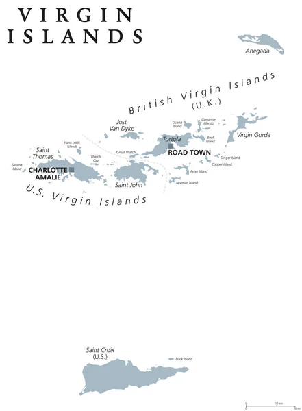
Virgin Islands Map With Political Jurisdictions. British, Spanish And U.S. Virgin Islands In The Caribbean. British Overseas Territory And Unincorporated Territories Of The USA. Illustration. Vector.
Vector, 1.96MB, 9000 × 6000 eps

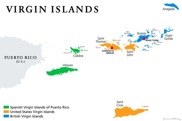
British, Spanish And United States Virgin Islands Political Map. Archipelago In The Caribbean Sea. British Overseas Territory And Unincorporated Territories Of The United States. Illustration. Vector.
Vector, 2.73MB, 9000 × 6000 eps
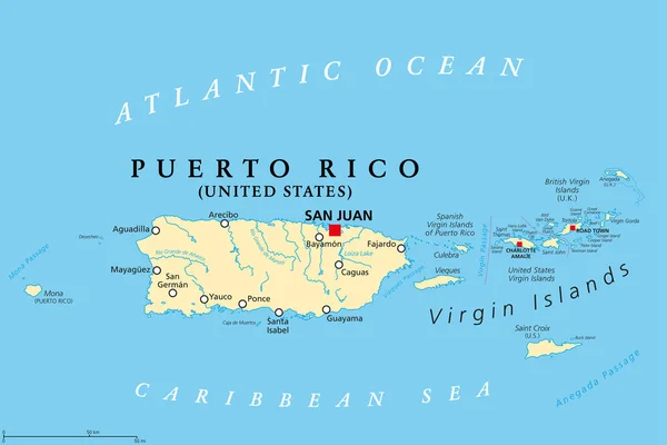
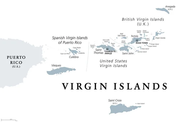
Puerto Rico And Virgin Islands, Political Map. British, Spanish And United States Virgin Islands. British Overseas Territory And Unincorporated Territories Of The United States. Illustration. Vector.
Vector, 3.01MB, 9000 × 6000 eps
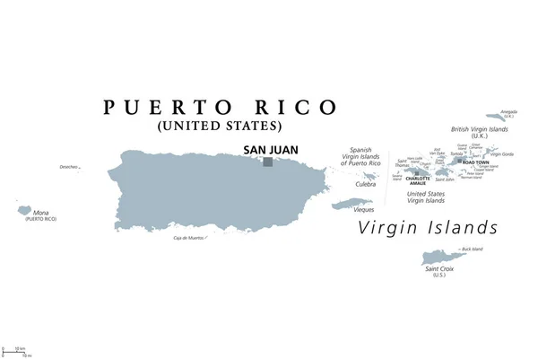
Puerto Rico And Virgin Islands, Gray Political Map. British, Spanish And U.S. Virgin Islands. British Overseas Territory And Unincorporated Territories Of The USA. Illustration Over White. Vector.
Vector, 2.28MB, 9000 × 6000 eps
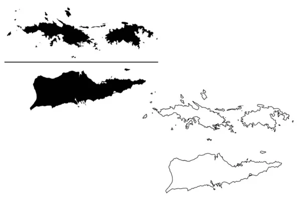
Virgin Islands Of The United States Of America (United States Of America, USA, US) Map Vector Illustration, Scribble Sketch United States Virgin Islands (Saint Thomas, Saint John, Saint Croix) Map
Vector, 1.58MB, 7087 × 4726 eps
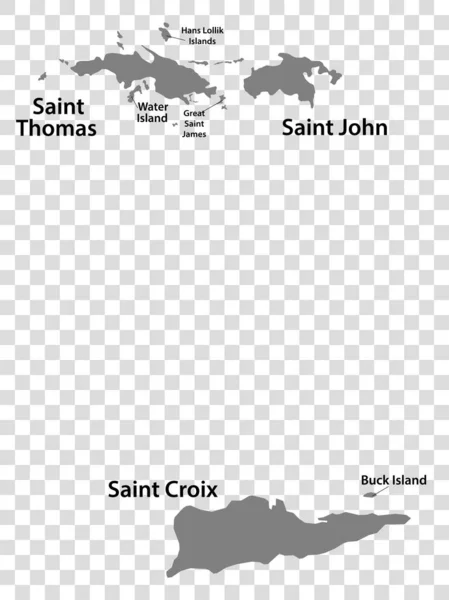
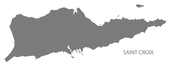
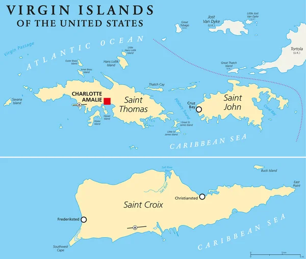
Blank Map United States Virgin Islands In Gray. Every Island Map Is With Titles. High Quality Map Of Virgin Islands On Transparent Background For Your Design. Caribbean. EPS10.
Vector, 4.14MB, 5000 × 6668 eps

Saint Croix Island In The Caribbean Sea On A Topographic, OSM Humanitarian Style Map
Image, 0.66MB, 2880 × 1620 jpg

Saint Croix Island In The Caribbean Sea, Belonging To U. S. Virgin Islands, Isolated On A Bilevel Elevation Map, With Distance Scale
Image, 0.37MB, 2160 × 2160 jpg


Saint Croix Island In The Caribbean Sea, Belonging To U. S. Virgin Islands, Isolated On A Topographic, OSM Humanitarian Style Map, With Distance Scale
Image, 0.77MB, 2160 × 2160 jpg

Saint Croix Island In The Caribbean Sea, Belonging To U. S. Virgin Islands, Isolated On A Satellite Image Taken In December 15, 2020, With Distance Scale
Image, 0.88MB, 2160 × 2160 jpg

Saint Croix Island In The Caribbean Sea On A Satellite Image Taken In March 30, 2020
Image, 3.99MB, 2880 × 1620 jpg

Saint Croix Island In The Caribbean Sea - Belonging To U. S. Virgin Islands. Described Location Diagram With Yellow Shape Of The Island And Sample Maps Of Its Surroundings
Image, 2.01MB, 3840 × 2160 jpg
Page 1 >> Next