
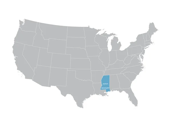
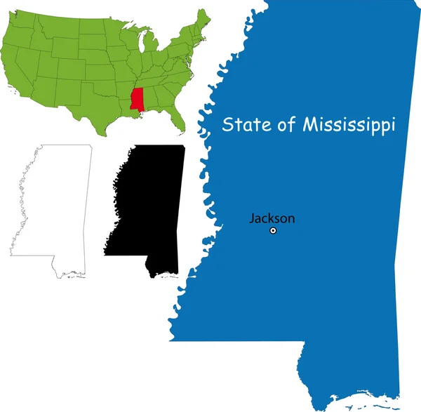
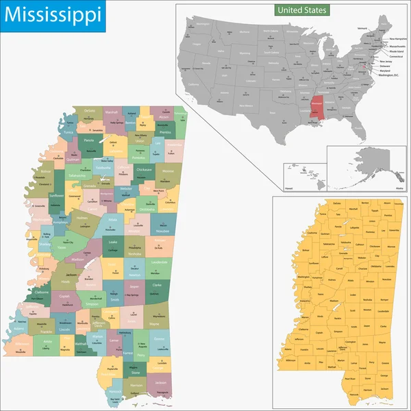
Stock image Jackson County
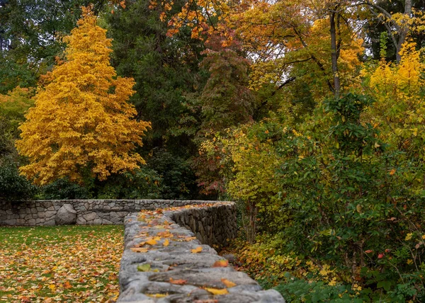
Leading Line From A Wall At Lithia Park In Ashland, Oregon, USA, Featuring Yellow Leaves In The Autumn. Ashland Is The Home Of The Shakespeare Festival
Image, 4.12MB, 3295 × 2353 jpg

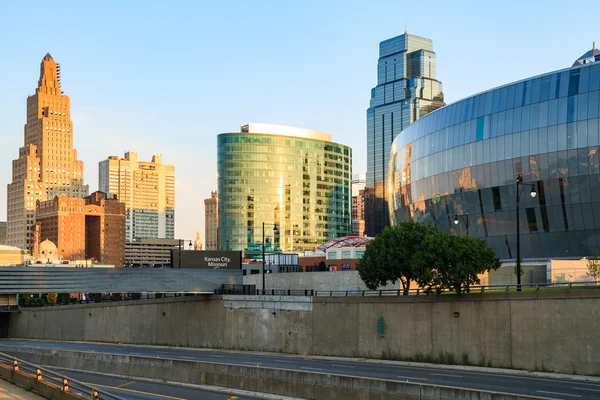
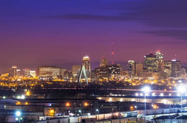
Kansas City, Missouri, USA On March 22, 2014. A Image Of The Kansas City Scout Overlooking Kansas City At Sunrise. The Indian Scout Is Known As A Kansas City Landmark And Symbol Of The City. The Scout Overlooks The Kansas City Skyline.
Image, 0MB, 4896 × 3264 jpg

Sylva, North Carolina: View From Historic Courthouse Stairs. Fountain And West Main Street. Blue Ridge Inn, Wells Fargo Bank, Sylva Police Department. Blue Ridge Mountains Surround The Town.
Image, 21.54MB, 5991 × 3994 jpg

Seen From A Bird's Eye View Forest Covers The Hills Surrounding Ashland, A Quaint City In Southern Oregon. This Area Is Known For Mountain Biking And The Oregon Shakespeare Festival.
Image, 6.96MB, 6000 × 1527 jpg

Soco Falls In Jackson County, North Carolina Is A Beautiful, Double Waterfall On The Edge Of The Cherokee Indian Reservation, Located Between The Towns Of Maggie Valley And Cherokee. South Of The Blue Ridge Parkway (at Soco Gap At Milepost 455.7)
Image, 7.48MB, 6000 × 4000 jpg
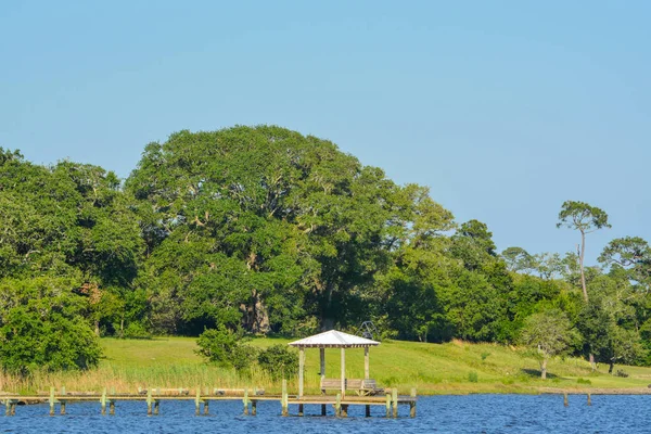
A Fishing Pier On The Mississippi Gulf Coast In The City Of Ocean Springs, Jackson County, Mississippi, USA
Image, 18.02MB, 5999 × 3999 jpg
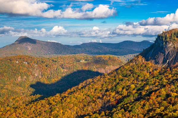
Whiteside Mountain, North Carolina, USA With The "Shadow Of The Bear" Shadow.
Image, 44.35MB, 8256 × 5504 jpg


Seen From A Bird's Eye View, A Forest Covers The Hills Surrounding Ashland, A Quaint City In Southern Oregon. This Area Is Known For Mountain Biking And The Oregon Shakespeare Festival.
Image, 14.19MB, 3597 × 5400 jpg
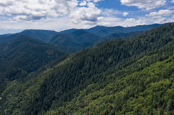
Seen From A Bird's Eye View, A Forest Covers The Hills Surrounding Ashland, A Quaint City In Southern Oregon. This Area Is Known For Mountain Biking And The Oregon Shakespeare Festival.
Image, 12.54MB, 5400 × 3597 jpg

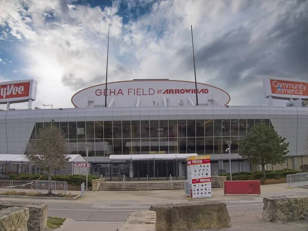
Kansas City, Missouri - December 28, 2023: GEHA Field At Arrowhead Stadium - KC Chiefs Football
Image, 8.07MB, 5776 × 4336 jpg

Kansas City, Missouri - December 28, 2023: GEHA Field At Arrowhead Stadium - KC Chiefs Football
Image, 6.67MB, 5510 × 4136 jpg


Kansas City, Missouri - December 28, 2023: GEHA Field At Arrowhead Stadium - KC Chiefs Football
Image, 3.3MB, 4104 × 3081 jpg

Lost Creek Bridge Sits In Jackson County, Oregon. It Was Built In 1881 And Sits Over Lost Creek.
Image, 18.22MB, 5921 × 3136 jpg

Flag Of The City Of Lee's Summit, Missouri, USA, On A Background Of A Wooden Fence. Conceptual Collage.
Image, 15.54MB, 5000 × 3000 jpg

Flag Of The City Of Lee's Summit, Missouri, USA, On A Background Of A Wooden Fence. Conceptual Collage.
Image, 13.84MB, 5000 × 3000 jpg

Flag Of The City Of Lee's Summit, Missouri, USA, On A Background Of Fabric Texture. Conceptual Collage.
Image, 24.64MB, 5000 × 3000 jpg

Flag Of The City Of Lee's Summit, Missouri, USA, On A Background Of The Stone Wall. Conceptual Collage.
Image, 10.86MB, 5000 × 3000 jpg

Flag Of The City Of Lee's Summit, Missouri, USA, Original Colors And Proportions. Illustration.
Image, 0.3MB, 5000 × 3000 jpg


Kansas City, Missouri - December 28, 2023: GEHA Field At Arrowhead Stadium - KC Chiefs Football
Image, 4.67MB, 5330 × 3553 jpg

Flag Of The City Of Lee's Summit, Missouri, USA, On A Background Of A Cracked Wall. Conceptual Collage.
Image, 13.27MB, 5000 × 3000 jpg

Flag Of The City Of Lee's Summit, Missouri, USA, On A Background Of Fabric Texture. Conceptual Collage.
Image, 15.33MB, 5000 × 3000 jpg


Queens Map Poster. New York City Borough Street Map. Cityscape Aria Panorama Silhouette Aerial View, Typography Style. Flushing Meadows, Corona, Field, Ozone, Jackson Heights, Flushing, Long Island.
Vector, 5.1MB, 4533 × 3767 eps
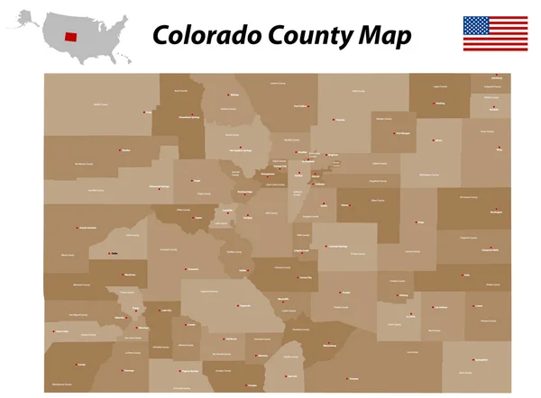
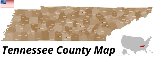
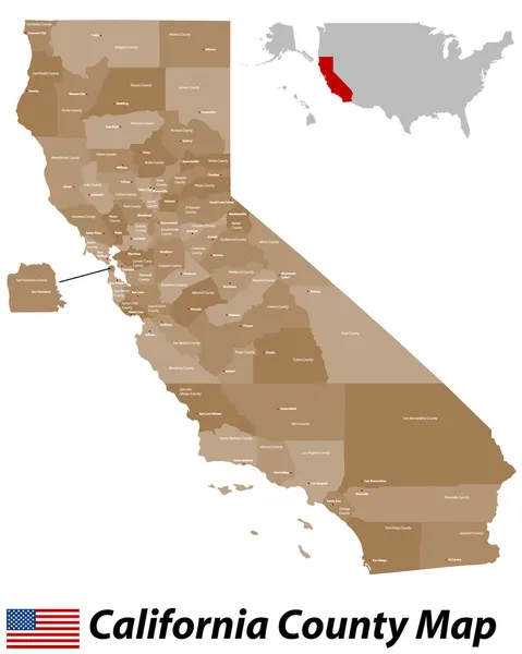
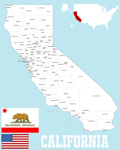
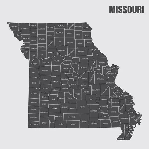
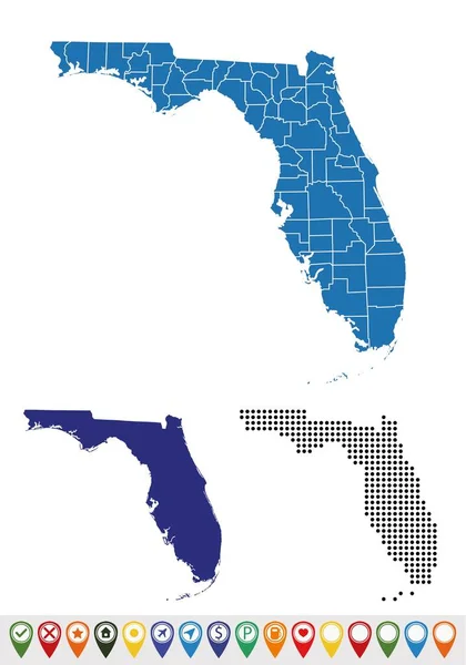
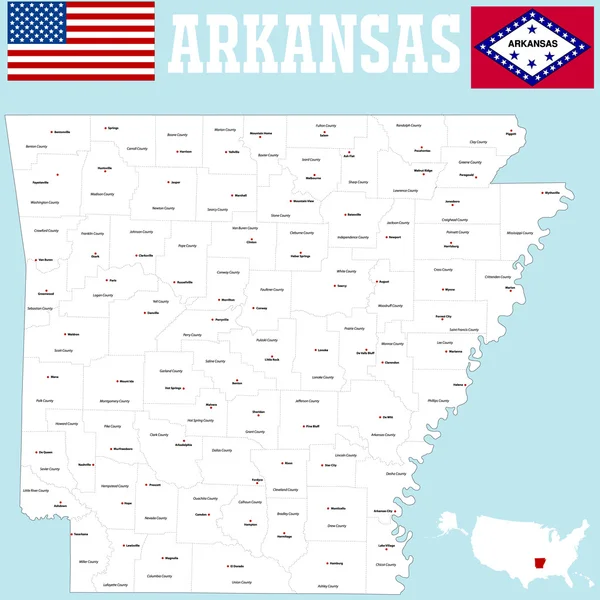
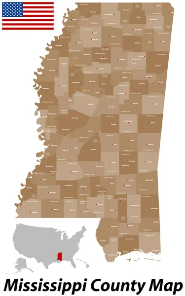
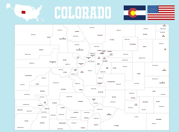
Vector Set 4 Of 10 Highly Detailed Silhouettes Of US State Maps, Divided Into Counties With Names And Territory Nicknames
Vector, 6.15MB, 9585 × 3348 eps

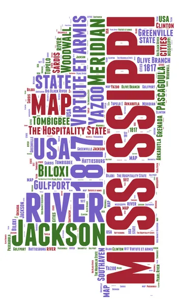

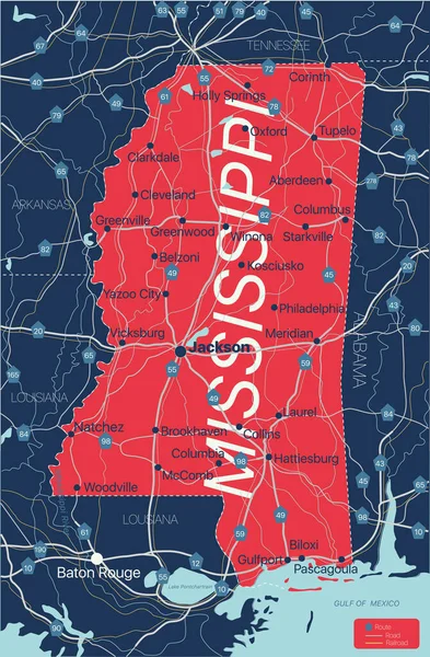
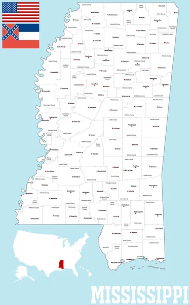
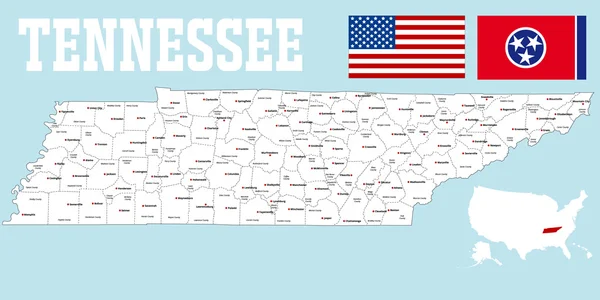
Highly Detailed Vector Silhouettes Of US State Maps, Division United States Into Counties, Political And Geographic Subdivisions Of A States, East South Central - Mississippi, Kentucky, Tennessee - Set 11 Of 17
Vector, 9.34MB, 9608 × 4501 eps
Page 1 >> Next