
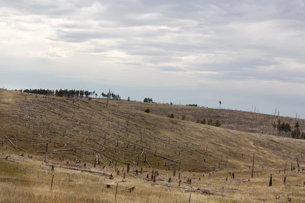
Stock image Land Use Change

Aerial View Of Deforestation Area For Agricultural Land By Drone. Contact Zone Between Forest And Plantation
Image, 20.62MB, 5464 × 3640 jpg


Conceptual Photo About Land Use And Zoning Law? With Handwritten Phrase
Image, 9.08MB, 5000 × 3750 jpg
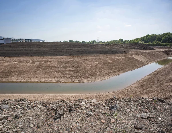
Land Remediation On Site Of Former Chemical Works, Prior To Redevelopment, UK.
Image, 21.37MB, 5160 × 4016 jpg
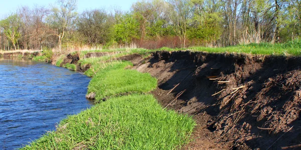
River Bank Erosion Often Occurs Along Meander Bends Such As This One On The Kishwaukee River In Northern Illinois.
Image, 11.42MB, 4750 × 2375 jpg
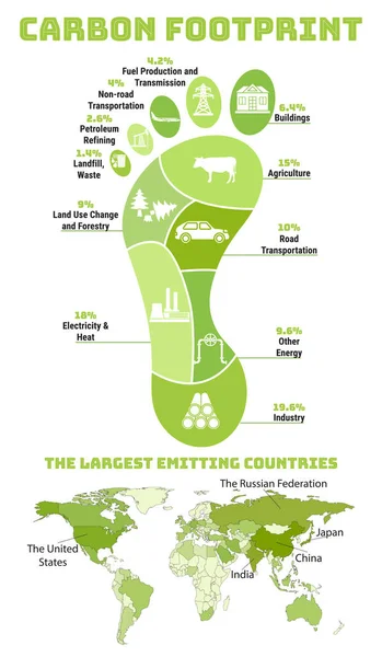
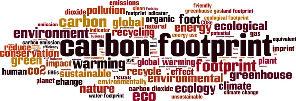
Carbon Footprint Infographic. CO2 Ecological Footprint. Greenhouse Gas Emission By Sector. Environmental And Climate Change Concept. The Largest Emitting Countries. Hand Drawn Vector Illustration.
Vector, 19.59MB, 3500 × 6000 eps

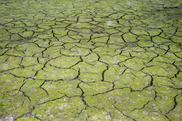
Desertification Of The Caatinga Biome In The Hinterland Of Paraiba, Northeastern Brazil. Caused By Deforestation, Fires, Erosion And Inadequate Land Use.
Image, 10.55MB, 4608 × 3072 jpg

Desertification Of The Caatinga Biome In The Hinterland Of Paraiba, Northeastern Brazil. Caused By Deforestation, Fires, Erosion And Inadequate Land Use.
Image, 10.36MB, 4608 × 3072 jpg
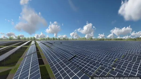
Assessing The Viability Of Large-Scale Solar Farms In Urban Settings
Image, 31.17MB, 11648 × 6528 jpg

Aerial View Of An Eroded Riverbank And Silted River, Highlighting Environmental Challenges And The Impact Of Erosion
Image, 9.14MB, 3840 × 2160 jpg

Carbon Footprint Infographic. CO2 Ecological Footprint Scheme. Greenhouse Gas Emission By Sector. Environmental And Climate Change Concept. True Data From Report. Hand Drawn Vector Illustration.
Vector, 5.62MB, 5000 × 5000 eps

Desertification Of The Caatinga Biome In The Hinterland Of Paraiba, Northeastern Brazil. Caused By Deforestation, Fires, Erosion And Inadequate Land Use.
Image, 9.22MB, 4608 × 3072 jpg

Desertification Of The Caatinga Biome In The Hinterland Of Paraiba, Northeastern Brazil. Caused By Deforestation, Fires, Erosion And Inadequate Land Use.
Image, 9.48MB, 4608 × 3072 jpg

Desertification Of The Caatinga Biome In The Hinterland Of Paraiba, Northeastern Brazil. Caused By Deforestation, Fires, Erosion And Inadequate Land Use.
Image, 12.45MB, 4608 × 3072 jpg

Fire And Smoke In The Sugarcane Field In Mamanguape, Paraiba, Brazil
Image, 14.82MB, 7258 × 4844 jpg

Tall Wind Turbines Gracefully Rotate, Generating Renewable Energy Amidst The Serene Dutch Landscape Of Golden Fields.
Image, 9.7MB, 7702 × 2861 jpg

Graceful Wind Turbines Harnessing Renewable Energy Stand Tall Against A Backdrop Of Blue Sky And Green Fields In The Noordoostpolder Netherlands
Image, 11.21MB, 7728 × 4347 jpg

A Steaming Industrial Chimney Rises Above Fields Of Young Sprouts, Illustrating The Stark Contrast Between Industry And Agriculture.
Image, 13.02MB, 5184 × 3456 jpg

Fire And Smoke In The Sugarcane Field In Mamanguape, Paraiba, Brazil
Image, 13.05MB, 7360 × 4912 jpg

Desertification Of The Caatinga Biome In The Hinterland Of Paraiba, Northeastern Brazil. Caused By Deforestation, Fires, Erosion And Inadequate Land Use.
Image, 9.96MB, 4608 × 3072 jpg
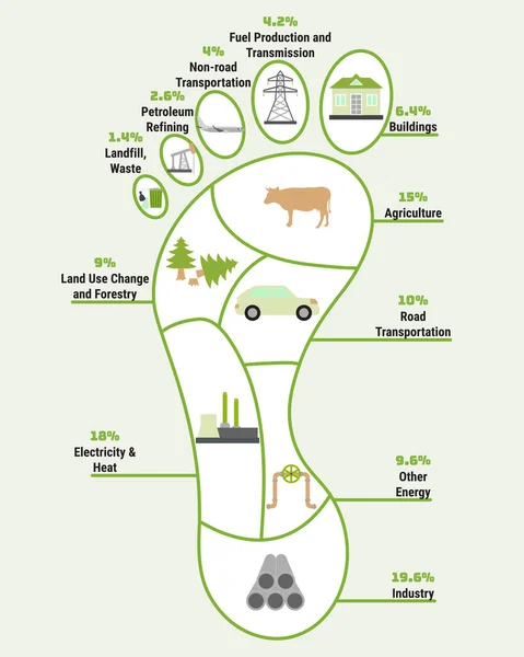
Carbon Footprint Infographic. CO2 Ecological Footprint Scheme. Greenhouse Gas Emission By Sector. Environmental And Climate Change Concept. True Data From Report. Hand Drawn Vector Illustration.
Vector, 5.72MB, 4000 × 5000 eps

Desertification Of The Caatinga Biome In The Hinterland Of Paraiba, Northeastern Brazil. Caused By Deforestation, Fires, Erosion And Inadequate Land Use.
Image, 9.23MB, 4534 × 3023 jpg


Trend In The Construction Industry And Building Market - Concept With Imaginary General Urban Plan And Chart
Image, 7.39MB, 4752 × 3168 jpg

Fire And Smoke In The Sugarcane Field In Mamanguape, Paraiba, Brazil
Image, 13.69MB, 7179 × 4791 jpg

Fire And Smoke In The Sugarcane Field In Mamanguape, Paraiba, Brazil
Image, 14.76MB, 7360 × 4912 jpg

Junction Of Railways Track Use For Trains Transport And Land Transportation Industry
Image, 14.3MB, 5616 × 3744 jpg

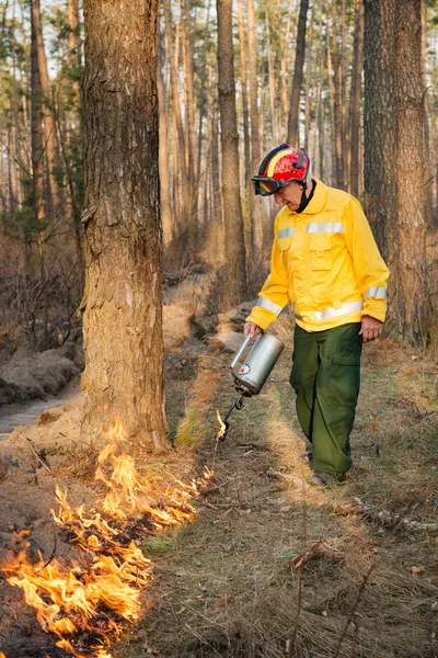
Drones Are Being Used By Fire Services To Monitor Controlled Burn Uprooting Trees In Construction Site
Image, 9.48MB, 5123 × 3417 jpg

A Rich Banker Uses The Africa As A Baby Bottle Turning Her Into A Desert
Image, 7.82MB, 3651 × 3868 jpg


We Have Moved Vector Illustration Concept. We Have Moved New Office Icon Location. Change Location Announcement Business Home Map. Use For, Landing Page, Template, Ui, Web, Mobile App, Poster, Banner
Vector, 11.09MB, 8482 × 4053 eps


We Have Moved Vector Illustration Concept. We Have Moved New Office Icon Location. Change Location Announcement Business Home Map. Use For, Landing Page, Template, Ui, Web, Mobile App, Poster, Banner
Vector, 11.58MB, 7876 × 3763 eps


We Have Moved Vector Illustration Concept. We Have Moved New Office Icon Location. Change Location Announcement Business Home Map. Use For, Landing Page, Template, Ui, Web, Mobile App, Poster, Banner
Vector, 2.68MB, 7153 × 4454 eps


Currency Exchange Concept. People Exchange Currencies Online. World Currency Exchange Services. Can Use For Web Landing Page, Banner, Flyer, Mobile App. Vector Illustration
Vector, 5.52MB, 5417 × 3386 eps
Page 1 >> Next