
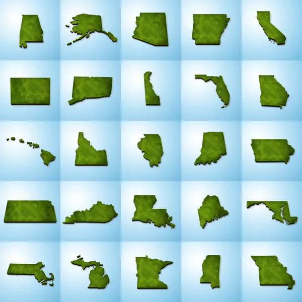
Stock image Massachusetts County Maps

Massachusetts Administrative Map. Counties Map Of Massachusetts, Blank Map, Empty Map Of Massachusetts
Image, 2.59MB, 8000 × 4000 jpg

Massachusetts Administrative Map. Counties Map Of Massachusetts, Blank Map, Empty Map Of Massachusetts
Image, 2.34MB, 8000 × 4000 jpg

Map Of Bristol County In Massachusetts State On White Background. Single County Map Highlighted By Black Colour On Massachusetts Map. UNITED STATES, US
Image, 4.08MB, 8000 × 6667 jpg

Massachusetts Administrative Map. Counties Map Of Massachusetts, Blank Map, Empty Map Of Massachusetts
Image, 2.8MB, 8000 × 4000 jpg

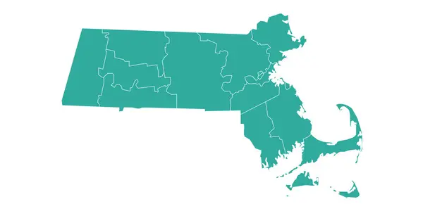
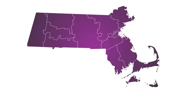
Massachusetts Administrative Map, Massachusetts Outline And Counties State Map Set - Illustration Version
Image, 1.95MB, 8000 × 2667 jpg

Massachusetts Administrative Map, Massachusetts Outline And Counties State Map Set - Illustration Version
Image, 1.75MB, 8000 × 2667 jpg

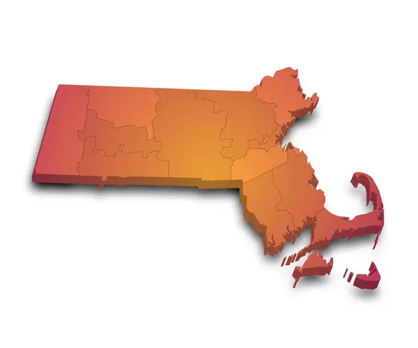
3d Map Of Massachusetts State With Color. United State Of America, US, United State
Image, 4.66MB, 8000 × 5334 jpg

Massachusetts Administrative Map. Counties Map Of Massachusetts, Blank Map, Empty Map Of Massachusetts
Image, 2.8MB, 8000 × 4000 jpg

Map Of Berkshire County In Massachusetts State On White Background. Single County Map Highlighted By Black Colour On Massachusetts Map. UNITED STATES, US
Image, 4.08MB, 8000 × 6667 jpg

3d Map Of Massachusetts State With Color. United State Of America, US, United State
Image, 4.44MB, 8000 × 5334 jpg

Massachusetts Administrative Map, Massachusetts Outline And Counties State Map Set - Illustration Version
Image, 5.79MB, 8000 × 8000 jpg

3d Map Of Massachusetts State With Color. United State Of America, US, United State
Image, 4.25MB, 8000 × 5334 jpg

Massachusetts Administrative Map. Counties Map Of Massachusetts, Blank Map, Empty Map Of Massachusetts
Image, 2.93MB, 8000 × 4000 jpg

Map Of Suffolk County In Massachusetts State On White Background. Single County Map Highlighted By Black Colour On Massachusetts Map. UNITED STATES, US
Image, 4.41MB, 8000 × 6667 jpg

Massachusetts Administrative Map, Massachusetts Outline And Counties State Map Set - Illustration Version
Image, 3.78MB, 8000 × 5334 jpg

Massachusetts Administrative Map. Counties Map Of Massachusetts, Blank Map, Empty Map Of Massachusetts
Image, 2.45MB, 8000 × 4000 jpg

3d Map Of Massachusetts State With Color. United State Of America, US, United State
Image, 4.59MB, 8000 × 5334 jpg
Massachusetts Administrative Map. Counties Map Of Massachusetts, Blank Map, Empty Map Of Massachusetts
Image, 2.77MB, 8000 × 4000 jpg

Massachusetts Administrative Map. Counties Map Of Massachusetts, Blank Map, Empty Map Of Massachusetts
Image, 3.19MB, 8000 × 4000 jpg

Map Of Plymouth County In Massachusetts State On White Background. Single County Map Highlighted By Black Colour On Massachusetts Map. UNITED STATES, US
Image, 4.39MB, 8000 × 6667 jpg

3d Map Of Massachusetts State With Color. United State Of America, US, United State
Image, 4.17MB, 8000 × 5334 jpg

3d Map Of Massachusetts State With Color. United State Of America, US, United State
Image, 3.8MB, 8000 × 5334 jpg

Map Of Bristol County In Massachusetts State On White Background. Single County Map Highlighted By Black Colour On Massachusetts Map. UNITED STATES, US
Image, 4.39MB, 8000 × 6667 jpg

3d Map Of Massachusetts State With Color. United State Of America, US, United State
Image, 4.07MB, 8000 × 5334 jpg


Map Of Norfolk County In Massachusetts State On White Background. Single County Map Highlighted By Black Colour On Massachusetts Map. UNITED STATES, US
Image, 4.1MB, 8000 × 6667 jpg

3d Map Of Massachusetts State With Color. United State Of America, US, United State
Image, 5.98MB, 8000 × 6667 jpg


3d Map Of Massachusetts State With Color. United State Of America, US, United State
Image, 4.37MB, 8000 × 5334 jpg

Massachusetts Administrative Map. Counties Map Of Massachusetts, Blank Map, Empty Map Of Massachusetts
Image, 2.72MB, 8000 × 4000 jpg

Map Of Nantucket County In Massachusetts State On White Background. Single County Map Highlighted By Black Colour On Massachusetts Map. UNITED STATES, US
Image, 4.06MB, 8000 × 6667 jpg

Map Of Barnstable County In Massachusetts State On White Background. Single County Map Highlighted By Black Colour On Massachusetts Map. UNITED STATES, US
Image, 4.03MB, 8000 × 6667 jpg

Massachusetts Administrative Map. Counties Map Of Massachusetts, Blank Map, Empty Map Of Massachusetts
Image, 2.78MB, 8000 × 4000 jpg

3d Map Of Massachusetts State With Color. United State Of America, US, United State
Image, 3.95MB, 8000 × 5334 jpg

Map Of Worcester County In Massachusetts State On White Background. Single County Map Highlighted By Black Colour On Massachusetts Map. UNITED STATES, US
Image, 4.12MB, 8000 × 6667 jpg

Map Of Franklin County In Massachusetts State On White Background. Single County Map Highlighted By Black Colour On Massachusetts Map. UNITED STATES, US
Image, 4.11MB, 8000 × 6667 jpg


Map Of Franklin County In Massachusetts State On White Background. Single County Map Highlighted By Black Colour On Massachusetts Map. UNITED STATES, US
Image, 4.41MB, 8000 × 6667 jpg
Massachusetts Administrative Map. Counties Map Of Massachusetts, Blank Map, Empty Map Of Massachusetts
Image, 3.06MB, 8000 × 4000 jpg

Map Of Middlesex County In Massachusetts State On White Background. Single County Map Highlighted By Black Colour On Massachusetts Map. UNITED STATES, US
Image, 4.13MB, 8000 × 6667 jpg

3d Map Of Massachusetts State With Color. United State Of America, US, United State
Image, 6.51MB, 8000 × 6667 jpg

3d Map Of Massachusetts State With Color. United State Of America, US, United State
Image, 3.8MB, 8000 × 5334 jpg

3d Map Of Massachusetts State With Color. United State Of America, US, United State
Image, 4.47MB, 8000 × 5334 jpg

3d Map Of Massachusetts State With Color. United State Of America, US, United State
Image, 5.84MB, 8000 × 6667 jpg

Massachusetts Administrative Map. Counties Map Of Massachusetts, Blank Map, Empty Map Of Massachusetts
Image, 2.46MB, 8000 × 4000 jpg

Massachusetts Administrative Map, Massachusetts Outline And Counties State Map Set - Illustration Version
Image, 2.15MB, 8000 × 2667 jpg


3d Map Of Massachusetts State With Color. United State Of America, US, United State
Image, 6.42MB, 8000 × 6667 jpg
3d Map Of Massachusetts State With Color. United State Of America, US, United State
Image, 6.29MB, 8000 × 6667 jpg
Page 1 >> Next