photo free
Home Images Vectors Videos

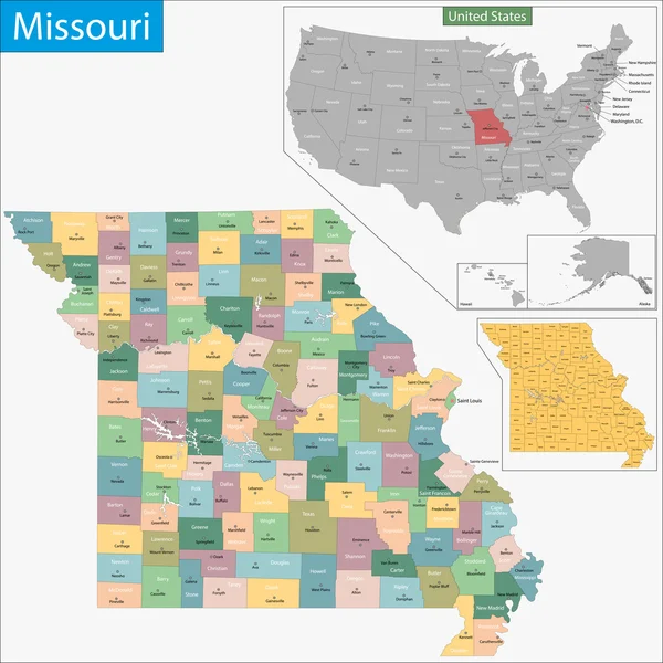
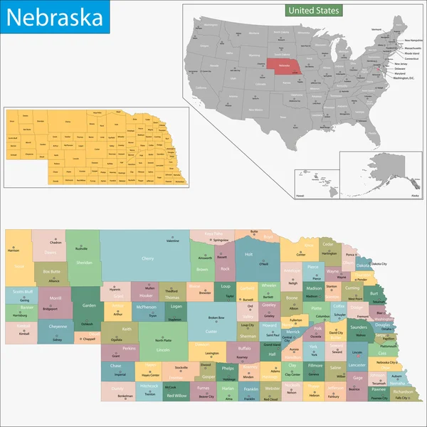
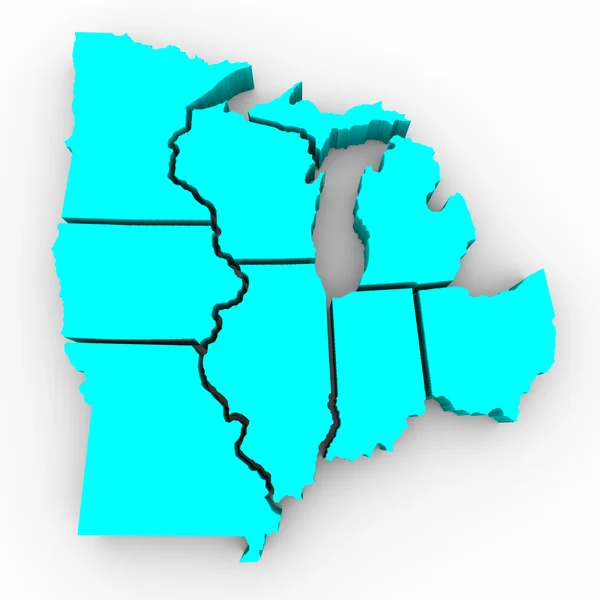
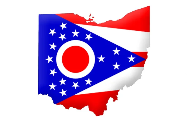
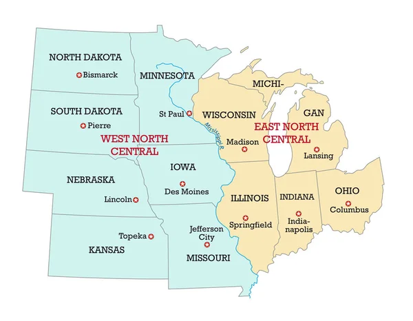
Stock image Midwestern United States

stock image Mourning Dove (Zenaida macroura)

Mourning Dove (Zenaida Macroura)

Image, 3.86MB, 3800 × 2535 jpg
stock vector Iowa map

Iowa Map

Vector, 7.91MB, 7002 × 7002 eps
stock vector Missouri map

Missouri Map

Vector, 9.23MB, 7002 × 7002 eps
stock vector Nebraska map

Nebraska Map

Vector, 7.44MB, 7002 × 7002 eps
stock vector Indiana map

Indiana Map

Vector, 8.29MB, 7002 × 7002 eps
stock vector Kansas, KS, political map with capital Topeka, important rivers and lakes. State in the Midwestern United States of America nicknamed The Sunflower State, also The Wheat or The Jayhawker State. Vector

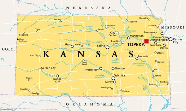
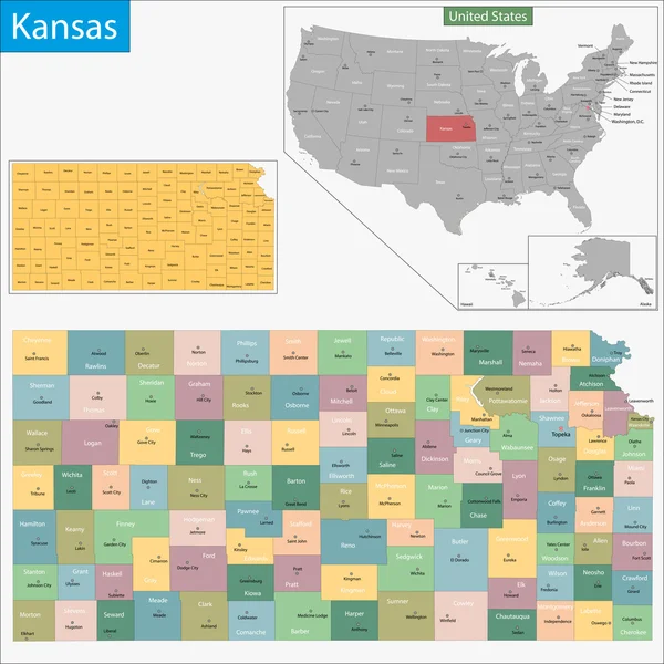
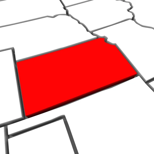
Kansas, KS, Political Map With Capital Topeka, Important Rivers And Lakes. State In The Midwestern United States Of America Nicknamed The Sunflower State, Also The Wheat Or The Jayhawker State. Vector

Vector, 3.32MB, 9000 × 5379 eps
stock image Great Lakes Region of States - 3d Map

Great Lakes Region Of States - 3d Map

Image, 2.62MB, 4096 × 4096 jpg
stock vector South Dakota map

South Dakota Map

Vector, 7.79MB, 7002 × 7002 eps
stock image Illinois IL USA Flag

Illinois IL USA Flag

Image, 4.76MB, 5000 × 3333 jpg
stock image State of Illinois map

State Of Illinois Map

Image, 1.63MB, 2800 × 4300 jpg
stock vector Kansas map

Kansas Map

Vector, 7.58MB, 7002 × 7002 eps
stock vector North Dakota map

North Dakota Map

Vector, 7.33MB, 7002 × 7002 eps
stock image State of Minnesota map

State Of Minnesota Map

Image, 0.86MB, 2800 × 4300 jpg
stock image State of Iowa map

State Of Iowa Map

Image, 0.86MB, 4300 × 2800 jpg
stock vector Illinois map

Illinois Map

Vector, 8.17MB, 7002 × 7002 eps
stock vector South Dakota, SD, political map, with capital Pierre, and largest city Sioux Falls. State in the upper Midwestern subregion of the United States of America, nicknamed The Mount Rushmore State. Vector.

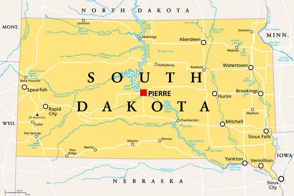
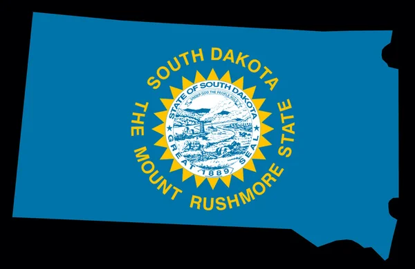
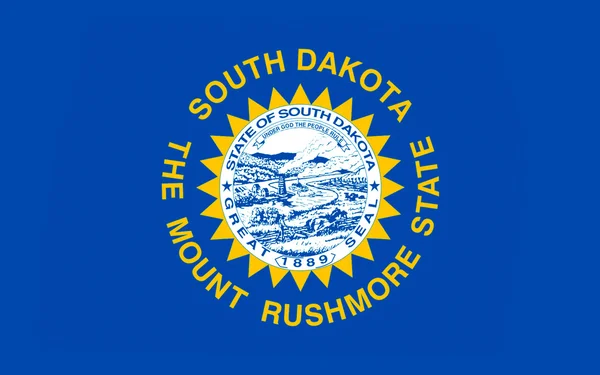
South Dakota, SD, Political Map, With Capital Pierre, And Largest City Sioux Falls. State In The Upper Midwestern Subregion Of The United States Of America, Nicknamed The Mount Rushmore State. Vector.

Vector, 3.62MB, 9000 × 5999 eps
stock vector Minnesota map

Minnesota Map

Vector, 8.31MB, 7002 × 7002 eps
stock image State of Minnesota map

State Of Minnesota Map

Image, 0.86MB, 2800 × 4300 jpg
stock image State of Iowa

State Of Iowa

Image, 1.79MB, 4300 × 2800 jpg
stock image State of Iowa map

State Of Iowa Map

Image, 0.86MB, 4300 × 2800 jpg
stock image Nebraska

Nebraska

Image, 1.91MB, 4300 × 2800 jpg
stock image State of Ohio

State Of Ohio

Image, 1.33MB, 4300 × 2800 jpg
stock image Stars - Stripes - Skyscrapers

Stars - Stripes - Skyscrapers

Image, 5.19MB, 4182 × 2850 jpg
stock image State of South Dakota map

State Of South Dakota Map

Image, 1.73MB, 4300 × 2800 jpg
stock vector Minnesota, MN, political map, with capital Saint Paul and metropolitan area Minneapolis. State in the upper Midwestern United States. Nicknamed Land of 10,000 Lakes, North Star State and Gopher State.

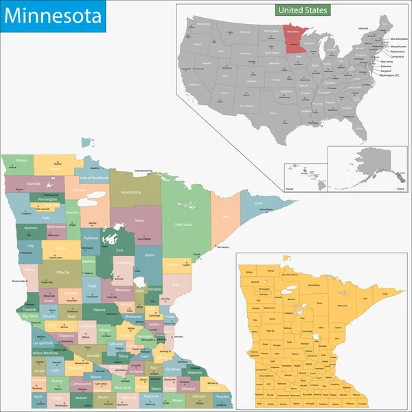
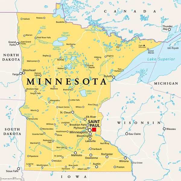
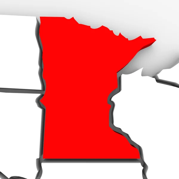
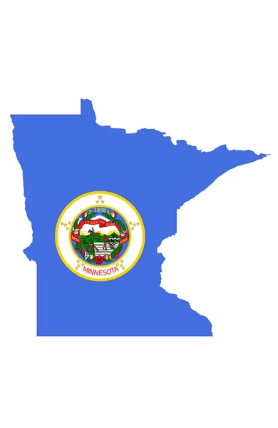
Minnesota, MN, Political Map, With Capital Saint Paul And Metropolitan Area Minneapolis. State In The Upper Midwestern United States. Nicknamed Land Of 10,000 Lakes, North Star State And Gopher State.

Vector, 6.13MB, 6000 × 6000 eps
stock image Minnesota Red Abstract 3D State Map United States America

Minnesota Red Abstract 3D State Map United States America

Image, 5.9MB, 4096 × 4096 jpg
stock image State of Illinois on black background

State Of Illinois On Black Background

Image, 0.91MB, 2800 × 4300 jpg
stock vector Iowa, IA, political map, with the capital Des Moines and most important cities, rivers and lakes. State in the Midwestern region of the United States of America, nicknamed The Hawkeye State. Vector.

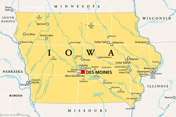
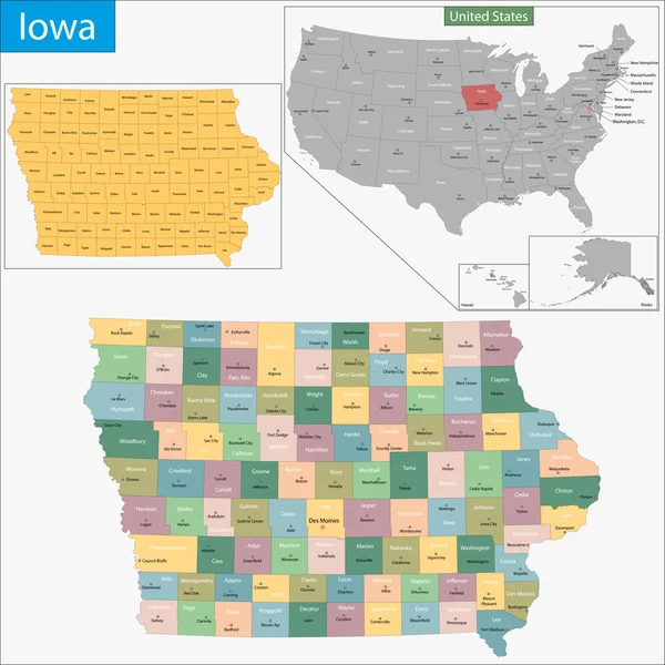
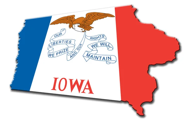
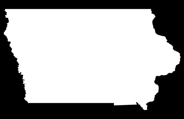
Iowa, IA, Political Map, With The Capital Des Moines And Most Important Cities, Rivers And Lakes. State In The Midwestern Region Of The United States Of America, Nicknamed The Hawkeye State. Vector.

Vector, 3.33MB, 9000 × 6000 eps
stock image State of Illinois map

State Of Illinois Map

Image, 0.91MB, 2800 × 4300 jpg
stock image State of Minnesota map

State Of Minnesota Map

Image, 1.24MB, 2800 × 4300 jpg
stock image State of Michigan map

State Of Michigan Map

Image, 0.9MB, 2800 × 4300 jpg
stock vector Michigan, MI, political map, with capital Lansing and metropolitan area Detroit. State in Great Lakes region of upper Midwestern United States, nicknamed The Great Lake State, and The Wolverine State.

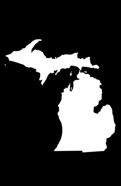
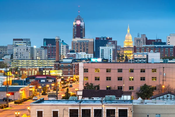
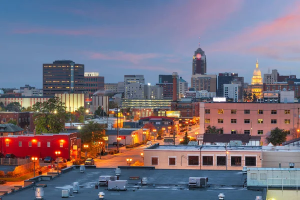
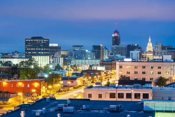
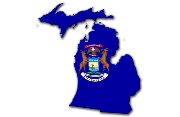
Michigan, MI, Political Map, With Capital Lansing And Metropolitan Area Detroit. State In Great Lakes Region Of Upper Midwestern United States, Nicknamed The Great Lake State, And The Wolverine State.

Vector, 6.65MB, 6000 × 6000 eps
stock image State of Ohio map

State Of Ohio Map

Image, 1.38MB, 4300 × 2800 jpg
stock vector Map of the Midwest United States of America

Map Of The Midwest United States Of America

Vector, 0.7MB, 3988 × 3100 eps
stock vector Wisconsin, WI, political map, with the capital Madison and metropolitan area Milwaukee. State in the upper Midwestern United States of America, with the nicknames Badger State, and Americas Dairyland.

Wisconsin, WI, Political Map, With The Capital Madison And Metropolitan Area Milwaukee. State In The Upper Midwestern United States Of America, With The Nicknames Badger State, And Americas Dairyland.

Vector, 4.43MB, 6000 × 6000 eps
stock vector Michigan map

Michigan Map

Vector, 8.12MB, 7002 × 7002 eps
stock image Chicago at twilight time

Chicago At Twilight Time

Image, 5.3MB, 4140 × 2760 jpg
stock image Flag of South Dakota, USA

Flag Of South Dakota, USA

Image, 1.77MB, 3072 × 1920 jpg
stock vector 37 of 50 states of the United States with a name, nickname, and

37 Of 50 States Of The United States With A Name, Nickname, And

Vector, 0.74MB, 7311 × 4112 eps
stock vector 19 of 50 states of the United States with a name, nickname, and

19 Of 50 States Of The United States With A Name, Nickname, And

Vector, 0.75MB, 7311 × 4112 eps
stock vector Indiana, IN, political map, with the capital Indianapolis, and most important cities, rivers and lakes. State in the Midwestern region of the United States of America, nicknamed The Hoosier State.

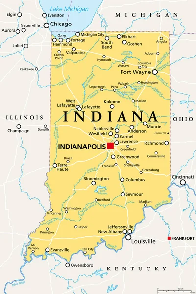
Indiana, IN, Political Map, With The Capital Indianapolis, And Most Important Cities, Rivers And Lakes. State In The Midwestern Region Of The United States Of America, Nicknamed The Hoosier State.

Vector, 3.4MB, 6000 × 9000 eps
stock image Lansing, Michigan, USA downtown city skyline at twilight.

Lansing, Michigan, USA Downtown City Skyline At Twilight.

Image, 32.07MB, 8256 × 5504 jpg
stock image Lansing, Michigan, USA downtown city skyline at twilight.

Lansing, Michigan, USA Downtown City Skyline At Twilight.

Image, 23.8MB, 8256 × 5504 jpg
stock image Old St. Louis County Courthouse

Old St. Louis County Courthouse

Image, 6.13MB, 4692 × 3207 jpg
stock image Chicago Skyline from the west with the train

Chicago Skyline From The West With The Train

Image, 14.14MB, 6016 × 4016 jpg
stock image Lansing, Michigan, USA downtown city skyline at twilight.

Lansing, Michigan, USA Downtown City Skyline At Twilight.

Image, 31.66MB, 8256 × 5504 jpg
stock image Michiganian

Michiganian

Image, 1.43MB, 4300 × 2800 jpg
stock image Kansas Red Abstract 3D State Map United States America

Kansas Red Abstract 3D State Map United States America

Image, 4.46MB, 4096 × 4096 jpg
stock image Illinois

Illinois

Image, 1.41MB, 4300 × 2800 jpg
stock image Chicago: panoramic view of the skyline of the city seen from the Navy Pier, one of the most visited attraction in the entire Midwestern Usa

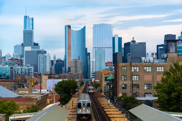
Chicago: Panoramic View Of The Skyline Of The City Seen From The Navy Pier, One Of The Most Visited Attraction In The Entire Midwestern Usa

Image, 11.48MB, 4288 × 2848 jpg
Page 1 >> Next