photo free
Home Images Vectors Videos

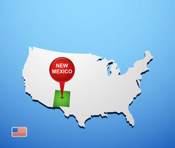
Stock image New Mexico Texas Border

stock image New Mexico Border Sign

New Mexico Border Sign

Image, 7.36MB, 4214 × 2809 jpg
stock vector New Mexico, political map, with capital Santa Fe, borders, important cities, rivers and lakes.State in the Southwestern region of United States of America. English labeling. Illustration. Vector.

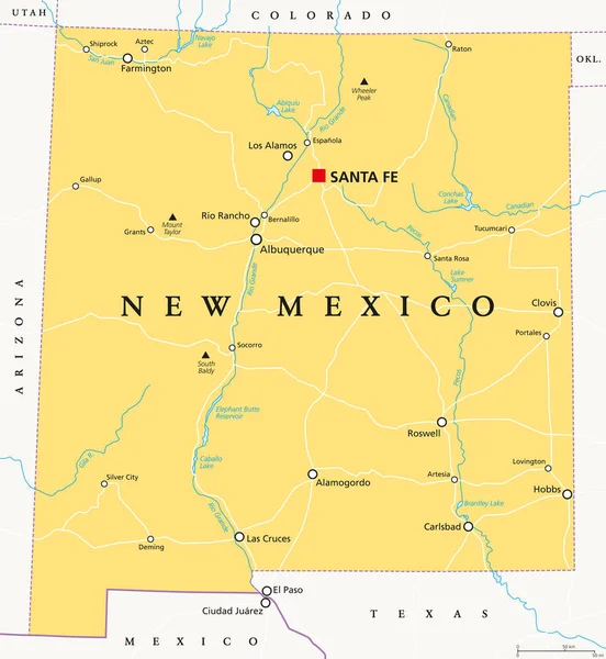
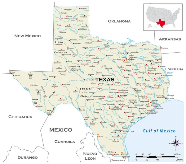
New Mexico, Political Map, With Capital Santa Fe, Borders, Important Cities, Rivers And Lakes.State In The Southwestern Region Of United States Of America. English Labeling. Illustration. Vector.

Vector, 2.78MB, 7674 × 8333 eps
stock vector Poster map United States of America with state names

Poster Map United States Of America With State Names

Vector, 1.94MB, 6000 × 4000 eps
stock vector Usa and Mexico border map with national flags, vector illustration

Usa And Mexico Border Map With National Flags, Vector Illustration

Vector, 2.15MB, 6000 × 3063 ai
stock vector Vector map of the physical regions of Texas

Vector Map Of The Physical Regions Of Texas

Vector, 0.9MB, 3503 × 3100 eps
stock image El Paso, Texas, USA  downtown city skyline at dusk with Juarez, Mexico in the distance.

El Paso, Texas, USA Downtown City Skyline At Dusk With Juarez, Mexico In The Distance.

Image, 27.55MB, 8256 × 5504 jpg
stock vector New Mexico on USA map

New Mexico On USA Map

Vector, 0.7MB, 5417 × 4589 eps
stock vector Texas region map

Texas Region Map

Vector, 8.27MB, 5012 × 4506 eps
stock vector vector road map of the US state of Texas

Vector Road Map Of The US State Of Texas

Vector, 2.51MB, 3454 × 3100 eps
stock vector route 66 map, vector illustration

Route 66 Map, Vector Illustration

Vector, 0MB, 6816 × 4344 zip
stock image Welcome to New Mexico Sign

Welcome To New Mexico Sign

Image, 23.76MB, 7952 × 5304 jpg
stock vector Highly detailed physical map of the US state of Texas

Highly Detailed Physical Map Of The US State Of Texas

Vector, 2.58MB, 3528 × 3100 eps
stock vector Vector map of the border districts in the United States and Mexico along the border

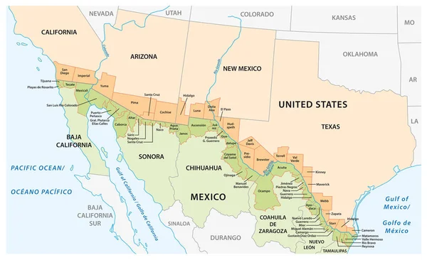
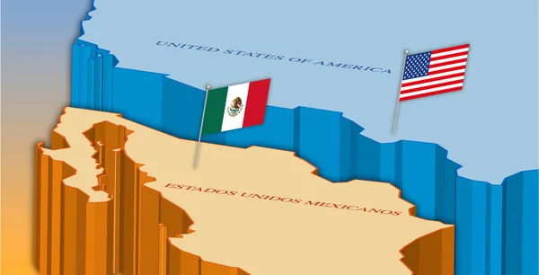
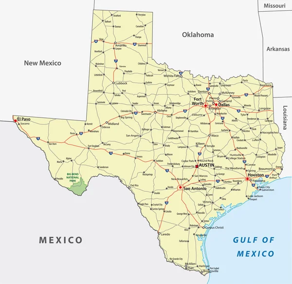
Vector Map Of The Border Districts In The United States And Mexico Along The Border

Vector, 1.17MB, 5067 × 3100 eps
stock vector Texas, United States, political map

Texas, United States, Political Map

Vector, 3.71MB, 8033 × 8033 eps
stock vector Administrative map of the Mexican state of Chihuahua

Administrative Map Of The Mexican State Of Chihuahua

Vector, 1.28MB, 3100 × 3969 eps
stock image Rio Grande Rocky River bed mountain view background Sante Fe New Mexico fly fish stream.

Rio Grande Rocky River Bed Mountain View Background Sante Fe New Mexico Fly Fish Stream.

Image, 7.65MB, 3943 × 2957 jpg
stock vector New Mexico United States political map

New Mexico United States Political Map

Vector, 3.38MB, 7674 × 8333 eps
stock image El Paso, Texas, USA  downtown city skyline at dusk with Juarez, Mexico in the distance.

El Paso, Texas, USA Downtown City Skyline At Dusk With Juarez, Mexico In The Distance.

Image, 33.17MB, 8256 × 5504 jpg
stock vector FRANKFURT AM MAIN, GERMANY-JUNE 14, 2018: the holbeinsteg footbridge in front of the skyline in frankfurt am main, germany

FRANKFURT AM MAIN, GERMANY-JUNE 14, 2018: The Holbeinsteg Footbridge In Front Of The Skyline In Frankfurt Am Main, Germany

Vector, 1.1MB, 3510 × 3100 eps
stock vector simple colored texas state physical vector map

Simple Colored Texas State Physical Vector Map

Vector, 0MB, 4000 × 3939 zip
stock image Gloomy View of Rusty Protective Border Wall Mexico Tijuana and United States of America. Defense Against Illegal Immigration, Narcotics, Drugs, Illegal Substances Trafficking due to Cartel Activity.

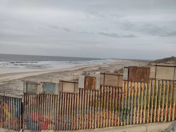
Gloomy View Of Rusty Protective Border Wall Mexico Tijuana And United States Of America. Defense Against Illegal Immigration, Narcotics, Drugs, Illegal Substances Trafficking Due To Cartel Activity.

Image, 2.67MB, 4000 × 3000 jpg
stock vector Typography composition of city names, silhouettes maps of the states of America, vector detailed posters, Division Mountain and West South Central - Colorado, New Mexico, Texas - set 13 of 17

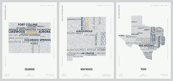
Typography Composition Of City Names, Silhouettes Maps Of The States Of America, Vector Detailed Posters, Division Mountain And West South Central - Colorado, New Mexico, Texas - Set 13 Of 17

Vector, 3.58MB, 8896 × 4168 eps
stock image Welcome to New Mexico Sign

Welcome To New Mexico Sign

Image, 17.48MB, 7319 × 4724 jpg
stock vector Highly detailed vector silhouettes of US state maps, Division United States into counties, political and geographic subdivisions of a states, Mountain and West South Central - Colorado, New Mexico, Texas - set 13 of 17

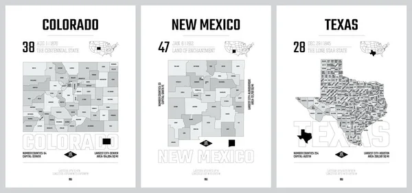
Highly Detailed Vector Silhouettes Of US State Maps, Division United States Into Counties, Political And Geographic Subdivisions Of A States, Mountain And West South Central - Colorado, New Mexico, Texas - Set 13 Of 17

Vector, 9.41MB, 9608 × 4501 eps
stock vector Texas road map

Texas Road Map

Vector, 1.78MB, 3079 × 2993 eps
stock vector Poster map United States of America with state names

Poster Map United States Of America With State Names

Vector, 2.03MB, 6000 × 4000 eps
stock vector USA map with flag and navigation icons

USA Map With Flag And Navigation Icons

Vector, 3.03MB, 8192 × 6357 eps
stock vector louisiana administrative and political map with flag

Louisiana Administrative And Political Map With Flag

Vector, 2.51MB, 3397 × 3100 eps
stock vector USA map with separated states

USA Map With Separated States

Vector, 6.27MB, 6000 × 3672 eps
stock vector United States of America Vector Map. Illustration.

United States Of America Vector Map. Illustration.

Vector, 0.81MB, 5000 × 5000 eps
stock vector United States of America Vector Map. Illustration.

United States Of America Vector Map. Illustration.

Vector, 1.14MB, 5000 × 5000 eps
stock vector Colorful hand drawn vector map of the USA

Colorful Hand Drawn Vector Map Of The USA

Vector, 5.94MB, 6000 × 3635 eps
stock image USA Mexico Wall concept

USA Mexico Wall Concept

Image, 8.94MB, 4500 × 3000 jpg
stock vector Colorful hand drawn vector map of the USA

Colorful Hand Drawn Vector Map Of The USA

Vector, 5.97MB, 6000 × 3635 eps
stock vector Cactus, opuntia, and agave in the desert. Natural background. Vector illustration

Cactus, Opuntia, And Agave In The Desert. Natural Background. Vector Illustration

Vector, 0.85MB, 6250 × 6250 eps
stock vector Map of attractions of United States of America

Map Of Attractions Of United States Of America

Vector, 10.59MB, 5785 × 7087 eps
stock vector Texas map icon vector for your web site computer and app

Texas Map Icon Vector For Your Web Site Computer And App

Vector, 4.93MB, 5280 × 2880 eps
stock vector United  States of America map print poster vintage design.

United States Of America Map Print Poster Vintage Design.

Vector, 6.31MB, 6112 × 4322 eps
stock image State of Oklahoma map

State Of Oklahoma Map

Image, 0.84MB, 4300 × 2800 jpg
stock vector Colorful united states administrative and political vector map

Colorful United States Administrative And Political Vector Map

Vector, 3.25MB, 4513 × 3100 eps
stock image United States of America Map. Illustration.

United States Of America Map. Illustration.

Image, 3.85MB, 5000 × 5000 jpg
stock vector Vector illustration map of the USA

Vector Illustration Map Of The USA

Vector, 6.74MB, 6000 × 3706 eps
stock vector United  States of America map print poster design.

United States Of America Map Print Poster Design.

Vector, 1.27MB, 6112 × 4322 eps
stock vector Colorful hand drawn vector map of the USA

Colorful Hand Drawn Vector Map Of The USA

Vector, 5.94MB, 6000 × 3646 eps
stock vector United States of America Vector Map. Illustration.

United States Of America Vector Map. Illustration.

Vector, 0.7MB, 5000 × 5000 eps
stock vector Poster map of United States of America with state names. Black and white print map of USA for t-shirt, poster or geographic themes. Hand-drawn black map with states.

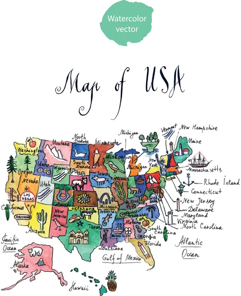
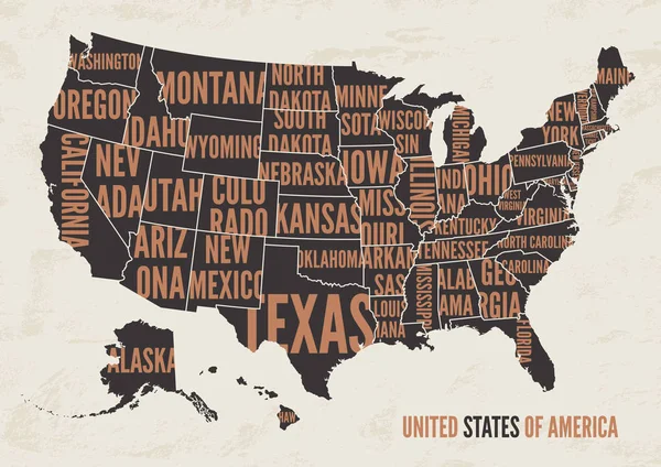
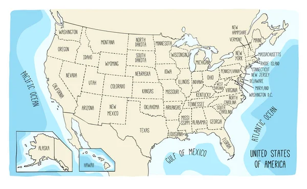
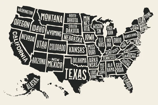
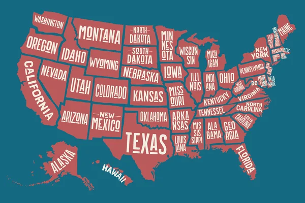
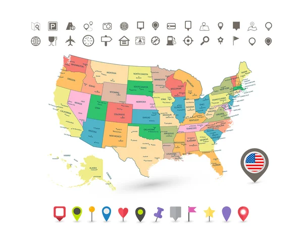
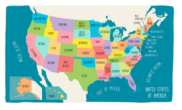
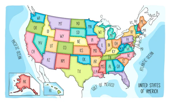
Poster Map Of United States Of America With State Names. Black And White Print Map Of USA For T-shirt, Poster Or Geographic Themes. Hand-drawn Black Map With States.

Vector, 4.51MB, 6254 × 4171 eps
stock vector louisiana administrative and political map with flag

Louisiana Administrative And Political Map With Flag

Vector, 2.64MB, 3397 × 3100 eps
stock vector Colorful hand drawn vector map of the USA

Colorful Hand Drawn Vector Map Of The USA

Vector, 6.5MB, 6000 × 3635 eps
stock vector road map of the US American State of louisiana

Road Map Of The US American State Of Louisiana

Vector, 2.05MB, 3392 × 3100 eps
stock image Busy Street in Mexican Border town of Nuevo Progreso, Mexico

Busy Street In Mexican Border Town Of Nuevo Progreso, Mexico

Image, 2.4MB, 3293 × 1852 jpg
Page 1 >> Next