photo free
Home Images Vectors Videos

Stock image North Central Texas

stock image Multiple apartment complex, business park, office building, residential neighborhood along West Parmer Street in lush green mixed-use development rapidly growing estate of North Austin, aerial. USA

Multiple Apartment Complex, Business Park, Office Building, Residential Neighborhood Along West Parmer Street In Lush Green Mixed-use Development Rapidly Growing Estate Of North Austin, Aerial. USA

Image, 7.73MB, 4000 × 2250 jpg
stock image Multiple apartment complex, business park, office building, residential neighborhood along West Parmer Street in lush green mixed-use development rapidly growing estate of North Austin, aerial. USA

Multiple Apartment Complex, Business Park, Office Building, Residential Neighborhood Along West Parmer Street In Lush Green Mixed-use Development Rapidly Growing Estate Of North Austin, Aerial. USA

Image, 6.38MB, 4000 × 2250 jpg
stock image Highway intersection with overpass between interstate I-35, Monarch Hwy and West Parmer Lane in North Austin, busy traffic at peak hour, large suburban shopping center, apartment complex, aerial. USA

Highway Intersection With Overpass Between Interstate I-35, Monarch Hwy And West Parmer Lane In North Austin, Busy Traffic At Peak Hour, Large Suburban Shopping Center, Apartment Complex, Aerial. USA

Image, 5.19MB, 4000 × 2250 jpg
stock image Panorama aerial view multiple apartment complex, business park, office building, residential neighborhood along West Parmer lush green mixed-use development rapidly growing estate of North Austin. USA

Panorama Aerial View Multiple Apartment Complex, Business Park, Office Building, Residential Neighborhood Along West Parmer Lush Green Mixed-use Development Rapidly Growing Estate Of North Austin. USA

Image, 4.39MB, 4000 × 1191 jpg
stock image Highway intersection with overpass between interstate I-35, Monarch Hwy and West Parmer Lane in North Austin, busy traffic at peak hour, large suburban shopping center, apartment complex, aerial. USA

Highway Intersection With Overpass Between Interstate I-35, Monarch Hwy And West Parmer Lane In North Austin, Busy Traffic At Peak Hour, Large Suburban Shopping Center, Apartment Complex, Aerial. USA

Image, 5.77MB, 4000 × 2250 jpg
stock image Highway intersection with overpass between interstate I-35, Monarch Hwy and West Parmer Lane in North Austin, busy traffic at peak hour, large suburban shopping center, apartment complex, aerial. USA

Highway Intersection With Overpass Between Interstate I-35, Monarch Hwy And West Parmer Lane In North Austin, Busy Traffic At Peak Hour, Large Suburban Shopping Center, Apartment Complex, Aerial. USA

Image, 4.94MB, 4000 × 2250 jpg
stock image Lush green mixed-use development area with new construction apartment complex, fulfilment center warehouse logistic, industrial zoning, business park in rapidly growing North Austin, aerial. USA

Lush Green Mixed-use Development Area With New Construction Apartment Complex, Fulfilment Center Warehouse Logistic, Industrial Zoning, Business Park In Rapidly Growing North Austin, Aerial. USA

Image, 7.08MB, 4000 × 2250 jpg
stock image Modern apartment complex, shopping center, business park, office building, residential neighborhood along West Parmer Ln and Interstate I-35, mixed-use development rapidly growing North Austin. USA

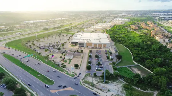
Modern Apartment Complex, Shopping Center, Business Park, Office Building, Residential Neighborhood Along West Parmer Ln And Interstate I-35, Mixed-use Development Rapidly Growing North Austin. USA

Image, 6.56MB, 4000 × 2250 jpg
stock image Busy intersection between interstate I-35, Monarch Hwy and West Parmer Lane in rapidly growing North Austin, busy traffic at peak hour, large suburban shopping center, apartment complex, aerial. USA

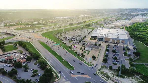
Busy Intersection Between Interstate I-35, Monarch Hwy And West Parmer Lane In Rapidly Growing North Austin, Busy Traffic At Peak Hour, Large Suburban Shopping Center, Apartment Complex, Aerial. USA

Image, 5.97MB, 4000 × 2250 jpg
stock image Interstate I-35, Monarch Hwy overpass, downtown Austin in background, rapidly growing North Austin mixed-use development, modern apartment complex, large shopping center, business park, aerial. USA

Interstate I-35, Monarch Hwy Overpass, Downtown Austin In Background, Rapidly Growing North Austin Mixed-use Development, Modern Apartment Complex, Large Shopping Center, Business Park, Aerial. USA

Image, 6.46MB, 4000 × 2250 jpg
stock image Multiple apartment complex, business park, office building, residential neighborhood along West Parmer Street in lush green mixed-use development rapidly growing estate of North Austin, aerial. USA

Multiple Apartment Complex, Business Park, Office Building, Residential Neighborhood Along West Parmer Street In Lush Green Mixed-use Development Rapidly Growing Estate Of North Austin, Aerial. USA

Image, 6.73MB, 4000 × 2250 jpg
stock image sniper scope aimed at the vintage american flag and texas state map

Sniper Scope Aimed At The Vintage American Flag And Texas State Map

Image, 11.39MB, 6000 × 3800 jpg
stock image Fort Worth Texas Downtown Skyline Trinity River Late Night

Fort Worth Texas Downtown Skyline Trinity River Late Night

Image, 7.95MB, 5396 × 2790 jpg
stock image Vintage texas map

Vintage Texas Map

Image, 22.51MB, 6300 × 4205 jpg
stock vector North America high detailed vector map with states borders of Canada, USA and Mexico. All elements separated in detached layers

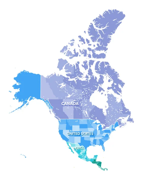
North America High Detailed Vector Map With States Borders Of Canada, USA And Mexico. All Elements Separated In Detached Layers

Vector, 9.05MB, 5950 × 7292 eps
stock image Fort Worth Texas Downtown Skyline Trinity River Late Night

Fort Worth Texas Downtown Skyline Trinity River Late Night

Image, 6.33MB, 5932 × 2185 jpg
stock vector United States census bureau regions and divisions vector map. Flag of United States of America

United States Census Bureau Regions And Divisions Vector Map. Flag Of United States Of America

Vector, 6.79MB, 7292 × 3543 eps
stock image abstract silhouette of the city with text Dallas at the vintage american flag

Abstract Silhouette Of The City With Text Dallas At The Vintage American Flag

Image, 6.59MB, 6000 × 4004 jpg
stock image shining texas state flag

Shining Texas State Flag

Image, 26.46MB, 6500 × 4338 jpg
stock image United States flag

United States Flag

Image, 6.11MB, 4300 × 2867 jpg
stock image sniper scope aimed at the abstract silhouette of the city with text El Paso at the vintage american flag

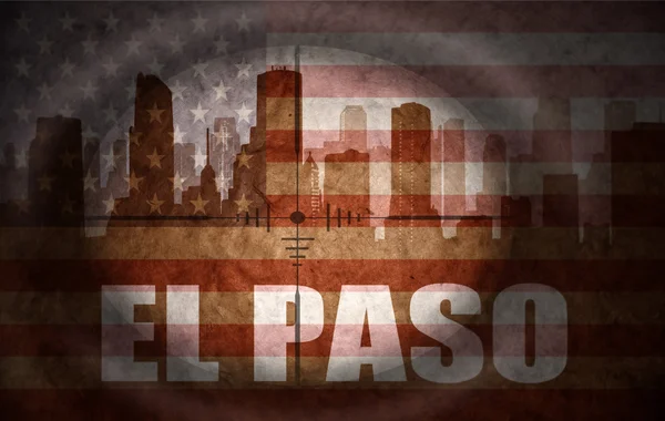
Sniper Scope Aimed At The Abstract Silhouette Of The City With Text El Paso At The Vintage American Flag

Image, 10.45MB, 6000 × 3800 jpg
stock image abstract silhouette of the city with text Houston at the vintage american flag

Abstract Silhouette Of The City With Text Houston At The Vintage American Flag

Image, 6.69MB, 6000 × 4004 jpg
stock image waving texas state rainbow gay pride flag banner

Waving Texas State Rainbow Gay Pride Flag Banner

Image, 11.66MB, 5500 × 3670 jpg
stock vector North America, Canada, Siberia and Hawaii Global World

North America, Canada, Siberia And Hawaii Global World

Vector, 1.05MB, 5560 × 5534 eps
stock image waving colorful national flag of united states of america on a gray texas state map background.

Waving Colorful National Flag Of United States Of America On A Gray Texas State Map Background.

Image, 9.04MB, 6558 × 4377 jpg
stock image sniper scope aimed at the abstract silhouette of the city with text Fort Worth at the vintage american flag

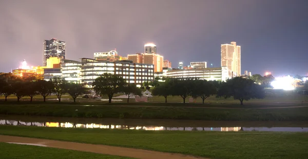
Sniper Scope Aimed At The Abstract Silhouette Of The City With Text Fort Worth At The Vintage American Flag

Image, 10.42MB, 6000 × 3800 jpg
stock image waving colorful flag of texas state.

Waving Colorful Flag Of Texas State.

Image, 10.92MB, 5500 × 3670 jpg
stock image North America map with country borders

North America Map With Country Borders

Image, 1.55MB, 2955 × 2955 jpg
stock vector North America, Canada, Siberia and Hawaii Global World

North America, Canada, Siberia And Hawaii Global World

Vector, 0.95MB, 5560 × 5534 eps
stock vector North America high detailed political map. All layers detached and labeled.

North America High Detailed Political Map. All Layers Detached And Labeled.

Vector, 12.82MB, 7296 × 6992 eps
stock vector North and South America high detailed vector map

North And South America High Detailed Vector Map

Vector, 9.5MB, 10207 × 14583 eps
stock vector North America administrative vector map with latitude and longitude

North America Administrative Vector Map With Latitude And Longitude

Vector, 1.11MB, 4020 × 3100 eps
stock image Border wall between Mexico and United States as president promises

Border Wall Between Mexico And United States As President Promises

Image, 16.33MB, 6000 × 4500 jpg
stock image Night panoramic view of Mexico city, Mexico. Central America.

Night Panoramic View Of Mexico City, Mexico. Central America.

Image, 7.65MB, 3240 × 2160 jpg
stock vector AMERICA, Global World

AMERICA, Global World

Vector, 1.22MB, 5560 × 5534 eps
stock vector North and South America Global World

North And South America Global World

Vector, 1.18MB, 5560 × 5534 eps
stock vector North, South, and Central AMERICA, Global World

North, South, And Central AMERICA, Global World

Vector, 1.32MB, 5560 × 5534 eps
stock image vintage Texas state map

Vintage Texas State Map

Image, 16.77MB, 6300 × 4205 jpg
stock vector North America, Canada, Siberia and Hawaii Background with Globe Icon 3D illustration, Glossy, Shiny Sphere with Global Map in Subtle Blues giving a transparent feel.

North America, Canada, Siberia And Hawaii Background With Globe Icon 3D Illustration, Glossy, Shiny Sphere With Global Map In Subtle Blues Giving A Transparent Feel.

Vector, 1.13MB, 5547 × 5547 eps
stock image Mexican tetra (Astyanax mexicanus)

Mexican Tetra (Astyanax Mexicanus)

Image, 2.77MB, 5616 × 3744 jpg
stock image Mexican tetra (Astyanax mexicanus).

Mexican Tetra (Astyanax Mexicanus).

Image, 1.8MB, 5156 × 3437 jpg
stock vector North America Global World

North America Global World

Vector, 1.13MB, 5560 × 5534 eps
stock image Mexican tetra (Astyanax mexicanus)

Mexican Tetra (Astyanax Mexicanus)

Image, 2.8MB, 5616 × 3744 jpg
stock image Peak hour traffic from South to North of Interstate Highway 35 to Central Austin downtown near Colorado River, dense of vehicle semi-trucks, cars commute high-rise office buildings, aerial view. USA

Peak Hour Traffic From South To North Of Interstate Highway 35 To Central Austin Downtown Near Colorado River, Dense Of Vehicle Semi-trucks, Cars Commute High-rise Office Buildings, Aerial View. USA

Image, 6.38MB, 4000 × 2250 jpg
stock image Rush hours traffic along Interstate Highway 35 and frontage road from South to North of Central Austin, downtown high-rise buildings near lush green Chicano Park and Colorado River, aerial view. USA

Rush Hours Traffic Along Interstate Highway 35 And Frontage Road From South To North Of Central Austin, Downtown High-rise Buildings Near Lush Green Chicano Park And Colorado River, Aerial View. USA

Image, 7.19MB, 4000 × 2250 jpg
stock image Riverside hotel resort along Colorado River with boardwalk, busy traffic over Highway 35 bridge, South of Central Austin city urban core to vibrant Riverside community neighborhood, aerial view. USA

Riverside Hotel Resort Along Colorado River With Boardwalk, Busy Traffic Over Highway 35 Bridge, South Of Central Austin City Urban Core To Vibrant Riverside Community Neighborhood, Aerial View. USA

Image, 7.61MB, 4000 × 2250 jpg
stock image Coming traffic from South to North Central Austin during rush hours over Interstate Highway 35 bridge across Colorado River, lush green trees along boardwalk of Travis Heights community, aerial. USA

Coming Traffic From South To North Central Austin During Rush Hours Over Interstate Highway 35 Bridge Across Colorado River, Lush Green Trees Along Boardwalk Of Travis Heights Community, Aerial. USA

Image, 7.64MB, 4000 × 2250 jpg
stock image Riverside hotel resort along Colorado River with boardwalk, busy traffic over Highway 35 bridge, South of Central Austin city urban core to vibrant Riverside community neighborhood, aerial view. USA

Riverside Hotel Resort Along Colorado River With Boardwalk, Busy Traffic Over Highway 35 Bridge, South Of Central Austin City Urban Core To Vibrant Riverside Community Neighborhood, Aerial View. USA

Image, 7.89MB, 4000 × 2250 jpg
stock image Busy traffic on river bridge Interstate Highway 35 across Colorado River near downtown Austin, Texas, dense of semi-trucks, cars commute both way of North and South frontage road streets, aerial. USA

Busy Traffic On River Bridge Interstate Highway 35 Across Colorado River Near Downtown Austin, Texas, Dense Of Semi-trucks, Cars Commute Both Way Of North And South Frontage Road Streets, Aerial. USA

Image, 6.34MB, 4000 × 2250 jpg
stock image fire fist with the flag of texas

Fire Fist With The Flag Of Texas

Image, 4.31MB, 5694 × 3800 jpg
Page 1 >> Next