photo free
Home Images Vectors Videos

Stock image North Dakota County

stock vector Map of North Dakota

Map Of North Dakota

Vector, 0.68MB, 5000 × 4000 eps
stock vector USA State counties emblem map

USA State Counties Emblem Map

Vector, 0MB, 5136 × 5168 zip
stock vector North Dakota map

North Dakota Map

Vector, 7.33MB, 7002 × 7002 eps
stock vector North Dakota County Map

North Dakota County Map

Vector, 2.77MB, 5864 × 3000 ai
stock vector Map of the United States of America

Map Of The United States Of America

Vector, 2.33MB, 5000 × 3123 ai
stock vector Map of North Dakota

Map Of North Dakota

Vector, 0.64MB, 5000 × 4000 eps
stock vector Map of North Dakota

Map Of North Dakota

Vector, 0.64MB, 5000 × 4000 eps
stock vector Map of North Dakota

Map Of North Dakota

Vector, 0.66MB, 5000 × 4000 eps
stock vector Map of North Dakota

Map Of North Dakota

Vector, 0.65MB, 5000 × 4000 eps
stock vector minnesota federal state road vector map with flag

Minnesota Federal State Road Vector Map With Flag

Vector, 1.94MB, 3100 × 3463 eps
stock vector road map of the US American State of Minnesota

Road Map Of The US American State Of Minnesota

Vector, 1.77MB, 3100 × 3463 eps
stock vector North Dakota - South Dakota - Minnesota - Wisoncsin labelled bla

North Dakota - South Dakota - Minnesota - Wisoncsin Labelled Bla

Vector, 3.16MB, 8653 × 5000 eps
stock vector High Quality map state of United States. North Dakota

High Quality Map State Of United States. North Dakota

Vector, 0.9MB, 4000 × 4000 eps
stock vector North Dakota map shape, united states of america. Flat concept icon symbol vector illustration .

North Dakota Map Shape, United States Of America. Flat Concept Icon Symbol Vector Illustration .

Vector, 0.26MB, 4096 × 4096 eps
stock image US State Maps Set II

US State Maps Set II

Image, 22MB, 7500 × 7500 jpg
stock image State of North Dakota map

State Of North Dakota Map

Image, 1.94MB, 4300 × 2800 jpg
stock vector North Dakota map, United States (USA), Americas. Filled and outline map designs. Vector illustration

North Dakota Map, United States (USA), Americas. Filled And Outline Map Designs. Vector Illustration

Vector, 0.31MB, 6001 × 3001 eps
stock vector North Dakota County Map

North Dakota County Map

Vector, 0.66MB, 5000 × 3077 ai
stock vector Dunn County, North Dakota State (U.S. county, United States of America, USA, U.S., US) map vector illustration, scribble sketch Dunn map

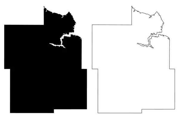
Dunn County, North Dakota State (U.S. County, United States Of America, USA, U.S., US) Map Vector Illustration, Scribble Sketch Dunn Map

Vector, 0.68MB, 7087 × 4726 eps
stock vector North Dakota USA state map vector tag cloud illustration

North Dakota USA State Map Vector Tag Cloud Illustration

Vector, 10.36MB, 12520 × 6408 eps
stock vector High Quality map of North Dakota is a state of United States of America with borders of the counties

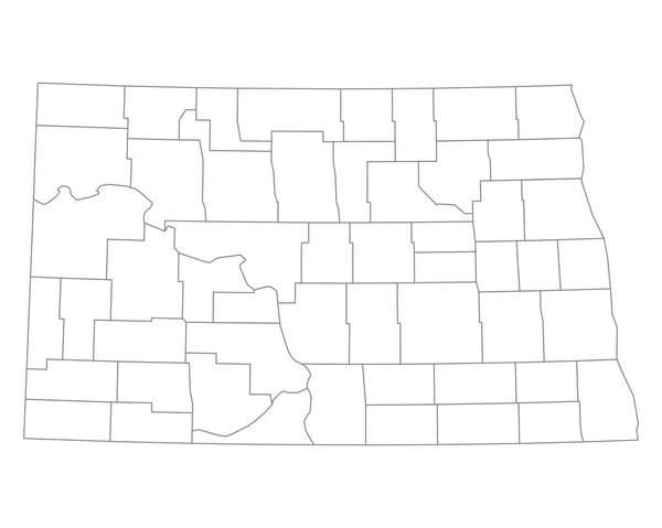
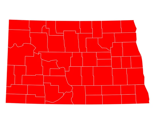
High Quality Map Of North Dakota Is A State Of United States Of America With Borders Of The Counties

Vector, 1.23MB, 4000 × 4000 eps
stock vector Set 4 of 5 Highly detailed vector silhouettes of USA state maps

Set 4 Of 5 Highly Detailed Vector Silhouettes Of USA State Maps

Vector, 5.44MB, 8858 × 3738 eps
stock vector Flag of North Dakota State, USA. Vector Format

Flag Of North Dakota State, USA. Vector Format

Vector, 6.31MB, 8250 × 5500 eps
stock vector 39 of 50 states of the United States with a name, nickname, and

39 Of 50 States Of The United States With A Name, Nickname, And

Vector, 0.96MB, 7311 × 4112 eps
stock vector Highly detailed vector silhouettes of US state maps, Division United States into counties, political and geographic subdivisions of a states, West North Central - North Dakota, South Dakota, Nebraska - set 7 of 17

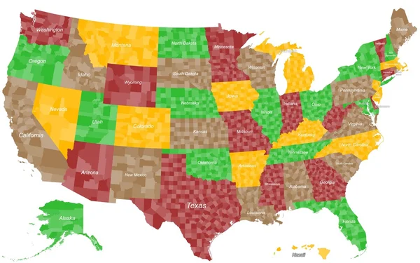
Highly Detailed Vector Silhouettes Of US State Maps, Division United States Into Counties, Political And Geographic Subdivisions Of A States, West North Central - North Dakota, South Dakota, Nebraska - Set 7 Of 17

Vector, 6.36MB, 9608 × 4501 eps
stock vector North Dakota, U.S. state subdivided into 53 counties, multi colored political map with its capital Bismarck, with borders and county names. State in the Upper Midwest region of the United States.

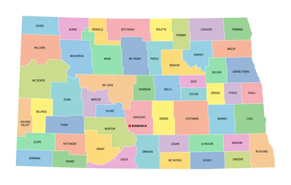
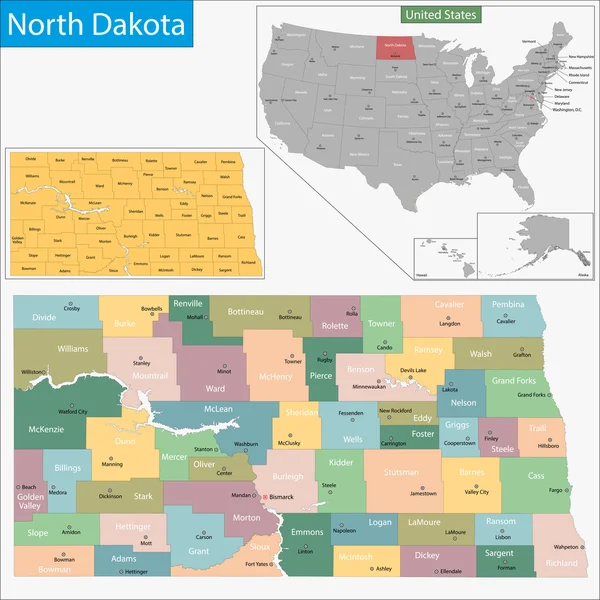
North Dakota, U.S. State Subdivided Into 53 Counties, Multi Colored Political Map With Its Capital Bismarck, With Borders And County Names. State In The Upper Midwest Region Of The United States.

Vector, 2.09MB, 9000 × 5737 eps
stock vector High detailed North Dakota road map with labeling.

High Detailed North Dakota Road Map With Labeling.

Vector, 7.08MB, 4786 × 3631 eps
stock vector North dakota vector map. High detailed illustration. United state of America country .

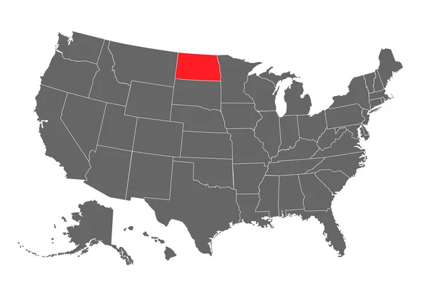
North Dakota Vector Map. High Detailed Illustration. United State Of America Country .

Vector, 1.37MB, 5300 × 3743 eps
stock vector road map of the US American State of Montana

Road Map Of The US American State Of Montana

Vector, 2.24MB, 5939 × 3100 eps
stock vector Map of North Dakota

Map Of North Dakota

Vector, 0.67MB, 5000 × 4000 eps
stock vector Map of North Dakota

Map Of North Dakota

Vector, 0.68MB, 5000 × 4000 eps
stock vector Map of the United States of America

Map Of The United States Of America

Vector, 2.58MB, 5000 × 3125 ai
stock vector Wyoming state detailed editable map

Wyoming State Detailed Editable Map

Vector, 1.1MB, 6000 × 4790 eps
stock vector Flag of  South Dakota from brush strokes. United States of America. Flag South Dakota on transparent background for your web site design, logo, app, UI. Stock vector. EPS10.

Flag Of South Dakota From Brush Strokes. United States Of America. Flag South Dakota On Transparent Background For Your Web Site Design, Logo, App, UI. Stock Vector. EPS10.

Vector, 3.97MB, 5000 × 5000 eps
stock image Moon Rising South Dakota State Capital Building Hughes County Pierre

Moon Rising South Dakota State Capital Building Hughes County Pierre

Image, 10.02MB, 6000 × 4000 jpg
stock vector South Dakota, U.S. state, subdivided into 66 counties, gray political map with borders and county names. State in the North Central region of the United States, nicknamed The Mount Rushmore State.

South Dakota, U.S. State, Subdivided Into 66 Counties, Gray Political Map With Borders And County Names. State In The North Central Region Of The United States, Nicknamed The Mount Rushmore State.

Vector, 2.11MB, 9000 × 5923 eps
stock vector North Dakota, U.S. state subdivided into 53 counties, gray political map with borders and county names. State in the Upper Midwest region of United States, nicknamed Peace Garden and Roughrider State.

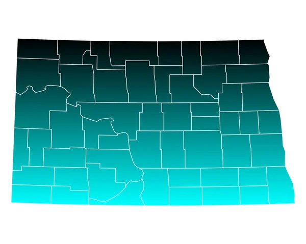
North Dakota, U.S. State Subdivided Into 53 Counties, Gray Political Map With Borders And County Names. State In The Upper Midwest Region Of United States, Nicknamed Peace Garden And Roughrider State.

Vector, 2.07MB, 9000 × 5737 eps
stock vector North Dakota, U.S. state, subdivided into 53 counties, political map with borders and county names. State in the Upper Midwest region of the United States, nicknamed Peace Garden and Roughrider State.

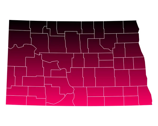
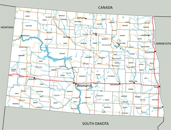
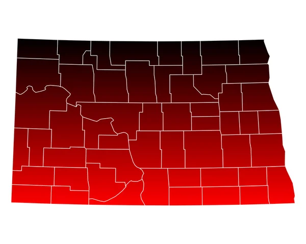
North Dakota, U.S. State, Subdivided Into 53 Counties, Political Map With Borders And County Names. State In The Upper Midwest Region Of The United States, Nicknamed Peace Garden And Roughrider State.

Vector, 2.1MB, 9000 × 5648 eps
stock vector South Dakota, U.S. state, subdivided into 66 counties, political map with borders and county names. State in the North Central region of the United States, nicknamed The Mount Rushmore State.

South Dakota, U.S. State, Subdivided Into 66 Counties, Political Map With Borders And County Names. State In The North Central Region Of The United States, Nicknamed The Mount Rushmore State.

Vector, 2.24MB, 9000 × 6000 eps
stock vector Minnesota, U.S. state, subdivided into 87 counties, multi colored political map with capital St. Paul, borders and county names. State in the Upper Midwestern region of the USA. North Star State.

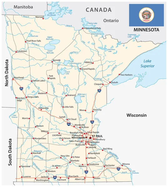
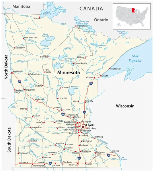
Minnesota, U.S. State, Subdivided Into 87 Counties, Multi Colored Political Map With Capital St. Paul, Borders And County Names. State In The Upper Midwestern Region Of The USA. North Star State.

Vector, 2.61MB, 6000 × 6781 eps
stock vector Flag of South Dakota State from brush strokes. United States of America.  Waving Flag State of South Dakota with title on transparent background for your web site design, app, UI. USA. Vector illustration. EPS10.

Flag Of South Dakota State From Brush Strokes. United States Of America. Waving Flag State Of South Dakota With Title On Transparent Background For Your Web Site Design, App, UI. USA. Vector Illustration. EPS10.

Vector, 10.82MB, 6668 × 5000 eps
stock vector South Dakota, U.S. state, subdivided into 66 counties, multi colored political map with capital Pierre, borders and county names. North Central region of United States, nicknamed Mount Rushmore State.

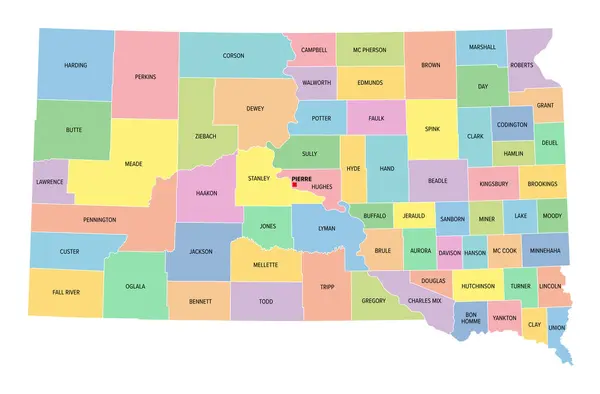
South Dakota, U.S. State, Subdivided Into 66 Counties, Multi Colored Political Map With Capital Pierre, Borders And County Names. North Central Region Of United States, Nicknamed Mount Rushmore State.

Vector, 2.12MB, 9000 × 5923 eps
Page 1 >> Next