
Stock image Oceanic Crust
Eruption Of The Underwater Volcano Near The Island Of Tonga. Hunga Tonga Hunga Haapai. Tsunami Warning. Column Of Smoke And Ashes. 3d Rendering
Image, 5.97MB, 3543 × 3335 jpg

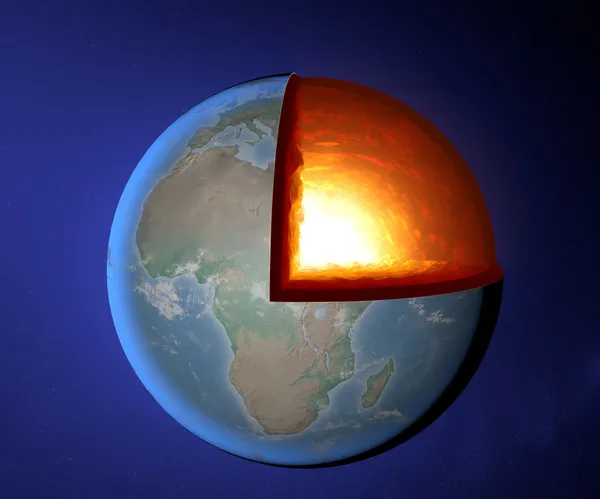
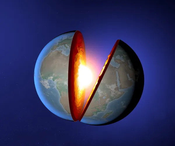
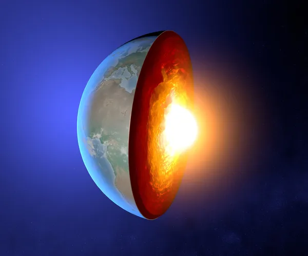
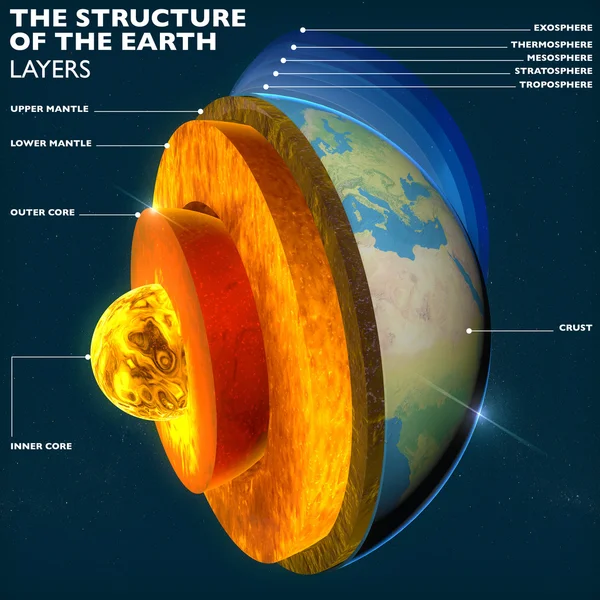
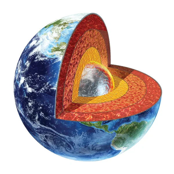
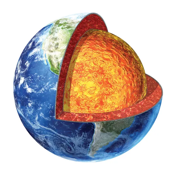
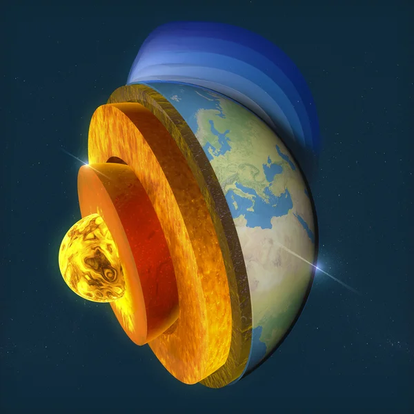
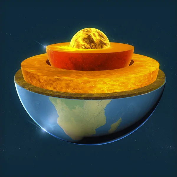
Earth Structure, Division Into Layers, The Earth's Crust And Core. 3d Rendering
Image, 15.61MB, 6299 × 4724 jpg

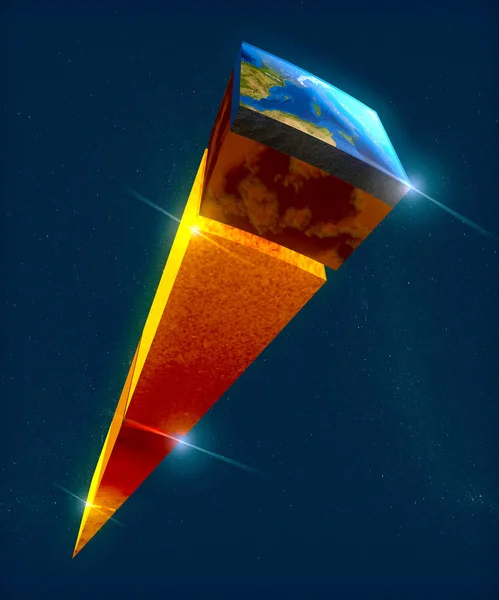
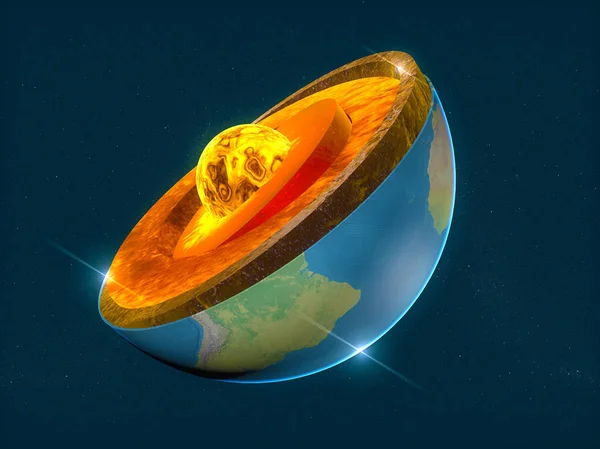
Earth Structure, Division Into Layers, The Earth's Crust And Core. 3d Rendering
Image, 12.1MB, 3937 × 4724 jpg
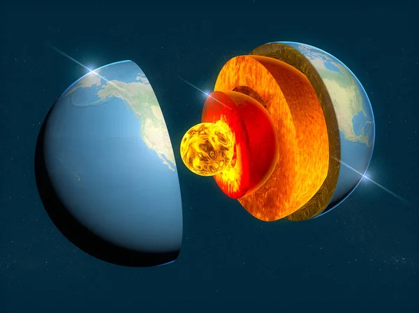
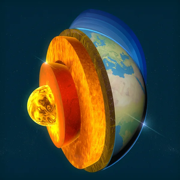
Earth Structure, Division Into Layers, The Earth's Crust And Core. 3d Rendering
Image, 15.94MB, 6299 × 4724 jpg
Earth Structure, Division Into Layers, The Earth's Crust And Core. 3d Rendering
Image, 12.23MB, 3938 × 4724 jpg

A Detailed Cross-section Of Earth's Layers, Revealing The Complexity Of Geological Formations.
Image, 7.21MB, 5824 × 3264 jpg
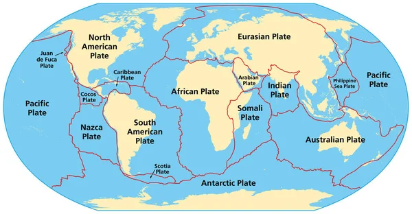
Map Of The Principal Tectonic Plates Of The Earth. The Sixteen Major Pieces Of Crust And Uppermost Mantle Of The Earth, Called The Lithosphere, And Consisting Of Oceanic And Continental Crust. Vector
Vector, 4.27MB, 9000 × 4681 eps
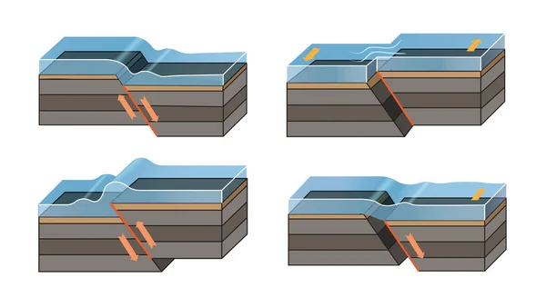
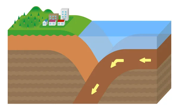
3d Illustration Of A Scientific Ground Cross-section To Explain Subduction And Plate Tectonics
Image, 16.67MB, 10000 × 5625 jpg

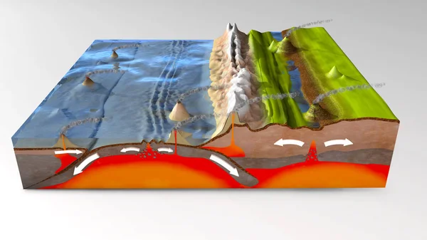
Scientific Ground Cross-section To Explain Subduction And Plate Tectonics - 3d Illustration
Image, 19.77MB, 10000 × 5000 jpg
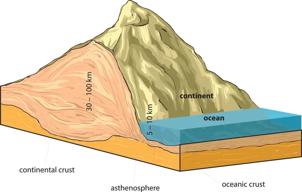
Continental Crust And Oceanic Crust. Sectional View Vector Illustration.
Vector, 0.77MB, 8076 × 4978 eps
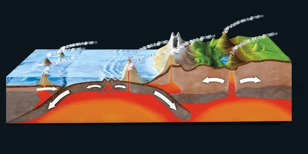
3d Illustration Of A Scientific Ground Cross-section To Explain Subduction And Plate Tectonics
Image, 14.41MB, 10000 × 6000 jpg
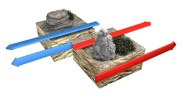
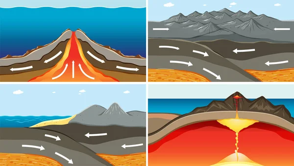
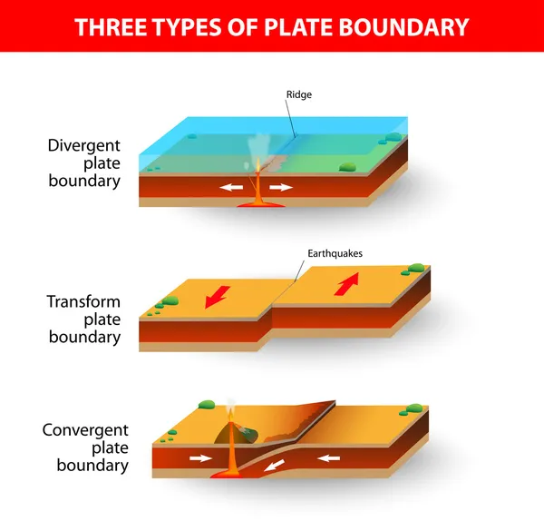
Types Of Plate Boundaries. Transform Boundaries (Conservative) Occur Where Two Lithospheric Plates Slide, Grind Past Each Other Along Transform Faults, Where Plates Are Neither Created Nor Destroyed. 3d Rendering
Image, 4.87MB, 5511 × 3100 jpg
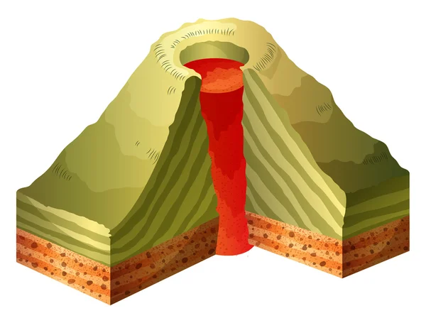
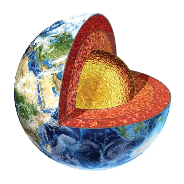
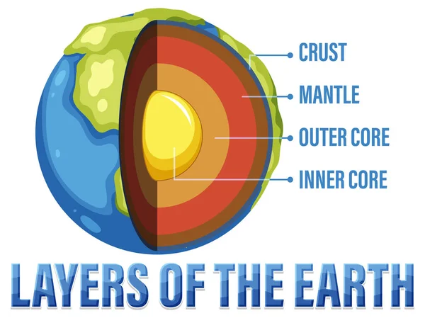

Plate Boundaries Vector Illustration. Labeled Tectonic Movement Comparison.
Vector, 5.64MB, 4000 × 4000 eps

Plate Tectonics Word Cloud Concept. Collage Made Of Words About Plate Tectonics. Vector Illustration
Vector, 1.59MB, 9072 × 4590 eps
Continental Crust And Oceanic Crust. Sectional View Vector Illustration.
Vector, 0.74MB, 8241 × 5079 eps
Scientific Ground Cross-section To Explain Subduction And Plate Tectonics - 3d Illustration
Image, 17.16MB, 10000 × 5625 jpg
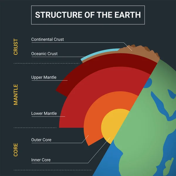
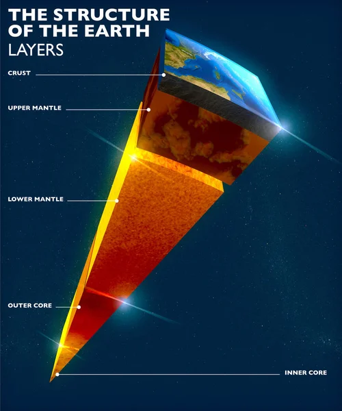
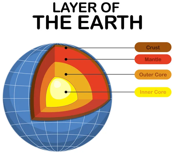
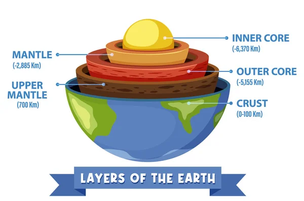
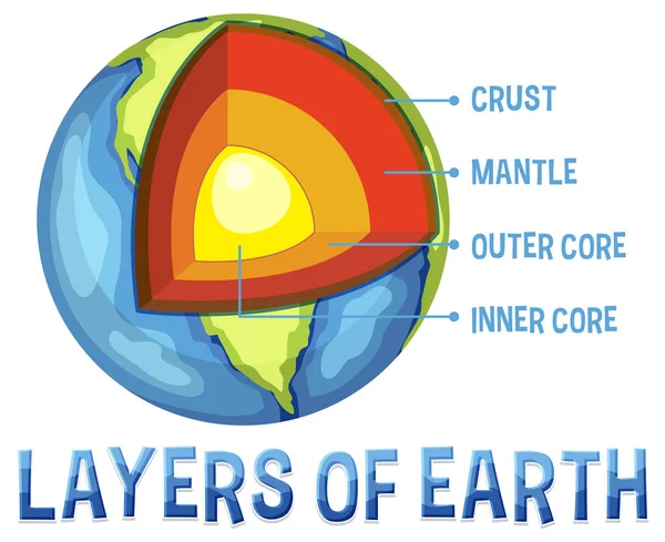
Structure Of The Earth Infographic. Diagram Of The Interior Layer Of Earth.
Vector, 9.84MB, 5000 × 5000 eps
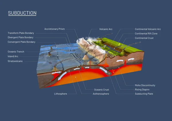
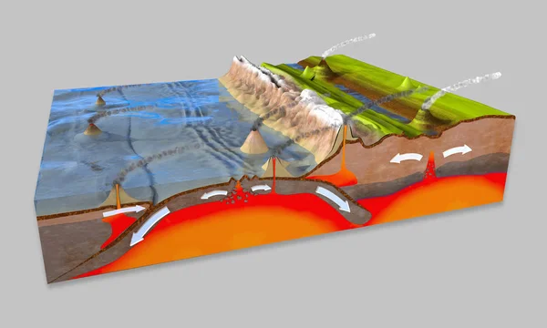
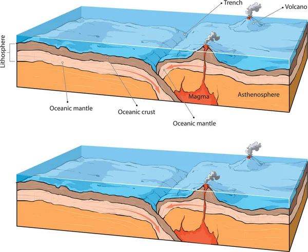
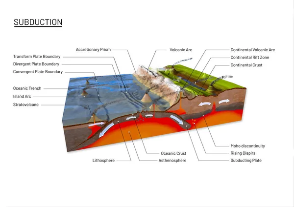
3d Illustration Of A Scientific Ground Cross-section To Explain Subduction And Plate Tectonics With Labels
Image, 15.9MB, 14043 × 9933 jpg

Ridge Push, Slab Pull Or Trench Suction Labeled Scheme Vector Illustration.
Vector, 5.95MB, 4000 × 4000 eps

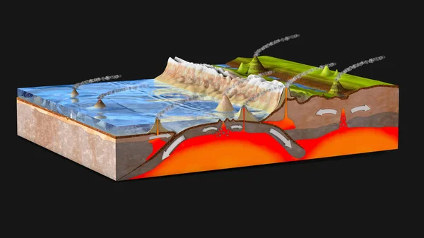
Scientific Ground Cross-section To Explain Subduction And Plate Tectonics
Image, 12.78MB, 9800 × 6932 jpg

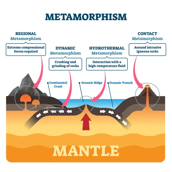
Metamorphism Vector Illustration. Labeled Mineral Geologic Structure Change
Vector, 5.95MB, 4000 × 4000 eps
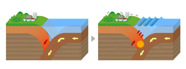
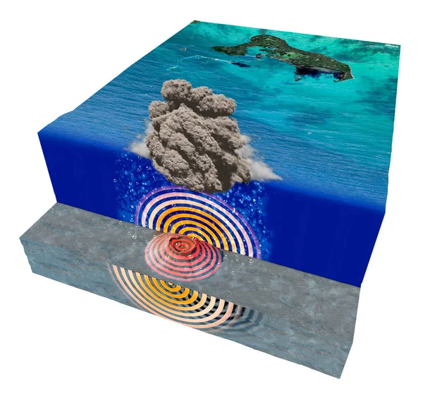
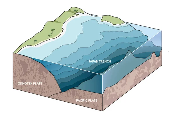
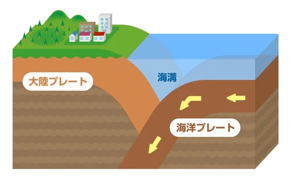
Mechanism Of Trench Earthquake Occurrence. Sectional View Vector Illustration.
Vector, 0.93MB, 9673 × 3620 eps
Page 1 >> Next