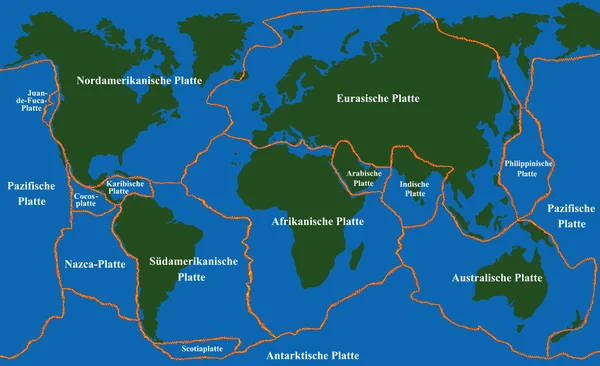
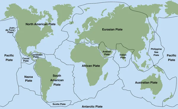
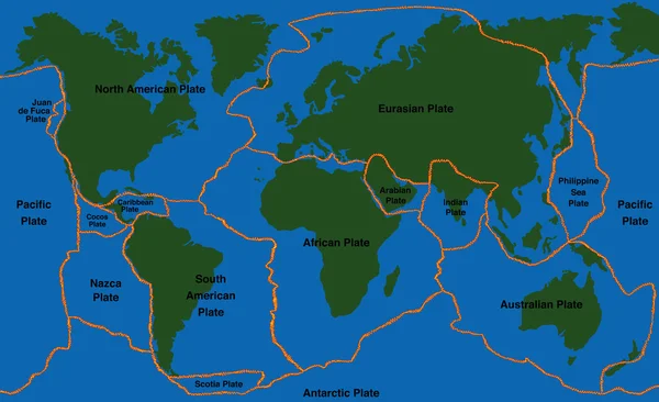
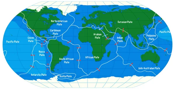
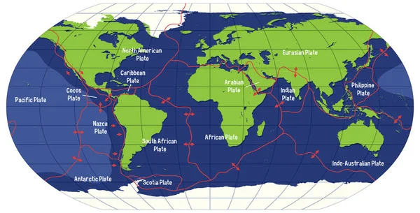
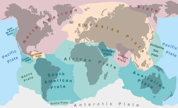
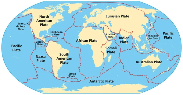
Stock vector Map of the principal tectonic plates of the Earth. The sixteen major pieces of crust and uppermost mantle of the Earth, called the lithosphere, and consisting of oceanic and continental crust. Vector
Published: Sep.11, 2023 10:27:29
Author: Furian
Views: 34
Downloads: 4
File type: vector / eps
File size: 4.27 MB
Orginal size: 9000 x 4681 px
Available sizes:
Level: silver