photo free
Home Images Vectors Videos

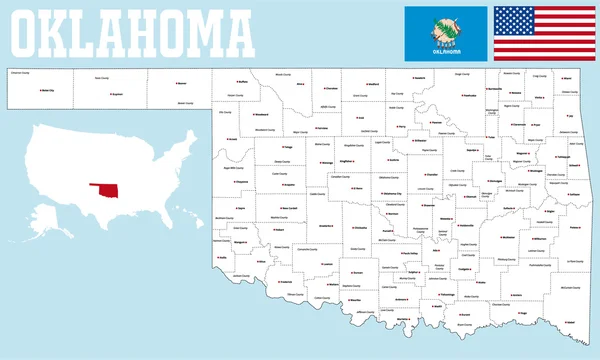
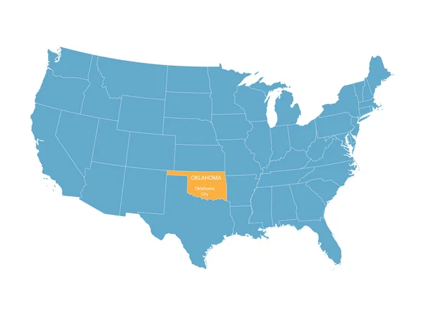
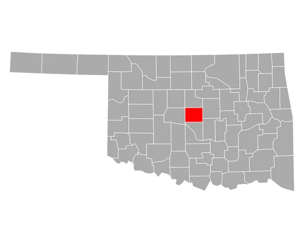
Stock image Oklahoma County Map

stock vector Oklahoma county map

Oklahoma County Map

Vector, 1.38MB, 5000 × 3005 ai
stock vector Oklahoma state outline administrative and political vector map in black and white

Oklahoma State Outline Administrative And Political Vector Map In Black And White

Vector, 0MB, 4000 × 3853 zip
stock vector Oklahoma map

Oklahoma Map

Vector, 8.72MB, 7002 × 7002 eps
stock vector Texas road map

Texas Road Map

Vector, 1.78MB, 3079 × 2993 eps
stock image US State Maps Set II

US State Maps Set II

Image, 22MB, 7500 × 7500 jpg
stock vector Texas county map

Texas County Map

Vector, 3.33MB, 5133 × 4500 eps
stock vector Welcome to Oklahoma vintage grunge poster, vector illustration

Welcome To Oklahoma Vintage Grunge Poster, Vector Illustration

Vector, 4.46MB, 5800 × 5800 eps
stock vector Accurate map of Oklahoma

Accurate Map Of Oklahoma

Vector, 0.7MB, 5000 × 4000 eps
stock vector USA map with abbreviated state names. United States of America cartography with colored states. Vector illustration.

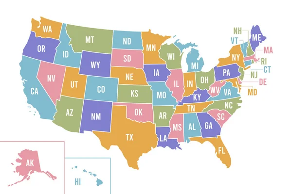
USA Map With Abbreviated State Names. United States Of America Cartography With Colored States. Vector Illustration.

Vector, 0.68MB, 6250 × 4167 eps
stock vector Oklahoma detailed exact detailed vector State Map with Community Assistance and Activates Icons Original pastel yellow Illustration with main roads. United States of Americ

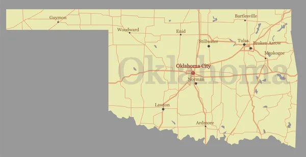
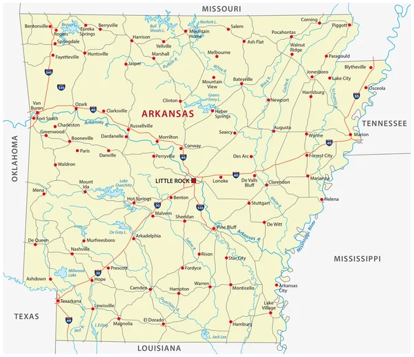
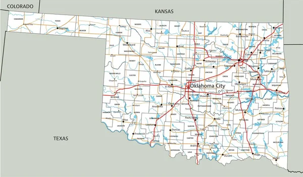
Oklahoma Detailed Exact Detailed Vector State Map With Community Assistance And Activates Icons Original Pastel Yellow Illustration With Main Roads. United States Of Americ

Vector, 0.55MB, 5501 × 2840 eps
stock vector blue vector map of United States with indication of Oklahoma

Blue Vector Map Of United States With Indication Of Oklahoma

Vector, 1.73MB, 4600 × 3450 eps
stock vector arkansas road map

Arkansas Road Map

Vector, 1.57MB, 3591 × 3100 eps
stock vector Illinois state outline administrative and political vector map in black and white

Illinois State Outline Administrative And Political Vector Map In Black And White

Vector, 1.07MB, 3100 × 3613 eps
stock vector Map of Oklahoma in Oklahoma

Map Of Oklahoma In Oklahoma

Vector, 0.26MB, 5000 × 4000 eps
stock vector Accurate map of Oklahoma

Accurate Map Of Oklahoma

Vector, 0.66MB, 5000 × 4000 eps
stock vector Oklahoma City Vector Map

Oklahoma City Vector Map

Vector, 5.4MB, 8000 × 8000 eps
stock vector vector road map of the US state of Texas

Vector Road Map Of The US State Of Texas

Vector, 2.51MB, 3454 × 3100 eps
stock vector Highly detailed vector silhouettes of US state maps, Division United States into counties, political and geographic subdivisions of a states, West South Central - Arkansas, Louisiana, Oklahoma - set 12 of 17

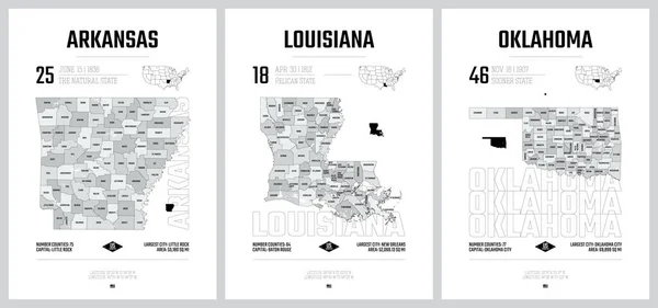
Highly Detailed Vector Silhouettes Of US State Maps, Division United States Into Counties, Political And Geographic Subdivisions Of A States, West South Central - Arkansas, Louisiana, Oklahoma - Set 12 Of 17

Vector, 11.98MB, 9608 × 4501 eps
stock vector Accurate map of Oklahoma

Accurate Map Of Oklahoma

Vector, 0.67MB, 5000 × 4000 eps
stock vector Oklahoma County Map

Oklahoma County Map

Vector, 0.82MB, 5000 × 3011 ai
stock vector High Quality map of Oklahoma is a state of United States of America with borders of the counties

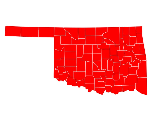
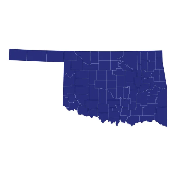
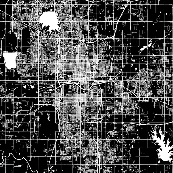
High Quality Map Of Oklahoma Is A State Of United States Of America With Borders Of The Counties

Vector, 1.18MB, 4000 × 4000 eps
stock vector USA State counties emblem map

USA State Counties Emblem Map

Vector, 0MB, 5136 × 5168 zip
stock vector Accurate map of Oklahoma

Accurate Map Of Oklahoma

Vector, 0.53MB, 5000 × 4000 eps
stock vector High Quality map state of United States

High Quality Map State Of United States

Vector, 1.28MB, 5714 × 4000 eps
stock vector Accurate map of Oklahoma

Accurate Map Of Oklahoma

Vector, 0.7MB, 5000 × 4000 eps
stock vector Accurate map of Oklahoma

Accurate Map Of Oklahoma

Vector, 0.67MB, 5000 × 4000 eps
stock vector Colorado - Kansas - Oklahoma - Missouri Map labelled black

Colorado - Kansas - Oklahoma - Missouri Map Labelled Black

Vector, 3.49MB, 10079 × 5000 eps
stock vector Accurate map of Oklahoma

Accurate Map Of Oklahoma

Vector, 0.66MB, 5000 × 4000 eps
stock vector Kanzas state detailed editable map

Kanzas State Detailed Editable Map

Vector, 1.15MB, 7500 × 4298 eps
stock vector Accurate map of Oklahoma

Accurate Map Of Oklahoma

Vector, 0.7MB, 5000 × 4000 eps
stock vector Colorado state detailed editable map

Colorado State Detailed Editable Map

Vector, 1.07MB, 7000 × 5291 eps
stock vector Texas region map

Texas Region Map

Vector, 8.27MB, 5012 × 4506 eps
stock vector Texas map icon vector for your web site computer and app

Texas Map Icon Vector For Your Web Site Computer And App

Vector, 4.93MB, 5280 × 2880 eps
stock vector oklahoma state outline administrative and political vector map in black and white

Oklahoma State Outline Administrative And Political Vector Map In Black And White

Vector, 0.92MB, 4627 × 3100 eps
stock vector Accurate map of Oklahoma

Accurate Map Of Oklahoma

Vector, 0.7MB, 5000 × 4000 eps
stock image State of Arkansas map

State Of Arkansas Map

Image, 1.1MB, 4300 × 2800 jpg
stock vector Set 5 of 5 Highly detailed vector silhouettes of USA state maps

Set 5 Of 5 Highly Detailed Vector Silhouettes Of USA State Maps

Vector, 7.62MB, 8858 × 3738 eps
stock vector USA states ans cities vehicle registration plates

USA States Ans Cities Vehicle Registration Plates

Vector, 2.97MB, 8393 × 4290 eps
stock image Glowing Map of Oklahoma, modern blue outline map, on dark Background

Glowing Map Of Oklahoma, Modern Blue Outline Map, On Dark Background

Image, 3.26MB, 7500 × 5000 jpg
stock vector Oklahoma USA state map vector tag cloud illustration

Oklahoma USA State Map Vector Tag Cloud Illustration

Vector, 8.46MB, 12992 × 6221 eps
stock vector High detailed Oklahoma road map with labeling.

High Detailed Oklahoma Road Map With Labeling.

Vector, 7.64MB, 7010 × 4106 eps
stock vector Set 5 of 5 Division United States into counties, political and geographic subdivisions of a states, Highly detailed vector maps with names and territory nicknames

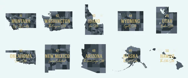
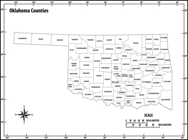
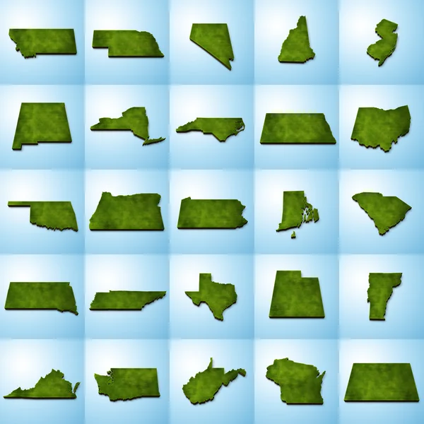
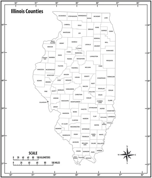
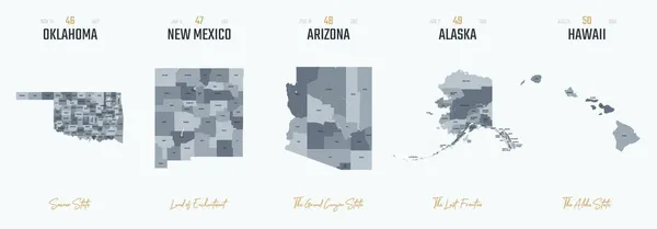
Set 5 Of 5 Division United States Into Counties, Political And Geographic Subdivisions Of A States, Highly Detailed Vector Maps With Names And Territory Nicknames

Vector, 5.97MB, 9585 × 4010 eps
stock vector Oklahoma, U.S. state, subdivided into 77 counties, multi colored political map with capital Oklahoma City, borders and county names. State in the South Central region of United States. Native America.

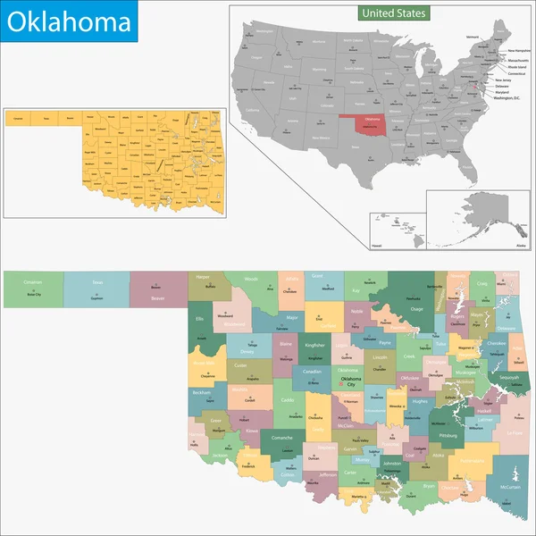
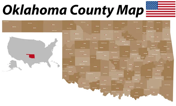
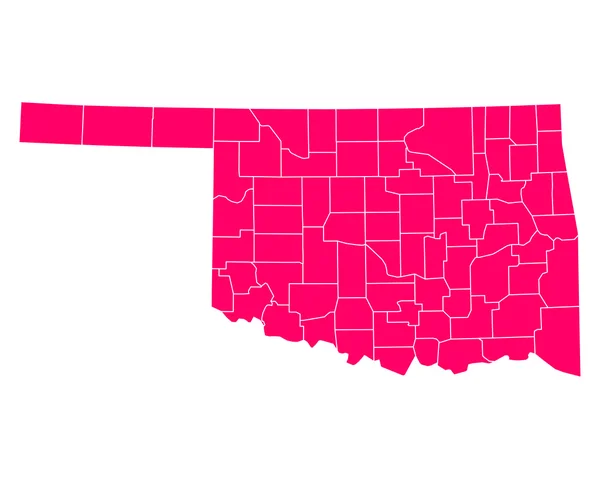
Oklahoma, U.S. State, Subdivided Into 77 Counties, Multi Colored Political Map With Capital Oklahoma City, Borders And County Names. State In The South Central Region Of United States. Native America.

Vector, 1.98MB, 9000 × 4955 eps
stock vector Set of Oklahoma map, united states of america. Flat concept symbol vector illustration .

Set Of Oklahoma Map, United States Of America. Flat Concept Symbol Vector Illustration .

Vector, 0.2MB, 5151 × 3513 eps
stock vector Oklahoma Circle Button States of US Map Icon Vector Template Illustration Design

Oklahoma Circle Button States Of US Map Icon Vector Template Illustration Design

Vector, 10.56MB, 8333 × 8333 eps
stock vector United States of America map. Red USA outline map on isolated background. Vector

United States Of America Map. Red USA Outline Map On Isolated Background. Vector

Vector, 0.4MB, 5923 × 4000 eps
stock vector The black and white administrative maps of Oklahoma State, USA

The Black And White Administrative Maps Of Oklahoma State, USA

Vector, 8.22MB, 5528 × 6000 eps
stock vector Oklahoma, U.S. state, gray political map with borders and county names. State in the South Central region of USA, subdivided into 77 counties. Native America, Land of the Red Man, and Sooner State.

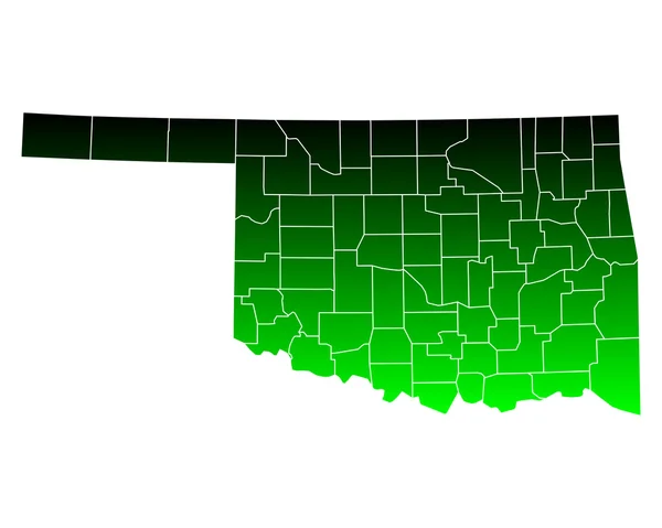
Oklahoma, U.S. State, Gray Political Map With Borders And County Names. State In The South Central Region Of USA, Subdivided Into 77 Counties. Native America, Land Of The Red Man, And Sooner State.

Vector, 1.96MB, 9000 × 4955 eps
stock vector Oklahoma, U.S. state, political map with borders and county names. State in the South Central region of the USA, subdivided into 77 counties. Native America, Land of the Red Man, and Sooner State.

Oklahoma, U.S. State, Political Map With Borders And County Names. State In The South Central Region Of The USA, Subdivided Into 77 Counties. Native America, Land Of The Red Man, And Sooner State.

Vector, 2.25MB, 9000 × 5113 eps
stock vector Vector set 10 of 10 Highly detailed silhouettes of US state maps, divided into counties with names and territory nicknames

Vector Set 10 Of 10 Highly Detailed Silhouettes Of US State Maps, Divided Into Counties With Names And Territory Nicknames

Vector, 4.76MB, 9585 × 3348 eps
Page 1 >> Next