
Stock image Old North State


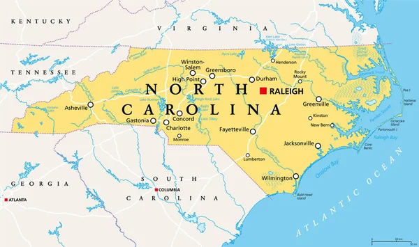
North Carolina, NC, Political Map. With The Capital Raleigh And Largest Cities. State In The Southeastern Region Of The United States Of America. Old North State. Tar Heel State. Illustration. Vector.
Vector, 5.04MB, 9000 × 5331 eps

North Carolina, NC, Gray Political Map. With Capital Raleigh And Largest Cities. State In The Southeastern Region Of The United States Of America. Old North State. Tar Heel State. Illustration. Vector
Vector, 2.31MB, 9000 × 4674 eps

Chicago: The Historic Sign Of The Chicago Theatre, Originally Known As The Balaban And Katz Chicago Theatre, A Landmark Built In 1921 And Located On North State Street In The Loop Area
Image, 11.15MB, 4288 × 2848 jpg


North Carolina Counties, Gray Political Map With Borders And County Names. State In The Southeastern Region Of United States Subdivided Into 100 Counties. Nicknamed Tar Heel State And Old North State.
Vector, 2.27MB, 9000 × 3935 eps

North Carolina Counties, Political Map With Borders County Names. State In The Southeastern Region Of United States, Subdivided Into 100 Counties. Nicknamed The Tar Heel State And The Old North State.
Vector, 3.61MB, 9000 × 5155 eps

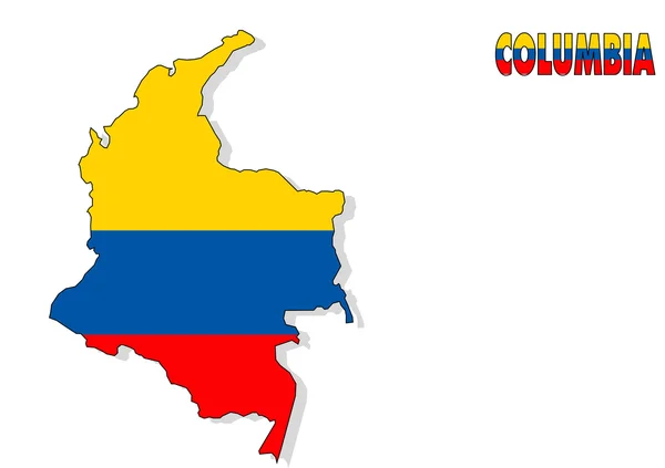
The Carolinas Or Carolina, The U.S. States North Carolina And South Carolina, Political Map, With Borders And Capitals Raleigh And Columbia. Bordered By Virginia, Tennessee, Georgia, And The Atlantic.
Vector, 4.05MB, 8806 × 6000 eps

The Carolinas Or Simply Carolina, U.S. States North And South Carolina, Gray Political Map, With Borders And Capitals Raleigh And Columbia. Bordered By Virginia, Tennessee, Georgia, And The Atlantic.
Vector, 3.14MB, 8808 × 6000 eps
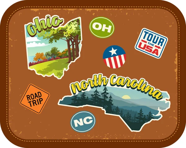
Ohio, North Carolina Travel Stickers With Scenic Attractions And Retro Text On Vintage Suitcase Background
Vector, 3.12MB, 5037 × 4020 eps
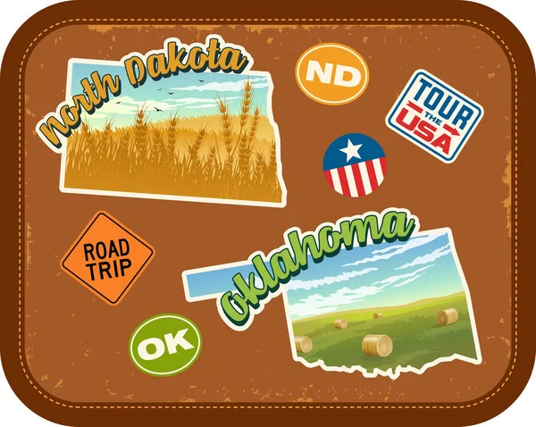
North Dakota, Oklahoma Travel Stickers With Scenic Attractions And Retro Text On Vintage Suitcase Background
Vector, 3.47MB, 5037 × 4020 eps

Wax Portrait Of Albert Einstein At Madame Tussaud's Museum In New York
Image, 6.03MB, 4608 × 3072 jpg


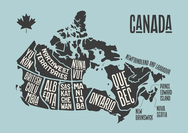
Map Canada. Poster Map Of Provinces And Territories Of Canada. Black And White Print Map Of Canada For T-shirt, Poster Or Geographic Themes. Hand-drawn Black Map With Provinces. Vector Illustration
Vector, 0.89MB, 6000 × 4259 eps
Map Canada. Poster Map Of Provinces And Territories Of Canada. Black And White Print Map Of Canada For T-shirt, Poster Or Geographic Themes. Hand-drawn Black Map With Provinces. Vector Illustration
Vector, 0.89MB, 6000 × 4259 eps

Wax Portrait Of Ernest Hemingway At Madame Tussaud's Museum In New York
Image, 5.9MB, 4436 × 2957 jpg

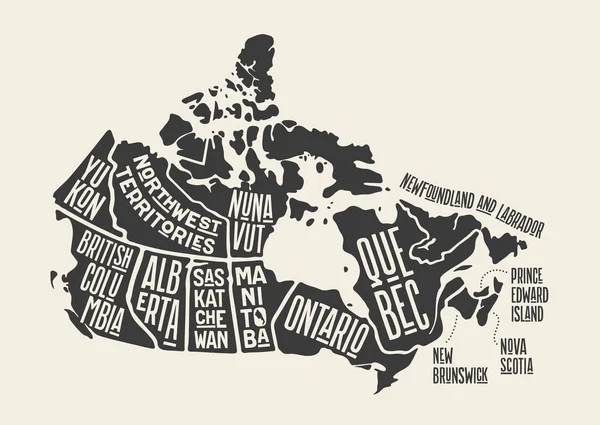
Map Canada. Poster Map Of Provinces And Territories Of Canada. Black And White Print Map Of Canada For T-shirt, Poster Or Geographic Themes. Hand-drawn Black Map With Provinces. Vector Illustration
Vector, 0.82MB, 6000 × 4259 eps


A Sunny Scenery Of The Bodie State Historic Park In Mono County, California
Image, 23.55MB, 5184 × 3456 jpg


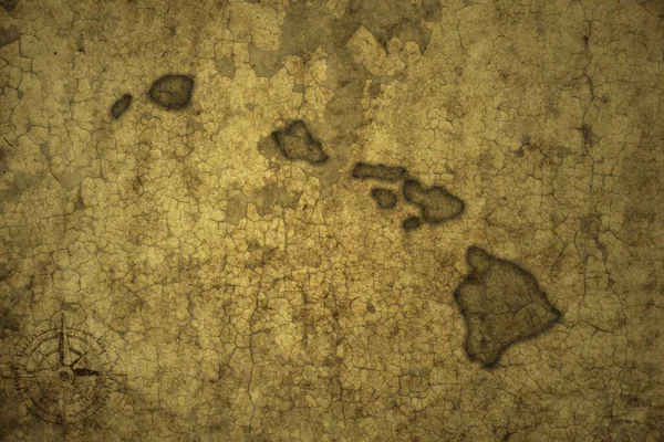
Map Of Hawaii State On A Old Vintage Crack Paper Background . 3d Illustration
Image, 22.47MB, 7360 × 4912 jpg

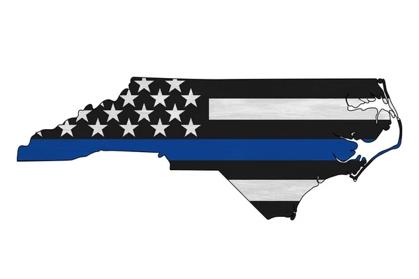
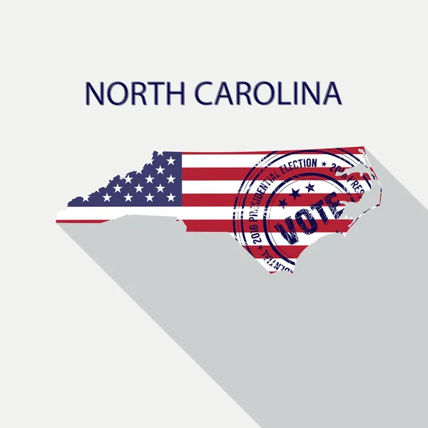
American Flag In North Carolina State Map. Vector Grunge Style With Typography Hand Drawn Lettering North Carolina On Map Shaped Old Grunge Vintage American National Flag Isolated On White Background
Vector, 4.37MB, 6000 × 4060 eps

Old, Antique Car Parked On The Legendary Route 66, Seligman, Arizona, USA.
Image, 10.58MB, 5007 × 3338 jpg

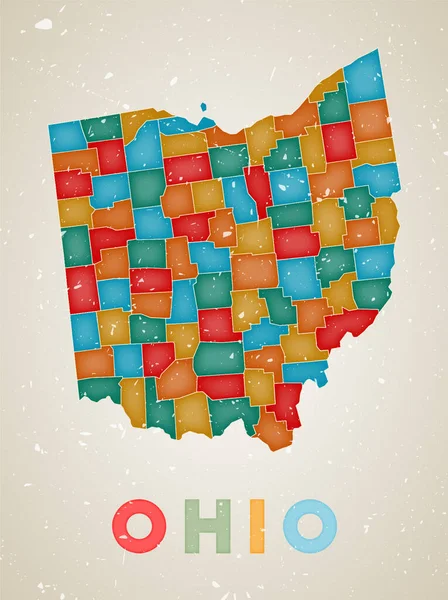
Ohio Map Us State Poster With Colored Regions Old Grunge Texture Vector Illustration Of Ohio With
Vector, 12.19MB, 1934 × 2590 eps
Page 1 >> Next