
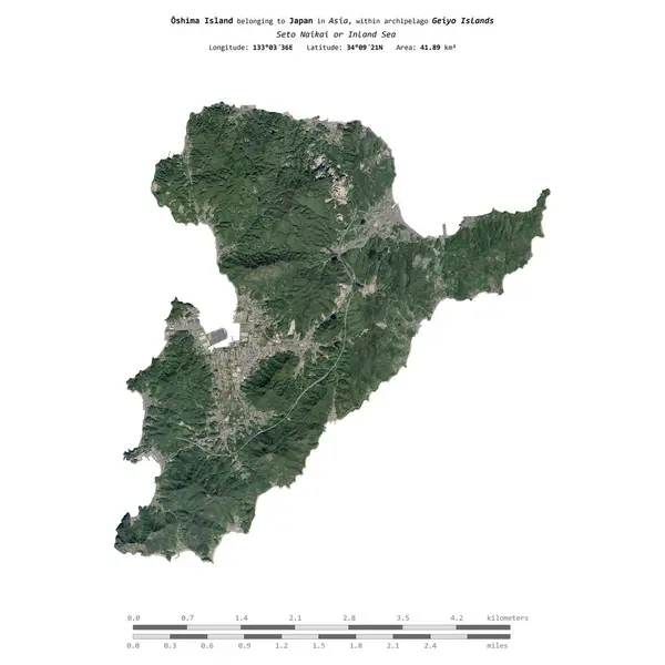
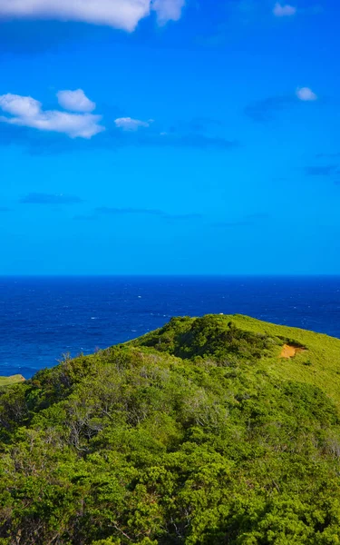
Stock image Oshima Island

Oshima Island In The Seto Naikai Or Inland Sea On A Colored Elevation Map
Image, 1.3MB, 2880 × 1620 jpg

Oshima Island In The Seto Naikai Or Inland Sea - Belonging To Japan. Described Location Diagram With Yellow Shape Of The Island And Sample Maps Of Its Surroundings
Image, 2.65MB, 3840 × 2160 jpg

Oshima Island In The Seto Naikai Or Inland Sea On A Satellite Image Taken In March 14, 2023
Image, 5.05MB, 2880 × 1620 jpg

Oshima Island In The Seto Naikai Or Inland Sea On A Topographic, OSM Humanitarian Style Map
Image, 2.02MB, 2880 × 1620 jpg

Oshima Island In The Seto Naikai Or Inland Sea, Belonging To Japan, Isolated On A Bilevel Elevation Map, With Distance Scale
Image, 0.42MB, 2160 × 2160 jpg

Oshima Island In The Seto Naikai Or Inland Sea, Belonging To Japan, Isolated On A Topographic, OSM Humanitarian Style Map, With Distance Scale
Image, 1.2MB, 2160 × 2160 jpg
Oshima Island In The Seto Naikai Or Inland Sea, Belonging To Japan, Isolated On A Satellite Image Taken In July 17, 2023, With Distance Scale
Image, 1.76MB, 2160 × 2160 jpg

Kagoshima, Japan - May 16, 2023: A Ferry Passing Through Oshima Strait, Between Amami Island And Kakeroma Island
Image, 22.6MB, 9504 × 6336 jpg

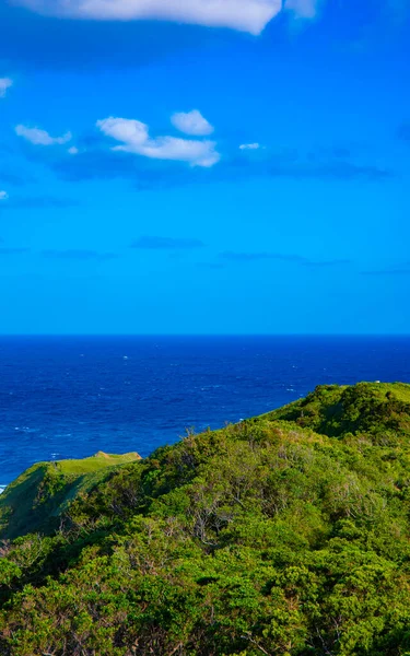
Scenery View From Lake Onuma On Sunny Day With Mt. Hokkaido Koma-ga-take And Clear Blue Sky In Background. Onuma Quasi-National Park. Town Nanae, Oshima Subprefecture, Hokkaido, Japan
Image, 16.46MB, 5928 × 3952 jpg
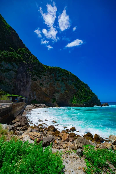
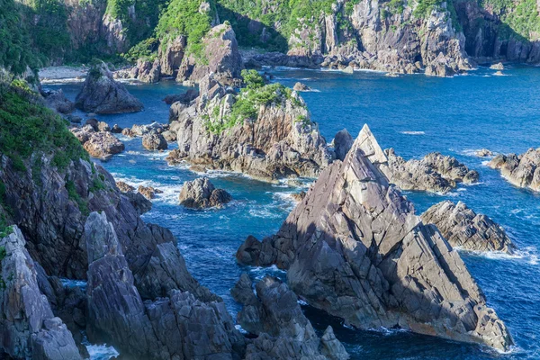
Tokuhama Cliff Near The Blue Ocean In Amami Oshima Kagoshima Wide Shot
Image, 7.87MB, 4480 × 6720 jpg
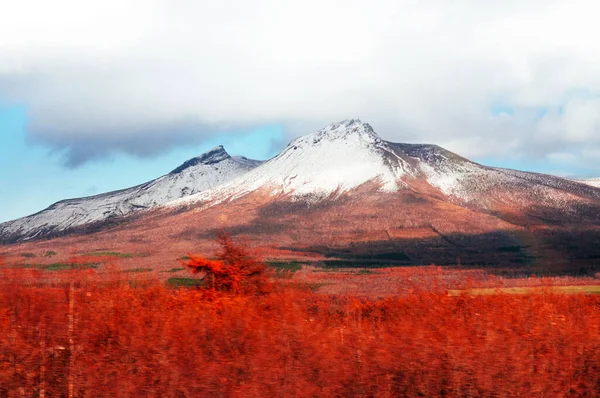
Mount Komagatake Of Hakodateyama Hokkaido In Winter With Dry Beautiful Colored Forest
Image, 8.88MB, 4288 × 2848 jpg

Mount Komagatake Of Hakodateyama Hokkaido In Winter With Dry Beautiful Colored Forest
Image, 8.72MB, 4288 × 2848 jpg
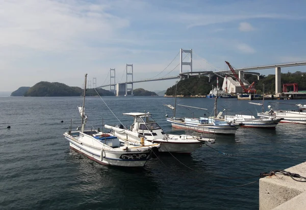
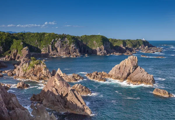
Docked Boats At Oshima Island With The Kurushima Bridge In The Background, Shimanami Kaido, Japan
Image, 6.3MB, 3949 × 2713 jpg

Mount Komagatake Of Hakodateyama Hokkaido In Winter With Dry Beautiful Colored Forest
Image, 9.43MB, 4288 × 2848 jpg
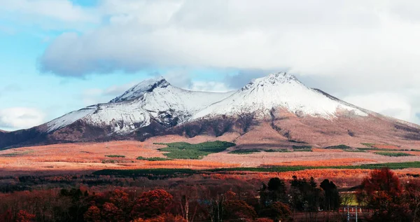
Mount Komagatake Of Hakodateyama Hokkaido In Winter With Dry Beautiful Colored Forest
Image, 5.98MB, 3996 × 2117 jpg


Amamioshima Island In The Eastern China Sea - Belonging To Japan. Described Location Diagram With Yellow Shape Of The Island And Sample Maps Of Its Surroundings
Image, 2.2MB, 3840 × 2160 jpg

Amamioshima Island In The Eastern China Sea, Belonging To Japan, Isolated On A Satellite Image Taken In October 29, 2018, With Distance Scale
Image, 1.05MB, 2160 × 2160 jpg

Ile Ouen In The Coral Sea - Belonging To France. Described Location Diagram With Yellow Shape Of The Island And Sample Maps Of Its Surroundings
Image, 2.01MB, 3840 × 2160 jpg

Amamioshima Island In The Eastern China Sea On A Colored Elevation Map
Image, 1.39MB, 2880 × 1620 jpg

Amamioshima Island In The Eastern China Sea On A Satellite Image Taken In September 23, 2021
Image, 3.29MB, 2880 × 1620 jpg

Isla Del Otro Lado In The North Pacific Ocean - Belonging To Mexico. Described Location Diagram With Yellow Shape Of The Island And Sample Maps Of Its Surroundings
Image, 2.04MB, 3840 × 2160 jpg

Ovalau Island In The South Pacific Ocean, Belonging To Fiji, Isolated On A Bilevel Elevation Map, With Distance Scale
Image, 0.42MB, 2160 × 2160 jpg

Amamioshima Island In The Eastern China Sea, Belonging To Japan, Isolated On A Bilevel Elevation Map, With Distance Scale
Image, 0.55MB, 2160 × 2160 jpg

Isla Del Otro Lado In The North Pacific Ocean, Belonging To Mexico, Isolated On A Topographic, OSM Humanitarian Style Map, With Distance Scale
Image, 0.28MB, 2160 × 2160 jpg

Ile Ouen In The Coral Sea, Belonging To France, Isolated On A Topographic, OSM Humanitarian Style Map, With Distance Scale
Image, 0.54MB, 2160 × 2160 jpg
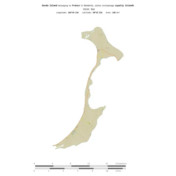
Ouvea Island In The Coral Sea, Belonging To France, Isolated On A Topographic, OSM Humanitarian Style Map, With Distance Scale
Image, 0.36MB, 2160 × 2160 jpg

Ouvea Island In The Coral Sea - Belonging To France. Described Location Diagram With Yellow Shape Of The Island And Sample Maps Of Its Surroundings
Image, 1.79MB, 3840 × 2160 jpg

Amamioshima Island In The Eastern China Sea, Belonging To Japan, Isolated On A Topographic, OSM Humanitarian Style Map, With Distance Scale
Image, 0.69MB, 2160 × 2160 jpg

Ovalau Island In The South Pacific Ocean, Belonging To Fiji, Isolated On A Topographic, OSM Humanitarian Style Map, With Distance Scale
Image, 0.5MB, 2160 × 2160 jpg

Ile De L'Ouest In The Indian Ocean - Belonging To French Southern And Antarctic Lands. Described Location Diagram With Yellow Shape Of The Island And Sample Maps Of Its Surroundings
Image, 2.56MB, 3840 × 2160 jpg

Ile De L'Ouest In The Indian Ocean, Belonging To French Southern And Antarctic Lands, Isolated On A Bilevel Elevation Map, With Distance Scale
Image, 0.33MB, 2160 × 2160 jpg

Ovalau Island In The South Pacific Ocean - Belonging To Fiji. Described Location Diagram With Yellow Shape Of The Island And Sample Maps Of Its Surroundings
Image, 1.77MB, 3840 × 2160 jpg

Amamioshima Island In The Eastern China Sea On A Topographic, OSM Humanitarian Style Map
Image, 0.88MB, 2880 × 1620 jpg

Ile Ouen In The Coral Sea, Belonging To France, Isolated On A Bilevel Elevation Map, With Distance Scale
Image, 0.37MB, 2160 × 2160 jpg

Ile De L'Ouest In The Indian Ocean, Belonging To French Southern And Antarctic Lands, Isolated On A Topographic, OSM Humanitarian Style Map, With Distance Scale
Image, 0.45MB, 2160 × 2160 jpg

Ouvea Island In The Coral Sea, Belonging To France, Isolated On A Bilevel Elevation Map, With Distance Scale
Image, 0.27MB, 2160 × 2160 jpg
Page 1 >> Next