
Stock image Plate Tectonics
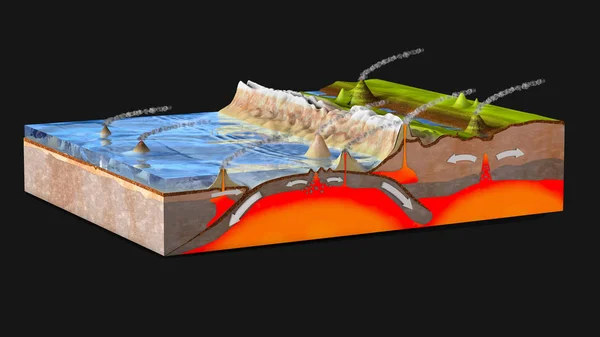
Scientific Ground Cross-section To Explain Subduction And Plate Tectonics - 3d Illustration
Image, 17.16MB, 10000 × 5625 jpg

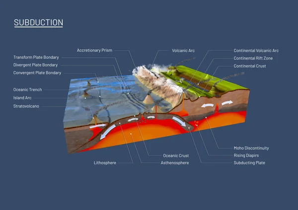
3d Illustration Of A Scientific Ground Cross-section To Explain Subduction And Plate Tectonics With Labels
Image, 15.9MB, 14043 × 9933 jpg
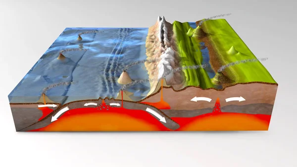
3d Illustration Of A Scientific Ground Cross-section To Explain Subduction And Plate Tectonics
Image, 16.67MB, 10000 × 5625 jpg
Scientific Ground Cross-section To Explain Subduction And Plate Tectonics - 3d Illustration
Image, 19.77MB, 10000 × 5000 jpg
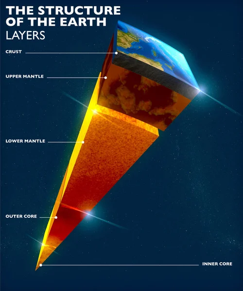
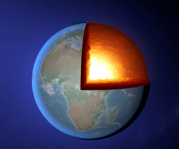
Earth Structure, Division Into Layers, The Earth's Crust And Core. 3d Rendering
Image, 12.23MB, 3938 × 4724 jpg
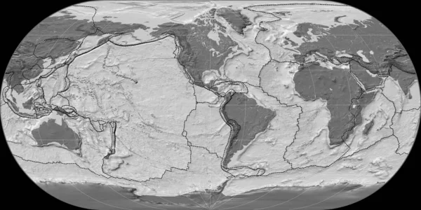
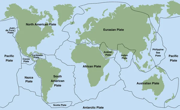
World Map In The Ortelius Oval Projection Centered On 90 West Longitude. Bilevel Topographic Map - Composite Of Raster With Graticule And Tectonic Plates Borders. 3D Illustration
Image, 4.7MB, 4000 × 2000 jpg
3d Illustration Of A Scientific Ground Cross-section To Explain Subduction And Plate Tectonics
Image, 14.41MB, 10000 × 6000 jpg
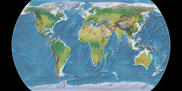
World Map In The Kavraisky VII Projection Centered On 90 East Longitude. Satellite Imagery A - Composite Of Raster With Graticule And Tectonic Plates Borders. 3D Illustration
Image, 8.84MB, 4000 × 2000 jpg
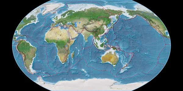
World Map In The Canters Pseudocylindric Projection Centered On 11 East Longitude. Main Physiographic Landscape Features - Composite Of Raster With Graticule And Tectonic Plates Borders. 3D Illustration
Image, 9.85MB, 4000 × 2000 jpg

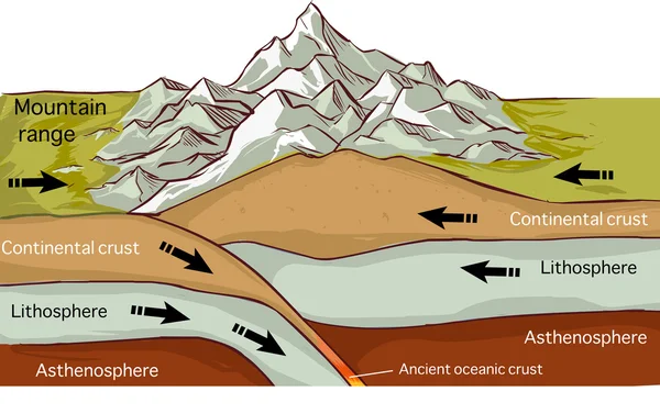
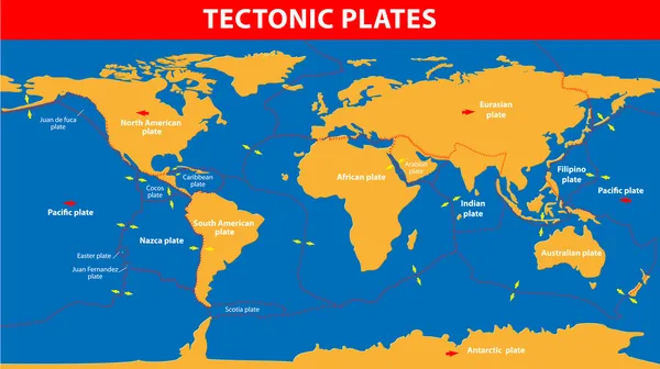
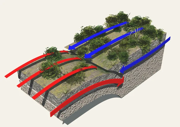
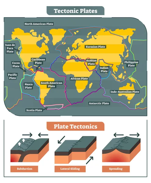
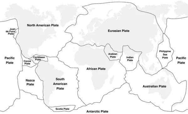
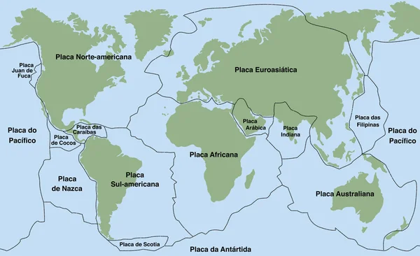
Tectonic Plates Move Constantly, Making New Areas Of Ocean Floor, Building Mountains, Causing Earthquakes, And Creating Volcanoes. 3d Rendering. Map. Element Of This Image Are Furnished By Nasa
Image, 9.22MB, 5014 × 5010 jpg

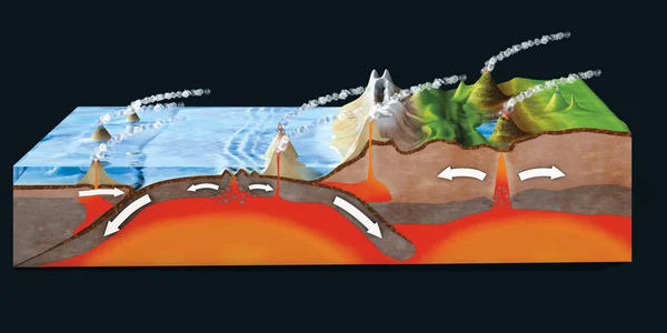
Scientific Ground Cross-section To Explain Subduction And Plate Tectonics
Image, 9.35MB, 9800 × 6932 jpg
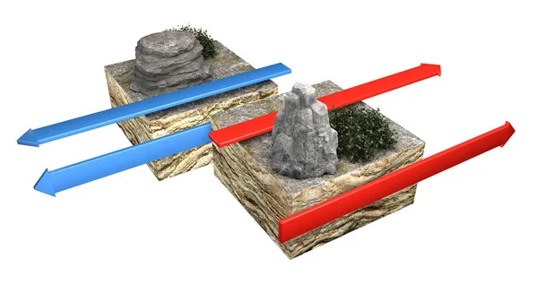
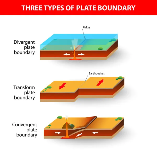
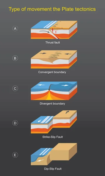
Types Of Plate Boundaries. Transform Boundaries (Conservative) Occur Where Two Lithospheric Plates Slide, Grind Past Each Other Along Transform Faults, Where Plates Are Neither Created Nor Destroyed. 3d Rendering
Image, 4.87MB, 5511 × 3100 jpg
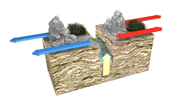
Types Of Plate Boundaries. Convergent Boundaries (Destructive) (or Active Margins) Occur Where Two Plates Slide Toward Each Other To Form Either A Subduction Zone (one Plate Moving Underneath The Other) Or A Continental Collision. 3d Rendering
Image, 6.07MB, 4675 × 3100 jpg
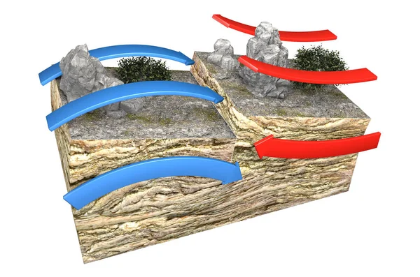
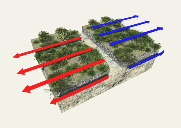
Types Of Plate Boundaries. Divergent Boundaries (Constructive) Occur Where Two Plates Slide Apart From Each Other. At Zones Of Continent-to-continent Rifting, Divergent Boundaries May Cause New Ocean Basin To Form As The Continent Splits, Spreads
Image, 5.61MB, 5214 × 3100 jpg


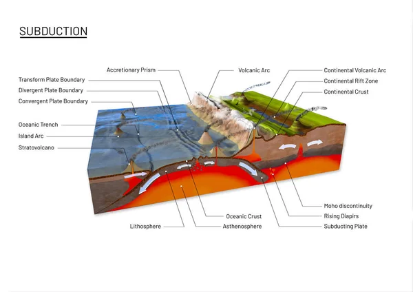
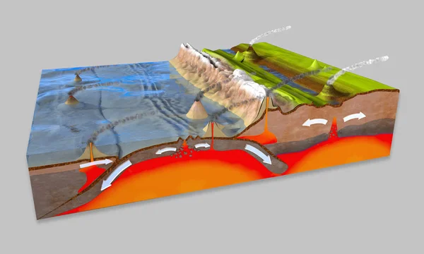
Scientific Ground Cross-section To Explain Subduction And Plate Tectonics
Image, 12.78MB, 9800 × 6932 jpg


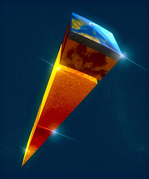
Earth Structure, Division Into Layers, The Earth's Crust And Core. 3d Rendering
Image, 12.1MB, 3937 × 4724 jpg
Page 1 >> Next