
Stock image Plate Tectonics page 2
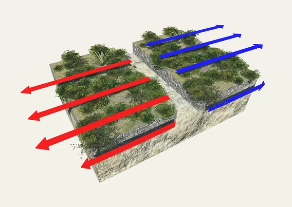


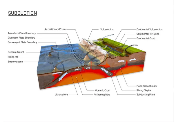
Scientific Ground Cross-section To Explain Subduction And Plate Tectonics
Image, 12.78MB, 9800 × 6932 jpg


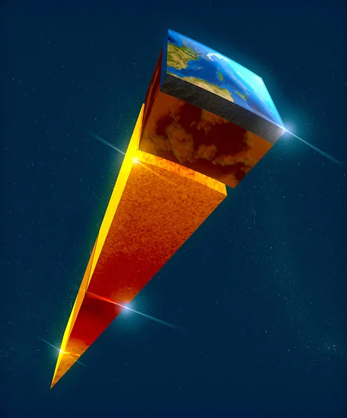
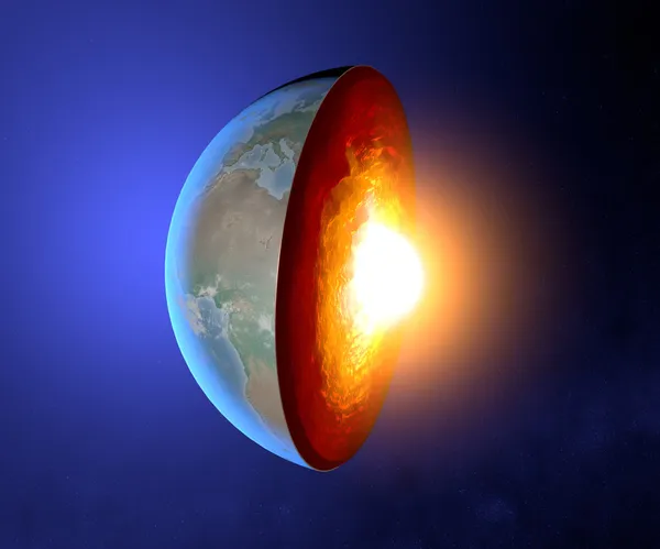
Earth Structure, Division Into Layers, The Earth's Crust And Core. 3d Rendering
Image, 12.1MB, 3937 × 4724 jpg

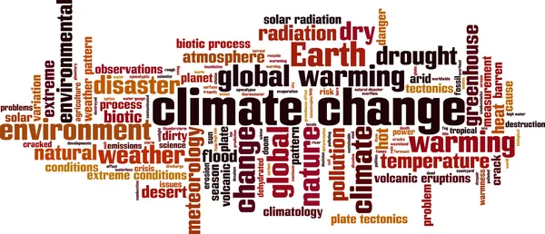
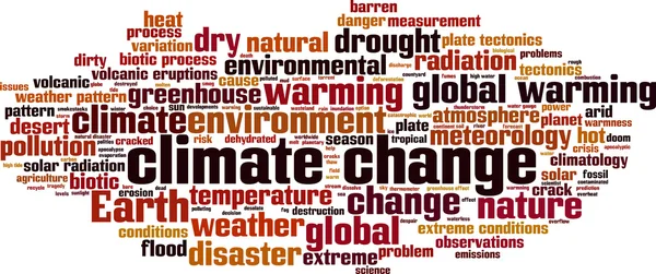
Plate Tectonics Word Cloud Concept. Collage Made Of Words About Plate Tectonics. Vector Illustration
Vector, 1.59MB, 9072 × 4590 eps


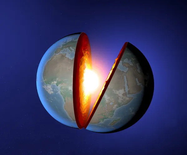

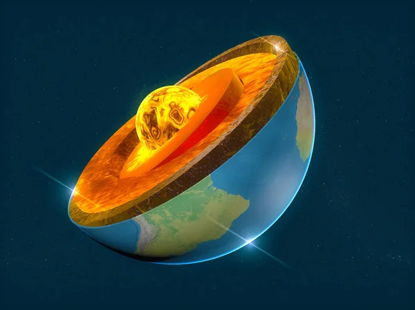
Earth Structure, Division Into Layers, The Earth's Crust And Core. 3d Rendering
Image, 15.61MB, 6299 × 4724 jpg


Crater Of The Kilauea Volcano In Hawaii, With Thick Smoke And Steam Rising From It. The Rugged Rim Of The Crater And The Surrounding Lava Fields Highlight The Intense Volcanic Activity At This Site, Known For Its Frequent Eruptions.
Image, 10.13MB, 4248 × 2832 jpg

Illustration Of Physics And Geology, Three Main Rock Types Sedimentary, Metamorphic And Igneous, Rock Is Any Naturally Occurring Solid Mass, Aggregate Of Minerals Or Mineraloid Matter
Vector, 13.76MB, 2128 × 3328 eps
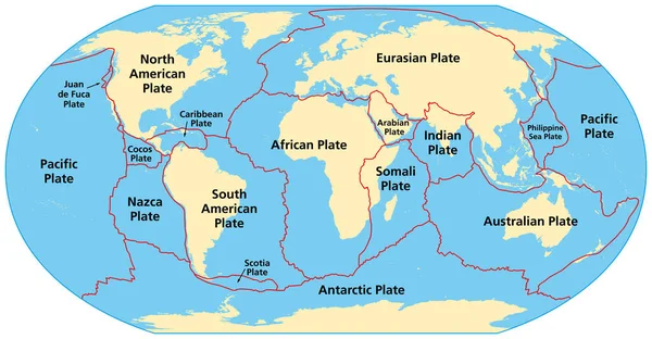
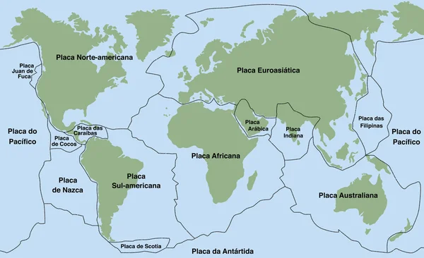
Map Of The Principal Tectonic Plates Of The Earth. The Sixteen Major Pieces Of Crust And Uppermost Mantle Of The Earth, Called The Lithosphere, And Consisting Of Oceanic And Continental Crust. Vector
Vector, 4.27MB, 9000 × 4681 eps


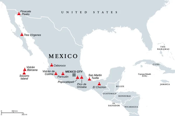
Trans-Mexican Volcanic Belt, Map With The Major Active Volcanoes Of Mexico. Also Known As Transvolcanic Belt And Locally As Sierra Nevada. Active Volcanic Belt, That Covers Central-southern Mexico.
Vector, 1.46MB, 9000 × 6000 eps

Previous << Page 2 >> Next