
Stock image Pulau Namsar

Kythnos Island In The Aegean Sea - Belonging To Greece. Described Location Diagram With Yellow Shape Of The Island And Sample Maps Of Its Surroundings
Image, 1.89MB, 3840 × 2160 jpg

Kyunthaya Island In The Bay Of Bengal, Belonging To Myanmar, Isolated On A Bilevel Elevation Map, With Distance Scale
Image, 0.3MB, 2160 × 2160 jpg

Kythnos Island In The Aegean Sea, Belonging To Greece, Isolated On A Bilevel Elevation Map, With Distance Scale
Image, 0.35MB, 2160 × 2160 jpg

Kyushu Island In The Japan Sea - Belonging To Japan. Described Location Diagram With Yellow Shape Of The Island And Sample Maps Of Its Surroundings
Image, 2.86MB, 3840 × 2160 jpg

Pulau Kur In The Banda Sea - Belonging To Indonesia. Described Location Diagram With Yellow Shape Of The Island And Sample Maps Of Its Surroundings
Image, 1.88MB, 3840 × 2160 jpg

Kurahashi Island In The Seto Naikai Or Inland Sea, Belonging To Japan, Isolated On A Bilevel Elevation Map, With Distance Scale
Image, 0.43MB, 2160 × 2160 jpg

Kyushu Island In The Japan Sea, Belonging To Japan, Isolated On A Bilevel Elevation Map, With Distance Scale
Image, 0.82MB, 2160 × 2160 jpg

Kutubdia Island In The Bay Of Bengal, Belonging To Bangladesh, Isolated On A Topographic, OSM Humanitarian Style Map, With Distance Scale
Image, 0.53MB, 2160 × 2160 jpg

Kyunthaya Island In The Bay Of Bengal - Belonging To Myanmar. Described Location Diagram With Yellow Shape Of The Island And Sample Maps Of Its Surroundings
Image, 2.14MB, 3840 × 2160 jpg

Kythira Island In The Aegean Sea - Belonging To Greece. Described Location Diagram With Yellow Shape Of The Island And Sample Maps Of Its Surroundings
Image, 1.98MB, 3840 × 2160 jpg

Pulau Kurkam In The Ceram Sea, Belonging To Indonesia, Isolated On A Bilevel Elevation Map, With Distance Scale
Image, 0.33MB, 2160 × 2160 jpg

Kythira Island In The Aegean Sea, Belonging To Greece, Isolated On A Bilevel Elevation Map, With Distance Scale
Image, 0.46MB, 2160 × 2160 jpg

Kythira Island In The Aegean Sea, Belonging To Greece, Isolated On A Topographic, OSM Humanitarian Style Map, With Distance Scale
Image, 0.99MB, 2160 × 2160 jpg
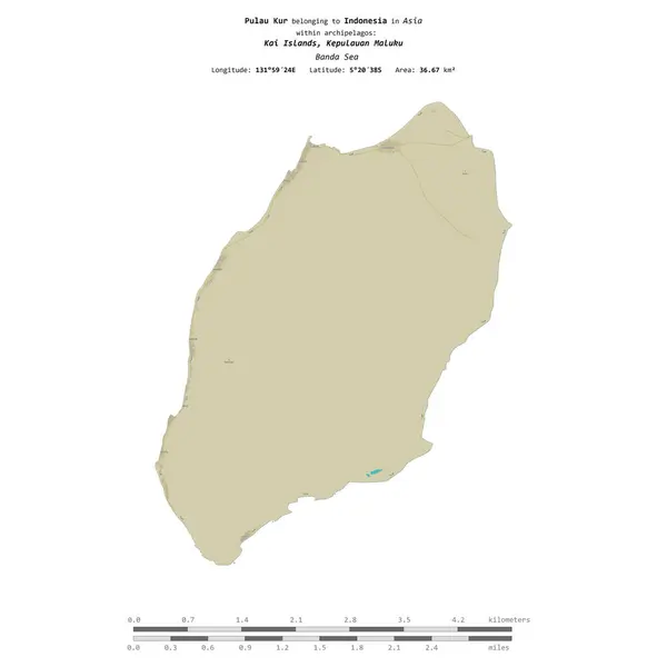
Pulau Kur In The Banda Sea, Belonging To Indonesia, Isolated On A Topographic, OSM Humanitarian Style Map, With Distance Scale
Image, 0.31MB, 2160 × 2160 jpg

Kyra Panagia Island In The Aegean Sea, Belonging To Greece, Isolated On A Topographic, OSM Humanitarian Style Map, With Distance Scale
Image, 0.45MB, 2160 × 2160 jpg

Kyra Panagia Island In The Aegean Sea, Belonging To Greece, Isolated On A Bilevel Elevation Map, With Distance Scale
Image, 0.31MB, 2160 × 2160 jpg

Pulau Kur In The Banda Sea On A Satellite Image Taken In September 21, 2020
Image, 4.74MB, 2880 × 1620 jpg


Pulau Kur In The Banda Sea, Belonging To Indonesia, Isolated On A Satellite Image Taken In May 9, 2020, With Distance Scale
Image, 1.37MB, 2160 × 2160 jpg

Kythnos Island In The Aegean Sea, Belonging To Greece, Isolated On A Topographic, OSM Humanitarian Style Map, With Distance Scale
Image, 0.59MB, 2160 × 2160 jpg

Kyunthaya Island In The Bay Of Bengal, Belonging To Myanmar, Isolated On A Topographic, OSM Humanitarian Style Map, With Distance Scale
Image, 0.36MB, 2160 × 2160 jpg

Pulau Kurkam In The Ceram Sea, Belonging To Indonesia, Isolated On A Topographic, OSM Humanitarian Style Map, With Distance Scale
Image, 0.28MB, 2160 × 2160 jpg

Kurahashi Island In The Seto Naikai Or Inland Sea, Belonging To Japan, Isolated On A Topographic, OSM Humanitarian Style Map, With Distance Scale
Image, 0.96MB, 2160 × 2160 jpg

Pulau Kur In The Banda Sea, Belonging To Indonesia, Isolated On A Bilevel Elevation Map, With Distance Scale
Image, 0.32MB, 2160 × 2160 jpg

Pulau Kur In The Banda Sea On A Topographic, OSM Humanitarian Style Map
Image, 0.22MB, 2880 × 1620 jpg

Kyushu Island In The Japan Sea, Belonging To Japan, Isolated On A Topographic, OSM Humanitarian Style Map, With Distance Scale
Image, 1.69MB, 2160 × 2160 jpg

Kutubdia Island In The Bay Of Bengal, Belonging To Bangladesh, Isolated On A Bilevel Elevation Map, With Distance Scale
Image, 0.21MB, 2160 × 2160 jpg
Page 1 >> Next