photo free
Home Images Vectors Videos

Stock image Rhode Island Region

stock vector High Quality map of Rhode Island is a state of United States of America with borders of the counties

High Quality Map Of Rhode Island Is A State Of United States Of America With Borders Of The Counties

Vector, 0.88MB, 4000 × 4000 eps
stock vector USA collection. Map of Rhode Island - yellow silhouette

USA Collection. Map Of Rhode Island - Yellow Silhouette

Vector, 5.36MB, 5001 × 5001 eps
stock vector Set 2 of 5 Highly detailed vector silhouettes of USA state maps

Set 2 Of 5 Highly Detailed Vector Silhouettes Of USA State Maps

Vector, 6.07MB, 8858 × 3738 eps
stock image Providence, RI

Providence, RI

Image, 3.33MB, 3474 × 2316 jpg
stock vector rhode island

Rhode Island

Vector, 2.83MB, 4000 × 5000 eps
stock vector Administrative vector map of the US Census Region Northeast

Administrative Vector Map Of The US Census Region Northeast

Vector, 0.71MB, 3100 × 3187 eps
stock vector Rhode Island, political map with the capital Providence. State of Rhode Island and Providence Plantations, RI, a state in the New England region of the United States of America. Illustration. Vector.

Rhode Island, Political Map With The Capital Providence. State Of Rhode Island And Providence Plantations, RI, A State In The New England Region Of The United States Of America. Illustration. Vector.

Vector, 3.19MB, 6000 × 7930 eps
stock vector Massachusetts, political map with capital Boston. Commonwealth of Massachusetts, MA. Most populous state in the New England region of the United States. The Bay State. English. Illustration. Vector.

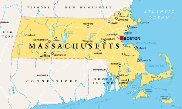
Massachusetts, Political Map With Capital Boston. Commonwealth Of Massachusetts, MA. Most Populous State In The New England Region Of The United States. The Bay State. English. Illustration. Vector.

Vector, 4.72MB, 9000 × 5401 eps
stock vector Rhode Island state detailed editable map

Rhode Island State Detailed Editable Map

Vector, 1.09MB, 5438 × 6000 eps
stock vector Vector set 3 of 10 Highly detailed silhouettes of US state maps, divided into counties with names and territory nicknames

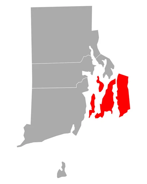
Vector Set 3 Of 10 Highly Detailed Silhouettes Of US State Maps, Divided Into Counties With Names And Territory Nicknames

Vector, 5.2MB, 9585 × 3348 eps
stock vector Connecticut, political map with capital Hartford. State of Connecticut, CT, southernmost state in New England region of northeastern United States of America. Gray illustration, over white. Vector.

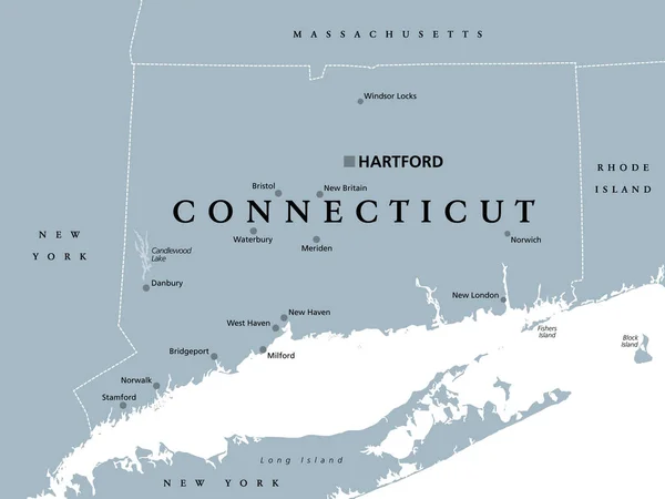
Connecticut, Political Map With Capital Hartford. State Of Connecticut, CT, Southernmost State In New England Region Of Northeastern United States Of America. Gray Illustration, Over White. Vector.

Vector, 2.66MB, 7986 × 6000 eps
stock vector Rhode Island map

Rhode Island Map

Vector, 7.26MB, 7002 × 7002 eps
stock vector Rhode Island, political map with capital Providence. State of Rhode Island and Providence Plantations, RI, in the New England region of United States of America. Gray illustration, over white. Vector.

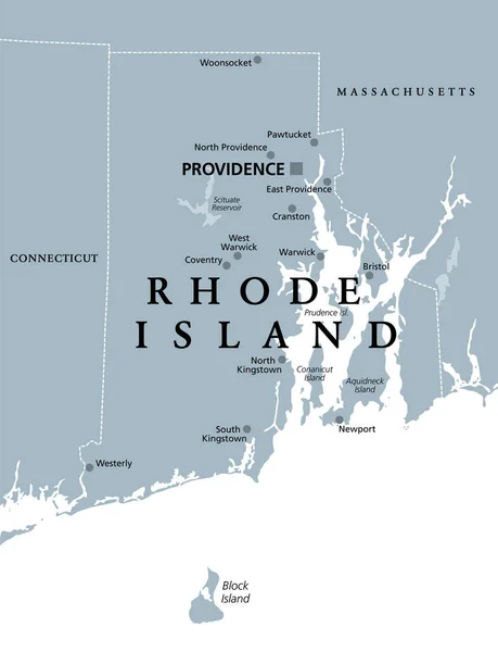
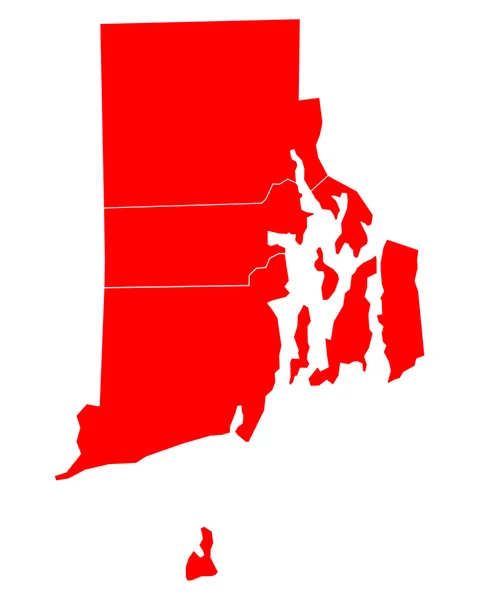
Rhode Island, Political Map With Capital Providence. State Of Rhode Island And Providence Plantations, RI, In The New England Region Of United States Of America. Gray Illustration, Over White. Vector.

Vector, 2.04MB, 6000 × 7823 eps
stock vector Map of Newport in Rhode Island

Map Of Newport In Rhode Island

Vector, 0.21MB, 4000 × 5000 eps
stock vector Rhode Island, New York, Maryland, Delaware, New Jersey USA state

Rhode Island, New York, Maryland, Delaware, New Jersey USA State

Vector, 14.58MB, 5000 × 5000 eps
stock image Rhode Island RI Skyline City Metropolitan Area Nightlife 3d Illustration

Rhode Island RI Skyline City Metropolitan Area Nightlife 3d Illustration

Image, 1.78MB, 5000 × 4000 jpg
stock image Providence, Rhode Island

Providence, Rhode Island

Image, 16.59MB, 6016 × 4016 jpg
stock image Roger Williams Statue - Prospect Terrace Park

Roger Williams Statue - Prospect Terrace Park

Image, 12.74MB, 7360 × 4912 jpg
stock image Brown University architecture

Brown University Architecture

Image, 4MB, 2592 × 3888 jpg
stock vector Set 2 of 5 Division United States into counties, political and geographic subdivisions of a states, Highly detailed vector maps with names and territory nicknames

Set 2 Of 5 Division United States Into Counties, Political And Geographic Subdivisions Of A States, Highly Detailed Vector Maps With Names And Territory Nicknames

Vector, 7.41MB, 9585 × 4010 eps
stock image Brown University

Brown University

Image, 4.46MB, 4272 × 2848 jpg
stock vector Massachusetts - Connecticut - Rhode Island Map labelled black

Massachusetts - Connecticut - Rhode Island Map Labelled Black

Vector, 2.4MB, 7558 × 5000 eps
stock vector Map of Rhode Island

Map Of Rhode Island

Vector, 0.62MB, 4000 × 5000 eps
stock image Providence

Providence

Image, 3.9MB, 3474 × 2317 jpg
stock image Providence - Brown University

Providence - Brown University

Image, 4.08MB, 4272 × 2848 jpg
stock image State of Rhode Island map

State Of Rhode Island Map

Image, 1.1MB, 4300 × 2800 jpg
stock vector map of the U.S. state  Rhode Island

Map Of The U.S. State Rhode Island

Vector, 1.84MB, 5000 × 5000 eps
stock vector Map of Rhode Island

Map Of Rhode Island

Vector, 0.61MB, 4000 × 5000 eps
stock image Roger Williams Statue - Prospect Terrace Park

Roger Williams Statue - Prospect Terrace Park

Image, 8.33MB, 4048 × 6065 jpg
stock vector Flag of Rhode Island. Vector Format

Flag Of Rhode Island. Vector Format

Vector, 5.75MB, 8253 × 5507 eps
stock image Flag of american state of Rhode Island, region of the United States, waving at wind

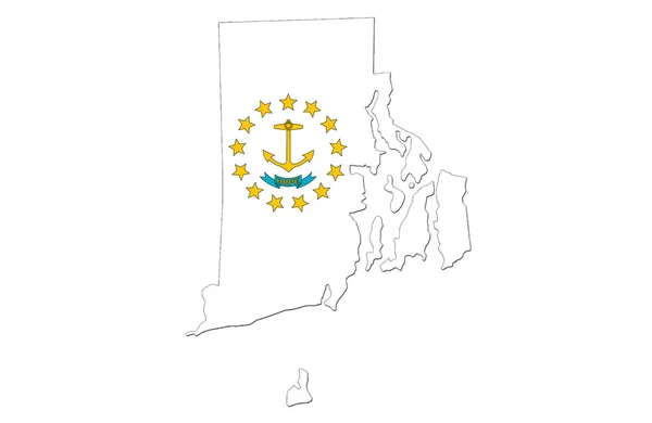
Flag Of American State Of Rhode Island, Region Of The United States, Waving At Wind

Image, 3.78MB, 7000 × 4000 jpg
stock vector map of the U.S. state of Rhode Island

Map Of The U.S. State Of Rhode Island

Vector, 0.61MB, 5000 × 5000 eps
stock image Providence

Providence

Image, 2.84MB, 3474 × 2316 jpg
stock vector map of the U.S. state  Rhode Island

Map Of The U.S. State Rhode Island

Vector, 0.63MB, 5000 × 5000 eps
stock vector Rhode Island, state of USA - solid black silhouette map of country area. Simple flat vector illustration

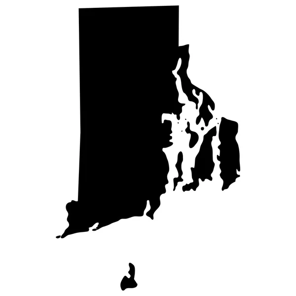
Rhode Island, State Of USA - Solid Black Silhouette Map Of Country Area. Simple Flat Vector Illustration

Vector, 0.23MB, 6000 × 6000 eps
stock vector Map of Rhode Island

Map Of Rhode Island

Vector, 0.61MB, 4000 × 5000 eps
stock image Brown University

Brown University

Image, 2.89MB, 2316 × 3474 jpg
stock vector Polygonal Wire Frame Mesh High Resolution Vector Map of Rhode Island State Abstractions

Polygonal Wire Frame Mesh High Resolution Vector Map Of Rhode Island State Abstractions

Vector, 4.7MB, 4880 × 3279 eps
stock image Rhode Island

Rhode Island

Image, 5.63MB, 5184 × 3456 jpg
stock vector map of the U.S. state of Rhode Island

Map Of The U.S. State Of Rhode Island

Vector, 0.73MB, 5000 × 5000 eps
stock vector flag of the American state of Rhode Island vector illustration

Flag Of The American State Of Rhode Island Vector Illustration

Vector, 5.07MB, 7742 × 4134 eps
stock vector 13 of 50 sets, US State Posters with name and Information in 3 Design Styles, Detailed vector art print Rhode Island map

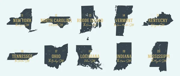
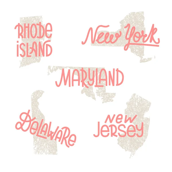
13 Of 50 Sets, US State Posters With Name And Information In 3 Design Styles, Detailed Vector Art Print Rhode Island Map

Vector, 1.55MB, 8896 × 4168 eps
stock image Rhode Island state capitol

Rhode Island State Capitol

Image, 3.1MB, 4272 × 2848 jpg
stock vector Rhode Island, state of USA - solid black outline map of country area. Simple flat vector illustration

Rhode Island, State Of USA - Solid Black Outline Map Of Country Area. Simple Flat Vector Illustration

Vector, 0.22MB, 5000 × 5000 eps
stock vector Highly detailed vector silhouettes of US state maps, Division United States into counties, political and geographic subdivisions of a states, New England - Connecticut, Massachusetts, Rhode Island - set 2 of 17

Highly Detailed Vector Silhouettes Of US State Maps, Division United States Into Counties, Political And Geographic Subdivisions Of A States, New England - Connecticut, Massachusetts, Rhode Island - Set 2 Of 17

Vector, 6.38MB, 9608 × 4501 eps
stock vector Map of Rhode Island in USA

Map Of Rhode Island In USA

Vector, 0.63MB, 5000 × 4000 eps
stock image Flag of Rhode Island, painted on old wood plank background

Flag Of Rhode Island, Painted On Old Wood Plank Background

Image, 18.07MB, 5184 × 3456 jpg
stock vector Northeast, census region of the United States of America, gray political map of census region 1, consisting of 9 single states. Map with geographical borders and capitals. Isolated illustration.

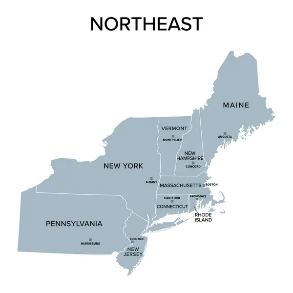
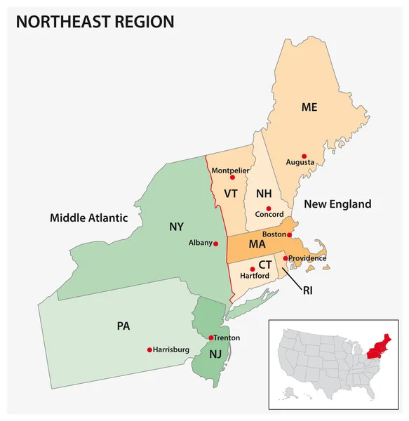
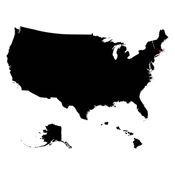
Northeast, Census Region Of The United States Of America, Gray Political Map Of Census Region 1, Consisting Of 9 Single States. Map With Geographical Borders And Capitals. Isolated Illustration.

Vector, 2.09MB, 6000 × 6000 eps
stock image Waving Flag of Rhode Island

Waving Flag Of Rhode Island

Image, 12.89MB, 5184 × 3456 jpg
stock image Flag of Rhode Island, painted on old wood plank background

Flag Of Rhode Island, Painted On Old Wood Plank Background

Image, 14.05MB, 5184 × 3456 jpg
Page 1 >> Next