photo free
Home Images Vectors Videos

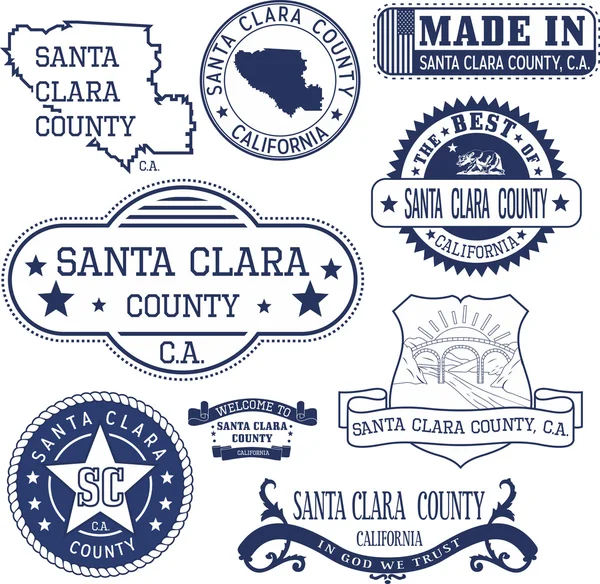
Stock image Santa Clara County

stock image Dusk over San Jose Downtown via Mount Hamilton Foothills. Downtown San Jose is the central business district of San Jose, California, in Silicon Valley.

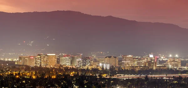
Dusk Over San Jose Downtown Via Mount Hamilton Foothills. Downtown San Jose Is The Central Business District Of San Jose, California, In Silicon Valley.

Image, 13.48MB, 8858 × 4177 jpg
stock image San Jose Palms

San Jose Palms

Image, 8.31MB, 3883 × 2590 jpg
stock image Silicon Valley Panorama. Santa Clara Valley at dusk as seen from Lick Observatory in Mount Hamilton east of San Jose, Santa Clara County, California, USA.

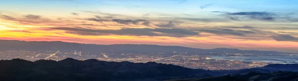
Silicon Valley Panorama. Santa Clara Valley At Dusk As Seen From Lick Observatory In Mount Hamilton East Of San Jose, Santa Clara County, California, USA.

Image, 24.14MB, 16066 × 4374 jpg
stock image Santa Clara Valley from Joseph D. Grant Country Park, Santa Clara County, California, USA

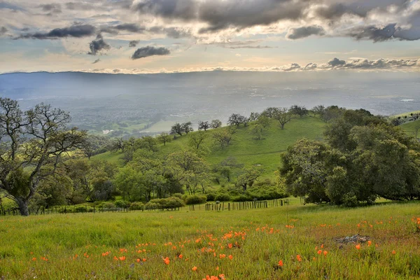
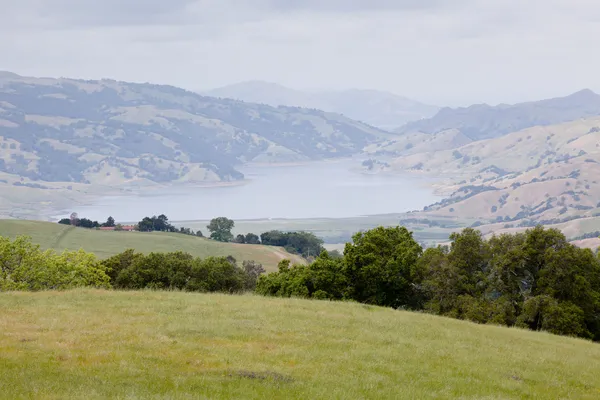
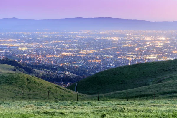
Santa Clara Valley From Joseph D. Grant Country Park, Santa Clara County, California, USA

Image, 14.34MB, 5760 × 3840 jpg
stock vector Santa Clara County, California map vector

Santa Clara County, California Map Vector

Vector, 0.72MB, 7087 × 4726 eps
stock vector vector road map of California Santa Clara County, United States

Vector Road Map Of California Santa Clara County, United States

Vector, 1.41MB, 4146 × 3100 eps
stock vector Santa Clara county, CA. Set of stamps and signs

Santa Clara County, CA. Set Of Stamps And Signs

Vector, 1.12MB, 4800 × 4673 eps
stock vector Map of Santa Clara in California

Map Of Santa Clara In California

Vector, 0.29MB, 4000 × 5000 eps
stock vector Map of Cuba

Map Of Cuba

Vector, 0.93MB, 7444 × 3000 ai
stock vector Map of Cuba

Map Of Cuba

Vector, 0.85MB, 7438 × 3000 ai
stock vector San jose red stamp text

San Jose Red Stamp Text

Vector, 1.5MB, 5000 × 3066 eps
stock image Flag of San Jose in Santa Clara of California, United States

Flag Of San Jose In Santa Clara Of California, United States

Image, 1.8MB, 4288 × 2848 jpg
stock vector San Jose rubber stamp

San Jose Rubber Stamp

Vector, 0.48MB, 4135 × 3851 eps
stock vector San Jose rubber stamp

San Jose Rubber Stamp

Vector, 0.76MB, 6600 × 3318 eps
stock image Marshland Sunset at Shorline Lake & Park, Santa Clara County, California

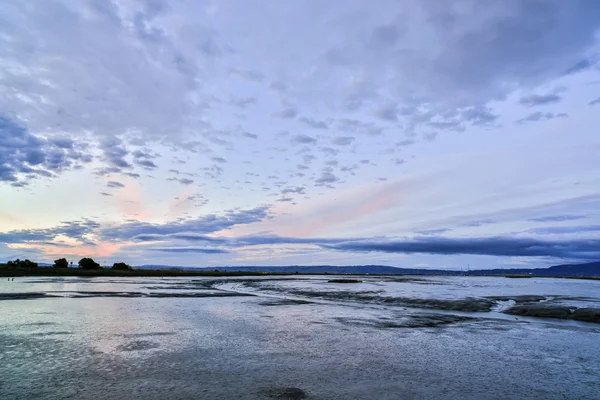
Marshland Sunset At Shorline Lake & Park, Santa Clara County, California

Image, 8.91MB, 5760 × 3840 jpg
stock image Vasona Park, formerly Vasona Lake County Park, is a park located in Los Gatos, California and part of the Santa Clara County Parks system. Adjacent Oak Meadow Park is owned by the Town of Los Gatos.

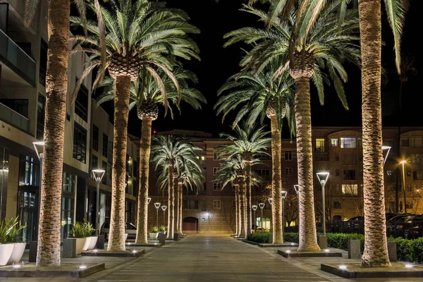
Vasona Park, Formerly Vasona Lake County Park, Is A Park Located In Los Gatos, California And Part Of The Santa Clara County Parks System. Adjacent Oak Meadow Park Is Owned By The Town Of Los Gatos.

Image, 0MB, 2500 × 1667 jpg
stock image Silicon Valley Views from above. Santa Clara Valley at dusk as seen from Lick Observatory in Mount Hamilton east of San Jose, Santa Clara County, California, USA.

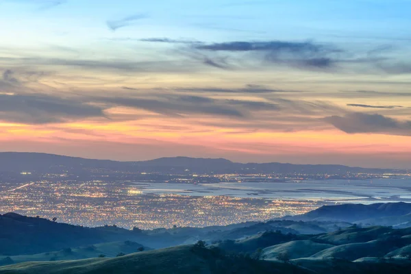
Silicon Valley Views From Above. Santa Clara Valley At Dusk As Seen From Lick Observatory In Mount Hamilton East Of San Jose, Santa Clara County, California, USA.

Image, 10.59MB, 6720 × 4480 jpg
stock image Exterior of Church of Mission Santa Clara de Asis. The front faade of Mission Santa Clara, student chapel of Santa Clara University.

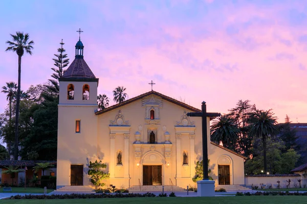
Exterior Of Church Of Mission Santa Clara De Asis. The Front Faade Of Mission Santa Clara, Student Chapel Of Santa Clara University.

Image, 12.59MB, 6720 × 4480 jpg
stock image Official election vote by mail ballot with a gold pen focused on the presidential candidates with a shallow depth - San Jose, California, USA - October 8, 2020

Official Election Vote By Mail Ballot With A Gold Pen Focused On The Presidential Candidates With A Shallow Depth - San Jose, California, USA - October 8, 2020

Image, 14.09MB, 6000 × 4000 jpg
stock vector TEMPORARY CLOSED Out of order caution sign

TEMPORARY CLOSED Out Of Order Caution Sign

Vector, 4.73MB, 7000 × 9415 eps
stock vector San Francisco Bay Area, region of the U.S. state California, gray political map with counties and largest cities. Area that surrounds and include the San Francisco Bay, which is a large tidal estuary.

San Francisco Bay Area, Region Of The U.S. State California, Gray Political Map With Counties And Largest Cities. Area That Surrounds And Include The San Francisco Bay, Which Is A Large Tidal Estuary.

Vector, 3.29MB, 6000 × 6000 eps
stock vector Silicon Valley, a region in Northern California, political map. Global center for high technology and innovation in the United States, located in the southern part of the San Francisco Bay Area.

Silicon Valley, A Region In Northern California, Political Map. Global Center For High Technology And Innovation In The United States, Located In The Southern Part Of The San Francisco Bay Area.

Vector, 2.32MB, 6000 × 6000 eps
stock image Santa Clara County Government Center in San Jose, California, USA - June 10, 2023. County of Santa Clara is the sixth-most populous county in the U.S. state of California.

Santa Clara County Government Center In San Jose, California, USA - June 10, 2023. County Of Santa Clara Is The Sixth-most Populous County In The U.S. State Of California.

Image, 3.8MB, 4303 × 2869 jpg
stock vector Subregions of the San Francisco Bay Area, divided by counties, political map. Area of the U.S. state of California, that surrounds and includes the San Francisco Bay, which is a large tidal estuary.

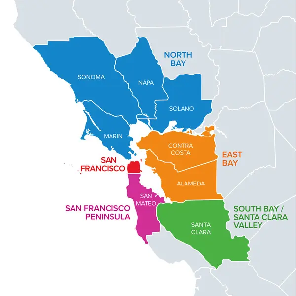
Subregions Of The San Francisco Bay Area, Divided By Counties, Political Map. Area Of The U.S. State Of California, That Surrounds And Includes The San Francisco Bay, Which Is A Large Tidal Estuary.

Vector, 2.94MB, 6000 × 6000 eps
stock image Official vote by mail ballot drop box located outdoors - Santa Clara, California, USA - October 20, 2020

Official Vote By Mail Ballot Drop Box Located Outdoors - Santa Clara, California, USA - October 20, 2020

Image, 13.53MB, 6000 × 4000 jpg
stock vector San Francisco Bay Area, a region of the U.S. state California, political map with counties and largest cities. An area that surrounds and include the San Francisco Bay, which is a large tidal estuary.

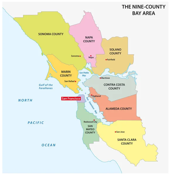
San Francisco Bay Area, A Region Of The U.S. State California, Political Map With Counties And Largest Cities. An Area That Surrounds And Include The San Francisco Bay, Which Is A Large Tidal Estuary.

Vector, 3.73MB, 6000 × 6000 eps
stock vector State of California counties, political map. U.S. state of California, subdivided into 58 counties, with San Bernardino County as largest and Los Angeles County as most populous in the United States.

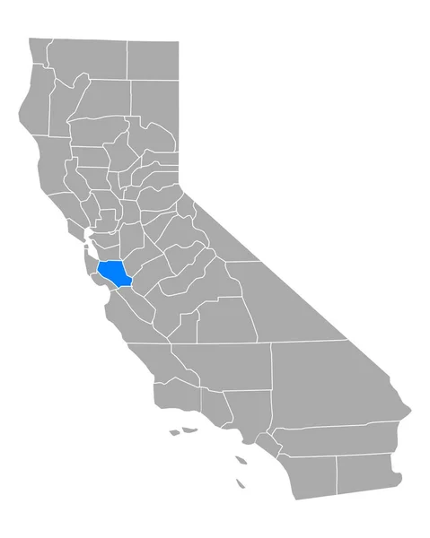
State Of California Counties, Political Map. U.S. State Of California, Subdivided Into 58 Counties, With San Bernardino County As Largest And Los Angeles County As Most Populous In The United States.

Vector, 3.13MB, 6000 × 7108 eps
stock vector California, U.S. state, multi colored political map with borders, county names and its capital Sacramento. State in the Western United States on the Pacific Coast, subdivided into 58 counties.

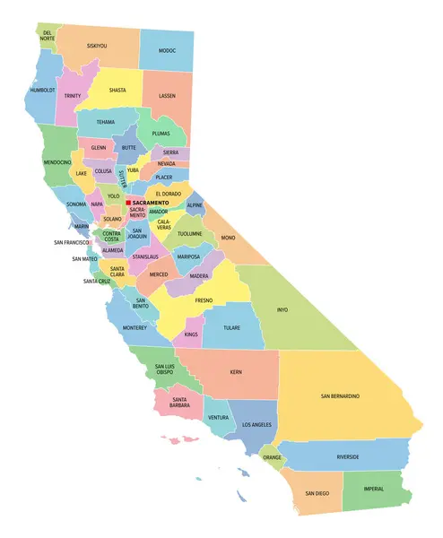
California, U.S. State, Multi Colored Political Map With Borders, County Names And Its Capital Sacramento. State In The Western United States On The Pacific Coast, Subdivided Into 58 Counties.

Vector, 2.85MB, 6000 × 7279 eps
stock vector Silicon Valley, a region in Northern California, gray political map. Global center for high technology and innovation in the United States, located in the southern part of the San Francisco Bay Area.

Silicon Valley, A Region In Northern California, Gray Political Map. Global Center For High Technology And Innovation In The United States, Located In The Southern Part Of The San Francisco Bay Area.

Vector, 2.1MB, 6000 × 6000 eps
stock image Mission Santa Clara de Asis in Santa Clara - California, United States

Mission Santa Clara De Asis In Santa Clara - California, United States

Image, 20.54MB, 7609 × 4641 jpg
stock vector Silicon Valley, a region in Northern California, dark political map. Global center for high technology and innovation in the United States, located in the southern part of the San Francisco Bay Area.

Silicon Valley, A Region In Northern California, Dark Political Map. Global Center For High Technology And Innovation In The United States, Located In The Southern Part Of The San Francisco Bay Area.

Vector, 2.06MB, 6000 × 6000 eps
stock image full length businesswoman holding coffee shopping for business carrying bags using cellphone replying email. young office lady walking in sunglasses on street outside leaving department store mall.

Full Length Businesswoman Holding Coffee Shopping For Business Carrying Bags Using Cellphone Replying Email. Young Office Lady Walking In Sunglasses On Street Outside Leaving Department Store Mall.

Image, 7.66MB, 5957 × 3971 jpg
stock vector California state counties, gray political map. U.S. state of California subdivided into 58 counties, with San Bernardino County as largest and Los Angeles County as most populous in the United States.

California State Counties, Gray Political Map. U.S. State Of California Subdivided Into 58 Counties, With San Bernardino County As Largest And Los Angeles County As Most Populous In The United States.

Vector, 2.83MB, 6000 × 7279 eps
stock vector California and its counties

California And Its Counties

Vector, 9.34MB, 5000 × 5000 eps
stock vector Administrative and road map of the California region San Francisco Bay Area

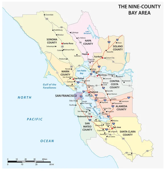
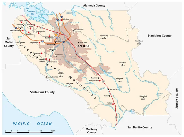
Administrative And Road Map Of The California Region San Francisco Bay Area

Vector, 1.55MB, 3100 × 3189 eps
stock vector Administrative map of the California region San Francisco Bay Area

Administrative Map Of The California Region San Francisco Bay Area

Vector, 0.74MB, 3100 × 3189 eps
stock vector Nevada

Nevada

Vector, 0.82MB, 2814 × 3626 eps
stock vector Nevada USA state map vector tag cloud illustration

Nevada USA State Map Vector Tag Cloud Illustration

Vector, 8.95MB, 7721 × 10276 eps
stock image Mission Peak, Mount Allison and Monument Peak from a dried salt pond.

Mission Peak, Mount Allison And Monument Peak From A Dried Salt Pond.

Image, 19.06MB, 6720 × 4480 jpg
stock image Counties of Central California Coast

Counties Of Central California Coast

Image, 11.26MB, 3832 × 2689 jpg
stock image Dark-eyed Junco (Junco hyemalis) adult female nesting on eggs. Santa Clara County, California, USA.

Dark-eyed Junco (Junco Hyemalis) Adult Female Nesting On Eggs. Santa Clara County, California, USA.

Image, 5.05MB, 3851 × 2939 jpg
stock image Calaveras Reservoir

Calaveras Reservoir

Image, 5.2MB, 3500 × 2333 jpg
stock image Lemon Tree Orchards in the Santa Clara River Valley, Fillmore, Ventura County, California

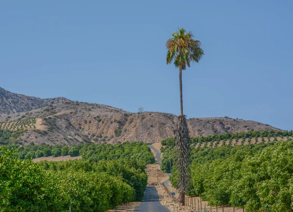
Lemon Tree Orchards In The Santa Clara River Valley, Fillmore, Ventura County, California

Image, 17.55MB, 5754 × 4171 jpg
stock image Palo Alto, California - July 15, 2021: The facde of Lane History Corner at Stanford University

Palo Alto, California - July 15, 2021: The Facde Of Lane History Corner At Stanford University

Image, 11.94MB, 6096 × 4272 jpg
stock image A Little California Toad

A Little California Toad

Image, 11.77MB, 6000 × 4000 jpg
stock image Cliff Swallow perched on its cup nest built from mud pellets in man-made structures. Santa Clara County, California, USA.

Cliff Swallow Perched On Its Cup Nest Built From Mud Pellets In Man-made Structures. Santa Clara County, California, USA.

Image, 5.38MB, 3906 × 2806 jpg
stock image San Jose Star Trails

San Jose Star Trails

Image, 7.14MB, 4288 × 2848 jpg
stock image Autumn in the Bay Area.

Autumn In The Bay Area.

Image, 16.17MB, 6720 × 4480 jpg
stock image SAN JOSE

SAN JOSE

Image, 2.94MB, 3508 × 2480 jpg
stock image Silicon Valley Twilight. Sierra Vista Open Space Preserve, San Jose, Santa Clara County, California, USA.

Silicon Valley Twilight. Sierra Vista Open Space Preserve, San Jose, Santa Clara County, California, USA.

Image, 15.52MB, 6720 × 4480 jpg
Page 1 >> Next