photo free
Home Images Vectors Videos

Stock image Satellite Imagery page 2

stock image Global Trails Arrangement

Global Trails Arrangement

Image, 6.72MB, 3600 × 2700 jpg
stock image Toward Digital World

Toward Digital World

Image, 5.2MB, 3600 × 2700 jpg
stock image Earth Trails Abstraction

Earth Trails Abstraction

Image, 5.07MB, 3600 × 2700 jpg
stock image Global Trails Abstraction

Global Trails Abstraction

Image, 8.34MB, 3600 × 2700 jpg
stock image Conceptual Information Highway

Conceptual Information Highway

Image, 4.58MB, 3600 × 2700 jpg
stock image Earth Trails Background

Earth Trails Background

Image, 5.22MB, 3600 × 2700 jpg
stock image Earth Trails Propagation

Earth Trails Propagation

Image, 5.96MB, 3600 × 2700 jpg
stock image Technological World

Technological World

Image, 5.57MB, 3600 × 2700 jpg
stock image Toward Digital World

Toward Digital World

Image, 8.73MB, 3600 × 2700 jpg
stock image Conceptual Information Highway

Conceptual Information Highway

Image, 5.18MB, 3600 × 2700 jpg
stock image Globalization of Information Highway

Globalization Of Information Highway

Image, 4.24MB, 3600 × 2700 jpg
stock image Earth Trails Propagation

Earth Trails Propagation

Image, 4.81MB, 3600 × 2700 jpg
stock image Tashkent City, city of Uzbekistan. Satellite imagery. Shape outlined against its country area. 3D rendering

Tashkent City, City Of Uzbekistan. Satellite Imagery. Shape Outlined Against Its Country Area. 3D Rendering

Image, 8.09MB, 2880 × 1620 jpg
stock image Kalbajar-Lachin, region of Azerbaijan. Sentinel-2 satellite imagery. Shape isolated on solid background with informative overlays. Contains modified Copernicus Sentinel data

Kalbajar-Lachin, Region Of Azerbaijan. Sentinel-2 Satellite Imagery. Shape Isolated On Solid Background With Informative Overlays. Contains Modified Copernicus Sentinel Data

Image, 2.9MB, 3133 × 3191 jpg
stock image Global Trails Background

Global Trails Background

Image, 6.28MB, 3600 × 2700 jpg
stock image Toward Digital World

Toward Digital World

Image, 4.68MB, 3600 × 2700 jpg
stock image Virtual Global Trails

Virtual Global Trails

Image, 5.39MB, 3600 × 2700 jpg
stock image Hurricane Katrina over The Gulf of Mexico

Hurricane Katrina Over The Gulf Of Mexico

Image, 8.78MB, 8000 × 5000 jpg
stock image Satellite image of New York in summer

Satellite Image Of New York In Summer

Image, 24.22MB, 4394 × 3515 jpg
stock image Toward Global Technologies

Toward Global Technologies

Image, 9.81MB, 3600 × 2700 jpg
stock image World map in the James Azimuthal projection centered on 11 East longitude. Satellite imagery A - raw composite of raster with graticule. 3D illustration

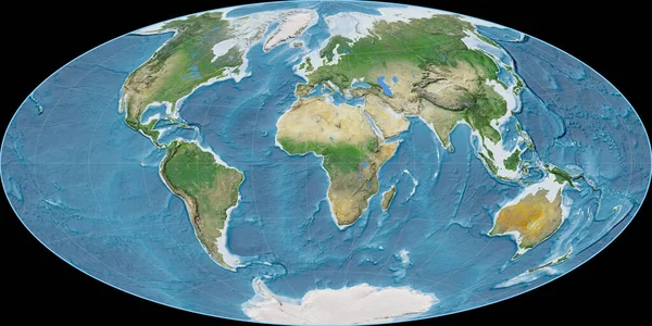
World Map In The James Azimuthal Projection Centered On 11 East Longitude. Satellite Imagery A - Raw Composite Of Raster With Graticule. 3D Illustration

Image, 5.18MB, 4000 × 2000 jpg
stock image Shape of Karelia, republic of Russia, with its capital isolated on white background. Satellite imagery. 3D rendering

Shape Of Karelia, Republic Of Russia, With Its Capital Isolated On White Background. Satellite Imagery. 3D Rendering

Image, 9.11MB, 3548 × 3836 jpg
stock image Technological Planet

Technological Planet

Image, 7.24MB, 3600 × 2700 jpg
stock image Visualization of Information Highway

Visualization Of Information Highway

Image, 3.66MB, 3600 × 2700 jpg
stock image World map in the Aitoff projection centered on 11 East longitude. Satellite imagery A - raw composite of raster with graticule. 3D illustration

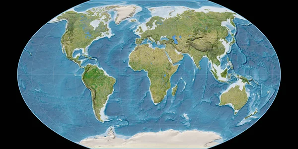
World Map In The Aitoff Projection Centered On 11 East Longitude. Satellite Imagery A - Raw Composite Of Raster With Graticule. 3D Illustration

Image, 9.82MB, 4000 × 2000 jpg
stock image Numbers of Earth

Numbers Of Earth

Image, 4.72MB, 3600 × 2700 jpg
stock image Global Trails Abstraction

Global Trails Abstraction

Image, 5.52MB, 3600 × 2700 jpg
stock image World map in the Winkel Tripel projection centered on 11 East longitude. Satellite imagery B - raw composite of raster with graticule. 3D illustration

World Map In The Winkel Tripel Projection Centered On 11 East Longitude. Satellite Imagery B - Raw Composite Of Raster With Graticule. 3D Illustration

Image, 9.18MB, 4000 × 2000 jpg
stock image Technological Planet

Technological Planet

Image, 6.74MB, 3600 × 2700 jpg
stock image Lights of Technology

Lights Of Technology

Image, 4.65MB, 3600 × 2700 jpg
stock image Volyn, region of Ukraine. Sentinel-2 satellite imagery. Shape isolated on black. Description, location of the capital. Contains modified Copernicus Sentinel data

Volyn, Region Of Ukraine. Sentinel-2 Satellite Imagery. Shape Isolated On Black. Description, Location Of The Capital. Contains Modified Copernicus Sentinel Data

Image, 7.7MB, 3136 × 3188 jpg
stock image Visualization of Digital Information Highway

Visualization Of Digital Information Highway

Image, 5.03MB, 3600 × 2700 jpg
stock image Gadget World

Gadget World

Image, 7.29MB, 3600 × 2700 jpg
stock image Visualization of Information Highway

Visualization Of Information Highway

Image, 2.19MB, 3600 × 2700 jpg
stock image Lima Province, province of Peru. Satellite imagery. Shape outlined against its country area. 3D rendering

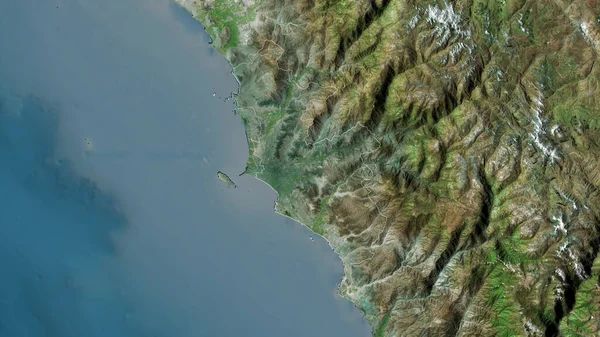
Lima Province, Province Of Peru. Satellite Imagery. Shape Outlined Against Its Country Area. 3D Rendering

Image, 4.53MB, 2880 × 1620 jpg
stock image Earth Backdrop

Earth Backdrop

Image, 6.99MB, 3600 × 2700 jpg
stock image Numbers of Earth

Numbers Of Earth

Image, 8.85MB, 3600 × 2700 jpg
stock image Technology Perspective

Technology Perspective

Image, 8.41MB, 3600 × 2700 jpg
stock image Shape of Istarska, county of Croatia, with its capital isolated on white background. Satellite imagery. 3D rendering

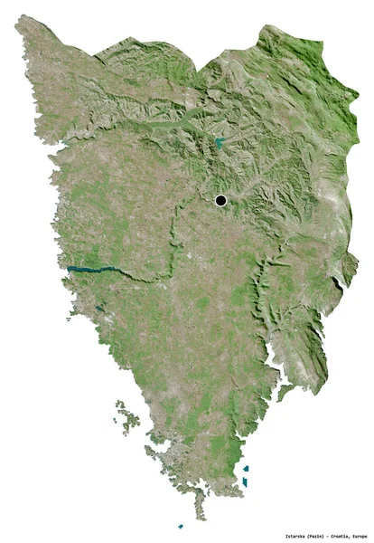
Shape Of Istarska, County Of Croatia, With Its Capital Isolated On White Background. Satellite Imagery. 3D Rendering

Image, 8.02MB, 2652 × 3836 jpg
stock image Storm Nemo 02-08-2013

Storm Nemo 02-08-2013

Image, 3.18MB, 4000 × 2690 jpg
stock image Lights of Earth

Lights Of Earth

Image, 5.9MB, 3600 × 2700 jpg
stock image Modern Information Highway

Modern Information Highway

Image, 4.39MB, 3600 × 2700 jpg
stock image Shape of Guatemala with its capital isolated on white background. Satellite imagery. 3D rendering

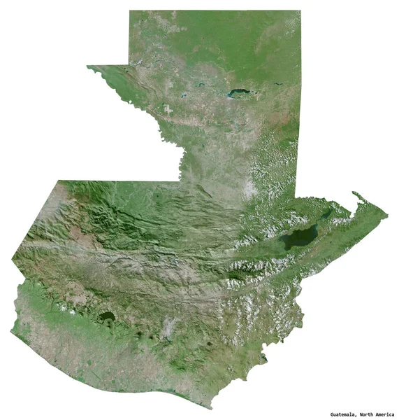
Shape Of Guatemala With Its Capital Isolated On White Background. Satellite Imagery. 3D Rendering

Image, 3.79MB, 2032 × 2132 jpg
stock image Shape of Mainland United States with its capital isolated on white background. Satellite imagery. 3D rendering

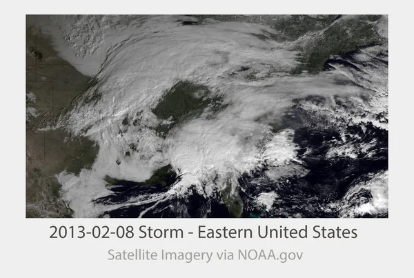
Shape Of Mainland United States With Its Capital Isolated On White Background. Satellite Imagery. 3D Rendering

Image, 5.69MB, 3110 × 1978 jpg
stock image Shape of Krasnodar, territory of Russia, with its capital isolated on white background. Satellite imagery. 3D rendering

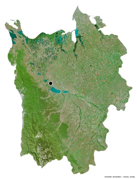
Shape Of Krasnodar, Territory Of Russia, With Its Capital Isolated On White Background. Satellite Imagery. 3D Rendering

Image, 9.9MB, 2946 × 3836 jpg
stock image Podravska, statistical region of Slovenia. Satellite imagery. Shape outlined against its country area. 3D rendering

Podravska, Statistical Region Of Slovenia. Satellite Imagery. Shape Outlined Against Its Country Area. 3D Rendering

Image, 7.82MB, 2880 × 1620 jpg
stock image Guangdong, province of China. Sentinel-2 satellite imagery. Shape isolated on white solid. Description, location of the capital. Contains modified Copernicus Sentinel data

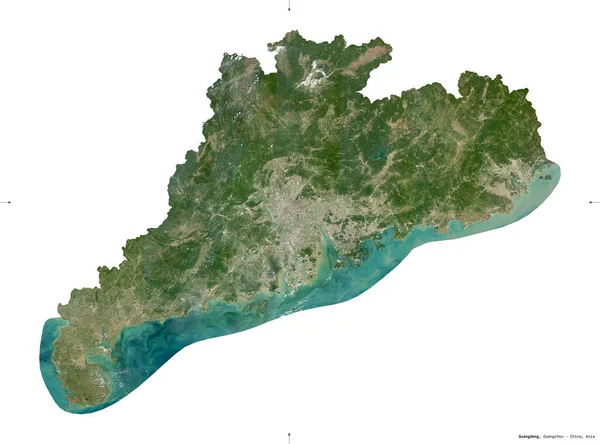
Guangdong, Province Of China. Sentinel-2 Satellite Imagery. Shape Isolated On White Solid. Description, Location Of The Capital. Contains Modified Copernicus Sentinel Data

Image, 5.95MB, 3675 × 2720 jpg
stock image Zlatiborski, district of Serbia. Satellite imagery. Shape outlined against its country area. 3D rendering

Zlatiborski, District Of Serbia. Satellite Imagery. Shape Outlined Against Its Country Area. 3D Rendering

Image, 7.81MB, 2880 × 1620 jpg
stock image Modern Information Highway

Modern Information Highway

Image, 5.82MB, 3600 × 2700 jpg
stock image Toward Digital World

Toward Digital World

Image, 6.59MB, 3600 × 2700 jpg
Previous << Page 2 >> Next