
Stock image Seismic Area page 3

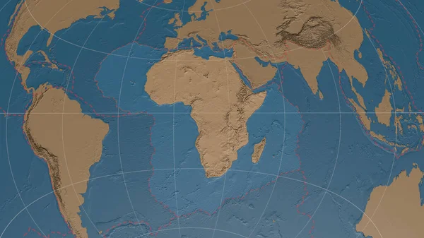
Africann Tectonic Plate Overview The Global Grayscale Elevation Map In The Azimuthal Equidistant Projection With Dashed Plates Borders. 3D Rendering
Image, 3.52MB, 2880 × 1620 jpg


Arequipa, Peru - Dec 5, 2023: Mirador De Los Volcanes (Volcano Viewpoint) In The Peruvian Andes Between Arequipa And Colca
Image, 15.45MB, 5490 × 3660 jpg
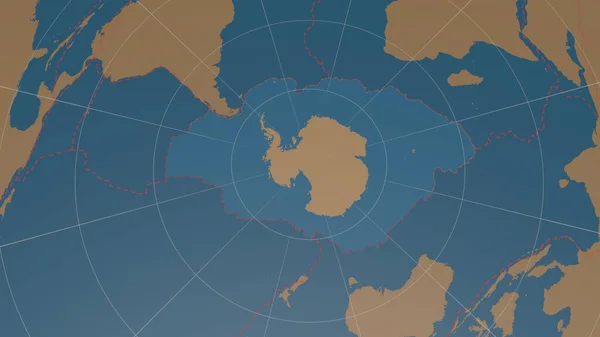
Antarctic Tectonic Plate Overview The Global Shapes Only - Land/ocean Mask In The Azimuthal Equidistant Projection With Dashed Plates Borders. 3D Rendering
Image, 1.56MB, 2880 × 1620 jpg

Antarctica Tectonic Plate Extruded On The Globe. Color Physical Map. 3D Rendering
Image, 3.72MB, 2880 × 1620 jpg
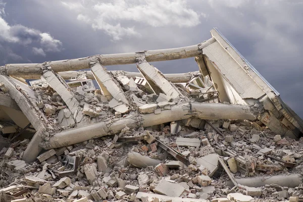
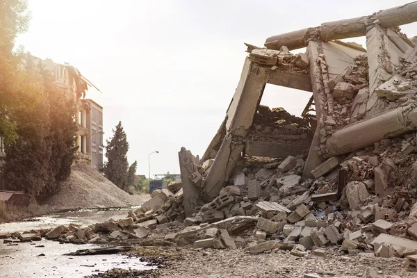
Industrial Concrete Building Destructed By Earthquake Strike. Disaster Scene Full Of Debris, Dust And Crashed Buildings.
Image, 14.03MB, 6016 × 4016 jpg


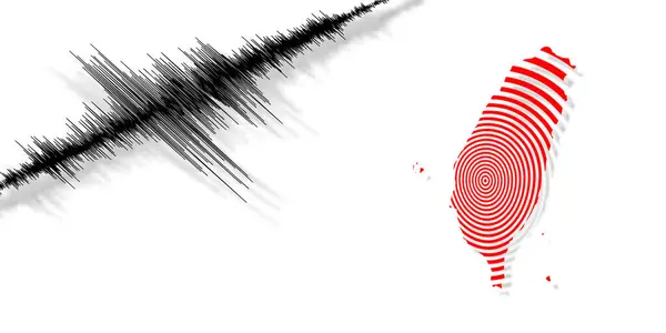
Warning Symbol On Yellow Background With Seismograph Waves And Text Earthquakes
Vector, 2.47MB, 4167 × 4167 eps

Niuafou Tectonic Plate Outlined On The Globe. Topography And Bathymetry Colored Elevation Map. 3D Rendering
Image, 2.45MB, 2880 × 1620 jpg
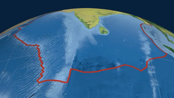
Indian Tectonic Plate Outlined On The Globe. Topographic Map. 3D Rendering
Image, 3.52MB, 2880 × 1620 jpg

Eurasian Tectonic Plate Outlined On The Globe. Natural Earth Topographic Map. 3D Rendering
Image, 4.55MB, 2880 × 1620 jpg
New Hebrides Tectonic Plate Outlined On The Global Topographic Relief Map In The Mollweide Projection. 3D Rendering
Image, 4.06MB, 2880 × 1620 jpg

Arequipa, Peru - Dec 5, 2023: Mirador De Los Volcanes (Volcano Viewpoint) In The Peruvian Andes Between Arequipa And Colca
Image, 10.69MB, 4000 × 4000 jpg
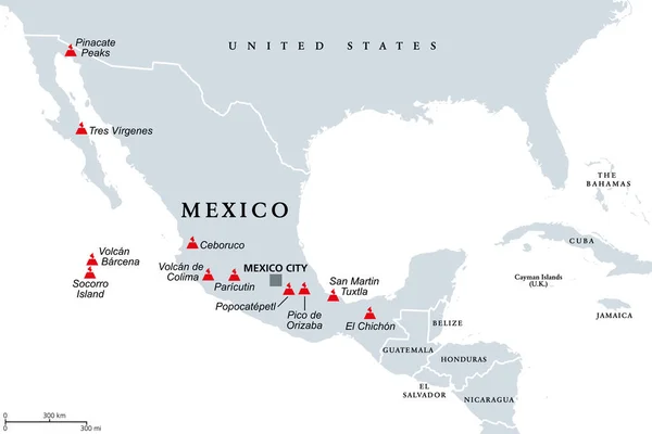
Trans-Mexican Volcanic Belt, Map With The Major Active Volcanoes Of Mexico. Also Known As Transvolcanic Belt And Locally As Sierra Nevada. Active Volcanic Belt, That Covers Central-southern Mexico.
Vector, 1.46MB, 9000 × 6000 eps

South America Tectonic Plate Extruded And Presented Against The Global Color Physical Map In The Kavrayskiy Projection. 3D Rendering
Image, 3.54MB, 2880 × 1620 jpg
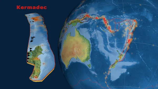
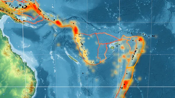
Kermadec Tectonic Plate Described, Extruded And Presented Against The Globe. Natural Earth Topographic Map. 3D Rendering
Image, 3.58MB, 2880 × 1620 jpg

South America Tectonic Plate Extruded And Presented Against The Globe. Grayscale Elevation Map. 3D Rendering
Image, 2.02MB, 2880 × 1620 jpg
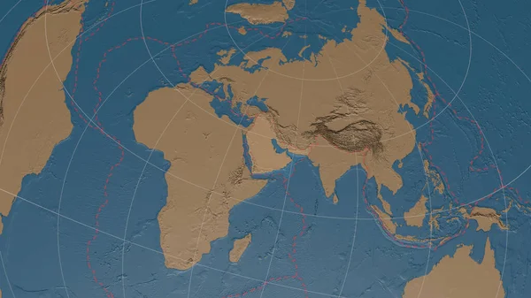
Arabiann Tectonic Plate Overview The Global Grayscale Elevation Map In The Azimuthal Equidistant Projection With Dashed Plates Borders. 3D Rendering
Image, 3.32MB, 2880 × 1620 jpg
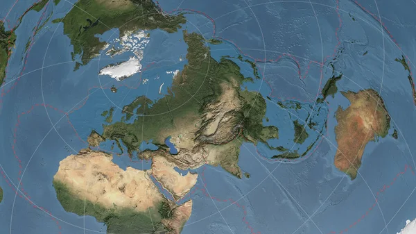
Eurasiann Tectonic Plate Overview The Global Satellite Imagery In The Azimuthal Equidistant Projection With Dashed Plates Borders. 3D Rendering
Image, 4.4MB, 2880 × 1620 jpg

Timor Tectonic Plate Extruded On The Globe. Satellite Imagery. 3D Rendering
Image, 4.03MB, 2880 × 1620 jpg

Philippine Sea Tectonic Plate Outlined On The Global Satellite Imagery In The Kavrayskiy Projection. 3D Rendering
Image, 4.84MB, 2880 × 1620 jpg
Altiplano Tectonic Plate Extruded And Presented Against The Global Color Physical Map In The Kavrayskiy Projection. 3D Rendering
Image, 3.77MB, 2880 × 1620 jpg

Industrial Concrete Building Destructed By Earthquake Strike. Disaster Scene Full Of Debris, Dust And Crashed Buildings.
Image, 13.29MB, 6016 × 4016 jpg


Arequipa, Peru - Dec 5, 2023: Mirador De Los Volcanes (Volcano Viewpoint) In The Peruvian Andes Between Arequipa And Colca
Image, 13.96MB, 6000 × 4000 jpg

Arequipa, Peru - Dec 5, 2023: Mirador De Los Volcanes (Volcano Viewpoint) In The Peruvian Andes Between Arequipa And Colca
Image, 13.13MB, 5451 × 3066 jpg


Arequipa, Peru - Dec 5, 2023: Mirador De Los Volcanes (Volcano Viewpoint) In The Peruvian Andes Between Arequipa And Colca
Image, 13.3MB, 3252 × 4878 jpg

South America Tectonic Plate Extruded And Presented Against The Globe. Topographic Map. 3D Rendering
Image, 3.81MB, 2880 × 1620 jpg
Page 3