photo free
Home Images Vectors Videos

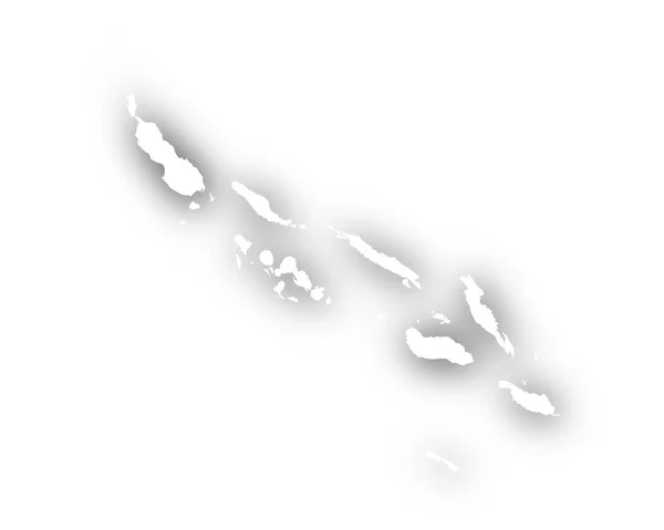
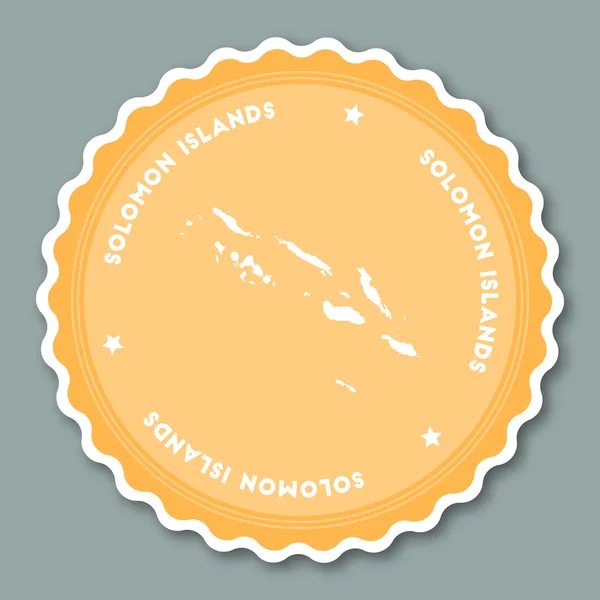
Stock image Solomon Islands Map

stock vector Australia and Oceania - map and navigation labels - illustration.

Australia And Oceania - Map And Navigation Labels - Illustration.

Vector, 4.32MB, 7400 × 5626 eps
stock image national flag of Solomon Islands

National Flag Of Solomon Islands

Image, 7.04MB, 8431 × 5637 jpg
stock vector Map of the Solomon Islands with shadow

Map Of The Solomon Islands With Shadow

Vector, 4.48MB, 5000 × 4000 eps
stock vector Solomon Islands map on road sign Wide poster with Solomon Islands country map on yellow rhomb road

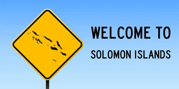
Solomon Islands Map On Road Sign Wide Poster With Solomon Islands Country Map On Yellow Rhomb Road

Vector, 0.35MB, 6930 × 3465 eps
stock vector Solomon Islands map vintage stamp Retro style handmade label Solomon Islands badge or element for

Solomon Islands Map Vintage Stamp Retro Style Handmade Label Solomon Islands Badge Or Element For

Vector, 14.51MB, 8333 × 8333 eps
stock vector Papua New Guinea Political Map

Papua New Guinea Political Map

Vector, 3.66MB, 9000 × 5403 eps
stock vector Solomon Islands sticker flat design.

Solomon Islands Sticker Flat Design.

Vector, 1.31MB, 8333 × 8333 eps
stock vector Australia and Oceania - map and navigation icons - illustration.

Australia And Oceania - Map And Navigation Icons - Illustration.

Vector, 3.99MB, 6400 × 4640 eps
stock vector Australia and Oceania - map and navigation icons - illustration.

Australia And Oceania - Map And Navigation Icons - Illustration.

Vector, 4.18MB, 6400 × 4774 eps
stock vector Australia and Oceania - map - illustration.

Australia And Oceania - Map - Illustration.

Vector, 3.28MB, 6400 × 4253 eps
stock vector Blank Relief Map of Oceania

Blank Relief Map Of Oceania

Vector, 6.41MB, 8192 × 5842 eps
stock vector Australia and Oceania - map, navigation icons - illustration.

Australia And Oceania - Map, Navigation Icons - Illustration.

Vector, 3.88MB, 7400 × 5312 eps
stock vector Relief Map of Oceania isolated on white

Relief Map Of Oceania Isolated On White

Vector, 8.73MB, 8192 × 5842 eps
stock vector Australia and Oceania - map - illustration.

Australia And Oceania - Map - Illustration.

Vector, 3.8MB, 6400 × 4253 eps
stock vector Australia and Oceania - map - illustration.

Australia And Oceania - Map - Illustration.

Vector, 4.55MB, 6400 × 4254 eps
stock vector Pinned countries flags on map of Oceania

Pinned Countries Flags On Map Of Oceania

Vector, 0.53MB, 5156 × 2950 ai
stock vector Map markers with flags - Oceania. Original colors.

Map Markers With Flags - Oceania. Original Colors.

Vector, 5.12MB, 4000 × 7091 eps
stock vector Micronesia

Micronesia

Vector, 1.81MB, 8038 × 6392 eps
stock vector Australia and New Zealand, South Pole, Antarctica, Global World

Australia And New Zealand, South Pole, Antarctica, Global World

Vector, 0.98MB, 5560 × 5534 eps
stock vector Australia and Oceania map and navigation icons - Illustration.

Australia And Oceania Map And Navigation Icons - Illustration.

Vector, 1.19MB, 6400 × 4640 eps
stock vector OCEANI Countries - Part Three

OCEANI Countries - Part Three

Vector, 2.34MB, 5512 × 5512 eps
stock vector Tonga map

Tonga Map

Vector, 0.84MB, 6040 × 6367 eps
stock image Solomon Islands, Honiara - capital city, pinned on political map

Solomon Islands, Honiara - Capital City, Pinned On Political Map

Image, 1.29MB, 6000 × 4000 jpg
stock vector Fifteen Flags of Australia and Oceania countries - alphabetical order with name.  Set of 2d geolocation signs like national flags of Australia and Oceania. Fifteen geolocation signs. EPS10.

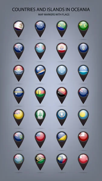
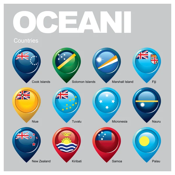
Fifteen Flags Of Australia And Oceania Countries - Alphabetical Order With Name. Set Of 2d Geolocation Signs Like National Flags Of Australia And Oceania. Fifteen Geolocation Signs. EPS10.

Vector, 7.12MB, 5000 × 5000 eps
stock vector Palau map

Palau Map

Vector, 1.71MB, 7348 × 4593 eps
stock vector Solomon islands infographics, statistical data, sights

Solomon Islands Infographics, Statistical Data, Sights

Vector, 2.86MB, 5000 × 5000 eps
stock vector Map marker with flag-set thirteenth

Map Marker With Flag-set Thirteenth

Vector, 7.09MB, 5000 × 5000 eps
stock vector Australia and Oceania - map and navigation labels - illustration.

Australia And Oceania - Map And Navigation Labels - Illustration.

Vector, 3.86MB, 7400 × 5359 eps
stock vector Melanesia, subregion of Oceania, political map. Extending from New Guinea in southwestern Pacific Ocean to Tonga, including Fiji, Vanuatu, Solomon Islands and Papua New Guinea. Illustration. Vector.

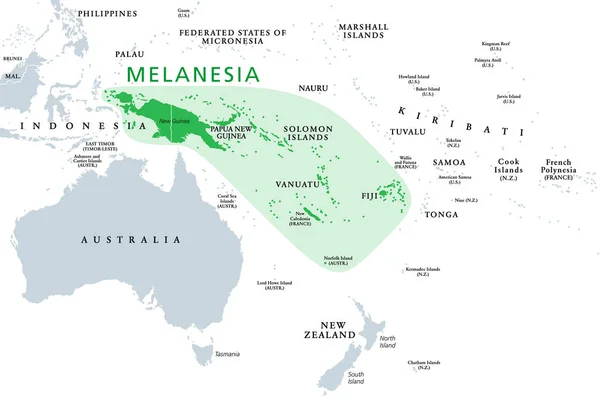
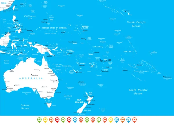
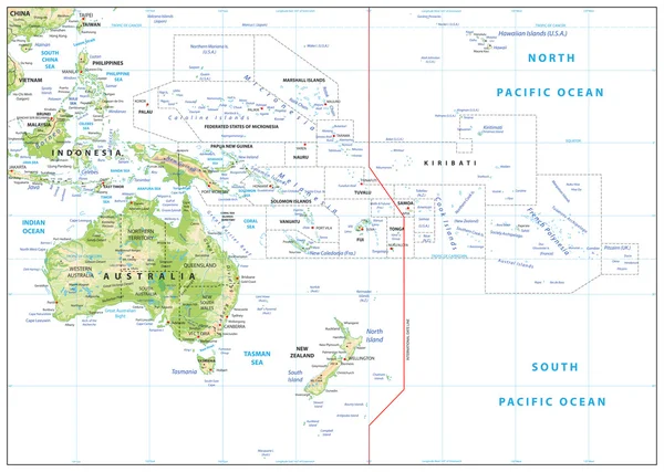
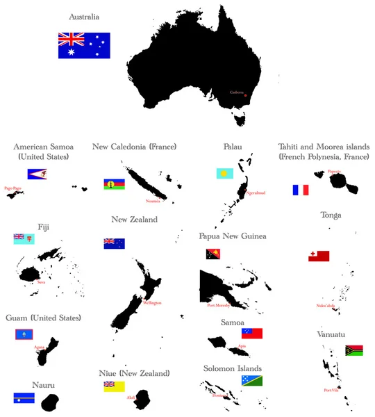
Melanesia, Subregion Of Oceania, Political Map. Extending From New Guinea In Southwestern Pacific Ocean To Tonga, Including Fiji, Vanuatu, Solomon Islands And Papua New Guinea. Illustration. Vector.

Vector, 2.46MB, 9000 × 6000 eps
stock vector map in form of Solomon islands

Map In Form Of Solomon Islands

Vector, 1.93MB, 5556 × 5556 eps
stock vector Asian, Australia and Oceania countries maps

Asian, Australia And Oceania Countries Maps

Vector, 13.28MB, 7292 × 7292 eps
stock vector OCEANI Countries - Part Two

OCEANI Countries - Part Two

Vector, 2.39MB, 5512 × 5512 eps
stock vector Asia and Australia, Global World

Asia And Australia, Global World

Vector, 1.49MB, 5340 × 5757 eps
stock vector Energy industry and ecology of Solomon Islands

Energy Industry And Ecology Of Solomon Islands

Vector, 3.54MB, 6400 × 6400 eps
stock image people group shape map Solomon Islands

People Group Shape Map Solomon Islands

Image, 3.4MB, 5500 × 5500 jpg
stock image Set of illustrations of pointers in the form of flags of the countries of Australia and Oceania. Groups of Australasia, Micronesia, Melanesia and Polynesia.

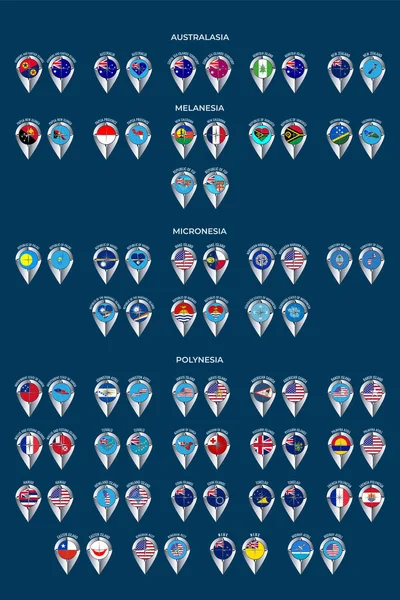
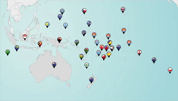
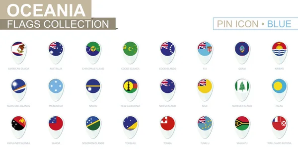
Set Of Illustrations Of Pointers In The Form Of Flags Of The Countries Of Australia And Oceania. Groups Of Australasia, Micronesia, Melanesia And Polynesia.

Image, 7.34MB, 5000 × 7501 jpg
stock vector vector maps and flags of oceania countries with administrative divisions (regions borders)

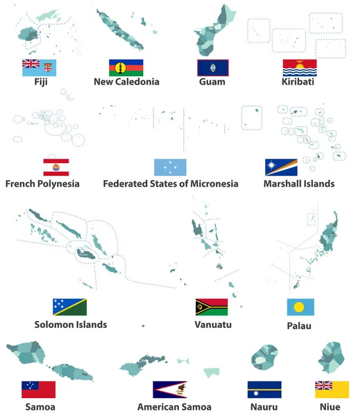
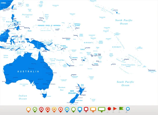
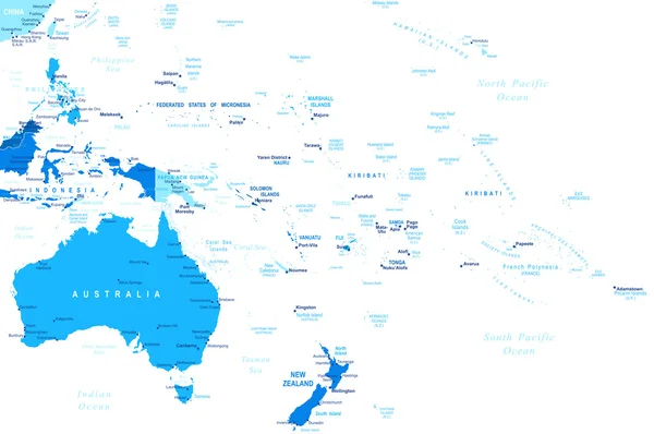
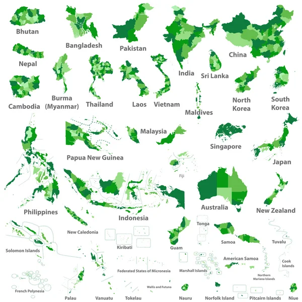
Vector Maps And Flags Of Oceania Countries With Administrative Divisions (regions Borders)

Vector, 7.89MB, 7139 × 8334 eps
stock image Solomon Islands extruded on the relief orthographic map. Capital, administrative borders and graticule

Solomon Islands Extruded On The Relief Orthographic Map. Capital, Administrative Borders And Graticule

Image, 4.76MB, 3840 × 2160 jpg
stock vector Countries of Oceania and Australia

Countries Of Oceania And Australia

Vector, 2.09MB, 4500 × 5000 eps
stock vector Palau map

Palau Map

Vector, 0.76MB, 5248 × 7172 eps
stock vector Oceania flags collection. Big set of blue pin icon with flags.

Oceania Flags Collection. Big Set Of Blue Pin Icon With Flags.

Vector, 1.16MB, 8000 × 4000 eps
stock vector Flags of world

Flags Of World

Vector, 1.36MB, 5000 × 5000 eps
stock vector United Kingdom and Australia, Papua New Guinea, New Zealand, Fiji, Solomon Islands Flag. 3d vector puzzle. Set 28.

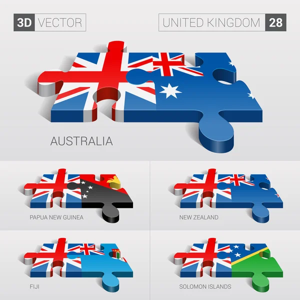
United Kingdom And Australia, Papua New Guinea, New Zealand, Fiji, Solomon Islands Flag. 3d Vector Puzzle. Set 28.

Vector, 13.02MB, 5197 × 5197 eps
stock vector Slovenia, Solomon Islands, Somalia, South Africa map and flag in circle.

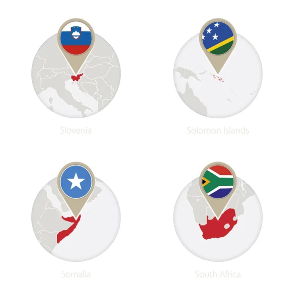
Slovenia, Solomon Islands, Somalia, South Africa Map And Flag In Circle.

Vector, 7.49MB, 5000 × 5000 eps
stock vector Locator map showing the location of the country Solomon Islands in Australia. The country is highlighted with a red polygon. Small countries are also marked with a red circle. The map shows yellow land areas, blue sea, state borders and a blue grid l

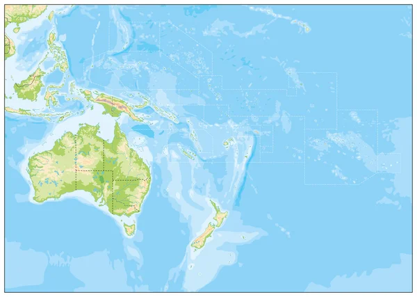
Locator Map Showing The Location Of The Country Solomon Islands In Australia. The Country Is Highlighted With A Red Polygon. Small Countries Are Also Marked With A Red Circle. The Map Shows Yellow Land Areas, Blue Sea, State Borders And A Blue Grid L

Vector, 3.13MB, 2400 × 2400 eps
stock vector Isabel province map, administrative division of Solomon Islands. Vector illustration.

Isabel Province Map, Administrative Division Of Solomon Islands. Vector Illustration.

Vector, 5.41MB, 8334 × 8334 eps
stock image Map of Honiara International Airport (Solomon Islands). IATA-code: HIR. Airport diagram with runways, taxiways, apron, parking areas and buildings. Map data from OpenStreetMap.

Map Of Honiara International Airport (Solomon Islands). IATA-code: HIR. Airport Diagram With Runways, Taxiways, Apron, Parking Areas And Buildings. Map Data From OpenStreetMap.

Image, 0.79MB, 6000 × 4476 jpg
stock vector Rennell and Bellona province map, administrative division of Solomon Islands. Vector illustration.

Rennell And Bellona Province Map, Administrative Division Of Solomon Islands. Vector Illustration.

Vector, 5.32MB, 8334 × 8334 eps
stock vector Makira Ulawa province map, administrative division of Solomon Islands. Vector illustration.

Makira Ulawa Province Map, Administrative Division Of Solomon Islands. Vector Illustration.

Vector, 5.37MB, 8334 × 8334 eps
stock vector Western province map, administrative division of Solomon Islands. Vector illustration.

Western Province Map, Administrative Division Of Solomon Islands. Vector Illustration.

Vector, 5.47MB, 8334 × 8334 eps
Page 1 >> Next