photo free
Home Images Vectors Videos

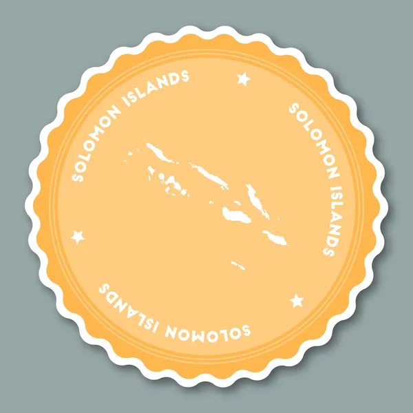
Stock image Solomon Islands Region Map

stock vector Solomon Islands sticker flat design.

Solomon Islands Sticker Flat Design.

Vector, 1.31MB, 8333 × 8333 eps
stock vector Fifteen Flags of Australia and Oceania countries - alphabetical order with name.  Set of 2d geolocation signs like national flags of Australia and Oceania. Fifteen geolocation signs. EPS10.

Fifteen Flags Of Australia And Oceania Countries - Alphabetical Order With Name. Set Of 2d Geolocation Signs Like National Flags Of Australia And Oceania. Fifteen Geolocation Signs. EPS10.

Vector, 7.12MB, 5000 × 5000 eps
stock vector Palau map

Palau Map

Vector, 1.71MB, 7348 × 4593 eps
stock vector Melanesia, subregion of Oceania, political map. Extending from New Guinea in southwestern Pacific Ocean to Tonga, including Fiji, Vanuatu, Solomon Islands and Papua New Guinea. Illustration. Vector.

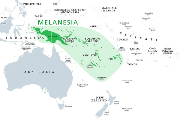
Melanesia, Subregion Of Oceania, Political Map. Extending From New Guinea In Southwestern Pacific Ocean To Tonga, Including Fiji, Vanuatu, Solomon Islands And Papua New Guinea. Illustration. Vector.

Vector, 2.46MB, 9000 × 6000 eps
stock vector Asian, Australia and Oceania countries maps

Asian, Australia And Oceania Countries Maps

Vector, 13.28MB, 7292 × 7292 eps
stock vector vector maps and flags of oceania countries with administrative divisions (regions borders)

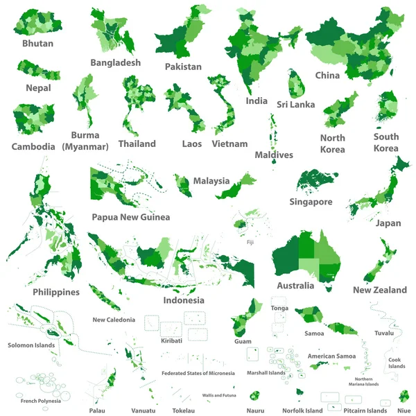
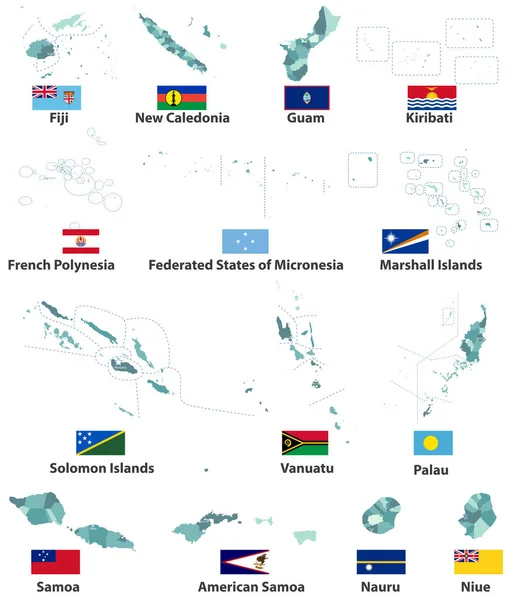
Vector Maps And Flags Of Oceania Countries With Administrative Divisions (regions Borders)

Vector, 7.89MB, 7139 × 8334 eps
stock vector Countries of Oceania and Australia

Countries Of Oceania And Australia

Vector, 2.09MB, 4500 × 5000 eps
stock vector Palau map

Palau Map

Vector, 0.76MB, 5248 × 7172 eps
stock vector Slovenia, Solomon Islands, Somalia, South Africa map and flag in circle.

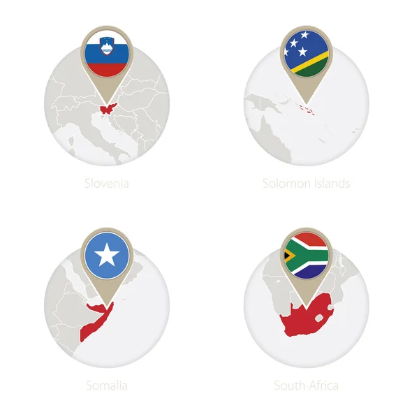
Slovenia, Solomon Islands, Somalia, South Africa Map And Flag In Circle.

Vector, 7.49MB, 5000 × 5000 eps
stock vector Temotu province map, administrative division of Solomon Islands. Vector illustration.

Temotu Province Map, Administrative Division Of Solomon Islands. Vector Illustration.

Vector, 5.35MB, 8334 × 8334 eps
stock vector Isabel province map, administrative division of Solomon Islands. Vector illustration.

Isabel Province Map, Administrative Division Of Solomon Islands. Vector Illustration.

Vector, 5.41MB, 8334 × 8334 eps
stock image Barora Fa Island in the South Pacific Ocean, belonging to Solomon Islands, isolated on a bilevel elevation map, with distance scale

Barora Fa Island In The South Pacific Ocean, Belonging To Solomon Islands, Isolated On A Bilevel Elevation Map, With Distance Scale

Image, 0.33MB, 2160 × 2160 jpg
stock image Mbulo Island in the Solomon Sea, belonging to Solomon Islands, isolated on a satellite image taken in February 14, 2024, with distance scale

Mbulo Island In The Solomon Sea, Belonging To Solomon Islands, Isolated On A Satellite Image Taken In February 14, 2024, With Distance Scale

Image, 2.17MB, 2160 × 2160 jpg
stock image Nggatokae Island in the Solomon Sea, belonging to Solomon Islands, isolated on a satellite image taken in March 2, 2018, with distance scale

Nggatokae Island In The Solomon Sea, Belonging To Solomon Islands, Isolated On A Satellite Image Taken In March 2, 2018, With Distance Scale

Image, 1.25MB, 2160 × 2160 jpg
stock image Nendo Island in the Coral Sea, belonging to Solomon Islands, isolated on a satellite image taken in March 8, 2019, with distance scale

Nendo Island In The Coral Sea, Belonging To Solomon Islands, Isolated On A Satellite Image Taken In March 8, 2019, With Distance Scale

Image, 1.18MB, 2160 × 2160 jpg
stock image Rendova Island in the Solomon Sea, belonging to Solomon Islands, isolated on a satellite image taken in February 2, 2023, with distance scale

Rendova Island In The Solomon Sea, Belonging To Solomon Islands, Isolated On A Satellite Image Taken In February 2, 2023, With Distance Scale

Image, 1.2MB, 2160 × 2160 jpg
stock image Ghizo Island in the Solomon Sea on a topographic, OSM Humanitarian style map

Ghizo Island In The Solomon Sea On A Topographic, OSM Humanitarian Style Map

Image, 0.48MB, 2880 × 1620 jpg
stock image Kolombangara Island in the Solomon Sea on a topographic, OSM Humanitarian style map

Kolombangara Island In The Solomon Sea On A Topographic, OSM Humanitarian Style Map

Image, 1MB, 2880 × 1620 jpg
stock image Ranongga Island in the Solomon Sea on a topographic, OSM Humanitarian style map

Ranongga Island In The Solomon Sea On A Topographic, OSM Humanitarian Style Map

Image, 0.35MB, 2880 × 1620 jpg
stock image Nendo Island in the Coral Sea on a topographic, OSM Humanitarian style map

Nendo Island In The Coral Sea On A Topographic, OSM Humanitarian Style Map

Image, 0.35MB, 2880 × 1620 jpg
stock image Nggela Pile Island in the Solomon Sea on a topographic, OSM Humanitarian style map

Nggela Pile Island In The Solomon Sea On A Topographic, OSM Humanitarian Style Map

Image, 0.64MB, 2880 × 1620 jpg
stock image Ghizo Island in the Solomon Sea on a satellite image taken in June 12, 2021

Ghizo Island In The Solomon Sea On A Satellite Image Taken In June 12, 2021

Image, 4.44MB, 2880 × 1620 jpg
stock image Shortland Island in the Solomon Sea - belonging to Solomon Islands. Described location diagram with yellow shape of the island and sample maps of its surroundings

Shortland Island In The Solomon Sea - Belonging To Solomon Islands. Described Location Diagram With Yellow Shape Of The Island And Sample Maps Of Its Surroundings

Image, 2.02MB, 3840 × 2160 jpg
stock image San Jorge Island in the Solomon Sea on a satellite image taken in October 2, 2020

San Jorge Island In The Solomon Sea On A Satellite Image Taken In October 2, 2020

Image, 5.8MB, 2880 × 1620 jpg
stock image Nggatokae Island in the Solomon Sea on a colored elevation map

Nggatokae Island In The Solomon Sea On A Colored Elevation Map

Image, 1.59MB, 2880 × 1620 jpg
stock image San Cristobal Island in the Coral Sea on a colored elevation map

San Cristobal Island In The Coral Sea On A Colored Elevation Map

Image, 1.57MB, 2880 × 1620 jpg
stock image Barora Ite Island in the Solomon Sea on a topographic, OSM Humanitarian style map

Barora Ite Island In The Solomon Sea On A Topographic, OSM Humanitarian Style Map

Image, 0.95MB, 2880 × 1620 jpg
stock image Guadalcanal Island in the Solomon Sea, belonging to Solomon Islands, isolated on a satellite image taken in July 19, 2021, with distance scale

Guadalcanal Island In The Solomon Sea, Belonging To Solomon Islands, Isolated On A Satellite Image Taken In July 19, 2021, With Distance Scale

Image, 1.22MB, 2160 × 2160 jpg
stock image Barora Ite Island in the Solomon Sea, belonging to Solomon Islands, isolated on a topographic, OSM Humanitarian style map, with distance scale

Barora Ite Island In The Solomon Sea, Belonging To Solomon Islands, Isolated On A Topographic, OSM Humanitarian Style Map, With Distance Scale

Image, 0.44MB, 2160 × 2160 jpg
stock image Ghizo Island in the Solomon Sea, belonging to Solomon Islands, isolated on a bilevel elevation map, with distance scale

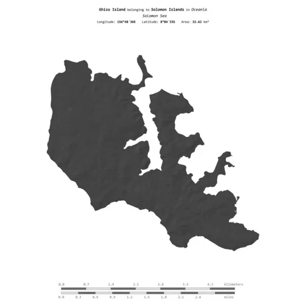
Ghizo Island In The Solomon Sea, Belonging To Solomon Islands, Isolated On A Bilevel Elevation Map, With Distance Scale

Image, 0.38MB, 2160 × 2160 jpg
stock image Mbulo Island in the Solomon Sea - belonging to Solomon Islands. Described location diagram with yellow shape of the island and sample maps of its surroundings

Mbulo Island In The Solomon Sea - Belonging To Solomon Islands. Described Location Diagram With Yellow Shape Of The Island And Sample Maps Of Its Surroundings

Image, 2.74MB, 3840 × 2160 jpg
stock image Mbanika Island in the Solomon Sea - belonging to Solomon Islands. Described location diagram with yellow shape of the island and sample maps of its surroundings

Mbanika Island In The Solomon Sea - Belonging To Solomon Islands. Described Location Diagram With Yellow Shape Of The Island And Sample Maps Of Its Surroundings

Image, 2.51MB, 3840 × 2160 jpg
stock image Ranongga Island in the Solomon Sea, belonging to Solomon Islands, isolated on a topographic, OSM Humanitarian style map, with distance scale

Ranongga Island In The Solomon Sea, Belonging To Solomon Islands, Isolated On A Topographic, OSM Humanitarian Style Map, With Distance Scale

Image, 0.33MB, 2160 × 2160 jpg
stock image New Georgia Island in the Solomon Sea, belonging to Solomon Islands, isolated on a topographic, OSM Humanitarian style map, with distance scale

New Georgia Island In The Solomon Sea, Belonging To Solomon Islands, Isolated On A Topographic, OSM Humanitarian Style Map, With Distance Scale

Image, 0.42MB, 2160 × 2160 jpg
stock image Vaghena Island in the Solomon Sea, belonging to Solomon Islands, isolated on a satellite image taken in June 12, 2021, with distance scale

Vaghena Island In The Solomon Sea, Belonging To Solomon Islands, Isolated On A Satellite Image Taken In June 12, 2021, With Distance Scale

Image, 1.81MB, 2160 × 2160 jpg
stock image Banie Island in the Coral Sea on a satellite image taken in November 8, 2019

Banie Island In The Coral Sea On A Satellite Image Taken In November 8, 2019

Image, 6.99MB, 2880 × 1620 jpg
stock image South Malaita Island in the Solomon Sea, belonging to Solomon Islands, isolated on a satellite image taken in September 5, 2019, with distance scale

South Malaita Island In The Solomon Sea, Belonging To Solomon Islands, Isolated On A Satellite Image Taken In September 5, 2019, With Distance Scale

Image, 0.88MB, 2160 × 2160 jpg
stock image Ulawa Island in the South Pacific Ocean, belonging to Solomon Islands, isolated on a satellite image taken in February 12, 2018, with distance scale

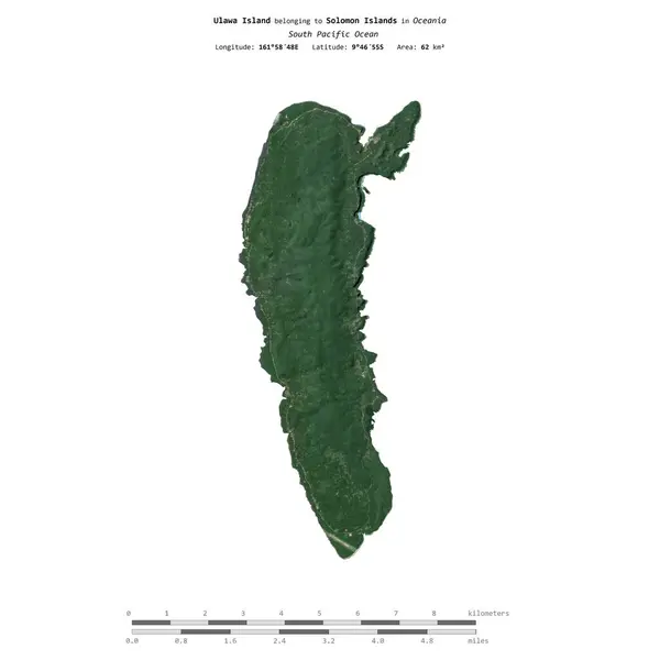
Ulawa Island In The South Pacific Ocean, Belonging To Solomon Islands, Isolated On A Satellite Image Taken In February 12, 2018, With Distance Scale

Image, 0.87MB, 2160 × 2160 jpg
stock image Ulawa Island in the South Pacific Ocean on a topographic, OSM Humanitarian style map

Ulawa Island In The South Pacific Ocean On A Topographic, OSM Humanitarian Style Map

Image, 0.23MB, 2880 × 1620 jpg
stock vector Rennell and Bellona province map, administrative division of Solomon Islands. Vector illustration.

Rennell And Bellona Province Map, Administrative Division Of Solomon Islands. Vector Illustration.

Vector, 5.32MB, 8334 × 8334 eps
stock vector Choiseul province map, administrative division of Solomon Islands. Vector illustration.

Choiseul Province Map, Administrative Division Of Solomon Islands. Vector Illustration.

Vector, 5.66MB, 8334 × 8334 eps
stock vector Rennell and Bellona province map, administrative division of Solomon Islands. Vector illustration.

Rennell And Bellona Province Map, Administrative Division Of Solomon Islands. Vector Illustration.

Vector, 5.32MB, 8334 × 8334 eps
stock vector Makira Ulawa province map, administrative division of Solomon Islands. Vector illustration.

Makira Ulawa Province Map, Administrative Division Of Solomon Islands. Vector Illustration.

Vector, 5.37MB, 8334 × 8334 eps
stock image Utupua Island in the Coral Sea on a colored elevation map

Utupua Island In The Coral Sea On A Colored Elevation Map

Image, 0.93MB, 2880 × 1620 jpg
stock image Banie Island in the Coral Sea, belonging to Solomon Islands, isolated on a bilevel elevation map, with distance scale

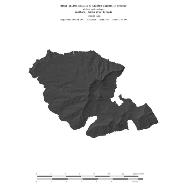
Banie Island In The Coral Sea, Belonging To Solomon Islands, Isolated On A Bilevel Elevation Map, With Distance Scale

Image, 0.45MB, 2160 × 2160 jpg
stock image Barora Ite Island in the Solomon Sea, belonging to Solomon Islands, isolated on a bilevel elevation map, with distance scale

Barora Ite Island In The Solomon Sea, Belonging To Solomon Islands, Isolated On A Bilevel Elevation Map, With Distance Scale

Image, 0.33MB, 2160 × 2160 jpg
stock image Ulawa Island in the South Pacific Ocean, belonging to Solomon Islands, isolated on a topographic, OSM Humanitarian style map, with distance scale

Ulawa Island In The South Pacific Ocean, Belonging To Solomon Islands, Isolated On A Topographic, OSM Humanitarian Style Map, With Distance Scale

Image, 0.33MB, 2160 × 2160 jpg
stock image Mbokonumbeta Island in the Solomon Sea, belonging to Solomon Islands, isolated on a bilevel elevation map, with distance scale

Mbokonumbeta Island In The Solomon Sea, Belonging To Solomon Islands, Isolated On A Bilevel Elevation Map, With Distance Scale

Image, 0.31MB, 2160 × 2160 jpg
stock image Nggatokae Island in the Solomon Sea, belonging to Solomon Islands, isolated on a topographic, OSM Humanitarian style map, with distance scale

Nggatokae Island In The Solomon Sea, Belonging To Solomon Islands, Isolated On A Topographic, OSM Humanitarian Style Map, With Distance Scale

Image, 0.44MB, 2160 × 2160 jpg
stock image Ghizo Island in the Solomon Sea, belonging to Solomon Islands, isolated on a topographic, OSM Humanitarian style map, with distance scale

Ghizo Island In The Solomon Sea, Belonging To Solomon Islands, Isolated On A Topographic, OSM Humanitarian Style Map, With Distance Scale

Image, 0.57MB, 2160 × 2160 jpg
Page 1 >> Next