photo free
Home Images Vectors Videos

Stock image South Dakota Counties

stock vector Map of South Dakota

Map Of South Dakota

Vector, 0.69MB, 5000 × 4000 eps
stock vector USA State counties emblem map

USA State Counties Emblem Map

Vector, 0MB, 5136 × 5168 zip
stock image US State Maps Set II

US State Maps Set II

Image, 22MB, 7500 × 7500 jpg
stock vector South Dakota County Map

South Dakota County Map

Vector, 0.85MB, 5000 × 3333 ai
stock image Custer State Park, South Dakota- July 2018: Two motorcycles drive thorugh beautiful rock formations at Needles Highway, Custer State Park.

Custer State Park, South Dakota- July 2018: Two Motorcycles Drive Thorugh Beautiful Rock Formations At Needles Highway, Custer State Park.

Image, 8.68MB, 5184 × 3659 jpg
stock vector Set 4 of 5 Highly detailed vector silhouettes of USA state maps

Set 4 Of 5 Highly Detailed Vector Silhouettes Of USA State Maps

Vector, 5.44MB, 8858 × 3738 eps
stock vector Map of South Dakota

Map Of South Dakota

Vector, 0.71MB, 5000 × 4167 ai
stock vector South Dakota map

South Dakota Map

Vector, 7.79MB, 7002 × 7002 eps
stock vector North Dakota - South Dakota - Minnesota - Wisoncsin labelled bla

North Dakota - South Dakota - Minnesota - Wisoncsin Labelled Bla

Vector, 3.16MB, 8653 × 5000 eps
stock vector Map of South Dakota

Map Of South Dakota

Vector, 0.66MB, 5000 × 4000 eps
stock vector Highly detailed vector silhouettes of US state maps, Division United States into counties, political and geographic subdivisions of a states, West North Central - North Dakota, South Dakota, Nebraska - set 7 of 17

Highly Detailed Vector Silhouettes Of US State Maps, Division United States Into Counties, Political And Geographic Subdivisions Of A States, West North Central - North Dakota, South Dakota, Nebraska - Set 7 Of 17

Vector, 6.36MB, 9608 × 4501 eps
stock vector Map of South Dakota

Map Of South Dakota

Vector, 0.69MB, 5000 × 4000 eps
stock vector South Dakota, U.S. state, subdivided into 66 counties, multi colored political map with capital Pierre, borders and county names. North Central region of United States, nicknamed Mount Rushmore State.

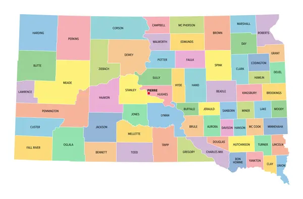
South Dakota, U.S. State, Subdivided Into 66 Counties, Multi Colored Political Map With Capital Pierre, Borders And County Names. North Central Region Of United States, Nicknamed Mount Rushmore State.

Vector, 2.12MB, 9000 × 5923 eps
stock vector South Dakota map Blank vector map of the Us State with counties Borders of South Dakota for your

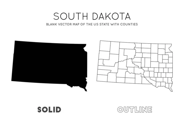
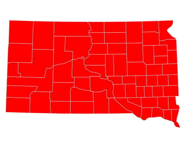
South Dakota Map Blank Vector Map Of The Us State With Counties Borders Of South Dakota For Your

Vector, 0.29MB, 6661 × 4523 eps
stock vector South Dakota, U.S. state, subdivided into 66 counties, gray political map with borders and county names. State in the North Central region of the United States, nicknamed The Mount Rushmore State.

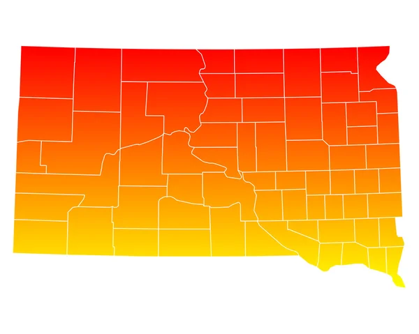
South Dakota, U.S. State, Subdivided Into 66 Counties, Gray Political Map With Borders And County Names. State In The North Central Region Of The United States, Nicknamed The Mount Rushmore State.

Vector, 2.11MB, 9000 × 5923 eps
stock vector South Dakota, U.S. state, subdivided into 66 counties, political map with borders and county names. State in the North Central region of the United States, nicknamed The Mount Rushmore State.

South Dakota, U.S. State, Subdivided Into 66 Counties, Political Map With Borders And County Names. State In The North Central Region Of The United States, Nicknamed The Mount Rushmore State.

Vector, 2.24MB, 9000 × 6000 eps
stock vector North Dakota map, United States (USA), Americas. Filled and outline map designs. Vector illustration

North Dakota Map, United States (USA), Americas. Filled And Outline Map Designs. Vector Illustration

Vector, 0.31MB, 6001 × 3001 eps
stock image South Dakota State of the United States with Counties Boundary Lines

South Dakota State Of The United States With Counties Boundary Lines

Image, 0.58MB, 3500 × 2000 jpg
Page 1 >> Next